
SLIDE 1
Colorado Station 2.0 Spring 2016 MURP Workshop UC Denver Ellen - - PowerPoint PPT Presentation
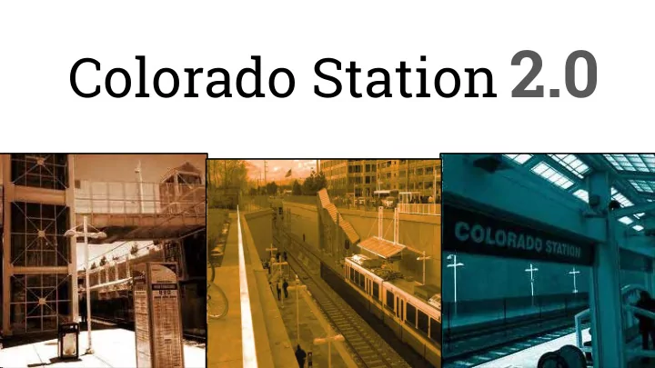
Colorado Station 2.0 Spring 2016 MURP Workshop UC Denver Ellen Ittelson Gregory Meek Claire Dalby Megan Yonke Matthias Helfen Katelyn Puga Mark Richardson Nathan Silverstein Jake Schmitz Gaby Hart Lauren Blankenship Colorado Station 2.0
Spring 2016 MURP Workshop UC Denver
Ellen Ittelson Gregory Meek Claire Dalby Megan Yonke Matthias Helfen Katelyn Puga Mark Richardson Nathan Silverstein Jake Schmitz Gaby Hart Lauren Blankenship
Colorado Station 2.0 Methods
Project Study Area
Site History
Neighborhoods around Colorado Station established in 1886 due to University of Denver’s move from downtown Denver & New Orleans Railroad line from Denver to Colorado Springs founded in 1886 Trolley Line from Denver to Virginia Village Neighborhood established in 1907 Railroad Line Branch to Colorado Springs went bankrupt in 1936 due to trucking competition Four-Lane Freeway built between 1951 and 1958 Colorado Blvd. and Evans Ave. became major truck routes
Site History
Suburbs near Colorado Blvd. and Evans Ave.grew due to Post WWII housing demand (University Hills & Virginia Village) University Hills Shopping Center opened in 1955. Served as an anchored economic hub, but was becoming abandoned by 1990. The site has since reopened as a supermarket based retail box store.
Existing Conditions
Demographics and Employment Zoning, Land Use, and Housing Street and Bus Networks Bicycle and Pedestrian Networks Stormwater Where are we? Where can we go?
Demographics
Census tracts: 39.02, 40.05 40.06, 51.04, 53
Demographics
Employment
Clusters of employment around the station
Employment
Employment
Unemployment rates
Zoning
Zoning
Land Use
Land Use
Housing
Street & Bus Network
Bicycle Network
Pedestrian Network
Stormwater
Intercept Survey
Intercept Survey
Intercept Survey
Intercept Survey
Intercept Survey
Intercept Survey
Intercept Survey
Intercept Survey
Intercept Survey
Intercept Survey
SWOT Analysis
Vision and Goals
Vision and Goals
➢ Encourage attractive design standards ➢ Foster a mix of uses ➢ Create safe public spaces ➢ Balance the Intensity of uses
Vision and Goals
➢ Compatible building types ➢ Identify parking alternatives ➢ Promote sustainable design and building techniques
Vision and Goals
➢ Create a “transit village” ➢ Encourage a variety of housing choices ➢ Promote transit supportive uses ➢ Create engaging, high quality public spaces
Vision and Goals
➢ Create connections between the surrounding community and transit ➢ Provide enhanced pedestrian infrastructure ➢ Enhance accessibility to non- drivers ➢ Introduce creative parking strategies
Vision and Goals
➢ Establish connections to the employment hubs and neighborhoods ➢ Produce last mile connections ➢ Support multi-modal transit
➢ Provide better access to below ground station elements
Vision and Goals
➢ Establish and maintain mutually beneficial relationships ➢ Communicate with stakeholders during development process ➢ Regularly gather public input ➢ Consider the station’s broader context
Recommendations
Placemaking: Distinct Spaces
Overt Spaces Flexible Spaces Covert Spaces
Bench in San Francisco, CA.
Source: Tim Griffith
Park with games in Philadelphia, PA.
Source: Halkin Mason Photography.
Denver’s 16th Street Mall
Source: Denvergov.org
Placemaking: Market Space on Colorado Center Drive
a quick stop or further explore the area
Market space in Granville Island, Vancouver www.marketmanila.com Crystal Shops in Arlington, VA
Source: Yelp
Efficient Design: Parking Strategies
The Freeway Ford site should be converted to surface parking which will also hold the site for future development. Parking meter in Cincinnati that adjusts parking price to demand.
Source: wyso.org
Mixed-Use: Ground Floor Retail & Community Spaces
Ground floor grocery store in Lodo: 1950 Chestnut Place Denver, CO
Source: denverpost.com
Rendering of a community center with library.
Source: Milwaukee Public Library
Mobility: Improve Bicycle Infrastructure
Mobility: Elevated Bicycle/Pedestrian Bridge
Elevated bicycle and pedestrian pathway in Denmark.
Source: Architizer
The Highline Trail, an elevated landscaped trail running along a former rail line in through New York City.
Source: Beyond My Ken
Millennium bridge in Denver, serves as a local and regional landmark.
Source: denverinfill.com
LAST-MILE CONNECTIONS “ ...opportunities and services which connect people from the transit station to their final destination, or vice versa.”
PUBLIC INPUT AND COMMUNITY PROGRAMMING
DIGITAL INFORMATION AND TRIP PLANNING KIOSK How will you get there? HERE THERE.
Routes Modes Travel Times Rider Alerts
Community Bulletin Board Job Opportunities Public Meetings Local School and Business Events Entertainment and Recreation Maps and Nearby Destinations
Spatial Relationship
Site Development
Conceptual Model Program Elements
Circulation Model
Pedestrian Bicycle Transit On Demand Transit
Circulation Model
Evans Ave S Colorado Blvd
Pedestrian
S Colorado Blvd Evans Ave
Circulation Model
Bicycle
Circulation Model
Evans Ave S Colorado Blvd
Transit
Circulation Model
Evans Ave S Colorado Blvd
On Demand Transit
Circulation Model
Evans Ave S Colorado Blvd
Site Development Plan
0' 100'
Site Development Plan
0' 100'
Open Space Park Plaza Multi-family Residential/Retail Multi-family Residential Surface Parking S Colorado Blvd Evans Ave Civic Kiosk Retail + Residential Retail + Office Retail + Office Retail + Office Retail + Residential Civic Station Plaza Bus On Demand Transit Market + Flex Space Entrance Sign E l e v a t e d P a t h Main Street Pedestrian Bridges Interstate 25
Site Development Plan
0’ 100’
Mobility Solutions
Pedestrian Bicycle Transit On Demand Transit
Market + Flex Space
Site Development Plan
0’ 100’
Public Space in TOD
Source: bettercities.net
Farmers Market
Source: northboroughapplefest.com
Site Development Plan
0’ 100’
Bicycle Parking + Storage
Green Bicycle Parking Pod
Source: Menthol Architects
Sculptural Bicycle Storage
Source: hbdesigns.co.uk
Site Development Plan
0’ 100’
Permeable Pavers
Source: hillsidegardencenter.com
Vegetated Stone Bioswales
Source: buoy.newpaltz.edu
Sustainable Solutions
Site Development Plan - Massing Model
Site Development Plan - Massing Model
Site Development Plan - Building Uses
Retail: 197,400 sq.ft. Office: 141,620 sq.ft. Cultural: 52,986 sq.ft. Housing: 663,593 sq.ft. Green Space: 89,986 sq.ft.
Site Development Plan - Station Area
Site Development Plan - Station Area
Site Development Plan - Station Area
Site Development Plan - Elevated Bikeway
Site Development Plan - Elevated Bikeway
Site Development Plan - Main Street
Site Development Plan - Main Street
Site Development Plan - Main Street Section
Site Development Plan - Creating Connections
0' 100'
Key Takeaways
In current state, Colorado Station is not mobilizing the region In future state, Colorado Station can serve as a distinct place and gateway by:
facilitate connectivity with surrounding neighborhoods
Thank you very much!
We welcome your questions
Introduction to Planning Workshop Class Section
Introduction - Jake 4 min Existing Conditions - Greg 10 min Intercept Survey - Megan 5 min SWOT Analysis - Katelyn 1 min Vision and Goals - Katelyn 3min Recommendations - Nathan, Gaby 11 min Site Development Plan - Lauren, Claire, Mattias 10 min South Evans - Mark 5 min Closing - Jake 1 min