
SLIDE 1
CO 9 Blue River/Breckenridge Access Control Plan
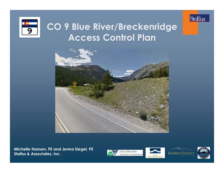
Michelle Hansen, PE and Jenna Siegel, PE Stolfus & Associates, Inc.
CO 9 Blue River/Breckenridge Access Control Plan Michelle Hansen, - - PowerPoint PPT Presentation
CO 9 Blue River/Breckenridge Access Control Plan Michelle Hansen, PE and Jenna Siegel, PE Stolfus & Associates, Inc. Purpose of Presentation Review Access Management Discuss Draft Long-Range Access Plan Discuss Draft Trail
Michelle Hansen, PE and Jenna Siegel, PE Stolfus & Associates, Inc.
CAN HELP A COMMUNITY ACHIEVE THEIR GOALS BY MANAGING THE
State Highway Access Code, August 31, 1998 Page 54 of 62
Figure 4 - 1: Information Guide to Basic Auxiliary Lane Elements (2) Necessary Components Determining Speed Change Lane Length (a) The components of an auxiliary turn lane consists of transition taper, full width auxiliary lane, and storage length. The use of these three components varies according to the assigned access category and to some extent, site specific conditions. Table 4 - 5 summarizes the components of speed change lanes when such lanes are required by the category standards. Read the category requirements and subsection 3.5 to determine if any speed change lanes are required. Table 4 - 5 is provided to be used in conjunction with table 4 - 6. Table 4 - 5: Components of Speed Change Lane Length Access Category Left turn deceleration lane Right turn deceleration lane Acceleration lane F-W Design must meet federal interstate standards, and no less then E-X E-X taper + decel.length+storage taper + decel. length accel.length + taper R-A * decel. length + storage * decel. length * accel. length R-B * decel. length + storage * decel. length * accel. length NR-A * decel. length + storage * decel. length * accel. length NR-B taper + storage taper + storage * accel. length NR-B >40mph * decel. length *decel. length * accel. length NR-C taper + storage taper + storage * accel. length NR-C >40mph * decel. length * decel. length * accel. length
each highway.
access.
mitigation of their impact to the public road at each access.
LAW
Consolidate direct access to major roadways
Consolidate Access Points Connect adjacent properties Define Driveways
Provide a supporting street and circulation system Relocate Access to Side Street (consider impacts to side street – do no harm)
Begin at Summit County Line – MP 77.50 End at Boreas Pass Road – MP 86.17
The plan will be implemented in phases as changes occur in the Towns or County that generate the need. Construction of improvements may be publicly and/or privately funded. The following cases trigger implementation:
Redevelopment that increases traffic by 20% or more. Publicly funded project by the Towns, County, or CDOT Safety or operational issue develops
The plan is a living document that can be amended.
AREAS OF INTEREST
A MAJOR INTERSECTION is defined in the plan
generally at ½ mile spacing along the corridor
Potential for future auxiliary lanes as-needed Potential for future signalization
A MINOR INTERSECTION is defined in the plan in
areas between major intersections
Potential for auxiliary lanes as-needed DO NOT have a potential for future signalization
Intersections identified as needing auxiliary lanes
today and in future planning year 2040:
Wagon Road Spruce Creek Road Blue River Road Sherwood Lane Whispering Pines Circle Rio Azul Quandary Road Mark Court Tordal Way Blue Lakes Road
The goal of the design plan is to take the study
recommendations to determine feasibility
Trail typical section(s) were determined as feasible
depending on existing conditions and constraints
Preferred trail alignment and sections will be taken to
Conceptual (15%) Design using horizontal and vertical data
Walls will be identified Starting point for obtaining future funding opportunities
Two public open houses
Present the DRAFT and FINAL plans, gain
First Public Open House:
May 15, 2019 4:00 PM – 7:00 PM Summit County Library
WE ARE HERE
Further develop trail design Incorporate transit plans into the access