
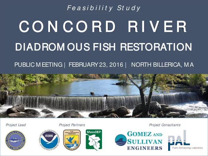
SLIDE 1
Fe a s i b i l i t y St u d y
C O N C O R D R D R I R I V E V E R
DI DIADR DROM OUS F S FISH R H RESTORA RATI TION
PUBLIC M EETING | FEBRUARY 23, 2016 | NORTH BILLERICA, M A
Project Lead Project Partners Project Consultants
C O N C O R D R D R I R I V E V E R DI DIADR DROM OUS F S - - PowerPoint PPT Presentation
Fe a s i b i l i t y St u d y C O N C O R D R D R I R I V E V E R DI DIADR DROM OUS F S FISH R H RESTORA RATI TION PUBLIC M EETING | FEBRUARY 23, 2016 | NORTH BILLERICA, M A Project Lead Project Partners Project Consultants OVERVIEW
Fe a s i b i l i t y St u d y
PUBLIC M EETING | FEBRUARY 23, 2016 | NORTH BILLERICA, M A
Project Lead Project Partners Project Consultants
s/tec echnical a assi ssistance: e:
nding ng:
Nyanza Natural Resource Damages Settlement
Project Lead Project Partners Project Consultants
Imagery credit: Herring Alliance
e of target spec ecies ies – ecosystem functions, commercial/ recreational fisheries, cultural values, range, etc.
River is well documented
abitat t – significant lacustrine and riverine spawning and rearing habitat exists upstream of Talbot M ills Dam
ectivit vity – the Concord River is low in the M errimack River watershed and fish must only navigate past one dam before reaching the it
pport – active and involved watershed associations, volunteer
support restoration
Input – one of 12 projects identified in the Nyanza Restoration Plan, which resulted from public input process
Blueback herring Alewife American shad American eel Sea lamprey
River Herring & American Shad
American Eel Sea Lamprey
RANGE CUL TURAL VALUES FISHERIES
(COM M ERCIAL & RECREATIONAL)
ECOSYSTEM FUNCTIONS
50,000 100,000 150,000 200,000 250,000 300,000 350,000 400,000
Number fo Fish Year
River Herring
10,000 20,000 30,000 40,000 50,000 60,000 70,000 80,000 90,000 100,000
Number of Fish Year
American Shad
Fish returns for M errimack River at Essex Dam in Lawrence, M A
2,000 4,000 6,000 8,000 10,000 12,000 14,000 16,000 18,000 20,000
Number of Fish Year
Sea Lamprey
M errimack River Watershed SuAsCo Watershed
Dam would open access to:
– 35 35 miles (740 acres) of mainstem rivers – 100 m 100 miles of tributaries – 260 a 260 acr cres of lakes and ponds
(Not including areas that could be accessed with fish passage at upstream dams)
Sudbury, Assabet, & Concord Wild and Scenic Rivers
Great Cedar Swamp ACEC
M arch 2010 Flood in Billerica
N
Breached M iddlesex Dam Fish Passage Route Imagery Source: Bing, 2015
(breached in 1980s)
impedance at some flows
may improve passage
raceway channel
Impoundment Centennial Falls Dam Fish Ladder & Downstream Bypass Power Canal Concord River Bypass Reach Gatehouse Imagery Source: Bing, 2014
N
(22-foot hydraulic head)
sluice added in 1990
management and coordination
ladder in 2015
Impoundment (M ill Pond) Talbot M ills Dam Faulkner M ills Complex Parking Lot Park Sluiceway Former Intake Structure
N
Imagery Source: Bing, 2015 Old M iddlesex Canal Alignment Former Warehouse Sluiceway Outlet
(CRT Development Realty, LLC)
The Concord River evolves over 1,000’s of years post glaciation without a dam The site is an American Indian encampment and fishing grounds with exposed falls
Pre- dam colonial use of river’s fisheries
~ 9000 BC 1653 1711
Dam C Constructed The Concord River evolves over thousands
The site is a Native American encampment and fishing grounds with exposed falls
High Low
1710 1711 First legal contest; dam owner ordered to pay restitution 1800 1900 2000 1722 Dam rebuilt Soon after 1723 Dam rebuilt again 1809 Legal effort to remove dam; dam retained ~1800 Dam raised for new canal system 1815 Legal effort to remove dam. Dam retained 1839 Henry David Thoreau writes about removing the dam with a crow-bar 1859 Dam ordered removed again; dam
powered generator for mill 1861 Dam owner files to repeal dam removal decision, but looses appeal 1861 Civil War starts; all efforts to remove dam cease 1983 M ill Dam area recognized as historically significant 2014-16 Feasibility study to restore fish passage 1739 Sawmill added 1747 Clothworks added 1987 Textile M ill closes 1791 Fishway added 1859 Canal charter revoked; Henry David Thoreau surveys river gathering evidence for the defendants looking to remove the dam ~1980 Fishway filled in with concrete
Pre- dam colonial use of river’s fisheries
1721 Dam removed by
1723 Dam forcefully removed by angry band of farmers 1798 New dam built 1829 New dam built; old dam retained just upstream 1653
NO USE INDUSTRIAL TEXTILE DAM CANAL DAM M ILL DAM
Dam Constructed
1798 “ legacy dam” submerged upstream Current (1828) dam
Ingraham, 2009
“ … so long as there shall be kept and upheld, a dam across Concord River, in the Town of Billerica… there shall be kept open at the usual place in said dam, a sluice or passage way for fish to pass up and down the river through said dam, from the first day of April to the twentieth day of M ay in each year… ” (1820 Chap. 0070)
Former Fishway
M iddlesex Canal Billerica Water Supply Intake
Faulkner St Bridge Pollard St Bridge Boston Rd/ Rte 3A Bridge
YSIS
YSIS
YSIS
YSIS
M iddlesex Falls Talbot M ills Dam
Talbot M ills Dam M iddlesex Falls
SECTIO ION 106 106 OF THE NATIO IONAL HI HISTORIC IC PRESERVATIO ION A ACT (NHP A): “… .take into account the effect of the undertaking on any district, site, building, structure, or object that is included in or eligible for inclusion in the National Register”. 106 106 PROCESS (CONSUL TATIVE): 1. Determine where the project may result in effects to historic properties (the APE) 2. Identify historic properties 3. Assess the potential impacts of the project to those properties 4. Seek ways to avoid, minimize, or mitigate adverse effects (M OA) HIST STORIC / C / ARCHAEOLOGICA CAL R RESO SOURCES R S RECONNAISSA SSANCE CE S SURVEY (2015)
Talbot M ills Dam (aka M iddlesex Canal Dam and Locks—M HC No. BIL.900/ BIL-HA-09) within 2 historic districts listed in the National Register:
Archaeological District (M HC
, BIL.K, BIL.P)
resource to the Billerica M ills Historic District (M HC Nos. BIL.O, BIL.E) Project APE contains multiple resources relating to the 2 districts
Four recorded pre-contact Native American “ village” sites upstream and downstream of the Talbot M ills Dam Four contributing archaeological resources to the M iddlesex Canal Historic and Archaeological District:
Dam Site;
Potential for 1798 wood dam remains (underwater) a few feet upstream of the current dam site Potential for belowground mid-19th
Faulkner M anufacturing Company
channel
removal
(video monitoring system)
passage notch & plunge pool
(stoplogs, flashboards)
Talbot M ills Dam
ALTERNATIVE No Action Technical Fishway Dam Removal POTENTIAL BENEFITS Upstream passage of target fish species Low M oderate High Downstream passage of target species M oderate High High Passage of other species (connectivity) Low M oderate High Improved water quality & aquatic habitat None None High Reduction of invasive species None None High Restoration of natural wetland habitat None None High Restoration of ecological functions (e.g., sediment transport) None None High Reduced upstream flooding None None High Improved recreation None Subjective Subjective Improved aesthetics None Subjective Subjective Decommissioning of aging infrastructure None None High Environmental justice for Nyanza None Low High POTENTIAL IM PACTS Blockage of fish passage High Low None Impairment of water quality High High None Fragmentation of aquatic habitat High High None Rare/ threatened/ endangered species None Low Low Loss of upstream wetlands None None M oderate Impoundment of sediment High High None Sediment management impacts None Low M oderate Artificial upstream flooding High High None Reduction of spillway capacity None Low N/ A Water supply impacts None None None Infrastructure impacts (e.g., bridges) None None Low Cultural resources impacts None M oderate High Recreation impacts None None Subjective Aesthetic impacts None Subjective Subjective OTHER FACTORS Permitting effort M oderate High High Operation & maintenance High High None Estimated cost (engineering, permitting, construction) $105k+ $590k $470k
IM P ACTS/ EFFECTS AND RECOM MENDATIONS – Fish Ladder
Design of fish ladder should conform to the Secretary of the Interior’s Standards for the Treatment
Notch in dam spillway would result in adverse effect—to the dam, also if the impoundment water level is so low that it changes relationship between canal components
IM P ACTS/ EFFECTS – Partial Dam Removal
Adverse effect on the M iddlesex Canal Historic and Archaeological District and the Billerica Mills Historic District.
Talbot M ills Dam
RECOM M ENDATIONS – T echnical Fishway
Archaeological monitoring and recordation in high sensitivity areas during construction, to identify and record any buried surviving components of the earlier dams and fishways.
RECOM M ENDATIONS – Partial Dam Removal
Archaeological monitoring and recordation in high sensitivity dam area (same as above), plus archaeological walkover with close ground surface inspection of high sensitivity pond shoreline and exposed impoundment drawdown areas.
preferred alternative
River is technically feasible
together, implemented simultaneously or in phases
mainstem rivers, plus more than 100 miles of habitat on tributaries could be restored
consultation
Jill Griffiths, PE | Gomez and Sullivan Engineers PO Box 2179 | Henniker, NH 03242 jgriffiths@gomezandsullivan.com
Jill Gr l Griffit iths, P PE
Gomez and Sullivan Engineers jgriffiths@gomezandsullivan.com 603-428-4960
M i M ichael l Baile iley, P PhD
US Fish and Wildlife Service michael_bailey@fws.gov 603-595-0957
Ben G Gahagan
M A Div. of M arine Fisheries ben.gahagan@state.ma.us 978-282-0308 ext. 140
Rose K Knox
M A Dept. of Env. Protection rosemary.knox@state.ma.us 617-556-1026
Eric ic H Hutchin ins
NOAA Restoration Center eric.hutchins@noaa.gov 978-281-9313
M o M olly ly S Sperduto
US Fish and Wildlife Service molly_sperduto@fws.gov 603-223-2541
Ka Karen P Pelto
M A Dept. of Env. Protection karen.pelto@state.ma.us 617-292-5785
NY ANZA NRD TRUSTEE COUNCIL
http://www.mass.gov/eea/agencies/massdep/cleanup/nrd/nyanza-chemical-waste-dump-superfund-site-nrd-settlement.html