
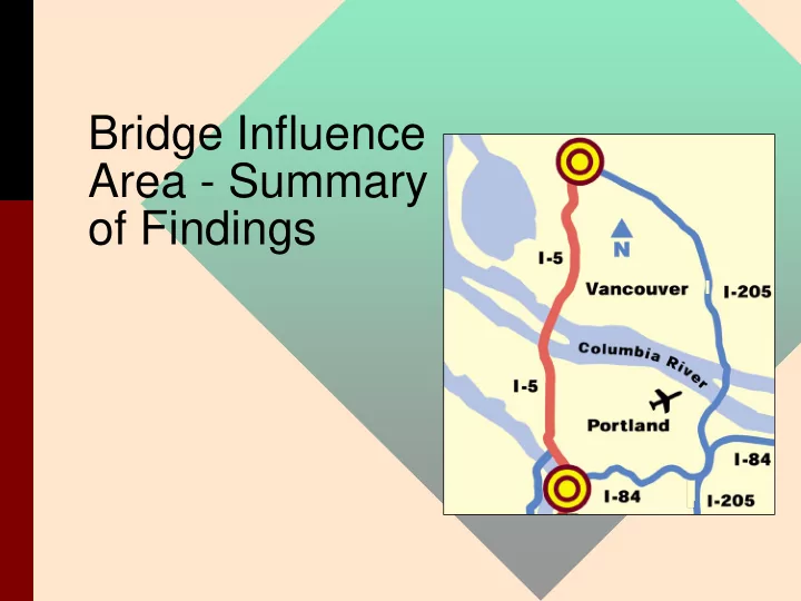
SLIDE 1
Bridge Influence Area - Summary
- f Findings
Bridge Influence Area - Summary of Findings About this - - PowerPoint PPT Presentation
Bridge Influence Area - Summary of Findings About this Presentation Focus is on: Bridge Influence Area (BIA) Traffic operations Impacts Costs Keep in mind -- draft recommendations include: LRT Loop
– Bridge Influence Area (BIA) – Traffic operations – Impacts – Costs
– LRT Loop – Substantially increased transit – Aggressive TDM targets
– New transit and vehicle capacity should be constructed across the Columbia River in the I-5 Corridor. – For vehicles, there should be no more than 3 through lanes in each direction and up to two supplemental lanes (auxiliary or local access) in each direction across the Columbia River (total 5 lanes in each direction). For transit, there should be two light rail tracks across the Columbia River in the I-5 Corridor. – In adding river-crossing capacity, every effort should be made to avoid displacements and encroachments. – The proposed design should include safety considerations.
Southbound - AM Peak Period Northbound - PM Peak Period BIA
NB PM Peak (2020) 11% Outside Metro Region 9% Battleground/N Clark Co. 7% E Clark Co. 11% Vancouver CBD/ Port of Vancouver 9% Outside Metro Region 22% Portland Central City 10% Washington Co. 19% N/NE Portland 1% Clackamas Co. 4% SW Portland 2% NW Portland 31% Columbia Corridor 2% SE Portland 32% Central/E Vancouver 30% Hazel Dell/ Salmon Creek Columbia River Bridges
Not to Scale
Southbound Northbound Northbound Existing bridges used for northbound traffic. New double-deck bridge for southbound freeway traffic and LRT, west of existing bridges.
VANCOUVER HAYDEN ISLAND
Low- to mid-level span over existing navigation channel.
five-lane bridge, LRT on lower deck -- west of existing bridges
with lift span over existing navigation channel
be split between the two existing bridges
Concept 1: 5-lane southbound supplemental bridge for freeway traffic w/LRT
Not to Scale
Northbound Southbound
HAYDEN ISLAND VANCOUVER
New mid- to high- level double-deck bridge for freeway traffic. Relocate shipping channel to mid-river. New mid- to high- level bridge for LRT.
Concept 4: 10-lane double deck, replacement bridge, plus LRT on separate new bridge
channel relocated to center of river
for highway and LRT (with Coast Guard reduction of existing lift requirements), or lift spans
Not to Scale
Southbound Northbound Southbound Northbound
VANCOUVER HAYDEN ISLAND
Low- to mid-level span over existing navigation channel. New double-deck bridge with LRT and four lanes of freeway traffic.
lane bridge with LRT west
with lift span over current navigation channel
collector-distributor (i.e., ramp access for Hayden Island, etc.). Requires fly-
south, as shown in the schematic on the left
Concept 6:
4-lane supplemental collector-distributor bridge w/LRT, plus 6 lane freeway
New 4-lane bridge Ex.3-lane bridge SB
bridge NB
Not to Scale
Southbound Northbound Southbound Northbound HOV, express,
lanes. Low- to mid-level span over existing navigation channel. Low- to mid-level span over existing navigation channel.
VANCOUVER HAYDEN ISLAND
lane bridge with LRT
bridges with lift spans
channel
northbound bridge could be used for HOV, express lanes, or (potentially) reversible lanes
Concept 7:
8-lane freeway concept plus new LRT bridge with two-lane arterial
Along I-5 (AM Peak Hour)
2000 4000 6000 8000 10000 12000 1-5 Mainline Begin 134th ON 99th St. ON 78th St. ON Main St. ON SR 500/39th ON 4th Plain ON Mill Plain ON SR 14 ON Jantzen Beach ON Marine Drive ON Victory Blvd. ON Columbia Blvd. ON Lombard WB ON Lombard EB ON Portland Blvd. ON Alberta St. ON Going St. ON Greeley ON I-405 ON Weidler ON 1-5 Mainline End
On-Ramps Locations (Full Corridor)
Southbound Traffic Volumes (Post-Processed AM Peak Hour)
2000 Existing 2020 Priority Baseline 2020 LRT/3 Lanes
2000 4000 6000 8000 10000 12000 I-5 Mainline Begin I-84 ON Tillamook ON I-405 ON Going ON Alberta ON Portland Blvd. ON Columbia Blvd. ON Denver/Delta ON Marine/Swift ON Hayden Is. ON SR14 ON Mill Plain ON 4th Plain ON 39th ON Main St. ON 78th St. ON 99th St. ON 134th St. ON I-205 ON I-5 Mainline End
On-Ramps Locations (Full Corridor)
Northbound Traffic Volumes (Post-Processed PM Peak Hour)
2000 Existing 2020 Priority Baseline 2020 LRT/3 Lanes
Along I-5 (PM Peak Hour)
10 20 30 40 50 60 6:30 AM 7:30 AM 8:30 AM
Time Southbound Speed (MPH)
2000 Existing 2020 Baseline 2020 10-Lane Double Deck Bridge 2020 6-Lane Fwy plus 4-Lane CD 2020 8-Lane Fwy plus Arterial Concept
Main St. Lombard
Columbia River
I -5
SR-500
.-~
10 20 30 40 50 60 2:30 PM 3:30 PM 4:30 PM 5:30 PM
Time Northbound Speed (MPH)
2000 Existing 2020 Baseline 2020 10-Lane Double Deck Bridge 2020 6-Lane Fwy plus 4-Lane CD 2020 8-Lane Fwy plus Arterial Concept
Main St. Lombard
Columbia River
I -5
SR-500
,-____________________________________________________________________________
~D
(AM and PM Peak Periods)
5000 10000 15000 20000 25000 30000 35000 2000 Existing 2020 Baseline 2020 10-Lane Double Deck Bridge 2020 6-Lane Fwy plus 4-Lane CD 2020 8-Lane Fwy plus Arterial Concept
Concept Package Vehicle Hours of Delay on Freeway (7 Hours)
8% I-5 20% Mill Plain/Fourth Plain 24% SR 14 17% Vancouver CBD 9% Denver 13% Marine Drive (west) 31% Hayden Island 17%Marine Drive (east) 2% Other 28% Hayden Island (west) 21% Other 10% Fruit Valley Road Arterial Bridge across Columbia River
Trip Patterns, NB Across Columbia River (PM Peak Period)
Average Trip Length Northbound Across Columbia River (PM Peak Hour)
14.7 15.7 17 5.7 39.4 9 13.6 13.5 17.2 13.5 37.6 38.7 8.9 16.9 16.6 15.7
5 10 15 20 25 30 35 40 45 Existing I-5 Baseline (2020) I-5 LRT/3 lanes I-5 Arterial Bridge
Option Package Miles SOV HOV Truck Average
full interchange
Marine Drive interchange
Columbia Blvd., Denver Ave, Marine Drive, MLK Blvd., and Hayden Island.
key industrial destinations: Port of Vancouver, Columbia Corridor, Rivergate
reduced delay on I-5
predictability
Along I-5 (AM Peak Hour)
2000 4000 6000 8000 10000 12000 1-5 Mainline Begin 134th ON 99th St. ON 78th St. ON Main St. ON SR 500/39th ON 4th Plain ON Mill Plain ON SR 14 ON Jantzen Beach ON Marine Drive ON Victory Blvd. ON Columbia Blvd. ON Lombard WB ON Lombard EB ON Portland Blvd. ON Alberta St. ON Going St. ON Greeley ON I-405 ON Weidler ON 1-5 Mainline End
On-Ramps Locations (Full Corridor)
Southbound Traffic Volumes (Post-Processed AM Peak Hour)
2000 Existing 2020 Priority Baseline 2020 LRT/3 Lanes
2000 4000 6000 8000 10000 12000 I-5 Mainline Begin I-84 ON Tillamook ON I-405 ON Going ON Alberta ON Portland Blvd. ON Columbia Blvd. ON Denver/Delta ON Marine/Swift ON Hayden Is. ON SR14 ON Mill Plain ON 4th Plain ON 39th ON Main St. ON 78th St. ON 99th St. ON 134th St. ON I-205 ON I-5 Mainline End
On-Ramps Locations (Full Corridor)
Northbound Traffic Volumes (Post-Processed PM Peak Hour)
2000 Existing 2020 Priority Baseline 2020 LRT/3 Lanes
Along I-5 (PM Peak Hour)
BIA Estimated Costs $2002 dollars - in millions* Concept LRT Arterial Freeway Total Ten- lane Freeway Concepts 5-lane southbound supplemental bridge for freeway traffic w/LRT $69 $0 $969 $1,038 10-lane double deck, replacement bridge, plus LRT on separate new bridge $186 $0 $989 $1,175 Eight freeway lanes plus two-lane arterial 8-lane freeway concept, plus new LRT bridge with two-lane arterial $69 $142 $612 $824
* Costs of potential improvements from SR 500 to Columbia Blvd, plus the Delta Park to Lombard widening.
Concept #1: 5- lane southbound supplemental bridge for freeway traffic w/LRT Concept #4: 10- lane double deck, replacement bridge, plus LRT
bridge Concept #6: 4- lane supplemental collector- distributor bridge w/LRT, plus 6 lane freeway Concept #7: 8- lane freeway concept plus new LRT bridge with two-lane arterial Resi- dential Non- Resi- dential Resi- dential Non- Resi- dential Resi- dential Non- Resi- dential Resi- dential Non- Resi- dential Displacements Vancouver 1 2 Portland 8 16 6 8 20 21 6 17 Total 8 16 6 9 20 23 6 17 Encroachments Vancouver 21 15 9 8 15 26 13 10 Portland 17 27 1 17 19 Total 21 32 9 35 16 43 13 29
building, however no historic buildings would be impacted
National Register of Historic Places and the southbound bridge is eligible for registration.
– construction staging – optimal alignment for LRT and hwy, and – light rail station siting
– optimizing traffic operations (replacement is easier) – costs (supplemental may be as costly as replacement) – right of way impacts (replacement appears to have fewer impacts) – impacts to cultural and historic resources (both supplemental and replacements have trade-offs)
0.0% 5.0% 10.0% 15.0% 20.0% 25.0% 30.0% 35.0% 40.0% Existing (2000) No Build Baseline West Arterial Express Bus/3 Lanes LRT/3 Lanes Express Bus/4 Lanes LRT/4 Lanes
Option Package Percentage Congested Lane-Miles
(4-Hour PM Peak Period)
Congested Lane-Miles (PM Peak)
24.1% 33.7% 30.4% 25.2% 19.8% 19.5% 13.6% 13.0%
0.0% 5.0% 10.0% 15.0% 20.0% 25.0% 30.0% 35.0% 40.0% Existing (2000) No Build (2020) Baseline (2020) West Arterial Express Bus/3 Lanes LRT/3 Lanes Express Bus/4 Lanes LRT/4 Lanes
Option Package Percentage Congested Lane-Miles
(4-Hour PM Peak Period)
Congested Lane-Miles (PM Peak)
25.1% 21.1% 22.6% 18.7% 18.9% 20.7% 19.3% 30.1%
5 10 15 20 25 30 35 40 45 50 Existing (2000) No Build (2020) Baseline (2020) West Arterial Express Bus/3 Lanes LRT/3 Lanes Express Bus/4 Lanes LRT/4 Lanes
Option Package Vehicle Travel Time in Minutes
(4-Hour PM Peak Period)
SOV/Truck HOV
38 44 40 34 32 31 30 21 33 37 35 29 25 25 25 21
5000 10000 15000 20000 25000 30000 35000
Existing (2000) No Build (2020) Baseline (2020) West Arterial Express Bus/3 Lanes LRT/3 Lanes Express Bus/4 Lanes LRT/4 Lanes
Option Package Vehicle Hours of Delay
(4-Hour PM Peak Period)
Other Roads Truck Routes
In the Study Area (PM Peak)
4359 4327 4065 2660 3891 4197 4751 6281 17,088 12,310 13,123 10,424 11,997 11,629 13,390 25,767
(In the Study Area)
$0 $5,000,000 $10,000,000 $15,000,000 $20,000,000 $25,000,000 $30,000,000 $35,000,000 $40,000,000 Existing (2000) No Build (2020) Baseline (2020) West Arterial Express Bus/3 Lanes LRT/3 Lanes Express Bus/4 Lanes LRT/4 Lanes
Option Package Annual Value of Truck Delays
$34.0M $21.3M $26.5M $17.2M $19.7M $20.4M $14.1M $16.9M
Main St. Lombard
Columbia River
I -5
SR-500
60 50
"C
Qj
40
Qj
C-
en
"C -
::I:
c a.. 30
::::I
0 :2:
..c - ..c
::::I
20
en
10
6:30 AM 7:30 AM
Time
8:30 AM
02000 Existing 02020 Baseline 02020 10-Lane Double Deck Bridge
4-Lane CD
&l 2020 Sola ne Fwy pi us
Arterial Conce
Main St. Lombard
Columbia River
I -5
SR-500
60
02000 Existing 02020 Baseline 02020 1
O-La ne Double
50
Deck Bridge
4-Lane CD flI2020 Sola ne Fwy pi "C
40
Arterial Concept
QI QI
C-
en
"C -
::I:
c a.. 30
::::I
0 :2:
..c - ..c
::::I
en
20 2:30 PM 3:30 PM 4:30 PM 5:30 PM
Time
(AM and PM Peak Periods)
1000 2000 3000 4000 8000 6000 5000
Vehicle Hours of Delay (VHD)
7000 100000
Demand Volume
D
VHD
90000
"'C
80000
c
'"
E
Qj
C 70000
"'C '':::
Qj
60000
a.
",Vi'
~ ~
Qj
:::l
50000
:;:J:
a.!::.
"'C
40000
c
'"
:;:
30000
« '"
20000
10000 2000 Existing 2020 Baseline 2020 10-Lane Double 2020 6-Lane Fwy plus 2020 8-Lane Fwy plus Deck Bridge 4-Lane CD Arterial Concept
Concept Package
7:00-8:00 AM 4:00-5:00 PM
Peak Demand 14000 13000 12000 11000
10000 - -, 9000
:g 8000
._ 7000 J:
CI)
>
6000 5000 4000 3000 2000 1000
2000 2020 202010- 20206- 20208- 2000 2020 202010- 20206- 20208- Existing Baseline Lane Lane Fwy Lane Fwy Existing Baseline Lane Lane Fwy Lane Fwy Double plus 4- plus Double plus 4- plus Deck Lane CD Arterial Deck Lane CD Arterial Bridge Concept Bridge Concept
2000 4000 6000 8000 10000 12000 I-5 Mainline Begin I-84 ON Tillamook ON I-405 ON Going ON Alberta ON Portland Blvd. ON Columbia Blvd. ON Denver/Delta ON Marine/Swift ON Hayden Is. ON SR14 ON Mill Plain ON 4th Plain ON 39th ON Main St. ON 78th St. ON 99th St. ON 134th St. ON I-205 ON I-5 Mainline End
On-Ramps Locations
Northbound Traffic Volumes (Post-Processed PM Peak Hour)
2000 Existing 2020 Priority Baseline 2020 LRT/3 Lanes
Northbound (PM Peak Hour)
Southbound (AM Peak Hour)
2000 4000 6000 8000 10000 12000 1-5 Mainline Begin 134th ON 99th St. ON 78th St. ON Main St. ON SR 500/39th ON 4th Plain ON Mill Plain ON SR 14 ON Jantzen Beach ON Marine Drive ON Victory Blvd. ON Columbia Blvd. ON Lombard WB ON Lombard EB ON Portland Blvd. ON Alberta St. ON Going St. ON Greeley ON I-405 ON Weidler ON 1-5 Mainline End
On-Ramps Locations
Southbound Traffic Volumes (Post-Processed AM Peak Hour)
2000 Existing 2020 Priority Baseline 2020 LRT/3 Lanes
Northbound traveling to I-5 Columbia River Bridge (PM Peak Period)
11% 20% 45% 24% I-5: Traffic already on I-5 Denver Ave. MLK Blvd. Other Roads: Marine Dr., Hayden Island, etc.
Marine Dr. Columbia River
I -5
SR-500 Denver Ave. I -5 MLK Ave. Hayden I sland
2000 4000 6000 8000 10000 12000 Going St. Portland Blvd. Columbia Blvd. Denver/Delta Marine/Swift Columbia River
On-Ramps Locations
Northbound Traffic Volumes (Post-Processed PM Peak Hour)
2000 Existing 2020 Priority Baseline 2020 LRT/3 Lanes
Northbound (PM Peak Hour)
,---r-- ,---
r--
.---
, , , , ,
2000 4000 6000 8000 10000 12000 South of Going St. South of Portland Blvd. South of Columbia Blvd. North of Columbia Blvd.
Screenline Locations
Northbound Traffic Volumes (emme/2 PM 4-Hour Volume)
2000 Existing 2020 Priority Baseline 2020 LRT/3 Lanes 2020 8-Lane Fwy plus Arterial Concept
Northbound (PM Peak Period)
2000 4000 6000 8000 10000 12000 South of Going St. South of Portland Blvd. South of Columbia Blvd. North of Columbia Blvd.
Screenline Locations
Northbound Traffic Volumes (emme/2 PM 4-Hour Volume)
2000 Existing 2020 Priority Baseline 2020 LRT/3 Lanes 2020 8-Lane plus Arterial Concept
Northbound (PM Peak Period)
Northbound traveling to I-5 Columbia River Bridge (PM Peak Period)
6% 2% 18% 27% 8% 30% 9% Mill Plain/4th Plain (west of I-5) Main/Washington St. north of 4th Plain I-5: continue on I-5 north of SR 500 SR 500 east of I-5 Mill Plain/4th Plain (east of I-5) SR 14 east of I-5 Other
2000 4000 6000 8000 10000 12000 Columbia River SR14 Mill Plain 4th Plain 39th/SR 500
On-Ramps Locations
Northbound Traffic Volumes (Post-Processed PM Peak Hour)
2000 Existing 2020 Priority Baseline 2020 LRT/3 Lanes
Northbound (PM Peak Hour)
,--- ,---
,---
,
2000 4000 6000 8000 10000 12000 East of Fruit Valley Road West of Main/ Washington St. West of I-5
Screenline Locations
Northbound Traffic Volumes (emme/2 PM 4-Hour Volume)
2000 Existing 2020 Priority Baseline 2020 LRT/3 Lanes 2020 8-Lane plus Arterial Concept
West of I-5 ( Northbound, PM Peak Period)
2000 4000 6000 8000 10000 12000 East of I-5 East of St. Johns/ Fort Vancouver Way East of Grand Ave. East of Andresen Rd.
Screenline Locations
Northbound Traffic Volumes (emme/2 PM 4-Hour Volume)
2000 Existing 2020 Priority Baseline 2020 LRT/3 Lanes 2020 8-Lane plus Arterial Concept
East of I-5 ( Northbound, PM Peak Period)
2000 4000 6000 8000 10000 12000 North of 6th St. North of Evergreen St. North of Mill Plain Blvd. South of 4th Plain Blvd. North of 4th Plain Blvd.
Screenline Locations
Northbound Traffic Volumes (emme/2 PM 4-Hour Volume)
2000 Existing 2020 Priority Baseline 2020 LRT/3 Lanes 2020 8-Lane plus Arterial Concept
Northbound (PM Peak Period)
2000 4000 6000 8000 10000 12000 East of I-5 East of Grand Ave. West of Evergreen Blvd. ramp
Screenline Locations
Northbound Traffic Volumes (emme/2 PM 4-Hour Volume)
2000 Existing 2020 Priority Baseline 2020 LRT/3 Lanes 2020 8-Lane plus Arterial Concept
(PM Peak Period)
.-~D
Northbound traveling to I-5 Columbia River Bridge (PM Peak Period)
11% 20% 45% 24% I-5: Traffic already on I-5 (N
Denver Ave. (N of Columbia) MLK Blvd. (N of Columbia) Other Roads: Marine Dr., Hayden Island, etc.
Marine Dr. Columbia River
I -5
SR-500 Denver Ave. I -5 MLK Ave. Hayden I sland
Northbound traveling to I-5 Columbia River Bridge (PM Peak Period)
6% 2% 18% 27% 8% 30% 9% Mill Plain/4th Plain (west of I-5) Main/Washington St. north of 4th Plain I-5 north of SR 500 SR 500 east of I-5 Mill Plain/4th Plain (east of I-5) SR 14 east of I-5 Other
2000 4000 6000 8000 10000 12000 14000 East of I-5 East of 39th St. East of St. Johns Rd. East of Andresen Rd. West of I-205
Screenline Locations
Northbound Traffic Volumes (emme/2 PM 4-Hour Volume)
2000 Existing 2020 Priority Baseline 2020 LRT/3 Lanes 2020 8-Lane plus Arterial Concept
Along SR 500 - east of I-5 (PM Peak Period)