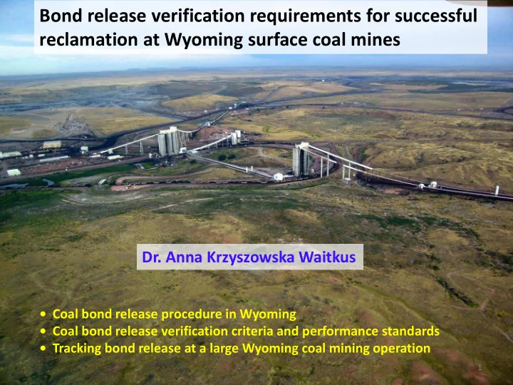
SLIDE 1 Bond release verification requirements for successful reclamation at Wyoming surface coal mines
- Coal bond release procedure in Wyoming
- Coal bond release verification criteria and performance standards
- Tracking bond release at a large Wyoming coal mining operation
1
- Dr. Anna Krzyszowska Waitkus
SLIDE 2 41% of USA total coal production comes from Wyoming
Million tons, 2015
2 North Antelope Rochelle Mine (NARM)
SLIDE 3 The Federal, Surface Mining Control and Reclamation Act (SMCRA) requires as a condition for obtaining a coal mining permit posting a reclamation performance bond to ensure that:
- regulatory authority will have sufficient funds to reclaim the site if the
permittee fails to complete the reclamation plan approved in the permit.
- regulatory authority will have sufficient funds to hire a third party to
complete the reclamation plan in the event of a bankruptcy of the coal mine company.
Reclamation bond
3
SLIDE 4 Mineral Bond, $ %
Coal, 35 coal mines 2,828,871,264 82 Uranium 375,450,294 11 Trona 149,516,450 4 Bentonite 70,432,273 2 Sand & gravel, granite, limestone, sandstone, clay, decorative rock, diamonds, dolomite, feldspar, gravel, gypsum, iron, jade, leonardite, opal, quartzite, sand, scoria, shale 42,694,405 1 Total
3,466,964,687
100
Total bond for minerals mined in Wyoming (November 2014)
4
SLIDE 5 5
- The permittee may apply for bond release through incremental bond
release phases as the permittee completes phases of reclamation.
- Wyoming Department of Environmental Quality (WDEQ), Land
Quality Division (LQD) approves reclamation bond submitted by the permittee through Annual Reports.
- Bond release - reduction of the reclamation bonds and the financial
risk to the public.
Reclamation bond
SLIDE 6 Wyoming reclamation bond release procedures
There are two steps to release a bond: 1. Verification and evaluation of bond release criteria and performance standards for reclaimed areas. 2. Reclamation bond release approval of areas that were verified.
6
SLIDE 7 Bond release phases Verification of the bond release criteria
Area Bond Backfilling, regrading completed according to the approved plan Phase 1 Stream channels reconstructed Soil applied Phase 2 Vegetation established (ocular evaluation) Surficial stability established Permanent impoundment construction/renovation designed and State Engineer Office approved Phase 3 Revegeation success standards established (statistical analysis) Mitigation of wetlands (approved by the US Army Corps of Engineers) Trees established
Each of the bond release phases has certain criteria and performance standards (permit commitments) that must be met before the bond is released.
60% Bond release phases and bond release verification criteria, WY 15% 25%
7
SLIDE 8 How this is done at the State of Wyoming ?
1. Bond release verification request for specific areas (submittals by the operator)
- inspections by the WDEQ/LQD of the requested area
- reviews of the submitted information
- approval of the request within 60 days from the submittal
- 2. Bond release request for areas that have already been verified.
- declaration of completion within 15 days from the approved submittal.
3. After approval by the WDEQ/LQD - the public is notified.
- public notice asking for comments/objections is published in a local newspaper at
least once per week for four consecutive weeks. 4. WDEQ/LQD, OSMRE (federal agency) representatives, and the land owners perform the inspection of the bond release requested areas together.
- 5. Reclamation bond release for requested areas is approved.
Reclamation bond release procedures
8
SLIDE 9 9
- Guideline No. 20 - Bond Release Categories and Submittal Procedures for Coal Mines
- Guideline No. 21 – Area Bond and Rough Backfill Verification Procedures for Coal Mines
- Guideline No. 22 - Verification for Phase 1 Bond Release for Coal Mines
- Guideline No. 23 – Verification fro Phase 2 Bond Release Procedures for Coal Mines
- Guideline No. 25 – Verification for Phase 3 Bond Release Procedures for Coal Mines
Cooperative effort:
- WDEQ/LQD
- coal industry
- Office of Surface Mining, Reclamation and Enforcement (OSMRE)
- consultants
Wyoming guidelines, bond release
http://deq.wyoming.gov/lqd/resources/guidelines/
SLIDE 10 Bond release verification procedures
Verification of the:
- criteria
- performance standards
Field inspections Annual reports Reviews What? How?
10
SLIDE 11 11
- “As built” map demonstrating acceptable postmining topography (PMT).
- Elevation tolerance (reclaimed elevation are within +/- 20 feet of the
approved PMT).
- Drainage divides match those of the approved PMT.
- Hill slopes lengths and profiles (complex hill slope profile).
- Valley bottom alignment, slopes and profile (generally flattening in a
downstream direction).
- Special commitments (Alluvial Valley Floors construction).
Area Bond
Rough Backfill verification
SLIDE 12 12
Area Bond
Rough backfill verification
Approximate Original Contour
SLIDE 13 13
Phase 1- Stream Channels Reconstruction
- Permanent diversions and restored stream channels have been constructed
per approved designs and are stable (no erosion).
- Rebuilt drainages must meet the premine drainage elevations and
must “tie-in” to existing drainages in the surrounding native areas.
- Rebuilt all suitable channel morphology (gradients, lengths, profiles,
sinuosity) for all channels with a drainage area greater than 50 acres.
- No depression >0.5 acre-ft. unless approved.
- Suitable backfill quality in drainage channels and floodplains.
SLIDE 14
- During the inspection, the reconstructed
Porcupine Creek was surveyed by the LQD inspector using a handheld Geographic Positioning System (GPS) unit.
- The surveyed channel was overlaid on the
permit map to compare the restored location
- f the creek to the original channel.
- Results were very good.
14
Phase 1- Stream Channel Reconstruction Verification
SLIDE 15 Phase 1 – Soil depth verification
15
SLIDE 16 16
- permanent water impoundment construction
- Verified if the surface landowner has consented.
- Verified if State Engineer’s Office (SEO) has approved the
impoundment for its intended use.
Verification of:
- cular vegetation establishment
- surficial stability
Phase 2
Phase 1 Phase 2
SLIDE 17 17
Phase 3- verification submittals
Approved postmining land uses have been restored
- Achievement of the revegetation performance standards
- Achievement of the shrub stablishment goals and/or standards
- Achievement of the tree replacement standards
- Successful restoration of wildlife habitat
- Postmining ground water supports the approved postmining land uses
- Postmining surface water quality and quantity support the approved
postmining land use and minimize impacts to the hydrologic balance
- All approved postminng road types and corridors are in place and
functional in support of approved postminng land uses
- Removal of all temporary structures
SLIDE 18 Requirements Goals, standards Vegetation Production and cover estimated on reclaimed areas and compared with baseline Vegetation sampling Two years of monitoring data at the end of 10 year periods of vegetation establishment Species composition/diversity Quantitative and qualitative analysis of reclaimed areas compared to baseline based on:
- Species and life form % cover
- Relative cover
- Relative frequency
Shrub density Goal – 1 shrub/m 2 on 10% land (3/27/1981- 8/6/1996) Standard – 1 shrub/m 2 on 20% land (post 8/6/1996) Tree density The same as pre-mining (80% of trees have been in place for 8 years)
Phase 3 - achievement of the revegetation performance standards
SLIDE 19 Phase 3 - achievement of revegetation goals
Verified if bond for revegetation has been retained for at least ten years after the
- perator has completed seeding and other work to ensure revegetation.
Revegetation sampling methods:
- A map with vegetation units and Reference Areas.
- Vegetation description: composition, the major species, cover.
- Vegetation sampling time (after June 1st and before September 1st)
- Statistical analysis of results from transect points showing that: total plant cover,
total ground cover, perennial production, species compositions of the reclaimed areas are comparable with standards derived from the Reference Area.
19
SLIDE 20 Phase 3 -Postmining ground and surface water
Goals of the reclaimed mine land:
- Supports the postmining land use (grazing, wildlife use, pasture, cropland).
- Minimize disturbances to the hydrologic balance.
- Provides a rate of recharge that approximates the premining recharge rate.
Verification:
- WDEQ/LQD reviews data annually and decides if the groundwater quality and
quantity are trending toward baseline or groundwater uses.
- WDEQ/LQD reviews surface water quality data and decides if water quality is
within standards for livestock uses.
20
SLIDE 21 Reclamation bond, example
Cost of the incremental phases of contemporaneous reclamation (Phase 1) as of 2014 (calculation from the mine’s 2014-2015 Annual Report) for a coal mine.
Phases of reclamation 1 ac
Area bond (including backfilling, rough and final grading) $13,627 Topsoil replacement, scarifying and seeding $2,418 TOTAL $16,0445
21
SLIDE 22 Access Road
May 2005 July 2006 July 2010
Photos taken from the same location at the North Antelope Rochelle Mine (NARM)
Reclamation results at a large western US surface coal mine
22
SLIDE 23 How do we track all bond release verification criteria, performance standards and bond release areas?
GIS/GPS approach
- Using a Geographic Information System (GIS) Bond Release Geodatabase to
track the verification of environmental performance standards and reclaimed areas that have achieved bond release at NARM.
- Using a Geographic Positioning System (GPS) equipment to verify the
reclamation and bond release compliance requirements during inspections.
- Developed a system of spatial data exchange between the LQD and the
- perator for sending, verifying, and approving features of the Geodatabase.
SLIDE 24
Data sets, feature classes, attribute fields and domains were chosen on the basis of the WYLQD Guidelines.
Feature datasets Criteria, bond release verification = Feature classes
Structure of the geodatabase
SLIDE 25
GPS screen, field inspection
SLIDE 26
Field name Data type Domains Comments
Feature ID text Number Inspection Date date Calendar Date of the last inspection Inspector Name text Waitkus Choose the inspector name Erosion Type text Rill active, Rill inactive Gully active, Gully inactive Depth, width Erosion Compliance text Acceptable, Not acceptable A significant active or inactive feature is not acceptable Erosion Compliance Date date Calendar A target date when the erosional feature will be repaired Cover status text Permanent seeded Temporary seeded Mulched Vegetation present text Yes, No Comments text Photo_Link text Link to the folder: Documents_Hotlink
Compliance assessment-checking for erosion features
SLIDE 27
November 2009 November 2009 December 2009 December 2009
Tracking erosion features - photo hotlink
SLIDE 28
transparency of the collected data.
- Tracking of all bond release
verification criteria and performance standards.
- Streamlining data retrieval for
reports and summaries.
- Decreasing time of preparing an
inspection report by 50%.
document the location and circumstances of incidents and events for further action or reporting.
Benefits of Geodatabase- efficiency and quality
SLIDE 29