
SLIDE 1
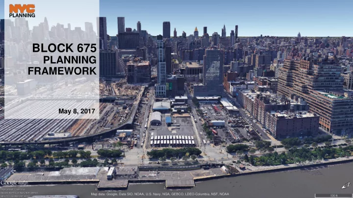
BLOCK 675
PLANNING FRAMEWORK
May 8, 2017
Map data: Google, Data SIO, NOAA, U.S. Navy, NGA, GEBCO, LDEO-Columbia, NSF, NOAA
BLOCK 675 PLANNING FRAMEWORK May 8, 2017 Map data: Google, Data - - PowerPoint PPT Presentation
BLOCK 675 PLANNING FRAMEWORK May 8, 2017 Map data: Google, Data SIO, NOAA, U.S. Navy, NGA, GEBCO, LDEO-Columbia, NSF, NOAA PURPOSE OF THE FRAMEWORK Articulate the Departments vision for Block 675 in terms of appropriate uses, density,
Map data: Google, Data SIO, NOAA, U.S. Navy, NGA, GEBCO, LDEO-Columbia, NSF, NOAA
2
3
Image Courtesy of Hudson River Park Trust
4
HELL’S KITCHEN
Tribeca Greenwich Village Meatpacking Chelsea Hell’s Kitchen Clinton
5
development rights
6
Special Hudson River Park District Map
Park District only includes Pier 40 (granting site) and the 550 Washington Street (receiving site).
transfer floor area from additional areas
sites, the Special District boundary will be amended to include those sites.
as potential new receiving sites for unused development rights on Piers 59, 60 and 61 including head houses in Hudson River Park.
Image courtesy of Google Earth; Map data: Google, SIO, NOAA, U.S. Navy, NGA, GEBCO
7
Western Rail Yards West Chelsea
ConEd Terminal Stores Starrett-Lehigh
Image courtesy of Google Earth; Map data: Google, SIO, NOAA, U.S. Navy, NGA, GEBCO
8
Douglaston Development LLC Lalezarian Properties LLC The Georgetown Company LLC Outparcel (Georgetown Company LLC)
Western Rail Yards West Chelsea ConEd
Source: Zoning Resolution, Zoning Map, DoF Map PLUTO
9
M2-3 M1-5 Hudson Yards WCh R8 M2-3 M1-6
12th Ave 11th Ave 10th Ave
10 19 (11) 5 / 7.5 7.5 / 12 10 2 2 5 33 24 33 24 21.6 13+2 6 21.6 13 13 5 5 6.5 2
C6-4
Source: DoF, PLUTO; land use information in HY is included based on as-of-right uses permitted by zoning and project information known to DCP. Subject to change.
10
M1-6 M2-3 C6-4 C6-4 C6-3
M1-6
12th Ave 11th Ave
Mixed use (projected) Mixed use (projected)
10 19 (11) 5 / 7.5 7.5 / 12 10 2
M2-3
Source: Building height information in HY is included based on information known to DCP. Subject to change.
11
* Roof heights of buildings in Hudson Yards are shown to the extent known for illustrative purposes
12
BLOCK 675
ConEd
13
Image courtesy of Hudson Tunnel Project http://www.hudsontunnelproject.com/documents/2017-04-05_Preferred_Alternative_Figure..pdf
Image courtesy of Google Earth; Map data: Google, SIO, U.S. Navy, NGA, GEBCO, LDBO-Columbia, NSF, NOAA
14
Image courtesy of Google Earth; Map data: Google, SIO, U.S. Navy, NGA, GEBCO, LDBO-Columbia, NSF, NOAA
15
Source: DoF, PLUTO; land use information in HY is included based on as-of-right uses permitted by zoning and project information known to DCP. Subject to change.
16
11th Ave
Mixed use (projected) Mixed use (projected) ConEd
17
11th Ave Looking South Conceptual illustration of north side of W 30th Street in Western Rail Yards
18
Open Space Corridor Commercial / Residential Corridor Active uses/glazing on ground floor Active uses/glazing on lower floors
11th Ave
19
frontages facing the High Line
Line level
Photo credit: Adrian Bonanni, DCP Manhattan Office
20
frontages facing the High Line
Line level
21
11th Ave
22
EXISTING
manufacturing district
district
11th Ave
23
districts
Hudson River Park
districts
Hudson River Park
Tunnel ventilation structure
RECOMMENDED
11th Ave
24
B C
(~ 25’ – 45’) (~ 45’ – 85’) (~ 85’ – 90’)
C A B General range of recommended base heights: A B C
Note: Building heights based on information known publicly; sources include PLUTO, DOB, press releases, Curbed, etc.
25
transitioning context
26
transitioning context
Sight lines
27
sites in Special Hudson River Park District
needs
+ Up to 20% HRP TDR
+ Up to 20% HRP TDR
structure
appropriate heights
River