
SLIDE 1
Workshop for Solar Energy and Smart Grid Development, Asian Development Bank, Regional Task Force [1] 13-15 September 2011, Jodhpur, Rajasthan, India
Bankable solar resource assessment and risk management in planning - - PowerPoint PPT Presentation
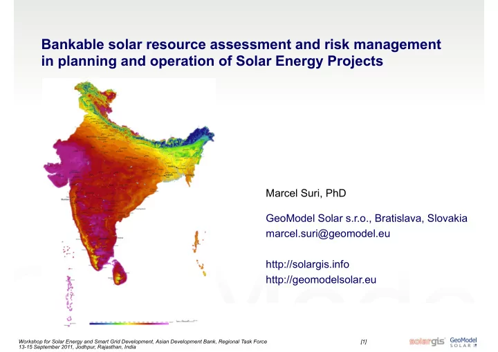
Bankable solar resource assessment and risk management in planning and operation of Solar Energy Projects Marcel Suri, PhD GeoModel Solar s.r.o., Bratislava, Slovakia marcel.suri@geomodel.eu http://solargis.info http://geomodelsolar.eu
Workshop for Solar Energy and Smart Grid Development, Asian Development Bank, Regional Task Force [1] 13-15 September 2011, Jodhpur, Rajasthan, India
Workshop for Solar Energy and Smart Grid Development, Asian Development Bank, Regional Task Force [2] 13-15 September 2011, Jodhpur, Rajasthan, India
Workshop for Solar Energy and Smart Grid Development, Asian Development Bank, Regional Task Force [3] 13-15 September 2011, Jodhpur, Rajasthan, India
Workshop for Solar Energy and Smart Grid Development, Asian Development Bank, Regional Task Force [4] 13-15 September 2011, Jodhpur, Rajasthan, India
Workshop for Solar Energy and Smart Grid Development, Asian Development Bank, Regional Task Force [5] 13-15 September 2011, Jodhpur, Rajasthan, India
Workshop for Solar Energy and Smart Grid Development, Asian Development Bank, Regional Task Force [6] 13-15 September 2011, Jodhpur, Rajasthan, India
Workshop for Solar Energy and Smart Grid Development, Asian Development Bank, Regional Task Force [7] 13-15 September 2011, Jodhpur, Rajasthan, India
Workshop for Solar Energy and Smart Grid Development, Asian Development Bank, Regional Task Force [8] 13-15 September 2011, Jodhpur, Rajasthan, India
Workshop for Solar Energy and Smart Grid Development, Asian Development Bank, Regional Task Force [9] 13-15 September 2011, Jodhpur, Rajasthan, India
Workshop for Solar Energy and Smart Grid Development, Asian Development Bank, Regional Task Force [10] 13-15 September 2011, Jodhpur, Rajasthan, India
Workshop for Solar Energy and Smart Grid Development, Asian Development Bank, Regional Task Force [11] 13-15 September 2011, Jodhpur, Rajasthan, India
Workshop for Solar Energy and Smart Grid Development, Asian Development Bank, Regional Task Force [12] 13-15 September 2011, Jodhpur, Rajasthan, India
Workshop for Solar Energy and Smart Grid Development, Asian Development Bank, Regional Task Force [13] 13-15 September 2011, Jodhpur, Rajasthan, India
Workshop for Solar Energy and Smart Grid Development, Asian Development Bank, Regional Task Force [14] 13-15 September 2011, Jodhpur, Rajasthan, India
Workshop for Solar Energy and Smart Grid Development, Asian Development Bank, Regional Task Force [15] 13-15 September 2011, Jodhpur, Rajasthan, India
Workshop for Solar Energy and Smart Grid Development, Asian Development Bank, Regional Task Force [16] 13-15 September 2011, Jodhpur, Rajasthan, India
Workshop for Solar Energy and Smart Grid Development, Asian Development Bank, Regional Task Force [17] 13-15 September 2011, Jodhpur, Rajasthan, India
Workshop for Solar Energy and Smart Grid Development, Asian Development Bank, Regional Task Force [18] 13-15 September 2011, Jodhpur, Rajasthan, India
Workshop for Solar Energy and Smart Grid Development, Asian Development Bank, Regional Task Force [19] 13-15 September 2011, Jodhpur, Rajasthan, India
Workshop for Solar Energy and Smart Grid Development, Asian Development Bank, Regional Task Force [20] 13-15 September 2011, Jodhpur, Rajasthan, India
Workshop for Solar Energy and Smart Grid Development, Asian Development Bank, Regional Task Force [21] 13-15 September 2011, Jodhpur, Rajasthan, India
Workshop for Solar Energy and Smart Grid Development, Asian Development Bank, Regional Task Force [22] 13-15 September 2011, Jodhpur, Rajasthan, India
Workshop for Solar Energy and Smart Grid Development, Asian Development Bank, Regional Task Force [23] 13-15 September 2011, Jodhpur, Rajasthan, India
Workshop for Solar Energy and Smart Grid Development, Asian Development Bank, Regional Task Force [24] 13-15 September 2011, Jodhpur, Rajasthan, India
Workshop for Solar Energy and Smart Grid Development, Asian Development Bank, Regional Task Force [25] 13-15 September 2011, Jodhpur, Rajasthan, India
Workshop for Solar Energy and Smart Grid Development, Asian Development Bank, Regional Task Force [26] 13-15 September 2011, Jodhpur, Rajasthan, India