SLIDE 1
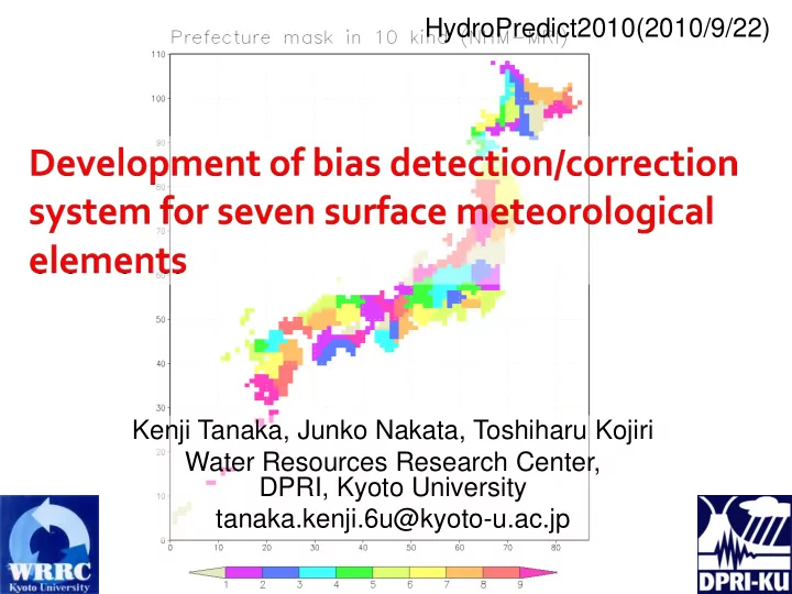
HydroPredict2010(2010/9/22) Kenji Tanaka, Junko Nakata, Toshiharu Kojiri Water Resources Research Center, DPRI, Kyoto University tanaka.kenji.6u@kyoto-u.ac.jp
SLIDE 2
Recently, a sense of impending crisis for the global warming came to be realized. Social needs for the concrete description of future climate has been increasing. Although RCMs have accomplished remarkable development in recent years, the requirement from user side on the resolution and the accuracy has been increasing more and more for detailed assessment of climate change impact. Thus, there is still a gap between precision realized by models and that required from users.
Back ground
SLIDE 3 Bias correction Bias detection Multi-model ensemble Model output
NIED Tsuku ba U. MRI
RCM20s
Validation data 20km grid future climate scenario
GCM
AOGCM
Global environment research fund (Ministry of Environment) S-5-3 "Multi-model ensemble and downscaling for global warming impact assessment study (FY2007-FY2011)”
KAKUSHIN GCM20km
SLIDE 4
RCM output v1 Bias detection RCM output v2 RCM output v3 Bias detection
Bias detection & correction Through the exchange of bias information, RCM is tuned or updated. Then, model bias of the next product will be reduced.
SLIDE 5
The resolution of climate model (GCM, RCM) is becoming smaller and smaller. But the resolution of the model grid is not the scale for meaningful result. Model results should be evaluated in a scale of several grids (3x3 or 4x4,…) Δx scale area target 300km ~1000km 1,000,000km2 country 100km ~300km 100,000km2 district 20km ~70km 5,000km2 prefecture 3km ~10km 100km2 city
SLIDE 6 Bias evaluation for each prefecture / river basin unit
(unit size: 5,000 -6,000 km2)
Not only mean value, but also frequency distribution Designed to be general so that it can easily fit to the
difference of grid coordinate or change in model setting
Items to be evaluated (forcing variables for LSM)
Prec, Tair, Eair, SWdown, LWdown, Wind, Psfc
7 surface meteorological variables
SLIDE 7 1.
Creation of river basin mask and prefecture mask
2.
Finding corresponding grid for each observation station
3.
Re-ordering RCM output (2D 1D)
4.
Detection of model mean bias, calculating frequency distribution, percentile, etc.
5.
Bias correction considering frequency distribution
SLIDE 8 Prefecture mask for NHMMRI2 grids
1 Souya 宗谷支庁 31 Fukui 福井 2 Kamikawa 上川支庁 32 Yamanashi 山梨 3 Rumoi 留萌支庁 33 Nagano 長野 4 Ishikari 石狩支庁 34 Gifu 岐阜 5 Sorachi 空知支庁 35 Shizuoka 静岡 6 Shiribeshi 後志支庁 36 Aichi 愛知 7 Abashiri 網走支庁 37 Mie 三重 8 Nemuro 根室支庁 38 Shiga 滋賀 9 Kushiro 釧路支庁 39 Kyoto 京都 10 Tokachi 十勝支庁 40 Osaka 大阪 11 Iburi 胆振支庁 41 Hyogo 兵庫 12 Hidaka 日高支庁 42 Nara 奈良 13 Oshima 渡島支庁 43 Wakayama 和歌山 14 Hiyama 檜山支庁 44 Tottori 鳥取 15 Aomori 青森 45 Shimane 島根 16 Iwate 岩手 46 Okayama 岡山 17 Miyagi 宮城 47 Hiroshima 広島 18 Akita 秋田 48 Yamaguchi 山口 19 Yamagata 山形 49 Tokushima 徳島 20 Fukushima 福島 50 Kagawa 香川 21 Ibaraki 茨城 51 Ehime 愛媛 22 Tochigi 栃木 52 Kochi 高知 23 Gunma 群馬 53 Fukuoka 福岡 24 Saitama 埼玉 54 Saga 佐賀 25 Chiba 千葉 55 Nagasaki 長崎 26 Tokyo 東京 56 Kumamoto 熊本 27 Kanagawa 神奈川 57 Oita 大分 28 Niigata 新潟 58 Miyazaki 宮崎 29 Toyama 富山 59 Kagoshima 鹿児島 30 Ishikawa 石川 60 Okinawa 沖縄
SLIDE 9
Finding corresponding grid
grid grid point AMeDAS station
SLIDE 10 Available surface meteorological observation
- SDP (meteorological observatory) 155stations
items: Psfc, Psea, Tair, Eair, RH, Wdir, Wind, cloud, weather, Tdew, SShr, SWdown, Prec
- AMeDAS (Automatic weather station) ~1400stations
items: Prec, Tair, SShr, Wdir, Wind
22 27 32 37 42 47 122 127 132 137 142 147 系列1 22 27 32 37 42 47 122 127 132 137 142 147 系列1
SDP AMeDAS
SLIDE 11
Observation for short-wave radiation
SDP (155 station) 66 station has SWdown & SShr(sunshine) 89 station has SShr only AMEDAS (about 1400 station) about 840 station has SShr only SWdown = (A (N/N0) + B) S0top N:SShr (observation) N0:potential sunshine duration S0top:SWdown at the top of atmosphere LWdown = E σ Tair4 E = 1- (1- C) D C = 0.74+0.19wtop+0.07wtop2 wtop: fnc (Tdew) D = 0.826(N/N0)3-1.234(N/N0)2+1.135(N/N0)+0.298
N,Tair,Tdew,lat,lon,DOY,hr SWdown, LWdown
SLIDE 12 Organization model version name (fmod) period MRI NHM Ver2 NHMMRI2 20yr (1985-2004) NIED RAMS Ver1 RAMSDP1 29yr (1979-2007) Tsukuba Univ. RAMS Ver1 RAMSTU1 20yr (1985-2004) Tsukuba Univ. WRF Ver1 WRF-TU1 20yr (1985-2004) MRI GCM GCM20km 25yr (1979-2003)
name mx my mr mp im iamax NHMMRI1 105 115 60 60 54 1076 NHMMRI2 131 121 61 60 49 1047 RAMSDP0 130 140 62 60 57 1094 RAMSDP1 128 144 62 60 57 1094 RAMSTU0 130 140 62 60 57 1094 RAMSTU1 130 140 62 60 57 1094 WRF-TU1 129 139 56 60 47 958 GCM20km 163 162 67 60 69 1275
Available 20km model output
SLIDE 13
Prefecture mask For each model
SLIDE 14
Bias of monthly mean value(NHMMRI2)
Observation AMeDAS SDP X: month Y: prefecture
SLIDE 15 every 1hr data are classified for each month 2 steps correction
Temporal correction with fixed ratio Adjustment of correction factor for each class
Monthly mean value Frequency distribution
class 1 2 3 4 5 6 7 8 fixed ratio
variable ratio provisional
SLIDE 16
Aomori Miyagi Tokyo Niigata Shizuoka Osaka Kouchi Fukuoka Kagoshima
Histogram (NHMMRI2, Prec, July)
SLIDE 17
Histogram (NHMMRI2, Tair, August)
Aomori Miyagi Tokyo Niigata Shizuoka Osaka Kouchi Fukuoka Kagoshima
SLIDE 18 Prec, 1hr, 0.900, July Prec, 1hr, 0.990, July Prec, 1hr, 0.999, July Tair, 1hr, 0.900, Aug Tair, 1hr, 0.990, Aug Tair, 1hr, 0.999, Aug
SLIDE 19
Statistics for extreme value
Prec, 1hr CC (0.900) Prec, 1hr CC (0.990) Prec, 1hr CC (0.999) Prec, 1day CC (0.900) Prec, 1day CC (0.990) Prec, 1day CC (0.999) Prec, 10day CC (0.900) Prec, 10day CC (0.990) Prec, 10day CC (0.999)
SLIDE 20
Statistics for extreme value
Tair, 1hr CC (0.900) Tair, 1hr CC (0.990) Tair, 1hr CC (0.999) Tair, 1day CC (0.900) Tair, 1day CC (0.990) Tair, 1day CC (0.999) Tair, 10day CC (0.900) Tair, 10day CC (0.990) Tair, 10day CC (0.999)
SLIDE 21
- 1. This study aims to develop the method for detecting and
correcting the bias information of RCMs. This system is designed to be general so that it can follow the change in model setting.
- 2. Model bias is evaluated for seven surface meteorological
items in each river basin or administrative unit. Not only the monthly mean value, but also frequency distribution is evaluated for each unit area.
- 3. A new bias correction method that can reproduce the
extreme values while keeping the monthly mean value is proposed. In most cases, this new method works well in getting better frequency distribution and extreme values.
- 4. Bias correction for hourly precipitation can improve the
statistics of extreme value of daily precipitation.
SLIDE 22
Future Works
Model output Evaluation period (observation)
Can detected model bias and correction factors be applicable to outside of the evaluation period? Can detected model bias and correction factors be directly applicable to future climate simulation result? 1985 2004 1991 2004
SLIDE 23
Stability (independency) of model bias
Model output Evaluation period (observation)
1985 2004 1991 2000 Sliding evaluation period, and selecting evaluation year according to mean temperature (warm year, cool year), stability (independency) of detected model bias should be investigated. Division of each class should be expressed in terms of mean value and standard deviation 1992 2001 1993 2002 1994 2003
SLIDE 24
Prec Evap Runoff Prec Evap Runoff Prec Evap Runoff Prec Evap Runoff
Difference in climate change assessment
bias correction no bias correction
SLIDE 25 Before bias correction
Unit(mm) Prec Evap Runoff Irrig Present 1189.6 456.8 804.3 61.4 Warm-up 897.0 481.1 503.1 73.4 Diff(W-P)
+24.3
+12.0
After bias correction
Unit(mm) Prec Evap Runoff Irrig Present 634.0 411.3 281.5 53.8 Warm-up 464.3 373.9 168.9 69.7 Diff(W-P)
+15.9
SLIDE 26
- riginal river code combined river code
SLIDE 27
SLIDE 28
SLIDE 29 +α
delS(α,i) : total change due to the change of correction factor of class i by α
階級1 階級2 階級3 階級4 階級5
1 2 3 4 5 7 6 8
k
1 2 3 4 5 6 7 8
l
del(1 (1) del(2 (2) del(3 (3) del(4 (4) del(5 (5) del(6 (6) del(7 (7) del(8 (8) 和
移動先の階級 元 の 階 級
Store(α,i,j) :change of class j amount due to the change of correction factor of class i by α
SLIDE 30 1
2
55.43
3
141.69
4
5
6
16.61
7
8
1 0.14 80.68 80.68 2 0.14
139.27 62.99 3 0.14
261.84 161 4 0.14
108.31 45 5 0.14
54.58 18.38 6 0.14 4.15 4.15 7 0.14 8 0.14
Example of Store(α,i,j), delS(α,i)
SLIDE 31 +α -β 階級1 階級2 階級3 階級4 階級5 +γ
1 2 3 4 5 7 6 8
k
1 2 3 4 5 6 7 8
l
ds ds
和 和
移動先の階級 元 の 階 級
Finding the best combination
- f variable ratio while keeping
monthly mean value
SLIDE 32 Prec, 1hr CC (0.900) Prec, 1hr CC (0.990) Prec, 1hr CC (0.999) Prec, 1day CC (0.900) Prec, 1day CC (0.990) Prec, 1day CC (0.999) Prec, 10day CC (0.900) Prec, 10day CC (0.990) Prec, 10day CC (0.999)