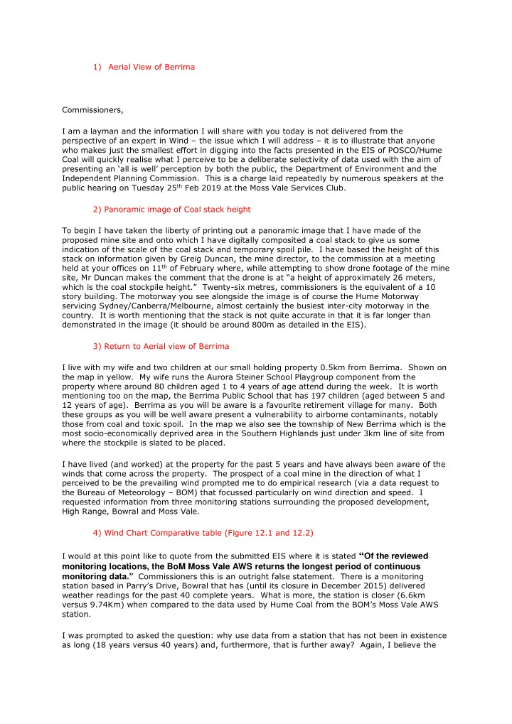

1) Aerial View of Berrima Commissioners, I am a layman and the information I will share with you today is not delivered from the perspective of an expert in Wind – the issue which I will address – it is to illustrate that anyone who makes just the smallest effort in digging into the facts presented in the EIS of POSCO/Hume Coal will quickly realise what I perceive to be a deliberate selectivity of data used with the aim of presenting an ‘all is well’ perception by both the public, the Department of Environment and the Independent Planning Commission. This is a charge laid repeatedly by numerous speakers at the public hearing on Tuesday 25th Feb 2019 at the Moss Vale Services Club. 2) Panoramic image of Coal stack height To begin I have taken the liberty of printing out a panoramic image that I have made of the proposed mine site and onto which I have digitally composited a coal stack to give us some indication of the scale of the coal stack and temporary spoil pile. I have based the height of this stack on information given by Greig Duncan, the mine director, to the commission at a meeting held at your offices on 11th of February where, while attempting to show drone footage of the mine site, Mr Duncan makes the comment that the drone is at “a height of approximately 26 meters, which is the coal stockpile height.” Twenty-six metres, commissioners is the equivalent of a 10 story building. The motorway you see alongside the image is of course the Hume Motorway servicing Sydney/Canberra/Melbourne, almost certainly the busiest inter-city motorway in the
- country. It is worth mentioning that the stack is not quite accurate in that it is far longer than
demonstrated in the image (it should be around 800m as detailed in the EIS). 3) Return to Aerial view of Berrima I live with my wife and two children at our small holding property 0.5km from Berrima. Shown on the map in yellow. My wife runs the Aurora Steiner School Playgroup component from the property where around 80 children aged 1 to 4 years of age attend during the week. It is worth mentioning too on the map, the Berrima Public School that has 197 children (aged between 5 and 12 years of age). Berrima as you will be aware is a favourite retirement village for many. Both these groups as you will be well aware present a vulnerability to airborne contaminants, notably those from coal and toxic spoil. In the map we also see the township of New Berrima which is the most socio-economically deprived area in the Southern Highlands just under 3km line of site from where the stockpile is slated to be placed. I have lived (and worked) at the property for the past 5 years and have always been aware of the winds that come across the property. The prospect of a coal mine in the direction of what I perceived to be the prevailing wind prompted me to do empirical research (via a data request to the Bureau of Meteorology – BOM) that focussed particularly on wind direction and speed. I requested information from three monitoring stations surrounding the proposed development, High Range, Bowral and Moss Vale. 4) Wind Chart Comparative table (Figure 12.1 and 12.2) I would at this point like to quote from the submitted EIS where it is stated “Of the reviewed
monitoring locations, the BoM Moss Vale AWS returns the longest period of continuous monitoring data.” Commissioners this is an outright false statement. There is a monitoring
station based in Parry’s Drive, Bowral that has (until its closure in December 2015) delivered weather readings for the past 40 complete years. What is more, the station is closer (6.6km versus 9.74Km) when compared to the data used by Hume Coal from the BOM’s Moss Vale AWS station. I was prompted to asked the question: why use data from a station that has not been in existence as long (18 years versus 40 years) and, furthermore, that is further away? Again, I believe the