+ Alaska Mapping Executive Committee (AMEC) Washington, D.C. - - PowerPoint PPT Presentation

alaska mapping executive committee amec washington d c
SMART_READER_LITE
LIVE PREVIEW

+ Alaska Mapping Executive Committee (AMEC) Washington, D.C. - - PowerPoint PPT Presentation

+ Alaska Mapping Executive Committee (AMEC) Washington, D.C. April 25, 2018 2 Agenda Welcome and introductions - Tim Petty, DOI and Tim Gallaudet, DOC AMEC history, objectives and status report - Kevin Gallagher, USGS Alaska


slide-1
SLIDE 1

+

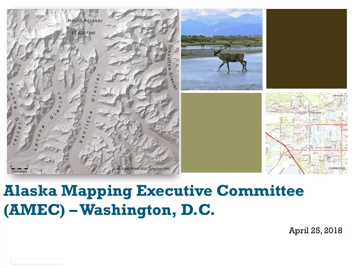
Alaska Mapping Executive Committee (AMEC) – Washington, D.C.

April 25, 2018

slide-2
SLIDE 2

Agenda

 Welcome and introductions - Tim Petty, DOI and Tim Gallaudet, DOC  AMEC history, objectives and status report - Kevin Gallagher, USGS  Alaska IfSAR completion plan - Mike Tischler , USGS  State of Alaska status report - Steve Masterman, State of Alaska  NOAA GRAV-D and shoreline mapping update - Juliana Blackwell, NOAA  3DNation update and Alaska Coastal Mapping Summit review - Ashley Chappell,

NOAA

 Alaska geologic mapping and use of geophysics - Steve Masterman, State of Alaska  Alaska imagery collection update - Chris Noyles, BLM  Open Discussion: Post-IfSAR transition to other priority themes – Steve Masterman,

State of Alaska and Kevin Gallagher, USGS, facilitators

 Schedule and promote next meeting: August 29, 2018 in Juneau, aligned with NOAA

HSRP – Juliana Blackwell, NOAA

 Review actions and next steps - Co-Chairs, Tim Petty, DOI and Tim Gallaudet, DOC  Adjourn 2

slide-3
SLIDE 3

AMEC History

3

In 2008 some would argue that the planet of Mars was better mapped than Alaska. The Alaska Mapping Roundtable convened June, 2012 to review the need to improve the state of mapping in Alaska. The Alaska Mapping Executive Committee (AMEC) was formed as an outcome of the Roundtable. AMEC held its first meeting in November, 2012. AMEC is chartered and meets twice annually to coordinate Alaska mapping priorities.

slide-4
SLIDE 4

AMEC Charter and 18-Month Tactical Plan: Updated

4

Both documents were approved on March 30, 2018. Documents will guide AMEC strategic direction and near- term tasking to reach priority objectives. Thanks to all agencies for participating in the updates.

slide-5
SLIDE 5

AMEC Charter: Updated

5

New AMEC charter runs 2018 through 2022. Guiding Principles: Use enterprise approaches to achieve efficiencies. Maximize Federal and State coordination. Leverage existing efforts. Implement FGDC best practices. Scope of the charter expanded to include potential mapping themes beyond topographic mapping such as: imagery coastal zone mapping bathymetric mapping targeted lidar acquisitions enhanced hydrography geologic mapping geophysical surveys land classification

slide-6
SLIDE 6

6

Example: 3DEEP

THREE DIMENSIONAL MAPPING ECONOMIC EMPOWERMENT PROGRAM

  • Executive Order calls for 3D mapping of the Nation to

identify mineral resources within our borders in order to:

  • Strengthen national security,
  • Create jobs, and
  • Generate economic and social benefits.
  • Topographic Mapping (3DEP Lidar): High-density, high-accuracy

3D elevation data.

  • Airborne Geophysics: Surveys of the geology beneath the Earth’s

surface.

  • Geological Mapping: 2D and 3D geologic models and maps.
slide-7
SLIDE 7

18-Month Tactical Plan: Updated

7

New tactical plan covers April 1, 2018 to September 30, 2019. Provides guidance for:

  • Completing IfSAR coverage of the Alaska mainland and other priority areas
  • Accelerating US Topo and Alaska National Hydrography Dataset production
  • Advancing GRAV-D, ground control, and coastal mapping goals
  • Evaluating alternatives for elevation data acquisition over the Aleutian

Islands and implementing a program plan for acquisition

  • Establishing an acquisition strategy for high-resolution lidar elevation data

for select areas in Alaska (coastlines, areas of mineral potential, etc.)

  • Identifying a methodology, and developing a technical and program plan for

next-generation high-resolution imagery data in Alaska

  • Developing and implementing a communications strategy
  • Renewing the priorities of the AMEC
slide-8
SLIDE 8

AMEC Activity Since October Meeting

8

Major Actions Completed

  • New co-chairs were established.
  • The updated AMEC Charter was finalized and approved.
  • The updated 18-Month Tactical Plan was finalized and approved.
  • 69,000 square miles of IfSAR data were published for public download.
  • $4,200,000 was tasked toward 2018 IfSAR acquisition, and includes

coverage for Nunivak Island, the Yukon-Kuskokwim Delta, and portions of the Alaska Peninsula.

  • The Prince of Wales Island Phase 2 lidar acquisition project was approved

for funding by the 3DEP BAA review team.

  • Transportation and Hydrography updates from multiple AMEC partners

were ingested by USGS for use in 2018 US Topo map production.

  • Alaska IfSAR data was delivered to the FAA for use in their aeronautical

charting program.

slide-9
SLIDE 9

Data Acquisition Accomplishments

Theme Metric 2013 Goal April 2018 Status Elevation % IFSAR acquired Complete in 4 years 96% statewide coverage achieved Hydrography % NHD updated Complete in 6 years 20% updated Transportation % of State completed and publicly available Complete in 5 years 100% complete;

  • ngoing

maintenance GRAV-D % GRAV-D acquired Complete in 2019 78.4% Coastal Mapping % AK shoreline updated Complete in 5 years with budget increase, longer term if no budget increase 48.5%

9

slide-10
SLIDE 10

Alaska IfSAR Coverage Growth 2005-2017

10

2005 2011 2013 2015 2016 2017

slide-11
SLIDE 11

Alaska IfSAR Status April 2018

11

96% now fully funded.

slide-12
SLIDE 12

US Topo Map Production Status

12

Map production follows IfSAR delivery. 11,275 total maps cover Alaska at 1:25,000 scale. 6453 AK US Topo maps are published 1860 maps planned for FY18 production. 57% complete 70% expected by September 30, 2018.

slide-13
SLIDE 13

IfSAR Completion Plan

13

FY2018: Alaska Peninsula and Yukon-Kuskokwim Delta ($4.25M – seeking $600,000 EOY to fund final processing of AK Peninsula cells). FY2019: NPR-A re-flight and Kodiak Island ($3.8M estimate, BLM seeking support funding for NPR-A). FY2020: Complete Western Aleutian Islands ($3.5M est.). FY2021: Complete Isolated Islands - St. Lawrence, St. Matthew, St. Paul, St. George, Chirikof, Middleton ($1.6M estimate).

slide-14
SLIDE 14

State of Alaska AGC Update

14

slide-15
SLIDE 15

NOAA GRAV-D and Shoreline Mapping

15

slide-16
SLIDE 16

3DNation Update and Alaska Coastal Mapping Summit Review

16

slide-17
SLIDE 17

Alaska Geologic Mapping and Geophysics

17

slide-18
SLIDE 18

NGA Statewide Imagery Collection Status

18

slide-19
SLIDE 19

Post-IfSAR Transition Discussion

19

Anticipate completing IfSAR in 2021. Many Alaska mapping requirements will remain and are noted in the updated charter, including:

Complete GRAV-D (likely complete by 2021). Complete statewide NHD/WBD/NHD+ and Shoreline updates. Continuously improve transportation layer. Acquire updated imagery layer – 1m resolution or better. Targeted high-resolution lidar elevation acquisitions. Geophysical data and geological mapping for critical areas in the State. Land characterization data.

Consider Committee processes for gathering background information and establishing future priorities. Consider funding mechanisms to support themes beyond basic topographic mapping. Consider strategies for promoting the new AMEC priorities.

slide-20
SLIDE 20

Next Meeting

20

Align with NOAA HSRP (Hydrographic Services Review Panel) meeting scheduled in Juneau, Alaska, August 28-30, 2018. NOAA description of HSRP objectives and potential attendees. AMEC meeting is tentatively scheduled Wednesday afternoon August 29, from 1-4 P.M. Conflicts with a NOAA facility tour, but AMEC planners feel it is a better option than holding the meeting on Monday (travel day) or Friday (before Labor Day Monday). Potential opportunity to engage State of Alaska political and State Agency leadership in Juneau. If approved, will send out a Save-the-Date to AMEC members, Alaska Region Federal executives, and State of Alaska executives.

slide-21
SLIDE 21

Actions, Next Steps

21

Reminder: Seeking $600,000 EOY funds to fund final processing of Alaska Peninsula IfSAR to reach 98% coverage. Several partners are investigating acquisition of lidar for Kodiak Island in 2019 – will keep Committee apprised of findings. August 29 Save-the-Date notice will be sent out. Actions from meeting...