
SLIDE 1
+
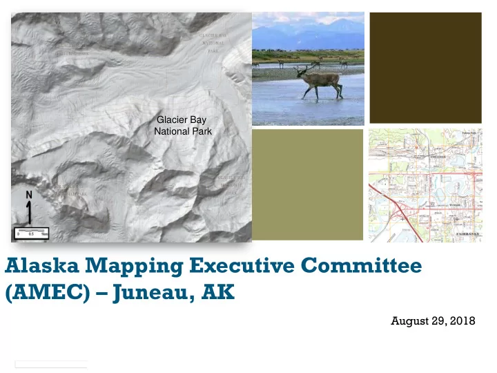
Alaska Mapping Executive Committee (AMEC) – Juneau, AK
August 29, 2018
Glacier Bay National Park
+ Glacier Bay National Park Alaska Mapping Executive Committee - - PowerPoint PPT Presentation
+ Glacier Bay National Park Alaska Mapping Executive Committee (AMEC) Juneau, AK August 29, 2018 2 Agenda Welcome and Introductions James Reilly, USGS and Tim Gallaudet, DOC AMEC Theme Status Report - Kevin Gallagher, USGS
August 29, 2018
Glacier Bay National Park
Welcome and Introductions – James Reilly, USGS and Tim Gallaudet, DOC AMEC Theme Status Report - Kevin Gallagher, USGS IfSAR Success Story and Lessons Learned – Fugru, InterMap, Dewberry State of Alaska Report - Steve Masterman, State of Alaska Alaska Regional Mapping Coordination – Aimee Devaris, USGS 3D Nation Update – Ashley Chappell, NOAA Break Alaska Terrestrial Hydrography Report – Kacy Krieger, University of
Alaska-Anchorage
GRAV-D and Shoreline Mapping Update - Juliana Blackwell, NOAA Alaska Coastal Mapping Strategy and Implementation – Nicole Kinsman,
NOAA
USACE Topographic/Bathymetric Mapping in Alaska – Chris Macon,
USACE
Discussion and Wrap Up - Kevin Gallagher, USGS Closing Comments – James Reilly, USGS and Tim Gallaudet, DOC
2
3
4
Theme, Metric 2013 Goal August 2018 Status Elevation % IFSAR acquired Complete in 4 years 98% coverage acquired Hydrography % NHD updated Complete in 6 years 25% updated Transportation % of State completed Complete in 5 years 100% complete;
maintenance Gravity % GRAV-D acquired Mainland by 2019 Aleutians by 2021 100% Mainland complete, Aleutians remain Shoreline Mapping % AK shoreline updated Complete in 5 years with budget increase, longer term if no budget increase 55.5%
5
6
98% now fully funded and collected. 78% available. 20% in work.
7
72% Statewide coverage achieved.
David F. Maune, Ph.D., PSM, PS, GS, SP, CP, CFM Dewberry Engineers, Inc. 8401 Arlington Blvd., Fairfax, VA 22031 (703) 849-0396
8
1. Intro to DEMs, 3-D Surface Modeling, Tides 2. Vertical Datums 3. Accuracy Standards 4. National Elevation Dataset 5. Photogrammetry 6. IFSAR 7. Topographic & Terrestrial Lidar 8. Airborne Lidar Bathymetry 9. Sonar
9
10
Rivers should flow through valleys – not uphill Some mountains in the NED were mapped a mile in wrong location. Failed imminent International Civil Aviation Organization (ICAO) and FAA minimum requirements for commercial overflights
11
Alaska DEM Funding & Implementation Plan; Program Mgt.
12
Fugro proposed that it map the 23% of the state that is most difficult (pink), with Intermap mapping the less-difficult 77% of the state (green). Our combined statewide total cost estimate equaled $77.3M
13
147th meridian
14
Satellite imagery now fits IFSAR data from Intermap and Fugro
15
Used IFSAR for NHD, NHD Plus, transportation update & orthos
16
5-m RapidEye 62.5-cm ORI 62.5-cm color orthophotos, no clouds; could be 1-meter or other resolution
17
Intermap (pink) has completed ~ 75% of AOR Fugro (blue) has completed ~ 23% Only the 2% brown areas remain for 2019 acquisition, including Far Islands, Kodiak and Western Aleutians But the remaining areas are the most expensive and will cost >10% of the total
18
To minimize costs and acquire data more cost- effectively, Fugro, Intermap and Dewberry acquired data on speculation, valued at nearly $17M (areas were subsequently funded) We paid for lobbyists at state & federal levels USGS knew to the penny what Dewberry paid its subcontractors
Land Ownership % of Land Owned % of dollars paid State of Alaska 24.1% 21.44% BLM 22.1% 5.25% F&WS 21.1% 1.53% NPS 14.1% 4.90% AK Native Corps 10.5% 0.00% USFS 6.0% 2.87% Other Private 1.6% 0.00% DOD 0.5% 3.86% USGS 0.0% 54.20% NRCS 0.0% 5.95% TOTALS 100.0% 100.00%
Total to date: $62.237 M, incl. USGS management fee
19
20
Dual Band IFSAR
X-band (3 cm wavelength) P-band (85 cm wavelength) Profiling LiDAR (3 Returns, 3 Intensities)
▪ Dual-band radar collected simultaneously from both sides of the aircraft ▪ Acquisition at an altitude of 32,000-39,000’ ▪ Profiling lidar for on-board ground control
21
www.fugro.com 2
Areas Mapped
To change footer text go to Insert > Header & Footer
Total area delivered: 353,744 km2
22
www.fugro.com 3
Example Flight Plans
To change footer text go to Insert > Header & Footer
Southcentral Alaska (2010) Kenai Peninsula, Alaska (2014)
23
www.fugro.com 4
Success Stories – IFSAR Overcollects
▪ Efficient flight plan ▪ Temporal continuity ▪ Cell price list ▪ Partner collaboration ▪ Partner budget planning
To change footer text go to Insert > Header & Footer
Blue cells represent the original tasking; red cells represent overcollects
24
www.fugro.com 5
Success Stories
▪ Search and rescue: F-22 Raptor Crash in 2010. Fugro provided unscheduled emergency delivery of IFSAR data to help assess avalanche danger for recovery
assessing potential avalanche danger for recovery crews on the scene. ▪ Ice thickness mapping: While mapping in high elevations and over glaciers, Fugro determined that P-band radar could penetrate deep into snow and ice. This discovery led to a new mapping capability developed in partnership with oil and gas majors and the University of Alaska Fairbanks to characterize ice type and thickness for engineering purposes, safety
pursuits.
To change footer text go to Insert > Header & Footer
25
www.fugro.com 6
Recognition of Excellence
To change footer text go to Insert > Header & Footer
Based on the ice thickness mapping technique born from the Alaska elevation mapping program,Fugro won the 2015 Governor’s North Star Award for International Excellence in the category of scientific
Technology Conference.
26
www.fugro.com 7
Cultural Feature Detection andAnalysis
To change footer text go to Insert > Header & Footer
27
www.fugro.com 8
More Value to Be Explored
New application of existing data 1. Intertidal zone topography from existing raw data can be extracted and used to improve coastal zone dataset 2. X- and P-band data can be made available for further ice thickness analyses over some of the most important glaciers and icefields in the world 3. Tighter hydro specification can be compiled from existing data
To change footer text go to Insert > Header & Footer
28
www.fugro.com 9
What’s next?
State of Alaska ASTAR Project Alaska’s North Slope – Home to one of the largest oil fields in North America
Near term data needs: 1. Oil and Gas industry 2. Transportation infrastructure 3. Coastal zone
To change footer text go to Insert > Header & Footer
29
w w w
w
.
w
f u
w
g
. f u
r
r
.
.
m
FeatureTypes
Challenges
USGS Hydrological Feature Collection specifications:
for length of 300m;
2/17/2 10 1
11 16
10
Initial 2D Hydro Final 2D Hydro
Alaska Mid-Accuracy DEM: Hydro Specification
30
w w w
w
.
w
f u
w
g
. f u
r
r
.
.
m
12
12
Alaska Mid-Accuracy DEM: High Tide vs Low Tide Shoreline Collection
31
w w w
w
.
w
f u
w
g
. f u
r
r
.
.
m
14
14
Alaska Mid-Accuracy DEM: Shoreline flattened and intertidal zone deleted
32
Ian Wosiski, Managing Director, National Sales iwosiski@intermap.com August 29th, 2018
Alaska IFSAR Mapping – Results and Reflections 2008-2018
Alaska Mapping Executive Committee
34
35
Intermap has developed a rigorous production Enterprise Work-Flow controlling every step from flight planning to final deliverables QAQC. This enables high volume production of standardized core products that meet and exceed USGS AK specifications.
36
IFSAR sensors and Enterprise Workflow.
pixel resolution ORI
higher resolution 1.25m pixel ORI.
were collected, processed and delivered to NASA and cooperating agencies
in our initial 2010 deliverables to USGS under the Alaska Mapping Initiative
37
2010-2018 AOIs
Since starting USGS 3DEP Alaska IFSAR operations in 2010, Intermap has successfully collected:
DTM data covering ~75% of the State
total, producing 289 1-degree cells
average data acceptance rate of ~85%
38
By working closely with our trusted partners in Alaska, Intermap was able to take calculated risks associated with speculative acquisition, thereby maximizing efficiency of short collection seasons and reducing overall program costs. The 69 spec cells shown in red were collected prior to receiving formal task
Total Area: 201,781 sqkm. Total value: ~$7,000,000 2010-2018 AOIs, with spec cells in red
39
To date, Intermap (pink) has completed ~75% of the State, with delivered data far exceeding contract accuracy requirements: Based on Dewberry’s 3rd party QAQC of Intermap’s delivered data, using hundreds
level (compared with 3m specification)
Only the 2% brown areas remain for 2019 acquisition, including Far Islands, Kodiak and Western Aleutians
40
specs, using a rigorous ISO 9001:2008 certified Enterprise WorkFlow incorporating QAQC at every step of the process.
since 2010.
41
and data finishing.
iteratively over time
lines up to 1,200km
be further refined by Intermap to meet NHD+ specifications statewide
New IFSAR and hydro vectors (top) vs.
42
been critical to the success of this team and this program.
with Dewberry, USGS, and stake-holders allowed us to take calculated risks, collecting
capture maximum data per season, using task
complete Processing & Delivery of Fly&IP cells
approaches would not have been possible.
43
2019 Planning is well underway for the remaining three AOIs to complete the State
Kodiak Island:
Western Aleutians:
Six Remote Islands:
44
4 4 Cold Bay, AK June 18, 2018
0.0 1.0 2.0 3.0 4.0 5.0
Targeted LIDAR Priorities Terrestrial Hydrography Imagery Update with Public License Geological & Geophysical Mapping Soreline delineation Coastal Mapping
3.29 3.66 4.71 3.00 2.57 4.00
Imagery Refresh, facilitates: Terrestrial Hydrography Coastal Mapping Imagery:
Additional suggestions: Hazards mapping Cadastral
8 of 11 AGC members responded
45
46
Shoreline topobathy (include major rivers) Detailed ortho imagery
47
Stakeholder relationships have been key to success
Federal partners, state, and boroughs important sources of requirements and collaborative solutions Alaska Coastal Mapping Summit, Alaska Surveying and Mapping Conference, Alaska Geospatial Council
New developments
DOI strengthening regional management model – Alaska Cooperative Planning Group remains a key convening body New co-chair role in NOAA supported by quarterly meetings between USGS and NOAA at national and regional levels US Arctic Research Commission recently stood up monthly meetings to coordinate scientific research efforts across Feds
Discussion
Reviewing priorities for work beyond IfSAR/DEM/Topo completion – Hydrography, Imagery, Coastal, Refresh cycle Other opportunities for leveraging partnerships and assets
August 29, 2018
Mapping a 3D Nation from the tops of the mountains, to the depths
48
Study Preparation
(7 months)
Study Design Questionnaire Development OMB Approval
Initial Data Collection
(8 months)
Identify Fed POCs/ State Champions Questionnaire Open Summary Reports for Interviews/ Workshops
Data Validation
(5 months)
Conduct Interviews/ Workshops Validate Interview Results (Reports & Geodatabase)
Aggregate/ Report
(6 months)
Aggregate Benefits by Business Use Final Report & Geodatabase
Analysis/ Development
(6 months)
Develop Program Scenarios Analyze Benefit/Cost and ROI Determine Program Direction
Information Gathering Phase Follow on Study Tasks
9/2017 – 3/2018 1/2018 – 9/2018 9/2018 – 1/2019 2/2019 –7/2019 8/2019 – 1/2020
2017 2018 2019
49
Status Agency
USDA DOD DHS DOI DOT EPA OMB OSTP FAA FEMA NGA NOAA NSF NORTHCOM USFS USACE USGS BLM FWS NPS Green: Responses look sufficient to cover AK Yellow: Responses light; may be worth assessing responses to see if Alaska covered Orange: No response completed Black: Not participating
50
Alaska DFG
Alaska DNR Kodiak Borough University of Alaska Fairbanks Alaska Municpal League ANCSA Regional Association
Northstar Borough -- Fairbanks North Star Borough
51
52
database.
agencies.
applications.
in Alaska.
collaborative editing platform.
workflow.
and standards.
updates.
Alaska.
53
54
55
FY18 FY 2019 FY 2020
A S O N D J F M A M J J A S O N J F M A M J J A S
Coordinator DBA Technical Steward USGS (2019) Agreement in discussion, Not yet in Place USFWS (2013-2019) Agreement in Place, 2019 agreement in Progress USFS (2010-2019) Agreement in Place, 2019 agreement in Progress NOAA NWS (2018) Agreement in Progress, Not yet in Place Other Other Funding Sources (Not Alaska Hydrography related)
56
Juliana Blackwell Director, National Geodetic Survey
GRAV-D Surveys NSRS Modernization Shoreline Mapping
57
Theme Metric 2013 Goal August 2018 Status Gravity % Airborne GRAV-D acquired Mainland by 2019 Aleutians by 2021 100% Mainland 88% w/ Aleutians Shoreline Mapping % Alaska shoreline updated Complete in 5 years w/ budget increase, longer w/o increase 55.5%
58
59
59
Annual geoid rate of change in mm/year, from 15 years of GRACE data (2002 - 2017)
60
60
61
61
62
62
AMEC August 2018 Presented by Nic Kinsman, NOAA On behalf of Marta Kumle, AOOS & Alaska DNR
63
Motivation:
differ from inland areas
Strategist Position:
Objectives:
Marta Kumle
64 64
http://agc.dnr.alaska.gov/coastal.html
65
complementary data gaps needed for derivative products
chart overlaps in data requirements
GIS evaluation system comprised of existing data to identify priority areas based on age, resolution, quality, and proximity to populations or infrastructure.
…seeking support and participation by AMEC
66
66
67
U.S. Army Corps of Engineers National Coastal Mapping Program Homer, AK Pilot Project
The U. S. Army Corps of Engineers (USACE) National Coastal Mapping Program (NCMP) conducted a Pilot Project along Alaska’s Homer Spit from June 10-12, 2018. This project was designed to evaluate the capabilities of the latest generation bathymetric lidar system along the Alaska Coastline. The Joint Airborne Lidar Bathymetry Technical Center of Expertise (JALBTCX) team used in-house survey capability called CZMIL (Coastal Zone Mapping and Imaging Lidar) to perform two full coverage flights, along with a third partial flight under different tide conditions. Standard NCMP products were generated from data collected during the flights:
Location: Airborne Survey:
Homer, Alaska: Is located about 200 miles south of Anchorage on the Kachemak Bay. Its most prominent feature is the 4.5 mile long gravel spit that extends into the bay. Widely known as “the halibut fishing capital of the world”, the town is also Alaska’s eco and adventure tourism capital. Flight Information: The primary survey area consisted of 47 flight lines and 585 line KM. The flight block was flown in it’s entirety two times at high tide. A third flight was conducted to target low tide in the early morning while the winds were light. Homer’s Port Facility Planned survey lines Site Selection: Homer Spit was selected for the pilot project due to broad interest by a number of federal and state agencies in obtaining updated topographic and seafloor maps for the area. For example, USACE maintains navigation channels and erosion protection structures for the harbor and spit. Requirements for the test were developed based on discussions during the Alaska Coastal Mapping Summit. Specifically, the project was designed to test bathymetric lidar performance in Alaska’s challenging operational environment, including short survey season, remote location, turbidity, high terrain, large tide range, and dark substrate. Outcomes: Bathymetric lidar, topographic lidar, aerial photography, and hyperspectral imagery were collected for 53 km2 on Homer Spit, AK. Depths were measured up to 19 m, beneath suspended sediment layers and submerged aquatic vegetation. The data support coastal navigation, planning for resilience, and resource management. True Color Mosaic Topo/Bathy DEM Turbidity plume from glacial runoff The pilot project at Homer demonstrated the cost effectiveness of using the JALBTCX aircraft as it transited back to the U.S. from its annual summer work in the Pacific. Timing of transit coincided with ideal environmental conditions in Alaska. Long duration aircraft makes remote locations in Alaska accessible for airborne surveys. The depth performance capability of modern bathymetric lidar systems like CZMIL is ideally suited to the high-turbidity and dark substrate characteristic of many areas in Alaska.
Joint Airborne Lidar Bathymetry Technical Center of Expertise
68
Open Discussion Next meeting Action Item Review
69
meeting. RDML Tim Gallaudet, Ph.D., USN Ret., Assistant Secretary of Commerce for Oceans and Atmosphere and Acting Under Secretary of Commerce for Oceans and Atmosphere, AMEC co-Chair. Visit https://www.usgs.gov/amec