SLIDE 1
AVHRR NRM641 Spring 2010
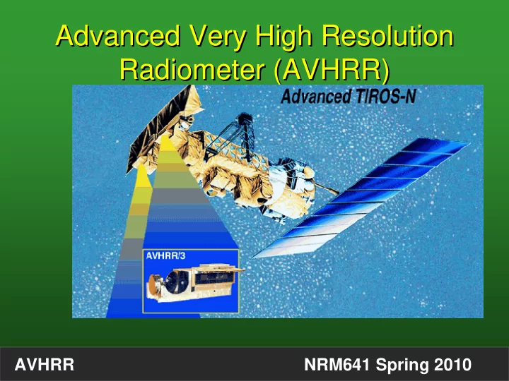
Advanced Very High Resolution Radiometer (AVHRR) Advanced Very High Resolution Radiometer (AVHRR)
SLIDE 2
AVHRR NRM641 Spring 2010
SLIDE 3
AVHRR NRM641 Spring 2010 http://www2.ncdc.noaa.gov/docs/klm/html/c3/sec3-1.htm
SLIDE 4
AVHRR NRM641 Spring 2010 http://coastwatch.noaa.gov/ http://coastwatch.noaa.gov/
SLIDE 5 AVHRR NRM641 Spring 2010
- Onboard NOAA Satellites
- AM and PM polar orbiting
- High temporal resolution
- Multiple coverage using four
NOAA satellites
- 8-10 passes a day in Alaska
- 2400 km swath width
- Onboard NOAA Satellites
- AM and PM polar orbiting
- High temporal resolution
- Multiple coverage using four
NOAA satellites
- 8-10 passes a day in Alaska
- 2400 km swath width
SLIDE 6
AVHRR NRM641 Spring 2010
SLIDE 7 AVHRR NRM641 Spring 2010
- Tradeoff: High Temporal Resolution(daily)
- Low Spatial Resolution
- Historic data since 1981….
- Tradeoff: High Temporal Resolution(daily)
- Low Spatial Resolution
- Historic data since 1981….
SLIDE 8 AVHRR NRM641 Spring 2010
- Instantaneous Field of View 1.1km only at nadir
Huge scan angle: +/- 55 degrees
- Instantaneous Field of View 1.1km only at nadir
Huge scan angle: +/- 55 degrees
SLIDE 9
AVHRR NRM641 Spring 2010
Bidirectional Reflectance Problem Bidirectional Reflectance Problem
SLIDE 10
AVHRR NRM641 Spring 2010
SLIDE 11 AVHRR NRM641 Spring 2010
- Broad spectral bands compared to
instruments designed for land remote sensing
- Broad spectral bands compared to
instruments designed for land remote sensing
AVHRR Data Problems AVHRR Data Problems
SLIDE 12 AVHRR NRM641 Spring 2010
- No on-board calibration of red or near-
infrared channels
- No on-board calibration of red or near-
infrared channels
AVHRR Data Problems AVHRR Data Problems
SLIDE 13 AVHRR NRM641 Spring 2010
1 1 . 0 5 1 . 1 1 . 1 5 1 . 2 1 . 2 5 1 . 3 1 9 8 0 1 9 8 5 1 9 9 0 1 9 9 5 2 0 0 0 2 0 0 5 Y e a r N O A A 7 N O A A 9 N O A A 1 1 N O A A 1 4 N O A A 1 6
C h a n n e l 2 C h a n n e l 2
0.8 0.85 0.9 0.95 1 1.05 1.1
1980 1980 NOAA7 NOAA9
NOAA11
NOAA14 NOAA16
Degradation in spectral Response (from ocean observations) Degradation in spectral Response (from ocean observations)
C h a n n e l 1 C h a n n e l 1
2005 2005
SLIDE 14 AVHRR NRM641 Spring 2010
- Lacks onboard calibration.
- Broad spectral bands
- Orbital drift
- Lacks onboard calibration.
- Broad spectral bands
- Orbital drift
AVHRR Data Problems AVHRR Data Problems
SLIDE 15
AVHRR NRM641 Spring 2010
SLIDE 16
AVHRR NRM641 Spring 2010
SLIDE 17
AVHRR NRM641 Spring 2010
SLIDE 18 AVHRR NRM641 Spring 2010
Normalized Difference Vegetation Index (NDVI) Normalized Difference Vegetation Index (NDVI)
Surface NDVI Soil < 0 Water <0 Willow Shrub 0.3-0.5 Birch Forest 0.6-0.8 Surface NDVI Soil < 0 Water <0 Willow Shrub 0.3-0.5 Birch Forest 0.6-0.8
SLIDE 19 AVHRR NRM641 Spring 2010
Red Reflectance Near-IR Reflectance
Dry Soil
High High
Urban
High High
Clear Water
Low Low
Muddy Water
High Low
Burned Area
Low Low
Ocean Water
Low Low
Sand Dunes
High High
Clouds
High High
Vegetation
Low High
SLIDE 20 AVHRR NRM641 Spring 2010
- Minimize cloud-contaminated pixels
- Minimize off-nadir pixels
- Capture peak of photosynthetic activity
- Minimize cloud-contaminated pixels
- Minimize off-nadir pixels
- Capture peak of photosynthetic activity
Maximum NDVI Compositing Maximum NDVI Compositing
SLIDE 21
AVHRR NRM641 Spring 2010
SLIDE 22 AVHRR NRM641 Spring 2010
- Free, ftp download
- Global, 8-km pixels
- 15-day composite period
- 1981-2006
- Corrected for calibration and orbit drift
- Adjusted for major volcanic eruptions
- Free, ftp download
- Global, 8-km pixels
- 15-day composite period
- 1981-2006
- Corrected for calibration and orbit drift
- Adjusted for major volcanic eruptions
GLIMMS (Global Inventory Modeling and Mapping Studies) NDVI data
http://glcf.umiacs.umd.edu/data/gimms/
GLIMMS (Global Inventory Modeling and Mapping Studies) NDVI data
http://glcf.umiacs.umd.edu/data/gimms/
SLIDE 23
AVHRR NRM641 Spring 2010 June 1-15 bimonthly NDVI 1982 June 1-15 bimonthly NDVI 1982
SLIDE 24
AVHRR NRM641 Spring 2010 June 16-30 bimonthly NDVI 1982 June 16-30 bimonthly NDVI 1982
SLIDE 25
AVHRR NRM641 Spring 2010 July 1-15 bimonthly NDVI 1982 July 1-15 bimonthly NDVI 1982
SLIDE 26 AVHRR NRM641 Spring 2010
- From USGS EROS Data Center
- Not free, not corrected
- 15-day composite period
- 1991-2005
- NDVI scaled to 0-250
- Channels 1-5 included
- Date of pixel observation included
- From USGS EROS Data Center
- Not free, not corrected
- 15-day composite period
- 1991-2005
- NDVI scaled to 0-250
- Channels 1-5 included
- Date of pixel observation included
Alaska 1-km Composite NDVI data Alaska 1-km Composite NDVI data
SLIDE 27
AVHRR NRM641 Spring 2010
SLIDE 28 AVHRR NRM641 Spring 2010
- Phenology metrics derived from NDVI
- Free
- 1991-2000
- Phenology metrics derived from NDVI
- Free
- 1991-2000
http://agdc.usgs.gov/data/usgs/erosafo/ak_avhrr/ak_avhrr_ndvi.html#2000 http://agdc.usgs.gov/data/usgs/erosafo/ak_avhrr/ak_avhrr_ndvi.html#2000
SLIDE 29 AVHRR NRM641 Spring 2010
References References
- Hope et al. 1999. Estimating lake area in an Arctic
landscape using linear mixture modelling. Int. J. Remote Sensing. 20:829-835. 102:13521-13525.
- Goetz et al. 2005. Satellite-observed photosynthetic
trends across boreal North America associated with climate and fire disturbance. PNAS.
- Raynolds et al. 2008. Relationship between satellite-
derived land surface temperatures, arctic vegetation types, and NDVI. Remote Sensing of Environment. 112:1884-1894.