
SLIDE 1
Adaptation measures related to water-related disasters to reduce the - - PowerPoint PPT Presentation
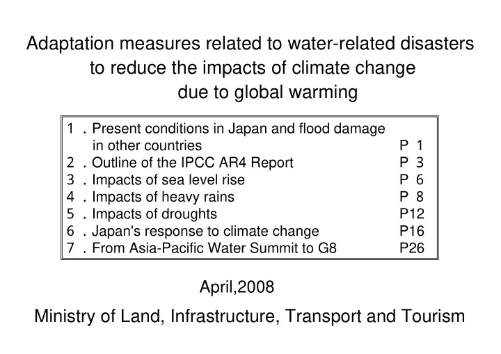
Adaptation measures related to water-related disasters to reduce the impacts of climate change due to global warming Present conditions in Japan and flood damage P in other countries Outline of the IPCC AR4 Report P
(i) Land: A north-south stretch of land extending over a length of 2000 km (ii) Four main islands: Four main islands are separated from one another by
(iii) Backbone mountain range: Mountains run at the middle of the land. (iv) Tectonic lines: Median and Itoigawa-Shizuoka Tectonic Lines run from north to south. (v) Plains: Narrow plains are located along shorelines. (vi) Weak soils: Most large cities are located on weak soils. (vii) Earthquakes: About 10% of world's earthquakes occur in Japan. (viii) Heavy rains: Japan is on the eastern edge of Monsoon Asian and is faced with the threats of heavy rains and typhoons. Rivers flow on steep slopes. (ix) Snow cover: Sixty percent of land is located in snowy and cold areas. Tone River Watarase River Tone River Kinu River Omoi River Edo River Ara River Tokyo Saitama
Japan and flood damage in other countries
Topography of the Kanto Plains from a viewpoint of flood control
Elevation Source: Geographical Survey Institute data of July 2006
Germany, Czech and Austria (August 2002) A tropical cyclone moving from the North Sea triggered heavy rains. Two-hundred and twenty thousand people were evacuated and 15 killed in Czech. The damage cost three billion euros.
New Orleans, US (August 2005) Hurricane Katrina, then a Category 4 storm, made landfall in the southern coastal area of US and killed more than 1,200 people.
Dominica and Haiti (May 2004) Heavy rains caused flood and sediment
United Kingdom (July 2007) The heaviest rains in recorded history caused flooding in the central and western areas of the country inundating 350,000 homes in water. China (summer of 2007) Floods induced by heavy rains and other water-related disasters left more than 1,300 people killed
North Korea (August 2008) Heavy rains continued for a week leaving more than 600 people dead or missing. Bangladesh (November 2007) Cyclone Sidr made landfall in southern Bangladesh killing or leaving missing more than 4,000
people suffered damage.
India (July and August 2005) Monsoon-induced heavy rains caused flooding and sediment damage. The event left more than 1,000 people dead or missing.
Japan and flood damage in other countries
Heavy rains of July (July 2006)
1,200 mm.
and other rivers
houses were damaged.
Sendai River in Kagoshima Prefecture
breached in the Maruyama and Izushi Rivers due to heavy rains induced by Typhoon No. 23.
were killed and 157 wounded. Typhoon No. 23 (September 2004)
Maruyama River in Hyogo Prefecture
IPCC Third Assessment Report are increasingly stronger. (i) Increasing levels of risks to unique and threatened systems such as polar and high mountain communities and ecosystems (ii) Increasing levels of risks of extreme meteorological events such as droughts, heatwaves and floods (iii) Greater impacts and vulnerabilities for the regional and social groups vulnerable to climate change (iv) Benefits from global warming are expected to peak at lower temperature, and damage will be higher as global warming progresses. The costs of impacts of global warming are expected to increase with time. (v) Increasing levels of risks of climate change such as sea level rise and accelerated reduction of ice sheets
significantly reduce the risks of climate change by complementing each other.
Item 5 Long-term perspective
sea level attest to the warming of climate system.
years.
Item 1 Results of monitoring of climate change and its impacts
Climate change due to emerging global warming: The Intergovernmental Panel on Climate Change Fourth Assessment Report (IPPC AR4 Report)
is highly likely to be attributable to the increase of man-made greenhouse gases.
Item 2 Cause of climate change
result in a rise of 4℃ in global average surface temperature and a rise of 0.26 to 0.59 m in sea level at the end of the 21st century according to the best available predictions.
phenomena, and the rise of sea level are expected to have adverse impacts on the nature and human system. Asia
southern, eastern and south-eastern Asia, in large river basins in particular.
the megadelta areas in southern, eastern and south-eastern Asia.
Item 3 Expected climate change and its potential impacts
vulnerability to climate change. Item 4 Options for adaptation and mitigation
decades through the implementation of adequate mitigation measures.
AR4 Report
Financial and technical barriers, possibility of using space for transport, comprehensive policy and management, synergy with sustainable development goals Considerations of climate change and criteria and regulations on which design is based, land use policy, construction codes and insurance Reinforcement of embankments, jetties against high tides and sand dunes, land acquisition and construction of lakes and marshes to moderate sea level rises and floodwater entries Infrastructure and habitation Financial, manpower and physical barriers, integrated water resources management, synergy with other sectors Domestic water resources policy, integrated management of water resources and control of water- related disasters Increase of rainwater intake, development of water storage and conservation techniques, recycling of water, desalination and increase of efficiency of water use and irrigation Water Major restrictions and
Basic policy framework Options and strategies for adaptation Category
Large volumes of greenhouse gas emissions cause CO2 concentration in the air to rise and increase heat absorption, resulting in temperature rise. Thus, global warming occurs. World's average temperature is projected to rise by 1.8 to 4.0℃ by 2100.
Increase of precipitation by a factor of 1.1 to 1.3* Change in snow accumulation condition Thermal expansion
Change in evapotranspiration Melting of glaciers, ice caps and ice sheets Sea level rise (Maximum rise: 59 cm) More intense typhoons More frequent high tides and coastal erosions More frequent high tides and coastal erosions Increase of river flow rate More frequent floods More frequent floods More serious debris flow More serious debris flow Higher risk of drought Higher risk of drought Earlier snow melt and reduction of discharge Change in water use pattern
More frequent heavy rains and droughts
*Calculated by the Ministry of Land, Infrastructure and Transport based on the predictions of precipitation made by various research institutions
AR4 Report
Source: IPCC AR4 WG1 (Working Group 1) Summary for Policymakers (Japan Meteorological Agency)
Rise of 4.0℃ Rise of 1.8℃
are controlled.
A1: High growth oriented society A1Fl: Dependent on fossil energy sources A1T: Dependent on non-fossil energy sources A1B: Emphasis on the balance among various energy sources A2: Multipolarized society B1: Sustainable growth oriented society B2: Emphasis on regional initiatives
Source: IPCC AR4 WG1 Report 2 6 ~5 9 c m Sea level rise Sea level rise About 4.0℃ (from 2.4℃ to 6.4℃) About 1.8℃ (from 1.1℃ to 2.9℃) Temperature rise Society achieving high economic growth dependent on fossil energy sources Society achieving both global environmental protection and economic development ・ Rises of average temperature and sea level at the end of the 21st century
・Average temperature
Source: Data prepared by the River Bureau based on the IPCC AR4 WG1 Report
1 2 3 4 5 6 7 1 8 6 01 8 8 1 9 01 9 2 1 9 4 01 9 6 1 9 8 02 2 2 02 4 2 6 02 8 2 1 水 位 変 化 ( m m )
Peak 590mm ・Average sea level
AR4 Report
Rise of global average surface temperature (℃)
Case where CO2 concentration in 2000 will remain unchanged
20th century Year Change in sea level (mm)
1 回 以 下 約 4 回 約 1 回 2 4 6 8 1 1 2 1 9 1 9 1 1 9 2 1 9 3 1 9 4 1 9 5 1 9 6 1 9 7 1 9 8 1 9 9 2 年 回
Annual frequency of inundation of the corridor of Itsukushima Shrine in Hiroshima (Graph prepared by the Chugoku Regional Development Bureau based on a diary of Itsukushima Shrine.) 1 1 1 4 2 1 3 1 2 1 0 1 1 1 7 7 2 2 5 1 1 5 2 2 5 1 9 8 9 1 9 9 1 9 9 1 1 9 9 2 1 9 9 3 1 9 9 4 1 9 9 5 1 9 9 6 1 9 9 7 1 9 9 8 1 9 9 9 2 2 1 2 2 2 3 2 4 2 5 2 6
The corridor of Itsukushima Shrine in Hiroshima was inundated in water less than five times a year in the 1990s. It was flooded about ten times a year in the 2000s. The frequency was 22 times a year in 2006 and is still increasing.
water less than ten times a year at the beginning
climate change later caused the frequency to increase to about 40 times a year by 1990 and to as many as 100 times a year in 1996.
year in 2006.
*At present, it is not clear whether the increase of inundation risk is attributable to global warming or not but there may be a possibility.
Annual frequency of inundation of St. Mark's Square in Venice, Italy (Graph prepared based on the Economics of Climate Change by Stern Review.)
593 879 海面上昇後 1 . 5 404 人口( 万人) 1 . 5 577 面積( k㎡) 倍率 現状 593 879 海面上昇後 1 . 5 404 人口( 万人) 1 . 5 577 面積( k㎡) 倍率 現状
Increases of below-sea-level areas in three large bay areas (Tokyo Bay, Ise Bay and Osaka Bay)
*Prepared by the River Bureau based on the national land-use digital information. *Shown are the areas at elevations lower than sea level shown in a three-dimensional mesh (1 km x 1 km). Total area and population are based
*No areas of surfaces of rivers
*A premium of 60% is applied to the potential flood risk area and to the population vulnerable to flood risk in the case with a one-meter rise of sea level.
Areas with flood risks due to high tides will increase.
Ise Bay Kawagoemachi to Tohkai City Osaka Bay Ashiya City to Osaka City Tokyo Bay Yokohoma City to Chiba City
Increase of risks of inundation due to high tides
sea level rise
Frequency (times) Less than ten times About 100 times About 40 times
Present After sea level rise Rate of increase Area (km2) Population (in tens of thousands of people)
Prepared by the River Bureau based on the "Assessment of impacts of sea level rise on sandy beaches"
9 . 3 8 1 . 7 5 6 . 6 Percentage of eroded area 1 1 . 4 6 5 . 4 3 . 5 5 Average distance
1 . 6 5 . 3 Sea level rise (m)
Present Retreat of the beach due to sea level rise Further retreat of the beach due to sea level rise
About 100 m
Same gradient
Source: Japan Center for Climate Change Actions
sea level rise
With sea level rise, the beach tries to achieve a stable gradient, so the shoreline retreats by a margin larger than the sea level rise. With a one-meter rise of sea level, beach retreats by about 100
Coastal erosion in the Majuro Atoll of the Marshall Islands (Masaaki Nakajima, May 2001)
資料) H16.9東京大学など合同研究チームによ る記者発表資料
Year-by-year predictions of number of days of heavy rains in summer (daily precipitation of more than 100 mm)
Increase of rainfall amount in summer
Source: Press report of September 16, 2004 by a joint research team including the University of Tokyo.
Number
Source: : 地球温暖化予測情報第6 巻 ( Japan Meteorological Agency, 2005 March)
Change of maximum daily precipitation( %) (Yearly average 2081-2100)/(Yearly average 1981~2000)
heavy rains
I P C C 1 次報告書( 1 9 9 0 ) 水平解像度 約500km I P C C 2 次報告書( 1 9 9 6 ) 水平解像度 約250km I P C C 3 次報告書( 2 0 0 1 ) 水平解像度 約180km I P C C 4 次報告書( 2 0 0 7 ) 水平解像度 約110km GCM20、 RCM20 水平解像度 約20km
河川局作成
※メ ッ シュ の大き さ を表現し たも ので、 実際のメ ッ シュ 箇所と は関係ない
Resolution of climate change prediction models has been enhanced year by year.
IPCC First Assessment Report (1990): Horizontal resolution of about 500 km IPCC Second Assessment Report (1996): Horizontal resolution of about 250 km IPCC Third Assessment Report (2001): Horizontal resolution of about 180 km IPCC Fourth Assessment Report (2007): Horizontal resolution of about 110 km GCM20 and RCM20: Horizontal resolution of about 20 km
Mesh sizes are simply indicated regardless of actual mesh locations. Prepared by the River Bureau
heavy rains
1 . 7
Kyushu
⑪ 1 . 1 1
Southern Shikoku
⑩ 1 . 1
Setouchi
⑨ 1 . 1 1
San-in
⑧ 1 . 1 3
Southern Kii
⑦ 1 . 7
Kinki
⑥ 1 . 6
Chubu
⑤ 1 . 1 4
Hokuriku
④ 1 . 1 1
Kanto
③ 1 . 2 2
Tohoku
② 1 . 2 4
Hokkaido
①
1.20~1.25 1.15~1.20 1.10~1.15 1.05~1.10 1.00~1.05
Legend
Legend
Section under the direct jurisdiction of Ministry of Land, Infrastructure and Transport Designated section (under the jurisdiction of governor) Border between prefecturesFuture rainfall amounts were predicted as a median value of Average rainfall in 2080-2099 period Average rainfall in 1979-1998 period The above equation was obtained based on the maximum daily precipitation in the year at each survey point identified in GCM20 (A1B scenario).
heavy rains
※ 82 River Basins calculated flood safety level
将来の降雨量の増大による治水安全度の低下
2 9 9 1 1 1 1 2 1 2 5 5 7 5 1 1 2 5 1 5 1 7 5 2 計画 関東 中部 近畿 瀬戸内
治 水 安 全 度 ( 超 過 確 率 年 )
1 1 . 5 1 . 1 1 . 1 5 1 . 2 1 . 2 5
降 雨 量 の 増 加
治水安全度 降雨量の伸び
将来の降水量の増大による治水安全度の低下
1 5 5 1 3 7 6 7 8 9 5 7 8 3 8 4 5 6 9 5 6 5 2 5 5 7 5 1 1 2 5 1 5
計画 北海道 東北 関東 北陸 中部 紀伊南部 山陰 瀬戸内 四国南部 九州
治 水 安 全 度 ( 超 過 確 率 年 )
1 1 . 5 1 . 1 1 . 1 5 1 . 2 1 . 2 5
降 雨 量 の 増 加
治水安全度 降雨量の伸び
将来の降雨量の増大による治水安全度の低下
1 3 5 3 5 4 3 6 4 3 5 1 5 4 5 6 6 2 5 5 7 5 1
計画 北海道 東北 関東 北陸 中部 紀伊南部 山陰 瀬戸内 四国南部 九州
治 水 安 全 度 ( 超 過 確 率 年 )
1 1 . 5 1 . 1 1 . 1 5 1 . 2 1 . 2 5
降 雨 量 の 増 加
治水安全度 降雨量の伸び
水系数 水系数 水系数
① 北海道
1 . 2 4 1 / 5 1
2
1 / 3 5
8 ② 東北
1 . 2 2 1 / 3 7
5
1 / 3
5 ③ 関東
1 . 1 1 1 / 9 9
3 1
/ 6 7
2
1 / 5
1 ④ 北陸
1 . 1 4 1 / 6 5
5
1 / 4 3
4 ⑤ 中部
1 . 6 1 / 1 1 1
2
1 / 8 9
4
1 / 6 4
3 ⑥ 近畿
1 . 7 1 / 1 2
1 ⑦ 紀伊南部
1 . 1 3 1 / 5 7
1
1 / 3
1 ⑧ 山陰
1 . 1 1 1 / 8 3
1
1 / 5 1
5 ⑨ 瀬戸内
1 . 1 1 / 1
1
1 / 8 4
3
1 / 5
3 ⑩ 四国南部
1 . 1 1 1 / 5 6
1
1 / 4 5
3 ⑪ 九州
1 . 7 1 / 9 5
4
1 / 6 6
1 4 将来の降雨量 増加 将来の治水安全度( 超過確率年) 地域名 1 / 1 ( 現計画) 1 / 2 ( 現計画) 1 / 1 5 ( 現計画)
heavy rains
Region
Future increase in precipitation
Current Plan Current Plan Current Plan
Number of River Basin
Hokkaido Tohoku Kanto Hokuriku Cyubu Kinki South Kii Sanin Setouchi
South Shikoku
Kyusyu
Future Flood Safety Level (Annual probability of exceedance)
Degrading flood safety level due to increasing precipitation in the future
Flood Safety Level Increase of precipitation Flood Safety Level Increase of precipitation Flood Safety Level Increase of precipitation
Degrading flood safety level due to increasing precipitation in the future Degrading flood safety level due to increasing precipitation in the future
Future Flood Safety Level (Annual probability of exceedance)
Plan Kanto Cyubu Kinki
Setouchi
Increase of precipitation Increase of precipitation Future Flood Safety Level (Annual probability of exceedance) Increase of precipitation Future Flood Safety Level (Annual probability of exceedance)
Plan
Hokkaido Tohoku Kanto Hokuriku Cyubu South Kii Sanin Setouchi South Shikoku Kyusyu
Plan
Hokkaido Tohoku Kanto Hokuriku Cyubu South Kii Sanin Setouchi South Shikoku Kyusyu Number of River Basin Number of River Basin
Predictions of changes in average rainfall amount during summer (June through August) in Japan
days with no rainfall also increases.
rice cropping.
droughts
Source: Papers submitted by Masahide Kimoto to "World Day of Water -Water-related problems induced by climate change", a water resources symposium
1 , 1 , 5 2 , 2 , 5 3 , S 2 1 S 2 6 S 3 1 S 3 6 S 4 1 S 4 6 S 5 1 S 5 6 S 6 1 H 3 H 8 H 1 3 年降水量 ( ㎜/ 年)
▲Year of drought Trend Average
droughts
Design water supply Possible stable supply (February 20) Worst drought in recent years (1994)
■There has been a smaller rainfall amount in recent years and the range of variation has been lower than in the late 1940s through the late 1960s when dams and other facilities were constructed. ■As a result, stable water supply using dams has been decreasing. Example in the Kiso River system ◇In recent years (in 1979 through 1998): Reduction of water supply below the design level by about 40% ◇Worst drought in recent years (1994): Reduction of water supply below the design level by about 70%
Annual precipitation (mm/year)
Dam and other facilities Reduction by about 40% Reduction by about 70% 1946 1951 1956 1961 1966 1971 1976 1981 1986 1991 1996 2001
droughts
Present conditions in Class A rivers (1979 to 1998) and water falling on the surface in the future (2080 to 2099)
Source: Water Resources in Japan 2007, Land and Water Bureau, Ministry of Land, Infrastructure and Transport
Future water volume/present water volume ≧ 1.4 1.2 ≦ Future water volume/present water volume < 1.4 1.0 ≦ Future water volume/present water volume < 1.2 0.8 ≦ Future water volume/present water volume < 1.0 Future water volume/present water volume < 0.8
Legend
Spring (March through June)
Release of reservoir water not contributing to effective water use Where the reservoir is full, released water is not used effectively. Present Future
Surface soil puddling period
River flow rate (m3/sec)
(ii) Reduction of river flow rate due to reduction of the amount
(i) Earlier discharge due to earlier snow melt
January July April October
(iii) Insufficient river flow rate even when the surface puddling starts earlier (requiring large amounts of irrigation water) Reduction of river flow rate during the surface soil puddling in paddy fields
droughts
5 1 1 5 2 2 5 3 1 月 1 日 1 1 月 1 日 1 2 月 1 日 1 月 1 日 2 月 1 日 3 月 1 日 4 月 1 日 5 月 1 日 積 雪 深 平 均 将 来 ( c m )
Change in snow cover in 100 years' time due to further global warming (Fujiwara) Change in snow cover in 100 years' time due to further global warming (Fujiwara)
*Prepared by Water Resources Department, Water and Land Bureau, Ministry of Land, Infrastructure and Transport based on Regional Climatic Model (RCM) 20, a global warming prediction model, developed by Japan Meteorological Agency.
Source: Water Resources in Japan 2007, Land and Water Bureau, Ministry of Land, Infrastructure and Transport
Average Future March 1 October 1 November 1 December 1 January 1 February 1 April 1 May 1
Snow cover (cm)
Combining CO2 reduction measures (mitigation measures) with global warming control measures (adaptation measures) is important to further reduction of the risks of climate change. Climate change due to global warming is expected to induce the following phenomena in coastal and low-lying areas.
Frequent and serious flood and sediment disasters
Frequent and serious high tides and coastal erosions
Frequent and serious droughts
to climate change
○Basic direction of climate change adaptation measures
difficult.
government from ceasing functioning to minimize the damage. ○To provide protection from frequent floods expected to be caused by climate change due to global warming, flood control policy should shift from the conventional approach for ensuring safety only in rivers to the addition of measures in the basin such as the one allowing inundation.
Maeslant Storm Surge Barrier)
Interim Defences during the construction of the Thames Barrier
1 8 9 7 F l
A c t
L a t e 1 9 u p d a t e t
l
A c t 1 9 2 8 F l
& s u b s e q u e n t 1 9 3 F l
A c t
to climate change
(Source) DAVID RAMSBOTTOM(HR Wallingford Ltd ), SARAH LAVERY(Environment Agency ). 2007. PAUL SAYERS(HR Wallingford), BEN GOULDBY(HR Wallingford), OWEN TARRENT(Environment Agency ). 2007 Environment Agency. 2005.
Protection against storm surges along the Thames is provided in such a manner as to provide a degree of safety ensuring protection against storm surges of a scale that would occur once per
protecting against storm surges of a scale that would occur once per century. Accordingly, a plan for coping with storm surges is currently being developed, which will be implemented by the end of October, 2009.
Conventional storm surge protection facilities have been designed and constructed in consideration of the disaster in 1953 as well as in expectation of the sea level rising (15cm over the period of 50 years, which represents the useful life of those facilities; this value is based on the assumption made around 1953 that sea level would rise by 30cm over 100 years). Facilities that will be newly constructed and renovated in the future are supposed to be designed in expectation of the sea level rising 25 to 50 cm
expected to rise 50 cm.)
(Source) Ministry of Transport, Public Works and Water Management
In several overseas countries, countermeasures against global warming have already been taken from the viewpoint of national land conservation.
to climate change
Degree of Degree of safety against safety against flood flood presently presently aimed at aimed at Degree of Degree of safety against safety against flood flood presently presently secured secured Degree of safety against Degree of safety against flood presently aimed at flood presently aimed at would deteriorate with would deteriorate with future increase of future increase of precipitation. precipitation.
Degree of safety Degree of safety against flood against flood currently aimed at in currently aimed at in 100 years' time 100 years' time
Deterioration of the Deterioration of the degree of safety against degree of safety against flood currently secured flood currently secured
(iii) Adaptation measures mainly using facilities
Future flood control measures Future flood control measures
(i) Adaptation measures based on regional development through such actions as restrictions on and review of land use (ii) Adaptation measures centering around risk management
climate change
Development of new facilities including the construction of new embankments, widening of river channels and construction of flood- regulating dams; and maximum use of existing facilities
前腹付けによる 老朽化対策後の護岸
Effective use or prolonging of the life of an existing facility (removal of sediment from an existing reservoir)
Example: Yokoyama Dam
対策後 対策後
Development of a river channel Construction of a flood-regulating dam
Development of new facilities
to climate change
Improvement of reliability, effective use, use for multiple purposes and prolonging of lives of existing facilities
面積は大きいが普段 の雨が少ない流域
治水 利水
面積は小さ いが雪解け水 などで流出量が多い流域
②創出さ れた容 量を 活かし て、 今後必要と 考 えら れて いた ダムを 不要に する 等合理化
既存計画 再編後
①同じ 利水効果 を 少ない容量 で発揮
A ダ ム
治水 利水
既存計画 再編後
B ダ ム
利水 再編 創出分
面積は大きいが普段 の雨が少ない流域
治水 利水
面積は小さ いが雪解け水 などで流出量が多い流域
②創出さ れた容 量を 活かし て、 今後必要と 考 えら れて いた ダムを 不要に する 等合理化
既存計画 再編後
①同じ 利水効果 を 少ない容量 で発揮
A ダ ム
治水 利水
既存計画 再編後
B ダ ム
利水 再編 創出分
Flexible use of reservoirs
reservoirs
Increase the effectiveness for flood control and safety against floods
to climate change
Improving the reliability of an existing facility (a coastal facility)
Revetment with deteriorated concrete Before improvement Revetment with increased thickness After improvement
Effective use of existing facilities (flexible use of reservoirs)
Large basin normally with small rainfall amounts Small basin with a great discharge owing to snow melt
(i) Enable the use of the same volume of water with a smaller capacity
(ii) Cancel planned construction of dams because created capacity will be available.
Existing plan After shift to flexible use of reservoirs
Flood control Water use
Capacity created by shift to flexible use
Dam A
Existing plan Flood control
Water use Water use Dam B
After shift to flexible use of reservoirs
Response to floods that cannot be dealt with by facility-based measures, through land use or community development allowing inundation.
Adaptation measures based on regional development through such actions as restrictions and review of land use
Designation of potential disaster hazard area
Residential area River area
River improvement for protection of specified areas by using circle levees River improvement by constructing continuous embankments
○Adopting pilotis to prevent damage to buildings during a flood Shift to community planning resistant to inundation
to climate change
Class 2 disaster hazard area Class 1 disaster hazard area Class 3 disaster hazard area Class 4 disaster hazard area
Sample ordinance restrictions (Nagoya City)
Restrictions on land use by designating potential disaster hazard areas
Map of disaster protection zones in the waterfront area of Nagoya
1 階の床の高さ 構 造 制 限 * 建築物の建築禁止 範囲…海岸線・ 河岸線から 5 m 以内で市長が指定する 区 域 制限…居住室を有する 建築 物、 病院及び児童福祉施設等 の建築禁止 木造以外の構造で、 居住室等 の床の高さ を N ・ P ( + ) 5 . 5 m 以 上と し たも のについては建築 可能 2 階以上に居室設置 * 公共建築物の制限 緩和: 延べ面積が1 ㎡ ( 第2 種~第4 種区域) 以内のも のは避難 室、 避難設備の設 置によ る 代替可 範囲…学校、 病院、 集会場、 官公署、 児童福祉施設等その 他こ れら に類する 公共建築物 第 3 種 区 域 市 街 化 区 域 N ・ P ( + ) 1 m 以上 第 4 種 区 域 市 街 化 調 整 区 域 N ・ P ( + ) 1 m 以上 2 階以上に居室設置 図 解 N ・ P ( + ) 1 m 以上 市 街 化 区 域 第 2 種 区 域 木造禁止 N ・ P ( + ) 4 m 以上 市 街 化 区 域 第 1 種 区 域 制限…1 階の床の高さ N ・ P ( + ) 2 m かつN ・ P ( + ) 3 . 5 m 以上の居 室設置
1 階床高 N ・ P 5 4 3 ( m) 1 階床高 N ・ P 2 1 ( m) 1 階床高 N ・ P 2 1 ( m) 1 階床高 N ・ P 2 1 ( m)
Class 1 zone
Class 2 zone Class 3 zone Class 4 zone Urbanization promotion area
Urbanization promotion area Urbanization promotion area Urbanization control area Floor height of the 1st storyN⋅P (+) 4m
N⋅P (+) 1m
N⋅P (+) 1m
N⋅P (+) 1m
Wooden structure is prohibited.
Any habitable room shall be locatedAny habitable room shall be located on the second story or higher.
Floor height of the 1st story Floor height of the 1st story Floor height of the 1st story Floor height of the 1st story*No buildings shall be constructed. Scope --- Areas designated by the mayor the distance from which to any shore line or riverbank line is not longer than 50 meters. Restriction --- Any building having one habitable room or more, hospital, welfare facility for children, and the like shall not be constructed. Any building of non-wooden construction may be constructed, provided that the height of the floor of any habitable room,
*Restriction on public buildings (Classes 2 to 4 zones) Scope --- Schools, hospitals, assembly halls, public offices, welfare facilities for children, and other public buildings similar thereto. Restriction --- The floor height of the 1st story shall be N⋅P (+) 2m and any habitable room shall be located at a height of N⋅P (+) 3.5m or higher. Structural restriction Illustration
Image of road-embankment connection Inundation of Route 34 during a flood in July 1990 Network of roads and river embankments
Building of a wide-area disaster prevention network that connects embankments, roads on the dry river bed for emergency traffic and elevated roads to wide-area disaster prevention bases.
構 成 員
現地支援センタ ー 広域基盤施設部隊
〈 河川・ 道路・ 砂防・ 港湾等〉
下水道部隊 宅地部隊 建築物部隊
体 制 各地方整備局・ 事務所職員
民間建設関連( 資機材の操作員) 国総研・ 土研等の技術専門家 技術支援グループ( 技術専門家)
契約 協定
地方公共団体職員
連携
構 成 員
現地支援センタ ー 広域基盤施設部隊
〈 河川・ 道路・ 砂防・ 港湾等〉
下水道部隊 宅地部隊 建築物部隊
体 制 各地方整備局・ 事務所職員
民間建設関連( 資機材の操作員) 国総研・ 土研等の技術専門家 技術支援グループ( 技術専門家)
契約 協定
地方公共団体職員
連携
Activities
damage risk
measures
guidance
reconstruction
Disaster control helicopter
Technical Emergency Control Force (TEC-FORCE) Reinforcement of actions in the initial stages of a disaster for minimizing damage and restoring infrastructure early, and enhancement of an
Drainage pumping vehicle
climate change
Organizational setup Field support center
Wide-area infrastructure force (rivers, roads, sediment control, ports, etc.)
Sewerage system force Building land force Buildings force
Staff of Regional Development Bureaus and Offices
Engineers of National Institute for Land and Infrastructure Management and Public Works Research Institute
Technical support group (engineers) Private sector construction organizations (operators of equipment) Staff of local public entities Coordination
Contract/ agreement Image of a flood hazard map
Easily recognizable signs
climate change
Underground space Information dissemination channel Locations and names of shelters Points of contact
institutions
management
Hints on escape and necessities Potential inundation areas and depths of inundation
Flood hazard map of xx City
Flood Embankment Shelter (building)
Toyooka City, Hyogo Prefecture
Relay station Flood alarm
Meteorological
River office Radar precipitation prediction Rainfall measurement station Rainfall measurement station Gauging station Flood (water level) prediction system
・ Provision of rainfall amounts and water levels real-time via cellular phone, the Internet or local disaster prevention radio ・ Flood forecasting through real-time simulation
Information provision via Information provision via cellular phone or personal cellular phone or personal computer computer Delivery of an image to a Delivery of an image to a TV screen TV screen
Radar observation station Gauging station Surveillance camera
Floodwater prediction through real Floodwater prediction through real-
time simulation
climate change
Expansion of inundated areas due to sea level rise
Coral reef turning white or dying Acceleration of desertification
Reduction of available water due to reduction of mountain glaciers and snow cover
Expansion of drought areas
Summit to G8
Muir Glacier in Alaska Sahel, Africa Holquin Desert in Inner Mongolia, China Maldives Before inundation After inundation Funafuti Island, Tuvalu Glacier AX010 in the Himalayas, Nepal May 1978 August 2004 December 1996 December 2004
Sources: Website of Japan Center of Climate Change Actions (http://www.jccca.org/), Ministry of Environment of Japan, and IPCC AR4 WG1 Report (official version)
Imja Tsho Glacial Lake in the Himalayas, Nepal
Flood due to the breach of a glacial lake
Summit to G8
The Summit was held under the theme of Water Security: Leadership and Commitment. Ten sessions were held under three main themes: Water infrastructure and human resources development, water-related disaster management and water for development and ecosystems.
Address by His Imperial Highness the Crown Prince of Japan (excerpts)
with various water-related issues. We are in a serious situation as the majority of world's water-related issues are concentrated in the region.
been increasing and are expected to have great impacts. We need to take measures urgently to control water-related disasters.
through water.
-Water poses serious problems in relation to climate
have various adverse impacts on people's activities such as sea level rise, frequent abnormal weather conditions, more severe disasters and large-scale water shortages. There have recently been more heavy rains throughout the world and wider areas have been subjected to the impacts
caused by water-related disasters that have been
-Water-related issues are intertwined. Water supply, sanitation and flood control are not independent of one
understand the diverse characteristics of water from the widest viewpoint possible and to take step-by-step approach suitable to the regional conditions based on a comprehensive perspective and through the innovative and cooperative efforts of those concerned
"Message from "Message from Beppu Beppu", a summary of two ", a summary of two-
day discussions, was issued. Top priority will be given to water and sanitation in economic, development and political activities in each country in the Asia-Pacific region and assistance will be enhanced. Effective actions will be taken promptly to prevent or reduce floods, droughts and
Assistance will be provided urgently to island countries,which are vulnerable to the impacts of climate change, to help them protect human lives and property. Some countries have already been witnessing the impacts of climate change such as the melting of snow caps and glaciers in the Himalayas, and sea level rise. The Message suggests that the UN Conference on Climatic Change meeting in Bali put the relationship between water and climate change on the agenda. Leaders in the Asia-Pacific region had full-scale discussions about the adaptation measures for reducing the risk of climate change. Leaders in the Asia-Pacific region faced with challenges in relation to water got together and re-confirmed their understanding that solving water-related problems is the top priority.
Source: Website of Prime Minister's Office
Address by Prime Minister Yasuo Fukuda of Japan (excerpts)
raise environmental and climate change issues as the main topic on the agenda at next year's G8 Hokkaido Toyako Summit.
provide great momentum and wisdom to the G8 Summit.