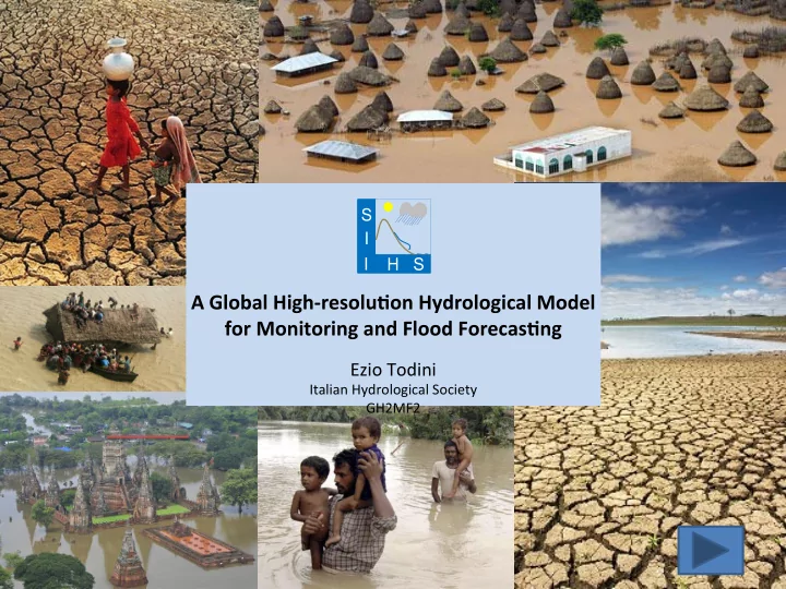
SLIDE 1 A Global High-resolu1on Hydrological Model for Monitoring and Flood Forecas1ng
Ezio Todini
Italian Hydrological Society GH2MF2
S S I I H
SLIDE 2
SLIDE 3
SLIDE 4
Hydrologists considered “evapo-transpira=on” as LOSSES, although evapo-transpira=on accounts from 40% to 60 % of the en=re water budget. Meteorologists and Climatologists considered “surface runoff” as LOSSES, although surface runoff accounts from 20% to 40 % of the en=re water budget.
SLIDE 5 In par=cular Meteorologists and Climatologists considered the soil effect as a BUCKET (the Manabe Bucket, 1969) which used to produce the following type
SLIDE 6 At the end of the eigh=es I collaborated with Lydia Dümenil, a climatologist from the Hamburg Max-Plank ins=tute, who asked me if I could provide her with a very simple scheme as an alterna=ve to the Manabe Bucket. I had recently modified the Xinanjiang model (Zhao, 1977) by introducing infiltra=on and percola=on losses, and produced a new lumped model, the Arno
- Model. The Xinanjiang/Arno
saturated area vs soil moisture volume func=on was then introducedin the Hamburg ECHAM GCM.
SLIDE 7
Using ECHAM with the new hydrological model we were able of comparing the GCM results with the flow of the large riversin the world, which data were made available by the Koblenz Global Runoff Data Centre.
SLIDE 8
1) The lack of a good rou=ng component 2) The lack of physically meaningful parameters in the hydrologic model to be es=mated on the basis of available maps This raised the idea of developing a physically meaningful model which parameters could be es=mated from maps. The results showed that only few rivers could be correctly reproduced and this was mainly due to two reasons.
SLIDE 9
This project presented at the EGU 2016 born of solidarity and the need to dignify the most disadvantaged people living in the poorest countries (Africa, South America and Asia), which are con=nually exposed to changes in the hydrologic cycle suffering events of large floods and/or long periods of droughts.
Global High-resolu1on Hydrological Model for Monitoring and Flood Forecas1ng
SLIDE 10 The project called: A Global High-resolu1on Hydrological Model for Flood Monitoring and Forecas1ng (GH2MF2) is Non-Profit and aims to provide at global high resolu=on (1x1 km2) hydrological monitoring and forecas=ng in real =me and con=nuously coupling Weather Forecast
- f GFS-0.25° (Determinis=c and Ensembles Run)
forcing a physically based distributed hydrological model TOPKAPI-eXtended. Finally using the MCP approach for the proper use of ensembles for Predic=ve Uncertainty assessment. Global High-resolu1on Hydrological Model for Monitoring and Flood Forecas1ng
SLIDE 11
The system will be integrated into a Decision Support System (DSS) plagorm, based on geographical data. The DSS is a classical client-server web applica=on (for Pcs, Tablets, Mobile phones) not requiring installa=on (a web browser and an internet connec=on only) or upda=ng (all upgrading being deployed on the remote server). THE PLATFORM
Global High-resolu1on Hydrological Model for Monitoring and Flood Forecas1ng
SLIDE 12 Global System for Hydrological Monitoring and Forecas1ng in Real Time at High Resolu1on
THE PLATFORM DSS is a classical client – server applica=on. The client side is an HTML 5 – CSS 3 applica=on, it runs in one of the most common browser (Mozilla Firefox, Google Chorme, Safari). The server side consist in:
- A web server (Apache web server);
- A map server (Geoserver);
- A Geographical Rela=onal Database
Management Sytem
- (Postgresql + Postgis);
- Tools based on GDAL Lybraries.
SLIDE 13
- The proposed plagorm is meant to be par=cipa=ve and
interac=ve. To meet this objec=ve, all informa=on used in the system must be freely accessible to users, including the hydrological models, and allowed to set-up the models for the benefit of the community.
Global System for Hydrological Monitoring and Forecas1ng in Real Time at High Resolu1on
- The novel aspect of the proposed project and its
plagorm is that any user will be allowed set-up, calibrate and validate hydrological models, by downloading from the plagorm the base maps (DEM, Flow Direc=ons, Flow Accumula=on, Soil Types and Land Use) and the hydro- meteorological forcing data.
SLIDE 14
X
Assimila1on of remote sensing observed rainfall NASA product TRMM 3B42RT into plaTorm
SLIDE 15
- Validated models (according to provided standards) will
be then uploaded on the plagorm to be part of the daily run of the system and to be available to other users, who can view and interrogate the plagorm for forecasts in all basins.
- The hydrological simula=ons will also be processed by
the plagorm for visualiza=on, diffusion and dissemina=on of warnings, alerts and alarms.
Global High-resolu1on Hydrological Model for Monitoring and Flood Forecas1ng
SLIDE 16
The proposed project is based on a much more computa=onally powerful hydrological model TOPKAPI- eXtended whose physically based parameters allow an easy seoung-up using world-wide availablebase maps. TOPKAPI-X has already accumulated a long history in the literature as well in opera=on all over the world. The simula=ons are meant to be performed at hourly temporal resolu=on on spa=al scales of 1x1 km2.
Con=nue for Presenta=on Click for exploring TOPKAPI-X Model
Global High-resolu1on Hydrological Model for Monitoring and Flood Forecas1ng
SLIDE 17 TOPKAPI-X is based on the hypothesis that sub-surface flow (Two Layers), overland flow and channel flow can be approximated using a Kinema1c wave approach.
c
b a t η η − = ∂ ∂
Superficial Soil Layer Overland flow Channel flow The integra1on in space of the non-linear Kinema1c wave equa1ons represen1ng subsurface flow, overland flow and channel flow results in FOUR ‘structurally-similar’ non-linear reservoir equa1ons.
KINEMATIC APPROACH HYPOTHESIS IN TOPKAPI-X
Deeper Soil Layer NEW version of the model: TOPKAPI-eXtended
SLIDE 18
- 1. Introduc1on of an 8-DIRECTIONS drainage network
- 2. ADDITIONAL SOIL RESPONSE in order to reproduce different
hydrological situa1ons. Two soil layers
- 3. Addi1on of an infiltra1on module based on the GREEN-AMPT
MODEL, to reproduce hortonian processes
- 4. Introduc1on of two coefficients to take into account the sun
height with respect to the cell aspect for the RADIATION ASSESSMENT and ALBEDO
- 5. Addi1on of a GROUNDWATER MODEL based on the cellular
automa
- 6. Addi1on of a RESERVOIR/LAKES MANAGEMENT MODE
MAIN MODIFICATIONS IN TOPKAPI - eXtended
NEW version of the model: TOPKAPI-eXtended
SLIDE 19 CONCEPTUAL SCHEME TOPKAPI - eXtended
NEW version of the model: TOPKAPI-eXtended
Snowmelt
SLIDE 20
CONCEPTUAL SCHEME TOPKAPI - eXtended
NEW version of the model: TOPKAPI-eXtended Evapo-transpira=on Snowmelt Overland Flow Sub-Surface Flow Channel Flow Surface Soil Layer Deeper Soil Layer Groundwater Flow Infiltra=on Percola=on Aquifer Layer
SLIDE 21 01/10/1987 31/12/2002 01/10/1988 01/10/1997 WARM UP CALIBRATION. VALIDATION
In the applica1on of American River Basin (inside the project DMIP-2/NWS) the TOPKAPI-X has generated the best simula1on during the calibra1on period (Smith et al., 2013). The new conceptualiza1on of the two soil layers plus Green and Ampt has allowed a correct reproduc1on of peak floods, the base flow and recession curves. Thanks to the model of infiltra1on even small summer events are simulated correctly. The evalua1on indices confirm the good behavior of the model, which returned a Nash-Sutcliffe coefficient equal to 0.90 calculated over 9 years of simula1on with hourly 1me step.
Simth M. et al., 2013. The Distributed Model Intercomparison Project - Phase 2: Experiment Design and Summary Results of the Western Basin Experiments, Journal of Hydrology 507 (Dec. 2013) 300–329. hSp://dx.doi.org/10.1016/j.jhydrol.2013.08.040
2nd PHASE of Distributed Model Intercomparison Project, Phase 2 NORTH FORK AMERICAN RIVER BASIN, CA, USA
NEW version of the model: TOPKAPI-eXtended
SLIDE 22 TOPKAPI-X Basin i TOPKAPI-X Basin 2 TOPKAPI-X Basin 1 TOPKAPI-X Basin n TOPKAPI-X Cloud Compu1ng
PLATFORM GH2MF2 OTHER DATA GFS 0.25° TRMM GLOBAL USERS
Global High-resolu1on Hydrological Model for Monitoring and Forecas1ng
SLIDE 23 Common Database GIS layers for topological processing of hydrologic models with TOPKAPI-X
HydroSHEDS 30 arc-sec
Iden1fier Types of data DEM Digital eleva=on model (void-filled) CON Hydrologically condi=oned eleva=on DIR Drainage direc=ons ACC Flow accumula=on (number of cells) RIV River network (stream lines) BAS Drainage basins (watershed boundaries)
Global High-resolu1on Hydrological Model for Monitoring and Forecas1ng
SLIDE 24
Common Database GIS layers for topological processing of hydrologic models with TOPKAPI-X
Global Land Cover
Global High-resolu1on Hydrological Model for Monitoring and Forecas1ng
SLIDE 25
Common Database GIS layers for topological processing of hydrologic models with TOPKAPI-X
Soil Type Harmonized World Soil Database (HWSD)
Global High-resolu1on Hydrological Model for Monitoring and Flood Forecas1ng
SLIDE 26
Common Database for calibrate/validate of hydrologic models with TOPKAPI-X
Discharge: Global Runoff Data Centre and others as well as data from ins1tu1ons who want to par1cipate
Global High-resolu1on Hydrological Model for Monitoring and Flood Forecas1ng
SLIDE 27
Common Meteorological DataSets for calibrate/validate hydrologic models with TOPKAPI-X
ERA-Interim|ECMWF and Others
Global High-resolu1on Hydrological Model for Monitoring and Flood Forecas1ng
SLIDE 28
GFS 0.25° Forcing TOPKAPI-X DISCHARGE FORECAST AT PIXEL SCALE 1x1 km2 TOPKAPI-X
Global High-resolu1on Hydrological Model for Monitoring and Flood Forecas1ng
SLIDE 29
This project received the unanimous approval and support from the Council of the Italian Hydrological Society (SII-IHS)
Global High-resolu1on Hydrological Model for Monitoring and Flood Forecas1ng
CROWDFUNDING hops://es.ulule.com/global-high-resolu=on-system-for- hydrological-mon/