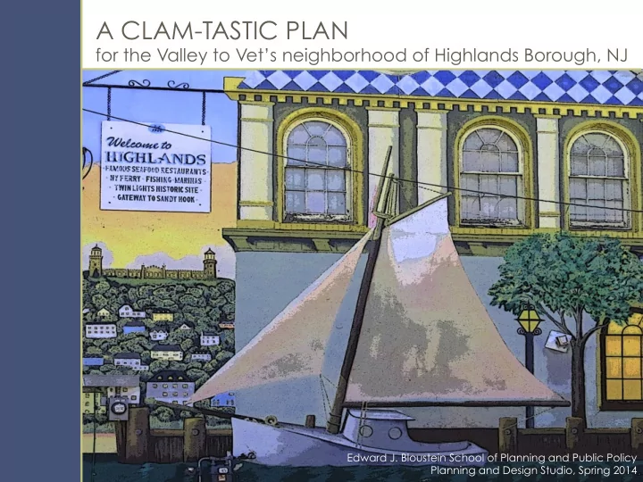
SLIDE 1 A CLAM-TASTIC PLAN
for the Valley to Vet’s neighborhood of Highlands Borough, NJ
Edward J. Bloustein School of Planning and Public Policy Planning and Design Studio, Spring 2014
SLIDE 2 q Introduc)ons ¡& ¡Acknowledgements ¡ q The ¡Studio’s ¡Mission ¡ q The ¡Study ¡Area: ¡
¡Exis)ng ¡Condi)ons, ¡Recent ¡Trends, ¡Planning ¡Goals, ¡ ¡ ¡ ¡ ¡ ¡ ¡Planning ¡Analysis ¡
q A ¡Planning ¡& ¡Design ¡Framework ¡for ¡Posi)ve ¡Transforma)on ¡ q Implementa)on ¡Mechanisms ¡ q Ques)ons? ¡
PRESENTATION OUTLINE
SLIDE 3 Planning Studio Team
q
Elizabeth ¡Carter ¡
q
Erwin ¡H. ¡Flesch ¡
q
Julie ¡Grof ¡
q
Greer ¡Reinalda ¡
q
Sharon ¡Williams ¡ Instructors ¡
q
Anton ¡Nelessen ¡
q
Carlos ¡Rodrigues ¡
INTRODUCTIONS & ACKNOWLEDGEMENTS
Stakeholders
Highlands ¡Borough ¡
q
Mayor ¡Frank ¡L. ¡Nolan ¡
q
Councilman ¡Chris ¡Francy ¡
q
Carla ¡Cefalo-‑Braswell ¡-‑ ¡HBP ¡
q
Charles ¡Heck ¡– ¡Tax ¡Assessor ¡
q
Donna ¡Conrad ¡– ¡Clerk ¡
q
Bruce ¡Padula, ¡Esq. ¡– ¡Borough ¡AWorney ¡ Monmouth ¡County ¡Division ¡of ¡Planning ¡
q
Joseph ¡Barris ¡
q
BriWany ¡Ashman ¡
q
Sharon ¡RaXer ¡ Monmouth ¡County ¡Parks ¡& ¡Recrea>on ¡
q
Paul ¡Gleitz ¡ Others ¡
q Paul ¡Cefalo ¡– ¡Weichert ¡Realty ¡ q Chris ¡Kok ¡– ¡FEMA ¡ q Leo ¡Cervantes ¡-‑ ¡Chilango’s ¡Restaurant ¡
¡
SLIDE 4 The Assignment
Create ¡a ¡“big-‑picture” ¡conceptual ¡framework ¡ for ¡the ¡Study ¡Area ¡to: ¡
q
Offer ¡a ¡more ¡informed ¡planning ¡and ¡ urban ¡design ¡framework ¡
q
Ac)vate ¡latent ¡commercial ¡opportuni)es ¡
q
Repopulate ¡the ¡surrounding ¡residen)al ¡ neighborhood ¡
q
Improve ¡public ¡access ¡to ¡the ¡waterfront ¡
q
Foster ¡storm-‑sustainable ¡and ¡green ¡ community ¡design ¡features ¡and ¡ strategies ¡
Implementation Mechanisms
Suggest ¡more ¡effec)ve ¡ways ¡for ¡Highlands ¡ to ¡deploy ¡its ¡regulatory ¡authority: ¡
q
Explore ¡pros ¡and ¡cons ¡of ¡market-‑ driven ¡approaches ¡to ¡transforma)on ¡ (zoning, ¡land ¡development ¡ regula)ons) ¡and ¡public ¡sector ¡driven ¡ approaches ¡(Abandoned ¡Proper)es ¡ Act, ¡Local ¡Redevelopment ¡and ¡ Housing ¡Act) ¡
q
Inform ¡strategic ¡choices ¡regarding ¡ neighborhood ¡transforma)on ¡
THE STUDIO’S MISSION
SLIDE 5
Regional Location Highlands ¡Borough, ¡Monmouth ¡County, ¡NJ ¡
SLIDE 6 THE STUDY AREA
q Between ¡Valley ¡Street ¡and ¡
Veteran’s ¡Memorial ¡Park, ¡and ¡ between ¡the ¡Shrewsbury ¡River ¡ and ¡Shore ¡Drive ¡
q 20 ¡Blocks, ¡56.4 ¡Acres
¡
q Includes ¡a ¡por)on ¡of ¡Bay ¡
Avenue, ¡Highlands’ ¡“Main ¡ Street”, ¡struggling ¡with ¡ vacancies ¡ ¡
q Prime ¡waterfront ¡real ¡estate, ¡
not ¡fully ¡u)lized ¡
q Lands ¡occupied ¡by ¡sub-‑prime ¡
uses, ¡such ¡as ¡parking, ¡the ¡ municipal ¡public ¡works ¡ department ¡and ¡private ¡light ¡ industrial ¡uses ¡
SLIDE 7 STUDY AREA – Existing Conditions
Key Indicators
¡ ¡ ¡ ¡ ¡Study ¡Area ¡Highlands ¡ ¡Monmouth ¡County ¡ Median ¡income ¡ ¡ ¡ ¡NA ¡ ¡ ¡$67,292 ¡ ¡ ¡$84,746 ¡
¡NA ¡ ¡ ¡1.91 ¡persons ¡ ¡2.66 ¡persons ¡
Families ¡below ¡poverty ¡level ¡NA ¡
¡ ¡17% ¡ ¡ ¡ ¡5% ¡ Unemployment ¡rate ¡ ¡NA ¡ ¡ ¡13% ¡ ¡ ¡ ¡8% ¡ Occupied ¡housing ¡units: ¡ ¡ ¡Owner-‑Occupied ¡37% ¡ ¡ ¡59% ¡ ¡ ¡ ¡75% ¡ ¡ ¡Renter-‑Occupied ¡63% ¡ ¡ ¡41% ¡ ¡ ¡ ¡25% ¡ Vacant ¡housing ¡units: ¡ ¡For ¡rent ¡ ¡ ¡53% ¡ ¡ ¡25% ¡ ¡ ¡ ¡21% ¡ ¡For ¡seasonal ¡use ¡ ¡31% ¡ ¡ ¡53% ¡ ¡ ¡ ¡45% ¡
25-‑34 ¡year ¡old ¡householders ¡22% ¡
¡ ¡14% ¡ ¡ ¡ ¡10% ¡ Non-‑family ¡households ¡59% ¡ ¡ ¡56% ¡ ¡ ¡ ¡30% ¡
Source: US Census, 2010
Highlands ¡as ¡a ¡whole ¡has ¡lower ¡household ¡income, ¡higher ¡ poverty, ¡higher ¡unemployment ¡and ¡smaller ¡households ¡than ¡ the ¡Monmouth ¡County ¡average. ¡The ¡Study ¡Area ¡has ¡younger ¡ households, ¡far ¡more ¡rental ¡housing ¡and ¡far ¡less ¡seasonal ¡ housing ¡than ¡Highlands ¡as ¡a ¡whole. ¡ ¡
SLIDE 8 STUDY AREA – Existing Conditions
Defining ¡Features ¡
¡
q Short ¡seasonal ¡economy ¡– ¡
hard ¡to ¡sustain ¡
q Lack ¡of ¡every ¡day ¡goods ¡and ¡
services ¡for ¡local ¡residents ¡
q Generic ¡“suburban” ¡street ¡
and ¡streetscape ¡treatments ¡
q Poor ¡public ¡access ¡to ¡
waterfront ¡– ¡largely ¡private ¡
q Severely ¡underu)lized ¡
waterfront ¡– ¡largely ¡private ¡
q Latent ¡commercial, ¡tax-‑
genera)ng ¡opportuni)es ¡
q Visibly ¡deteriorated ¡
structures ¡and ¡streetscapes ¡
q Erosion ¡of ¡the ¡historic ¡
character ¡as ¡a ¡working ¡ waterfront ¡community ¡
SLIDE 9 STUDY AREA – Existing Conditions
Overview Physical ¡ABributes ¡
q Average ¡eleva)on: ¡0 ¡to ¡10 ¡X ¡ q Mainly ¡residen)al, ¡except ¡for ¡
Bay ¡Av ¡and ¡Shrewsbury ¡Av ¡
q Average ¡lot ¡size ¡+/-‑ ¡2,500 ¡sq ¡X ¡ q Inefficient ¡block ¡structure ¡and ¡
awkward ¡street ¡paWern ¡
q Street ¡network ¡does ¡not ¡
facilitate ¡waterfront ¡access ¡ ¡ Local ¡and ¡Regional ¡ABributes ¡
q Limited ¡regional ¡access ¡ ¡ q Lack ¡of ¡clearly ¡iden)fied ¡gateways; ¡
poor ¡local ¡wayfinding, ¡in ¡par)cular ¡ direc)ons ¡to ¡the ¡waterfront ¡
q 2 ¡million ¡annual ¡visitors ¡to ¡Sandy ¡Hook ¡
Recrea)onal ¡Area, ¡but ¡only ¡100,000 ¡ annual ¡visitors ¡to ¡Highlands ¡
q Need ¡to ¡beWer ¡capitalize ¡on ¡other ¡local ¡
aWrac)ons: ¡
q Twin ¡Lights ¡Na)onal ¡Historic ¡Site ¡ q Pompora ¡Park ¡ q Henry ¡Hudson ¡Trail ¡ q Cer)fied ¡Clam ¡Depura)on ¡Plant ¡ q Mount ¡Mitchell ¡overlook ¡ q Clamming, ¡restaurants, ¡marinas, ¡
and ¡NYC ¡ferry ¡ ¡
SLIDE 10 STUDY AREA – Existing Conditions
Past and Present Issues
q Rou)ne ¡flooding, ¡both ¡)dal ¡and ¡from ¡stormwater ¡runoff ¡ q Severe ¡inflow ¡+ ¡infiltra)on ¡in ¡sewer ¡system, ¡and ¡very ¡limited ¡reserve ¡capacity ¡
for ¡treatment ¡of ¡addi)onal ¡effluent ¡
q Uncertainty ¡regarding ¡possible ¡future ¡construc)on ¡of ¡Army ¡Corps ¡of ¡Engineers ¡
bulkhead ¡/ ¡seawall ¡project ¡to ¡prevent ¡)dal ¡inunda)on ¡/ ¡storm ¡surges ¡
q Flood ¡insurance ¡mandates ¡and ¡local ¡construc)on ¡code ¡require ¡flood ¡proofing ¡
- f ¡commercial ¡buildings ¡and ¡substan)al ¡eleva)on ¡of ¡residen)al ¡structures ¡
q Persistent ¡ground ¡floor ¡vacancies ¡and ¡lack ¡of ¡ac)ve ¡street ¡life ¡on ¡Bay ¡Avenue ¡
SLIDE 11
STUDY AREA – Recent Events
Impacts from 2012 Hurricane Sandy
q Widespread ¡flooding, ¡with ¡substan)al ¡
damage ¡to ¡real ¡property ¡and ¡both ¡ personal ¡and ¡business ¡assets ¡ ¡
q Dilapidated, ¡vacant ¡and ¡abandoned ¡
homes ¡and ¡businesses ¡ ¡
q Substan)al ¡loss ¡of ¡real ¡estate ¡value ¡(up ¡
to ¡1/3 ¡of ¡tax ¡base) ¡and ¡devalua)on ¡of ¡ real ¡estate ¡ ¡
q Required ¡ground ¡floor ¡eleva)on ¡of ¡
new, ¡or ¡substan)ally ¡damaged ¡ structures ¡– ¡between ¡12 ¡and ¡18 ¡feet ¡
¡
SLIDE 12
STUDY AREA – Possible Future Events
Flooding Conditions During Sandy Source: ¡NJGIN, ¡State ¡LIDAR, ¡Lyna ¡Wiggins ¡and ¡Students ¡
SLIDE 13 STUDY AREA – Possible Future Events
FEMA / ACE Plan
q Proposed ¡ACE ¡design ¡of ¡Reach ¡3 ¡)dal ¡protec)on ¡devices ¡for ¡the ¡Study ¡Area ¡
SLIDE 14 STUDY AREA – Planning Goals
q Adopt ¡smart ¡responses ¡to ¡flood ¡control ¡
and ¡mi)ga)on ¡measures ¡ ¡
q Address ¡under-‑performing ¡Main ¡St ¡ q Facilitate ¡public ¡access ¡to ¡waterfront ¡
¡
q Increase ¡high-‑quality ¡waterfront ¡
development ¡ ¡
q Enhance ¡streetscapes ¡and ¡public ¡spaces ¡
¡
q Improve ¡circula)on ¡for ¡motorists, ¡cyclists ¡
and ¡pedestrians ¡ ¡
q Develop ¡new ¡urban ¡infill ¡prototypes ¡
¡
q Increase ¡real ¡property ¡values ¡through ¡
private ¡investment ¡and ¡public ¡ac)ons ¡ ¡
q Address ¡community ¡equity ¡concerns ¡
SLIDE 15 STUDY AREA – Planning Analysis
Candidates for Infill Development – Quantitative Criteria
q “Significantly ¡low” ¡and ¡“extremely ¡low” ¡
ra)os ¡of ¡value ¡of ¡improvements ¡to ¡value ¡of ¡ land ¡ ¡
q Vacant ¡parcels ¡(no ¡improvements) ¡as ¡per ¡
County ¡Tax ¡Assessment ¡Data ¡ ¡
q Proper)es ¡deemed ¡locally ¡under ¡the ¡UCC ¡
as ¡presen)ng ¡an ¡“imminent ¡hazard” ¡ ¡
q Proper)es ¡with ¡tax ¡liens ¡as ¡per ¡Borough ¡tax ¡
collector ¡data ¡
q Proper)es ¡“suscep)ble ¡to ¡change”
SLIDE 16 STUDY AREA – Planning Analysis
Land/Parcel Value Category ¡ Improvement to land ratio ¡ Valley to Vets parcels % ¡ Empty lots to extreme low value ¡ .00 to .20 ¡ 76 ¡ 22.75 ¡ Significantly low value ¡ .21 to .49 ¡ 66 ¡ 19.76 ¡ Low value ¡ .50 to .79 ¡ 71 ¡ 21.26 ¡ Improvements equal to land value ¡ .80 to .99 ¡ 29 ¡ 8.68 ¡ Improvements greater than land value ¡ 1.00 to 1.99 ¡ 76 ¡ 22.75 ¡ Significantly valuable improvements ¡ 2.0 and up ¡ 16 ¡ 4.79 ¡ TOTAL Parcels ¡ ¡ 334 ¡ ¡
76 Parcels, 23% of our study area, are either empty lots or have the lowest improvement to land value ratios
SLIDE 17
STUDY AREA – Planning Analysis
8 Properties deemed by the local Construction Code Official to constitute an “imminent hazard”
SLIDE 18
STUDY AREA – Planning Analysis 25 vacant parcels
SLIDE 19
STUDY AREA – Planning Analysis 133 parcels with significant infill potential
SLIDE 20 PLANNING VISION
Some of the generic goals from the 2004 Master Plan are still relevant:
q Physically: ¡create ¡mixed ¡use ¡
development, ¡make ¡the ¡waterfront ¡a ¡ des)na)on ¡for ¡ac)vity ¡and ¡relaxa)on. ¡ ¡
q Socially: ¡redevelop ¡the ¡community ¡
- ffering ¡homes, ¡employment, ¡services, ¡
civic ¡spaces ¡and ¡leisure. ¡ ¡
q Naturally: ¡protect ¡the ¡exis)ng ¡resource ¡
base ¡through ¡sensi)ve ¡design, ¡energy ¡ efficiency, ¡and ¡minimize ¡the ¡impact ¡on ¡ the ¡local ¡environment. ¡ But the Master Plan is functionally
- bsolete with respect to the Study
- Area. It offers no practical guidance
and must be replaced ASAP. ¡
SLIDE 21 Visual Preference Survey Results
DESIGN VISION
Rated +5.6 on the Visual Preference Survey
Standard Deviation of 6
The responses from Highlands residents to the Bloustein on- line survey suggest a much higher than expected embrace of positive change and support for transformation.
SLIDE 22 Challenges
q Vacant, ¡storm ¡damaged ¡proper)es ¡ q Very ¡small ¡average ¡lot ¡size ¡ q Awkward, ¡inefficient ¡block ¡structure ¡ q Sanitary ¡and ¡storm ¡water ¡sewer ¡
capacity ¡limita)ons ¡
q Conflicts ¡between ¡exis)ng ¡
commercial ¡and ¡residen)al ¡uses ¡
q Parking ¡overflow ¡from ¡commercial ¡
proper)es ¡in ¡residen)al ¡areas ¡ Opportunities
q The ¡Shrewsbury ¡River ¡waterfront ¡ q Miller ¡Street ¡waterfront ¡access ¡ q Miller ¡Street ¡and ¡Bay ¡Avenue ¡
intersec)on ¡– ¡the ¡“100% ¡corner” ¡
q North ¡Street ¡pedestrian ¡walkway ¡ q Luring ¡regional ¡visitors ¡to ¡local ¡
aWrac)ons ¡and ¡landmarks ¡
q Adop)ng ¡new ¡storm-‑resilient ¡
building ¡typologies ¡
DESIGN VISION
SLIDE 23 DESIGN VISION
§ Reimagine this section of Bay Av as a multi-purpose, mixed-use corridor for incubator retail, remote parking, services and class C office, as well as attached housing. § Reimagine Miller St as the main gateway / connector to the waterfront § The Bay Av / Miller St intersection becomes a major focus for redevelopment § Miller St becomes the new “Main St” with a regional draw and an emphasis on uses focused on the proximity and access to the waterfront § Shrewsbury Av takes on a new role as the locus for higher value waterfront uses, such as a new marina and hotel § The adjacent residential neighborhood increases in value and becomes more storm-resilient by gradually converting to attached housing types as a result of market forces. § Reimagine the local streets as “green streets” and “shared spaces” – green stormwater and bike/ped facilities.
SLIDE 24
SLIDE 25
Proposed Site Plan
DESIGN VISION
SLIDE 26
DESIGN VISION
Proposed Site Plan ¡
SLIDE 27 DESIGN VISION
Streets ¡ The retrofitting of the current suburban street design into the proposed “green”, “shared” streets will help recreate the maritime character Highlands residents value in their community, improve the quality of place, improve circulation (both vehicular as well as bike/ ped), clarify parking
flooding from stormwater and generally institutionalize a 21st Century street design standard.
SLIDE 28
Shared ¡Streets ¡
DESIGN VISION
SLIDE 29
DESIGN VISION
North ¡Street ¡
SLIDE 30
Bay Avenue at Miller Street
DESIGN VISION
This intersection assumes heightened importance as the planned major gateway to the waterfront and the anchor for new higher-density, waterfront-oriented retail and housing
SLIDE 31
Miller Street
DESIGN VISION
SLIDE 32
Single Family Attached Typologies
DESIGN VISION
SLIDE 33
DESIGN VISION
Public Space & Spray Park
SLIDE 34
The Marina
DESIGN VISION
SLIDE 35
Waterfront Shops
DESIGN VISION
SLIDE 36
The Highlands Inn
DESIGN VISION
The Highlands Residence
SLIDE 37
Civic Building
DESIGN VISION
SLIDE 38
DESIGN VISION
Parking and Circulation ¡
Parking Garage Square Footage ¡ Total Parking Spaces ¡ 577,237 ¡ 1,675 ¡
SLIDE 39
Visual simulations – what might it look like?
DESIGN VISION
Insert graphic
SLIDE 40 Options
q Zoning ¡reform ¡-‑ ¡collapsing ¡8 ¡zoning ¡districts ¡into ¡4 ¡ ¡ q Uniform ¡Construc)on ¡Code ¡– ¡proper)es ¡deemed ¡an ¡
“imminent ¡hazard” ¡– ¡tool ¡already ¡used ¡by ¡the ¡Borough ¡
q Abandoned ¡Proper)es ¡Rehabilita)on ¡Act ¡ q Local ¡Redevelopment ¡and ¡Housing ¡Law: ¡“Area ¡in ¡Need ¡
- f ¡Rehabilita)on” ¡and ¡“Area ¡in ¡Need ¡of ¡
Redevelopment” ¡with, ¡or ¡without, ¡the ¡possibility ¡of ¡ using ¡eminent ¡domain ¡
IMPLEMENTATION MECHANISMS
SLIDE 41 Municipal Land Use Law: Zoning – NJSA 40:55D et seq
q Borough ¡creates ¡the ¡planning ¡
and ¡legal ¡framework, ¡but ¡ does ¡not ¡have ¡a ¡role ¡in ¡ implementa)on ¡
q Market-‑driven ¡– ¡the ¡private ¡
sector ¡sets ¡the ¡tone ¡and ¡pace ¡
q Implemented ¡by ¡individual ¡
property-‑owners ¡/ ¡developers ¡
q Development ¡proposals ¡are ¡
reviewed ¡by ¡the ¡Planning ¡ Board ¡or ¡the ¡Zoning ¡Board ¡
q Limited ¡public ¡incen)ves ¡ q Fragmented, ¡incremental ¡
transforma)on ¡
IMPLEMENTATION MECHANISMS
SLIDE 42 IMPLEMENTATION MECHANISMS
Existing Zoning Proposed Zoning
R-2.02 Single Family Residential R-2.03 Single Family Residential B-2 Central Business District B-2-0 Central Business Overlay District WT-C Waterfront Transition – Commercial WC-T/C Waterfront Transition – Commercial/Townhouse WC-1 Waterfront Commercial WT-R Waterfront Transition - Residential W Waterfront R-1 Residential Miller Miller Avenue Corridor Bay Bay Avenue Corridor
SLIDE 43
Uniform Construction Code – Properties Deemed an “Imminent Hazard”
IMPLEMENTATION MECHANISMS
Criteria ¡for ¡IntervenHon: ¡ ¡ Emergency ¡ac)ons ¡directed ¡at ¡ unsafe ¡buildings/structures ¡ q Fire ¡Hazard ¡ q In ¡Danger ¡of ¡Collapsing ¡ q Unsanitary ¡ q Dangerous ¡to ¡life/welfare ¡ q Emergency ¡repairs ¡ q Demoli)on ¡ LimitaHons: ¡ ¡ q Not ¡a ¡tool ¡for ¡public ¡acquisi)on ¡ q Cannot ¡compel ¡rebuilding ¡ q Allows ¡risk ¡of ¡land ¡specula)on ¡ q Not ¡coordinated ¡with ¡other ¡ redevelopment ¡tools ¡ q No ¡“end-‑game” ¡vision ¡ ¡
SLIDE 44 IMPLEMENTATION MECHANISMS
Area in Need of Rehabilitation - NJSA 40A:12A et seq
q Purpose: ¡to ¡restore ¡buildings ¡to ¡a ¡good ¡condi)on, ¡opera)on, ¡or ¡capacity; ¡
infill ¡vacant ¡lands ¡
q The ¡Borough ¡adopted ¡a ¡Rehabilita)on ¡Ordinance ¡in ¡2008 ¡and ¡re-‑adopted ¡it ¡
in ¡2012 ¡
q All ¡of ¡Highlands ¡was ¡designated ¡an ¡area ¡“in ¡need ¡of ¡rehabilita)on” ¡ q Financial ¡incen)ves ¡are ¡limited ¡to ¡short ¡term ¡tax ¡abatements ¡(up ¡to ¡5 ¡years, ¡
$25,000); ¡eligibility ¡expires ¡aXer ¡10 ¡years ¡from ¡ordinance ¡adop)on. ¡
q Only ¡one ¡applica)on ¡has ¡been ¡filed ¡since ¡the ¡adop)on ¡of ¡the ¡rehabilita)on ¡
q Conclusion: ¡not ¡providing ¡the ¡incen)ves ¡needed ¡to ¡get ¡things ¡moving. ¡
SLIDE 45
Abandoned Properties Rehabilitation Act - NJSA 55:19-81
IMPLEMENTATION MECHANISMS
Criteria ¡for ¡DesignaHon: ¡ q Not ¡legally ¡occupied ¡for ¡at ¡least ¡ 6 ¡Months ¡ q Seasonal ¡proper)es ¡ q Tax ¡liens ¡ q “in ¡need ¡of ¡rehabilita)on” ¡ q Allows ¡the ¡applica)on ¡of ¡ “redevelopment” ¡to ¡individual ¡ proper)es ¡without ¡a ¡formal ¡ determina)on ¡of ¡“area ¡in ¡need” ¡ ¡ LimitaHons: ¡ q Applies ¡to ¡abandoned ¡ proper)es ¡only ¡ q Implemented ¡parcel ¡by ¡parcel ¡ q Requires ¡“big ¡picture” ¡strategy ¡ for ¡successful ¡outcomes ¡
SLIDE 46
IMPLEMENTATION MECHANISMS
Area in Need of Redevelopment, N.J.S.A. 40A:12A-5 Criteria ¡for ¡DesignaHon: ¡A, ¡D ¡ ¡ Buildings/Improvements ¡ ¡ q Dilapidated ¡ q Obsolete ¡layout ¡ q Faulty ¡arrangement ¡ q Unsafe ¡ q Overcrowding ¡
SLIDE 47
Area in Need of Redevelopment, N.J.S.A. 40A:12A-5 Criteria ¡for ¡DesignaHon: ¡B ¡ Commercial ¡buildings ¡ ¡ ¡ q Discon)nued ¡Use ¡ q Abandoned ¡ q Disrepair ¡
SLIDE 48
Area in Need of Redevelopment, N.J.S.A. 40A:12A-5 Criteria ¡for ¡DesignaHon: ¡C ¡ Unimproved ¡vacant ¡land ¡for ¡ at ¡least ¡10 ¡years ¡and ¡not ¡likely ¡ to ¡be ¡developed ¡ ¡ q Loca)on ¡ q Remoteness ¡ q Lack ¡of ¡access ¡ q Topography ¡ ¡ Criteria ¡for ¡DesignaHon: ¡D ¡ Deleterious ¡land ¡use ¡
SLIDE 49
Types ¡of ¡redevelopment ¡(at ¡Borough’s ¡discre)on) ¡ q Non-‑condemna)on ¡ q ¡Condemna)on ¡(ie, ¡allows ¡eminent ¡domain) ¡ ¡ Possible ¡public ¡financing ¡incen)ves ¡ q Tax ¡exempt ¡bonds ¡ q Long-‑term ¡tax ¡exemp)ons ¡(30/35 ¡years) ¡ q “Payments-‑in-‑lieu ¡of ¡taxes ¡(“PILOTS”) ¡ q Exemp)on ¡from ¡sewer ¡hook-‑up ¡fees ¡ q Conveyance ¡of ¡public ¡lands ¡ q Public ¡/ ¡private ¡partnerships ¡ ¡ Affordable ¡Housing ¡Trust ¡Fund ¡ Public ¡space ¡dedica)on ¡ Developer-‑funded ¡infrastructure ¡ Puts ¡the ¡Borough ¡in ¡the ¡“driver’s ¡seat” ¡ Area in Need of Redevelopment, NJSA 40A:12A-5; 40A: 20-12
SLIDE 50
NEW HIGHLANDS
Movement Plan: Year-Round
SLIDE 51
NEW HIGHLANDS
Movement Plan: Summer Season
SLIDE 52
NEW HIGHLANDS
Old North Street
SLIDE 53
SLIDE 54 NEW HIGHLANDS
This plan achieves:
Residential Units ¡ Residential Square Footage ¡ Inn Square Footage ¡ Retail Square Footage ¡ Total Proposed Square Footage ¡ Parking Spaces Needed ¡ Parking Spaces Total ¡ Jobs Added
393 ¡ 344,070 ¡ 53,104 ¡ 124,595 ¡ 1,099,006 ¡ 1,669 ¡ 2,010 ¡ 283
SLIDE 55
Thank You for Inviting Us Into Your Community QUESTIONS?