
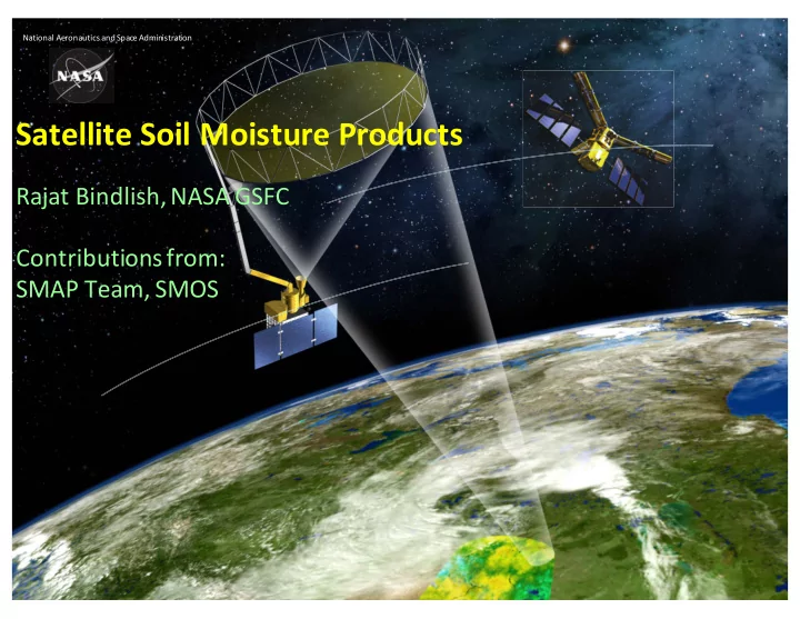
SLIDE 1
!"#$%&"'()*+%&",#$-.("&/(01"-*()/2$&$.#+"#$%&
!"#$%%&#$'!(&%')(&*#+,$'-,(.+/#* - - PowerPoint PPT Presentation
!"#$%&"'()*+%&",#$-.("&/(01"-*()/2$&$.#+"#$%& !"#$%%&#$'!(&%')(&*#+,$'-,(.+/#* 3"4"#(5$&/'$.67(!)0)(809: :%&#+$;,#$%&.(<+%2= 0>)?(@*"27(0>A0
!"#$%&"'()*+%&",#$-.("&/(01"-*()/2$&$.#+"#$%&
Limitations in measuring global soil moisture:
! Ground measurements of soil moisture are sparse and have limited
coverage
! Higher frequency (X-band) Space-borne sensors have relatively low
sensitivity and resolution
Objective of a Soil Moisture mission is to provide high-resolution and frequent- revisit global maps of soil moisture.
Science and applications addressed by SMOS and SMAP:
!
Understand processes that link the terrestrial water, energy and carbon cycles
!
Estimate global water and energy fluxes at the land surface
!
Quantify net carbon flux in boreal landscapes
!
Enhance weather, flood and drought prediction
!
Other applications such as agricultural productivity and human health
:%,+#*.E(%<(#6*(8%//"+/(F$.,"'$G"#$%&(H";
! SMOS (ESA) ! ASCAT (ESA) ! GCOM-W (JAXA)
! "#$%&'#(#)*+&,-.&/-01,1+.&(+-(21(&$%+&(2#*&#(&3,(4+.&)5&6*27.(&,-.&8+9+$,$#2-:&;<$#6,*&(+-(21(&2<+1,$+&)5& 3+,(71#-9&(6,$$+1+.&(7-*#9%$&,-.&,1+&=.,5$#3+&2-*5>: ! ?#612@,8+(&6,-&<+-+$1,$+&$%1279%&6*27.(&,-.&8+9+$,$#2-A&2<+1,$+&.,5&,-.&-#9%$A&,-.&,1+&%#9%*5&(+-(#$#8+& $2&$%+&@,$+1&#-&$%+&(2#*&.7+&$2&$%+&6%,-9+&#-&$%+&(2#*&3#612@,8+&.#+*+6$1#6&<12<+1$#+(:
HV (radar)
soil-vegetation interaction
with corrections for vegetation, roughness and surface temperature Emission Backscatter
! TBp
t = TBp s Lp + TBp v + TBp sv
! " pq
t
= " pq
s Lpq 2 +" pq v +" pq sv
(Emission) (Backscatter)
IJ"-K.%&("&/(A!*$''7(!"""#$%&'()#%"*+,7(LMNOPQ
012"3. 456'789 :);! <)!= >5?'789 !!)@; 4A'789
# R(S"C*'*&D#6 !>&R(T2 U3*<+"-#$C*(T&/*VW ?%X*+()##*&,"#*.(".(-YGZ/
/(R [(\ &>
Vegetation attenuation increases with increasing measurement frequency
456'789 >5?'789 4?5?'789
Effective sensing depth decreases with increasing measurement frequency
#
L-band provides significant improvements in soil moisture sensing capability
Mission Duration SM Spatial Coverage1 Temporal Revisit Orbit Product Resolution AMSR-E 2002-2011 Global land 2-3 days (1:30 pm asc / 1:30 am desc) 25 km GCOM- W(AMSR2) 2012-Present Global land 2-3 days (1:30 pm asc / 1:30 am desc) 25 km WindSat (DoD) 2004-? Global land 2-3 days Sun synch (6:00 am asc/ 6:00 desc) 25 km ASCAT 2009-Present Global land Sun synch (9:30pm asc / 9:30am desc) 12.5 km/25 km SMOS 2009-Present Global land 2-3 days Sun-synch (6am asc / 6pm desc) 25 km Aquarius 2011-2015 Global land 8 days Sun-synch (6pm asc / 6 am desc) 100 km SMAP 2015-Present Global land 2-3 days Sun-synch (6am desc / 6pm asc) 3 km/9 km/36 km SAOCOM 2022-? Argentina Pampas ? ? 1 km NISAR 2021/2022-? US and India land 12 days ? 1 km
! AMSR-E was the first satellite mission to develop a soil moisture product ! AMSR-E provided invaluable environmental data products (precipitation, cloud water, soil moisture, snow, sea ice) from 2002 to 2011 ! AMSR2 was launched by JAXA in July 2012 and provides an opportunity to extend this data record ! AMSR2 products will be invaluable for a more complete understanding of the climate system ! AMSR-E and AMSR2 are both part of NASA’s A-train satellites ! Goal Accuracy: 0.05 m3/m3 for regions with vegetation water contents (VWC) < 2 kg/m2, 0.10 m3/m3 for VWC 2-5 kg/m2.
Comments ! Global soil moisture maps. Data represent long term averages for the month of July. ! Maps show similar spatial structure and consistency between the two SCA retrievals. ! Areas with dense vegetation masked out.
! USA (7) ! Canada (2) ! Argentina (1) ! Spain (1) ! Netherlands (1) ! Mongolia (1) ! Australia (2)
JAXA SCA LPRM
ubRMSE (m3/m3) Bias (m3/m3) RMSE (m3/m3) R ubRMSE (m3/m3) Bias (m3/m3) RMSE (m3/m3) R ubRMSE (m3/m3) Bias (m3/m3) RMSE (m3/m3) R
All 0.059
0.502 0.055
0.080 0.569 0.088 0.100 0.137 0.601 AMSR2 (VWC < 2 kg/m2) 0.049
0.533 0.048
0.069 0.593 0.083 0.077 0.115 0.655
SMOS is the second Earth Explorer
An ESA/CNES/CDTI project Selected in 1999, initiated in 2000 Launched in November 2009
A new technique (2D interferometry) to provide global measurements from space of key variables (SSS and SM) for the first time.
surface salinity fields
adequate (antenna size) ==>Synthetic antenna ]"&&(*#("'P
!)<-';3*#,+B$3#':(3C&D+,"#&(3
=".", 9+*^,*&-E=(LP_`(8aG( ?%'"+$G"#$%&.=(FF7(aa7(aF( 3*.%',#$%&=(b(K2 3*'"#$C*()--,+"-E=(LPc(/5(daa("&/(FFe7(LPf(/5(daFe =".&(B$#$, 9+*^,*&-E=(LP[L(8aG( ?%'"+$G"#$%&.=(a7(F7(b+/ g([#6 0#%K*. 3*.%',#$%&=([c(K2 3*'"#$C*()--,+"-E=(LPb(h !E",$.'<3#$33" 6-m diameter deployable mesh antenna Conical scan at 14.6 rpm Constant incidence angle: 40 degrees 1000 km-wide swath Swath and orbit enable 2-3 day global revisit F,G&# 0,&Y.E&-6+%&%,.7(`("2Z12(%+;$#7(>HI'JB "'#$#,/* )&**&(3'FK$,"#&(3* bYE*"+(;".*'$&*(2$..$%&
Launch: Jan. 31, 2015 from Vandenberg Air Force Base in California onboard a Delta II.
SMAP objective is to provide high-resolution and frequent-revisit global mappings of soil moisture and landscape freeze/thaw state
!"#$%&"'"() *+%,-.+%/)$&" 0&""1"2 3456 B+(2*7$#2-
7-5(8 9:-;' C&43
B+01+(% B,$+
C&.,5( D&.,5(EFG
H6671,65
<=<> I63CJ63CK EDG LMN&ECG
O71,$#2-
CP&32-$%(
dLe(!%+#6(%<([f!(H"#$#,/* d_e(j(C%',2*#+$-(X"#*+(-%&#*(LY.$D2" dbe(j(-'"..$<$-"#$%&("--,+"-E(d;$&"+E=(9+**G*( %+(@6"Xe((
?&+8$@) *4+&)-A5'" B"/@&%C)%+( B5)5- !"/+,$)%+(
D9E03EF%!"/ O,#*5 Q*2),* R23<2(#$+ S1++T+JU%,@ V$,$+ FWC&43 D9E*.E? O,#*5 Q*2),* R23<2(#$+ B,.#23+$+1 V2#* ?2#($71+ CP&43 D9E*.EG? B5%,H I,+J5, K+'C+/%)" G@)%L"M?5//%L" *+%, .+%/)$&" 7-;' D>E*. V710,6+ X B22$ Y2-+ V2#* ?2#($71+ Z&43 D>EK R,1)2- [+$ \62(5($+3 \]6%,-9+ Z&43
Product Description Gridding (Resolution) Latency Data Type L1A_Radiometer Radiometer Data in Time Order
Instrument Data L1A_Radar Radar Data in Time Order
L1B_TB Radiometer TB in Time Order (36 x 47 km) 12 hrs L1B_S0_LoRes Low Resolution Radar !o in Time Order (5 x 30 km) 12 hrs L1C_S0_HiRes High Resolution Radar !o on EASE Grid 2.0 1 km (1 – 3 km) 12 hrs L1C_TB Radiometer TB on EASE Grid 2.0 36 km 12 hrs L1C_TB_E () Radiometer TB on EASE Grid 2.0 (Enhanced) 9 km 12 hrs L2_SM_A Soil Moisture (Radar) 3 km 24 hrs Science Data (Half-Orbit) L2_SM_P Soil Moisture (Radiometer) 36 km 24 hrs L2_SM_P_E () Soil Moisture (Radiometer, Enhanced) 9 km 24 hrs L2_SM_AP Soil Moisture (Radar + Radiometer) 9 km 24 hrs L2_SM_SP () Soil Moisture (Sentinel Radar + Radiometer) 3 km Best effort L3_FT_A Freeze/Thaw State (Radar) 3 km 50 hrs Science Data (Daily Composite) L3_FT_P Freeze/Thaw State (Radiometer) 36 km 50 hrs L3_FT_P_E () Freeze/Thaw State (Radiometer, Enhanced) 9 km 50 hrs L3_SM_A Soil Moisture (Radar) 3 km 50 hrs L3_SM_P Soil Moisture (Radiometer) 36 km 50 hrs L3_SM_P_E () Soil Moisture (Radiometer, Enhanced) 9 km 50 hrs L3_SM_AP Soil Moisture (Radar + Radiometer) 9 km 50 hrs L4_SM Soil Moisture (Surface and Root Zone) 9 km 7 days Science Value-Added L4_C Carbon Net Ecosystem Exchange (NEE) 9 km 14 days
Products in boldface are in routine operational production
New SMAP products post-radar failure
SMAP T15570 L2_SM_P_E (SCA-V) [Jun 1-5, 2016] $%&'(&)*+,-'.%/.'/(&'&01&2.&3'.+'4&'5&(6'3(6'7*8&89'.%&'!/%/(/'3&-&(.:'/,3';&.'7*8&89'.%&'<=/>+,'?/-*,:'(&@A&2.'.%&' &01&2.&3'A&5&A-'+@'(&.(*&5&3'-+*A'=+*-.B(&8
Enhanced SMAP Passive Soil Moisture Product
(9 km grid resolution)
Standard SMAP Passive Soil Moisture Product
(36 km grid resolution)
2016-08-14 2016-08-14
soil moisture mapping during the 2016 Louisiana flood
SMAP T15570 L2_SM_P_E (SCA-V) [Jun 1-5, 2016] SMAP T15570 L2_SM_P_E (SCA-V) [Jun 1-5, 2016] SMAP T15570 L2_SM_P_E (SCA-V) [Jun 1-5, 2016] SMAP T15570 L2_SM_P_E (SCA-V) [Jun 1-5, 2016]
!)<-'</#&L$1-"**&L$'<%D(,&#EB
k".(*#("'P
9%+(J?H($&#*+&"'(,.*(%&'EP
@6* #$2* .*+$*. %C*+ #X% /$<<*+*&# +*D$%&. -'*"+'E /*2%&.#+"#* 6%X #6* H_l0>l0? 1+%/,-#
#6* *C%',#$%& dX*##$&D "&/ /+E$&De %< .%$' 2%$.#,+* "# <$&* +*.%',#$%&P
9%+(J?H($&#*+&"'(,.*(%&'EP
?6@44@M?4H ?6@MM@M?4H ?I@?I@M?4H
9%+(J?H($&#*+&"'(,.*(%&'EP
0%,#6*".#(T%X" 0"&(J%"^,$&(F"''*E7(:"'$<%+&$"
?I@?M@M?4H ?6@?H@M?4H ?N@?6@M?4H ?M@?H@M?4H
k".(*#("'P
Surface and root-zone soil moisture
3*$-6'*(*#("'P
_[
! @C[ccc( .,+<"-*(.'$D6#'E(/+$*+($&(2%.#(+*D$%&.P ! H*..($21"-#(%<(.%$'( #*V#,+*(1"##*+&.($&(C*+E(/+E(+*D$%&.P ! :6"&D*.( $&()<+$-"("&/("#(C*+E(6$D6('"#$#,/*.(%X$&D(#%(+*.-"'$&D(%<( :6"&D*.( $&()<+$-"("&/("#(C*+E(6$D6('"#$#,/*.(%X$&D(#%(+*.-"'$&D(%<( 8BA0 :6"&D*.( $&()<+$-"("&/("#(C*+E(6$D6('"#$#,/*.(%X$&D(#%(+*.-"'$&D(%<( 8BA0 8BA0Y :6"&D*.( $&()<+$-"("&/("#(C*+E(6$D6('"#$#,/*.(%X$&D(#%(+*.-"'$&D(%<( 8BA0 8BA0 f( :6"&D*.( $&()<+$-"("&/("#(C*+E(6$D6('"#$#,/*.(%X$&D(#%(+*.-"'$&D(%<( :6"&D*.( $&()<+$-"("&/("#(C*+E(6$D6('"#$#,/*.(%X$&D(#%(+*.-"'$&D(%<( :6"&D*.( $&()<+$-"("&/("#(C*+E(6$D6('"#$#,/*.(%X$&D(#%(+*.-"'$&D(%<( :6"&D*.( $&()<+$-"("&/("#(C*+E(6$D6('"#$#,/*.(%X$&D(#%(+*.-"'$&D(%<( f( f(1+*-$1 :6"&D*.( $&()<+$-"("&/("#(C*+E(6$D6('"#$#,/*.(%X$&D(#%(+*.-"'$&D(%<( :6"&D*.( $&()<+$-"("&/("#(C*+E(6$D6('"#$#,/*.(%X$&D(#%(+*.-"'$&D(%<( 1+*-$1 1+*-$1 #%(8?:?C_P_( -'$2"#%'%DEP
3*$-6'*(*#("'P
_f
! @C[ccc( +%%# @C[ccc( +%%#Y @C[ccc( +%%# G%&*(.'$D6#'E(X*##*+($&(2%.#(+*D$%&.P ! :6"&D*.( $&()<+$-"("&/("#(C*+E(6$D6('"#$#,/*.(%X$&D(#%(+*.-"'$&D(%<( :6"&D*.( $&()<+$-"("&/("#(C*+E(6$D6('"#$#,/*.(%X$&D(#%(+*.-"'$&D(%<( 8BA0 :6"&D*.( $&()<+$-"("&/("#(C*+E(6$D6('"#$#,/*.(%X$&D(#%(+*.-"'$&D(%<( 8BA0 8BA0Y :6"&D*.( $&()<+$-"("&/("#(C*+E(6$D6('"#$#,/*.(%X$&D(#%(+*.-"'$&D(%<( 8BA0 8BA0 f( :6"&D*.( $&()<+$-"("&/("#(C*+E(6$D6('"#$#,/*.(%X$&D(#%(+*.-"'$&D(%<( :6"&D*.( $&()<+$-"("&/("#(C*+E(6$D6('"#$#,/*.(%X$&D(#%(+*.-"'$&D(%<( :6"&D*.( $&()<+$-"("&/("#(C*+E(6$D6('"#$#,/*.(%X$&D(#%(+*.-"'$&D(%<( :6"&D*.( $&()<+$-"("&/("#(C*+E(6$D6('"#$#,/*.(%X$&D(#%(+*.-"'$&D(%<( f( f(1+*-$1 :6"&D*.( $&()<+$-"("&/("#(C*+E(6$D6('"#$#,/*.(%X$&D(#%(+*.-"'$&D(%<( :6"&D*.( $&()<+$-"("&/("#(C*+E(6$D6('"#$#,/*.(%X$&D(#%(+*.-"'$&D(%<( 1+*-$1 1+*-$1 #%(8?:?C_P_( -'$2"#%'%DEP
3*$-6'*(*#("'P
! ?+$2"+E -"'$;+"#$%&("&/(C"'$/"#$%&("11+%"-6($.( ,#$'$G"#$%&(%<(/*&.*($&(.$#,(.%$'(2%$.#,+*( 2*".,+*2*&#.( d2,'#$1'*(.%$'(2%$.#,+*( 2*".,+*2*&#( X$#6$&(#6*(bYK2(#%(b`YK2(0>)?( <%%#1+$&#e ! 0,11'*2*&#"' "11+%"-6(X$''(,#$'$G*('"+D*Y.-"'*( .1"+.*(&*#X%+K.(d%&*(2*".,+*2*&#( X$#6$&( <%%#1+$&#e7("&/(D'%;"'(+*2%#*(.*&.$&D("&/(2%/*'Y ;".*/(.%$'(2%$.#,+*(/"#"(1+%/,-#.(
I,+J5,-8%/)&%J$)%+(-+N-@+&"-L5,%85)%+(-/%)"/ AOGG-P*K!A
B"(/"-(")6+&;- Q@+&"-/%)"R S<<-;' S<<-;'
CVS ubRMSE (m3/m3) Bias (m3/m3) RMSE (m3/m3) R SCA-H SCA-V DCA SCA-H SCA-V DCA SCA-H SCA-V DCA SCA-H SCA-V DCA AM SMAP L2SMP_E Average V2 (2018) 0.046 0.038 0.049 -0.029 -0.001 0.039 0.062 0.047 0.072 0.780 0.814 0.728 AM SMOS Average V2 (2018) 0.053
0.067 0.665 PM SMAP L2SMP_E Average V2 (2018) 0.045 0.036 0.047 -0.024 -0.002 0.031 0.061 0.045 0.066 0.780 0.818 0.712 PM SMOS Average V2 (2018) 0.055
0.068 0.677
" 0>)?(+"/$%2*#*+Y%&'E( .%$'(2%$.#,+*(1+%/,-#.(2**#(#6*('*C*'(L("--,+"-E( +*^,$+*2*&# " 0>)?(.%$'(2%$.#,+*(*.#$2"#*.(%,#1*+<%+2( %#6*+(."#*''$#*(.%$'(2%$.#,+*( 1+%/,-#. " )>("&/(?>(+*#+$*C"'( "..*..2*&#( $.(-%&.$.#*&#
!K",*$'P$#Q(,J'<**$**B$3#
! )>(1*+<%+2.(.'$D6#'E(;*##*+ #6"&(?>
;72-':%"** +G=)!R' SBN@BNT 2&"*'SBN@BNT =)!R'SBN@BNT = P !:<1O !)F! !:<1O !)F! !:<1O !)F! !:<1O !)F! <)'!)<-'0M!)-UV''''''''' <L$,"D$'OM'SM?4HT
0.045 0.068 0.003 -0.043 0.065 0.099 0.668 0.511 399
<L$,"D$'OM'SM?4HT
0.046 0.067 0.008 -0.039 0.067 0.097 0.635 0.497 399
<L$,"D$'&*'G"*$.'+K(3'"%%'*$#*'(C'(G*$,L"#&(3*W'3(#'#E$'"L$,"D$'(C'#E$'%"3.'/(L$,'/"#$D(,X',$*+%#*5
" 01"+.*(+*.,'#.("+*(.$2$'"+(#%(:F0(+*.,'#.("&/(C*+$<E(#6*("..*..2*&#.
9"&(*#("'P
JAXA SCA LPRM
ubRMSE (m3/m3) Bias (m3/m3) RMSE (m3/m3) R ubRMSE (m3/m3) Bias (m3/m3) RMSE (m3/m3) R ubRMSE (m3/m3) Bias (m3/m3) RMSE (m3/m3) R
All 0.059
0.502 0.055
0.080 0.569 0.088 0.100 0.137 0.601 AMSR2 (VWC < 2 kg/m2) 0.049
0.533 0.048
0.069 0.593 0.083 0.077 0.115 0.655 SMAP
0.047 0.820
(SMAP, SMOS, AMSR2, ASCAT)
0>)? 0>A0 )>03_ )0:)@
(Bias wrt SMAP)
globe
drier over arid areas, wetter over other biomes)
wetter than SMAP over most domains)
(RMSD wrt SMAP)
differences over Sahel, India)
most biomes
(R wrt SMAP)
moisture products
dynamic range)
" AMSR2 is healthy and providing good soil moisture estimates over areas with low vegetation. " Plans for AMSR3 are currently being developed. " SMOS is healthy is performing well. New SMOS product will be released later this
" SMAP radiometer is in good health. SMAP radiometer-only soil moisture products meet the level 1 accuracy requirement " SMAP project has developed additional products after the radar failure. Radiometer-
information and added benefit to the community. " Next version (end of prime mission) products will be publically released in June 2018 (Next Week). SMAP mission was approved for extended mission " L-Band passive satellite provides the most reliable soil moisture estimates " Currently there are no plans for a follow-on soil moisture mission beyond SMOS and SMAP (Takes 5-7 years before the mission is launched)