
SLIDE 1
EUMETSAT Information Day, Tirana, Albania, 18-19 March 2015
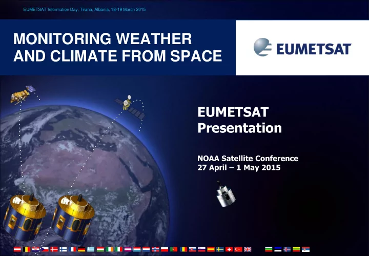
MONITORING WEATHER AND CLIMATE FROM SPACE
EUMETSAT Presentation
NOAA Satellite Conference 27 April – 1 May 2015
MONITORING WEATHER AND CLIMATE FROM SPACE EUMETSAT Presentation - - PowerPoint PPT Presentation
EUMETSAT Information Day, Tirana, Albania, 18-19 March 2015 MONITORING WEATHER AND CLIMATE FROM SPACE EUMETSAT Presentation NOAA Satellite Conference 27 April 1 May 2015 Current EUMETSAT satellites METOP A-B JASON-2 (shared with CNES,
EUMETSAT Information Day, Tirana, Albania, 18-19 March 2015
NOAA Satellite Conference 27 April – 1 May 2015
2 EUMETSAT presentation for the NOAA Satellite Conference 27 April – 1 May 2015
(LOW-EARTH, SUN – SYNCHRONOUS ORBIT) EUMETSAT POLAR SYSTEM/INITIAL JOINT POLAR SYSTEM
(LOW-EARTH, 63° INCL. NON SYNCHRONOUS ORBIT) OCEAN SURFACE TOPOGRAPHY MISSION
(GEOSTATIONARY ORBIT) TWO-SATELLITE SYSTEM:
METEOSAT – 7 (1st GENERATION)
(GEOSTATIONARY ORBIT) INDIAN OCEAN DATA COVERAGE MISSION AT 57°5 E (UNTILL END 2016)
3 EUMETSAT presentation for the NOAA Satellite Conference 27 April – 1 May 2015
03 04 05 06 07 08 09 10 11 12 13 14 15 16 17 18 19 20 21 22 23 24 25 26 27 28 29 30 31 32 33 34 35 36 37 38 39 40 YEAR...
METEOSAT FIRST GENERATION METEOSAT SECOND GENERATION METEOSAT THIRD GENERATION EUMETSAT POLAR SYSTEM (EPS) METEOSAT-7 MSG-4/METEOSAT-11* MTG-I-1 : IMAGERY MTG-S-1: SOUNDING MTG-I-2: IMAGERY MTG-I-3: IMAGERY MTG-S-2: SOUNDING MTG-I-4: IMAGERY METOP-C EPS-SECOND GENERATION (EPS-SG) METOP-SG A: SOUNDING AND IMAGERY METOP-SG B: MICROWAVE IMAGERY JASON JASON-3 JASON-CS/SENTINEL-6
03 04 05 06 07 08 09 10 11 12 13 14 15 16 17 18 19 20 21 22 23 24 25 26 27 28 29 30 31 32 33 34 35 36 37 38 39 40 YEAR...
Mandatory Programmes Optional Programmes
JASON-2 METOP-B METOP-A METEOSAT-10 METEOSAT-9 METEOSAT-8
MSG-4 launch 2 July 2015
4 EUMETSAT presentation for the NOAA Satellite Conference 27 April – 1 May 2015
5 EUMETSAT presentation for the NOAA Satellite Conference 27 April – 1 May 2015
6 EUMETSAT presentation for the NOAA Satellite Conference 27 April – 1 May 2015
RELATIVE CONTRIBUTION OF OBSERVATIONS TO REDUCTION OF ERROR IN DAY 1 NUMERICAL FORECAST
Error Reduc uction
7 EUMETSAT presentation for the NOAA Satellite Conference 27 April – 1 May 2015
EUMETCast Users Worldwide as of 30 June 2014
43
2-10 11-50 51-200 201-500 1 User 500+ 0 User EUMETCast Americas SES 6, C-BAND EUMETCast Africa EUTELSAT 5 WEST A, C-BAND EUMETCast Europe EUTELSAT 9 A, KU-BAND
2789 users in Member States 4 users in Cooperating State 3310 users world-wide
EUMETSAT presentation for the NOAA Satellite Conference 27 April – 1 May 2015 8
9 EUMETSAT presentation for the NOAA Satellite Conference 27 April – 1 May 2015
Jason-CS : Proposed, open to subscription in Nov. 2014 Satellite development approved at ESA CMIN14 Recurrent satellite co-funded by European Union/Copernicus EPS-SG : approval process started in July 2014 Metop-SG programme approved at ESA Council Sentinel-5 development approved at ESA Council Recurrent Sentinel-5 instruments funded by European Union/Copernicus MTG: Approved, under development Sentinel-4 approved (2 instruments funded by ESA)
10 EUMETSAT presentation for the NOAA Satellite Conference 27 April – 1 May 2015
11 EUMETSAT presentation for the NOAA Satellite Conference 27 April – 1 May 2015
12
EUMETSAT presentation for the NOAA Satellite Conference 27 April – 1 May 2015
13
EUMETSAT presentation for the NOAA Satellite Conference 27 April – 1 May 2015
14
EUMETSAT presentation for the NOAA Satellite Conference 27 April – 1 May 2015
15
EUMETSAT presentation for the NOAA Satellite Conference 27 April – 1 May 2015
16
EUMETSAT presentation for the NOAA Satellite Conference 27 April – 1 May 2015
17
EUMETSAT presentation for the NOAA Satellite Conference 27 April – 1 May 2015
Sentinel-3 (in blue) and Jason-3/-CS (white) orbital paths, superimposed on a MyOcean sea surface temperature image.
EUMETSAT presentation for the NOAA Satellite Conference 27 April – 1 May 2015 18
19 EUMETSAT presentation for the NOAA Satellite Conference 27 April – 1 May 2015
20 EUMETSAT presentation for the NOAA Satellite Conference 27 April – 1 May 2015
21 EUMETSAT presentation for the NOAA Satellite Conference 27 April – 1 May 2015
22 EUMETSAT presentation for the NOAA Satellite Conference 27 April – 1 May 2015
S-NPP Svalbard
The European Commission’s GMES Initial Operations 2013 Work Programme includes an action provide data to the marine and atmosphere services (MyOcean2 and MACC-II) in gap resulting from the loss of ENVISAT until the start of Sentinel-3 operations. These data are provided from Suomi-NPP EUMETSAT’s existing relationship with NOAA has enabled EUMETSAT to access and redistribute Suomi-NPP data to Copernicus users on behalf of the European Commission MyOcean2 and EUMETSAT have identified the need for sea surface temperature (SST) and ocean colour products from VIIRS on Suomi-
precise user requirements before being made available in near real time via EUMETCast. Together with the MACC-II, the requirements for atmospheric composition products from S-NPP have also been defined and dissemination of these products via EUMETCast has been put in place.
23 EUMETSAT presentation for the NOAA Satellite Conference 27 April – 1 May 2015