
SLIDE 1
2014 Duhamel Creek Hydrogeomorphic study findings
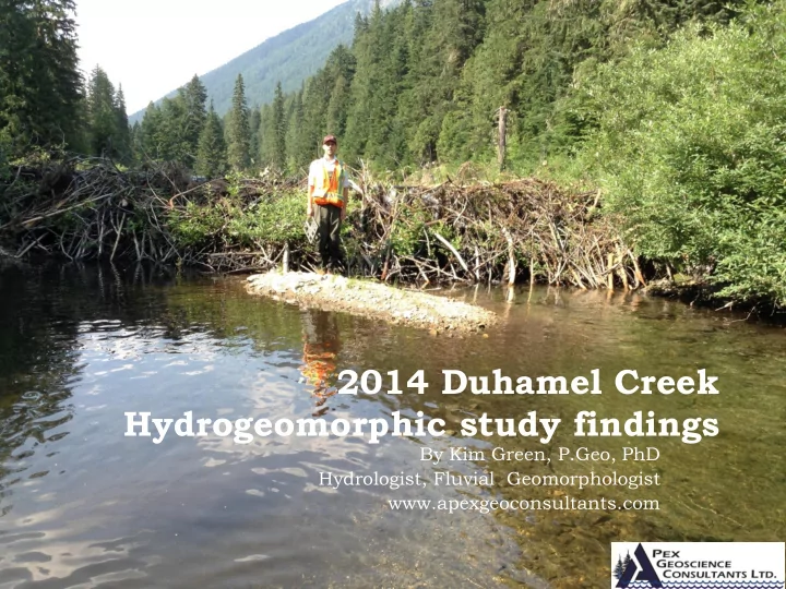
By Kim Green, P.Geo, PhD Hydrologist, Fluvial Geomorphologist www.apexgeoconsultants.com
2014 Duhamel Creek Hydrogeomorphic study findings By Kim Green, - - PowerPoint PPT Presentation
2014 Duhamel Creek Hydrogeomorphic study findings By Kim Green, P.Geo, PhD Hydrologist, Fluvial Geomorphologist www.apexgeoconsultants.com Presentation Outline Terms of reference for hydrogeomorphology study Scope of work Field
By Kim Green, P.Geo, PhD Hydrologist, Fluvial Geomorphologist www.apexgeoconsultants.com
Terms of reference for hydrogeomorphology study Scope of work
Field work Hydrological analysis
General physiography of Duhamel Creek Channel morphology observations
Evidence of past channel and riparian disturbance
Hydrological analysis
Historical annual flood data Flood frequency analysis Field observations of past flood impacts
Hydraulic geometry of Duhamel Creek Hydrogeomorphic Risk Analysis for Forest Development Recommendations for forest management
2 Apex Geoscience Consultants Ltd 2015-01-23
Dipper nest in Reach 5
Assess the likelihood of adverse material impacts to water quality and
Adverse material impacts considered here include;
Substantial increases in sedimentation at the intake (i.e. above the normal
Increases in the frequency of floods that could affect the stability of the
Substantial impacts to riparian function that could affect the long term
Apply the risk analysis framework of LMH 61 Managing Forested
Provide recommendations for forest management to minimize impacts
3 Apex Geoscience Consultants Ltd 2015-01-23
2015-01-23 Apex Geoscience Consultants Ltd 4
Pre-Field component
Investigation of watershed using Google Earth™ imagery and Province of BC air photo
Preliminary GIS analysis to determine landcover conditions, watershed physiography,
Field component
Field survey of channel along the length of the main channel and major tributaries to
Post-Field component
Survey data analysis to define hydraulic geometry relations Hydrometric analysis to determine causes and frequency of floods GIS analysis to establish linkages between morphological and hydrological processes in
Risk Analysis that considers the potential for forest development impacts to processes
Development of recommendations for forest management
2015-01-23 Apex Geoscience Consultants Ltd 5
Area = 57 km2 watershed 12-kilometre long, single main stem channel that
Mount Grohman at 2296m and Mount Cornfield
T
Dozens of snow avalanche/debris flow tributaries
Mean annual precipitation ranges from 800 at
2015-01-23 Apex Geoscience Consultants Ltd 6
2015-01-23 Apex Geoscience Consultants Ltd 7
2015-01-23 Apex Geoscience Consultants Ltd 8
2015-01-23 Apex Geoscience Consultants Ltd 9
2015-01-23 Apex Geoscience Consultants Ltd 10
2015-01-23 Apex Geoscience Consultants Ltd 11
2015-01-23 Apex Geoscience Consultants Ltd 12
channel morphology channel geometry and
bedload sediment
riparian function sediment sources disturbance history
2015-01-23 Apex Geoscience Consultants Ltd 13
The wide U-shaped valley with
Avalanche/debris flow cones
The valley gradient ranges from less
Mobile bed material is mostly
2015-01-23 Apex Geoscience Consultants Ltd 14
Boulder cascade to step-pool morphology. Angular colluvial boulders from avalanche
Channel gradient ranges from 14 percent in
Bed sediment up to 23 cm is mobile annually
Large angular colluvium in the channel is moss
Channel bed is bimodal in appearance with
2015-01-23 Apex Geoscience Consultants Ltd 15
2015-01-23 Apex Geoscience Consultants Ltd 16
2015-01-23 Apex Geoscience Consultants Ltd 17
2015-01-23 Apex Geoscience Consultants Ltd 18
2015-01-23 Apex Geoscience Consultants Ltd 19
2015-01-23 Apex Geoscience Consultants Ltd 20
2015-01-23 Apex Geoscience Consultants Ltd 21
2015-01-23 Apex Geoscience Consultants Ltd 22
Continuous discharge
The time-series of
4 6 8 10 12 14 16 1995 1997 1999 2001 2003 2005 2007 2009 2011 2013 2015 Discharge (m3/s) Year
Duhamel Maximum Annual Daily Peak Flow
2015-01-23 Apex Geoscience Consultants Ltd 23
2015-01-23 Apex Geoscience Consultants Ltd 24
2015-01-23 Apex Geoscience Consultants Ltd 25 Rank Year Discharge Exc Prob Rtn Pd 1 2012 14.2 3.125 32 2 1997 13.7 8.333 12 3 2006 13.2 13.542 7.38 4 1999 12.6 18.75 5.33 5 2013 10.6 23.958 4.17 6 2011 9.93 29.167 3.43 7 2007 9.9 34.375 2.91 8 2002 9.57 39.583 2.53 9 2008 9.1 44.792 2.23 10 2009 8.83 50 2 11 1998 7.95 55.208 1.81 12 2003 7.56 60.417 1.66 13 1996 7.56 65.625 1.52 14 1995 7.29 70.833 1.41 15 2010 6.76 76.042 1.32 16 2004 6.68 81.25 1.23 17 2005 6.55 86.458 1.16 18 2000 6.4 91.667 1.09 19 2001 6.22 96.875 1.03 FLOOD FREQUENCY REGIME Rtn Pd Exc Prob Discharge 1.003 0.997 4.74 1.05 0.952 5.835 1.25 0.8 7.023 2 0.5 8.697 5 0.2 11.063 10 0.1 12.688 20 0.05 14.295 50 0.02 16.457 100 0.01 18.151 200 0.005 19.91 500 0.002 22.356
2015-01-23 Apex Geoscience Consultants Ltd 26
Large damaging floods
Following the 1972
The cribbing
2015-01-23 Apex Geoscience Consultants Ltd 27
2015-01-23 Apex Geoscience Consultants Ltd 28
2015-01-23 Apex Geoscience Consultants Ltd 29
2015-01-23 Apex Geoscience Consultants Ltd 30
Duhamel Creek display well developed downstream geometry indicating it is a
The maximum mobile grain size (D90) does not display increasing size in the
2015-01-23 Apex Geoscience Consultants Ltd 31
Consequence Likelihood High Moderate Low Very high Very high Very high High High Very high High Moderate Moderate High Moderate Low Low Moderate Low Very low Very low Low Very low Very low
2015-01-23 Apex Geoscience Consultants Ltd 32
Field observations indicate that
Field indicators suggest that the
An investigation of the
A frequency analysis using long-term
Photo from Gwen Arnett (Up the Lake)
2015-01-23 Apex Geoscience Consultants Ltd 33
Dozens of snow avalanche/debris
Above Reach 2 much of this
Cumulatively, these wetland
2015-01-23 Apex Geoscience Consultants Ltd 34
2015-01-23 Apex Geoscience Consultants Ltd 35
2015-01-23 Apex Geoscience Consultants Ltd 36
2015-01-23 Apex Geoscience Consultants Ltd 37
2015-01-23 Apex Geoscience Consultants Ltd 38 Harvest date Area of disturbance (ha) ECA (ha) 1960’s to 1970’s 106.6 56.8 1980’s 40.2 27.8 1990’s 88.1 89.1 2000’s (not Kalesnikoff) 42.8 42.8 Kalesnikoff (CP 1, 21, 30 and 40) 205.5 205.5 Burned area (2004, 2011) 112 112 T
595.2 (10.7%) 534 (9.6%)
2015-01-23 Apex Geoscience Consultants Ltd 39
2015-01-23 Apex Geoscience Consultants Ltd 40
Current research indicates that
Research also indicates that harvesting
2015-01-23 Apex Geoscience Consultants Ltd 41
The current cutblocks of less
3 proposed blocks of CP 46 have
the proposed harvesting will not
2015-01-23 Apex Geoscience Consultants Ltd 42
To avoid increasing the frequency of larger floods, harvest levels in Duhamel Creek should be limited to less than 18% and any future blocks should be planned so as to balance the cut across aspects on slopes below 1350m elevation.
Harvesting on the fans and cones of active debris flow/debris flood tributaries (such as Tributary 1) should be undertaken with exceptional care as harvesting in these areas can increase channel instability (See BC FLNRO, LMH 56).
To avoid increasing the frequency of debris floods in Tributary 1 harvesting should be limited to less than 5% of the watershed area of Tributary 1 and should be limited to south aspect slopes or low elevation slopes (below 1100m). This recommendation also applies to the debris flow tributary directly south of Tributary 1 which shares the same fan and appears to carry debris flows with a similar frequency.
Roads and trails on or above unstable or potentially unstable slopes must be designed and deactivated by a QRP to avoid concentrating and diverting surface and subsurface runoff. Drainage structures are to be sized to accommodate increased surface flows following harvesting.
Harvesting and road building activities near water courses must consider information provided in Kalesnikoff’s Riparian Management Strategies (Apex, 2013) to determine best practices for forest harvesting adjacent to S2 to S6 streams to maintain channel and riparian integrity.
2015-01-23 Apex Geoscience Consultants Ltd 43
Up the Lake website (upthelakehistory.wordpress.com, Randi
Greg Nesteroff (Nelson Star Editor and History Buff) Peter Jordan (Regional Geomorphologist, BC MFLNO
2015-01-23 Apex Geoscience Consultants Ltd 44