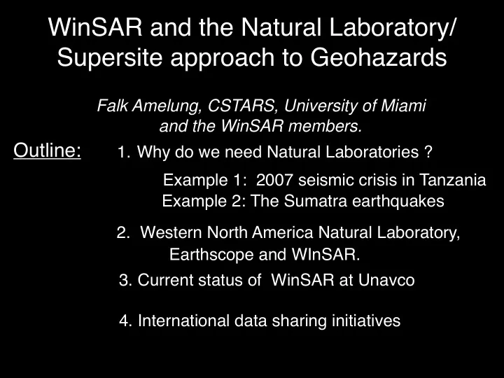
SLIDE 1 Outline:
- 1. Why do we need Natural Laboratories ?
Example 2: The Sumatra earthquakes Example 1: 2007 seismic crisis in Tanzania
- 2. Western North America Natural Laboratory,
Earthscope and WInSAR.
- 3. Current status of WinSAR at Unavco
- 4. International data sharing initiatives
WinSAR and the Natural Laboratory/ Supersite approach to Geohazards
Falk Amelung, CSTARS, University of Miami and the WinSAR members.
SLIDE 2 Example 1: Tanzania seismic crisis, 7/2007
17 July 2007 M5.9 earthquake, 1-2 weeks of moderate events
Rifting
Courtesy Elifuraha Saria, Erik Calais
SLIDE 3 Courtesy Elifuraha Saria, Erik Calais
Example 1: Tanzania seismic crisis, 7/2007
SLIDE 4 Courtesy Elifuraha Saria, Erik Calais
Example 1: Tanzania seismic crisis, 7/2007
?
without natural laboratory …
SLIDE 5 Courtesy Elifuraha Saria, Erik Calais
Example 1: Tanzania seismic crisis, 7/2007
with natural laboratory in place…
SLIDE 6 Courtesy Elifuraha Saria, Erik Calais
7/17-8/21 2007 Envisat “rifting event with 10 km long dike”
The gentleman is here !
Example 1: Tanzania seismic crisis, 7/2007
with natural laboratory in place…
Natural laboratory provides data access Research institution provides products
SLIDE 7 Example 2: Sumatra 2004-2007
Natawidjaja et al., 2006
Tsunami threat for Padang (7 m a.s.l) previous event in 1833
The M9.2 2004 and M8.7 2005 earthquakes increased the stress along the Mentawai segment
Science, News, 2007
Key Questions:
ment did the 2007 events rupture?
creased the stress on the Mentawai segment? M8.4, M7.9 earthquakes 12 Sep 2007
NEIC earthquake poster, 2007
Fault slip distribution available from seismology hours after the earthquake, but was their significant aseismic slip?
SLIDE 8 Example 2: Sumatra 2004-2007
M8.4, M7.9 earthquakes 12 Sep 2007
NEIC earthquake poster, 2007
Fault slip distribution available from seismology hours after the earthquake, but was their significant aseismic slip?
From Tobita’s website at Geographical Survey Institute, Japan
SLIDE 9 How do seismologists get near-real-time results ?
Distributed data sharing networks!
USGS NEIC interpretive posters available 2-6 hours after earthquake
IRIS’s data sharing software
SLIDE 10
The Western North-America Natural Laboratory
SLIDE 11
The Western North-America Natural Laboratory
WInSAR - GeoEarthscope
Open access data.
SLIDE 12 Western North American InSAR (WInSAR) data consortium winsar.unavco.org
What is WinSAR ? Internet SAR data portal for member institutions (Password-protected SAR data sharing system)
SLIDE 13 Search and Order Data
2-5 minutes download time for 1 scene Some institutions maintain mirrors (data processing from archive)
SLIDE 14 Western North American InSAR (WInSAR) data consortium
Arizona State Caltech Central Washington Cornell Harvard JPL LLNL MIT SDSU
Stanford
UC San Diego UC Santa Cruz UC Los Angeles UC Davis UC Berkeley USC
45 U.S. Member Institutions
USGS
- U. Utah
- U. Texas
- U. Hawaii
- U. Alaska
Western Washington
Purdue U. No commercial companies !
8 International Member Institutions
PHILVOLCS (Phillipines) INGEOMINAS (Columbia) Canadian Geological Survey University College London (U.K.) Simon Fraser U. (Canada)
- U. of Western Ontario (Canada)
CICESE (Mexico) University of Beijing (China) New members accepted by vote of Executive Committee
SLIDE 15 Mission
To provide access to as much raw InSAR data to as many geophysicists as possible (within constraints imposed by international space agencies and their commercial vendors).
Philosophy
- Data must be free to members, “Seismology effect”
- Simple and low cost (Internet distribution system)
- Minimal points of contact for funding/data agencies
Holdings
- 8000 ERS 1 and 2 (1992 – present) + Envisat, Radarsat, ALOS
- 3 TB of data
87 publications using WinSAR data ! Text
- 3 types of membership:
- Full: US institutions. full data access and order privilege.
- Adjunct-1: Canada and Mexico, full data access but no ordering.
- Adjunct-2: Rest of the world. Full access to all ALOS and Radarsat imagery.
No ordering.
SLIDE 16 University NAVSTAR consortium
Sponsors:
Promoting Earth science by advancing high-precision techniques for the measurement of crustal deformation GPS support: permanent, campaign networks, data formats, data archiving InSAR support: imagery acquisition and archiving (WinSAR, Natural labs) Activities:
Members: 67 U.S. + 43 foreign
Mission:
GPS stations maintained by UNAVCO
SLIDE 17 WinSAR Science results (1): Yellowstone caldera
Wicks et al., Nature, 2006 ERS1,2 SAR data
GPS vertical
Model:
SLIDE 18 Science results (2): Southern San Andreas Fault
Stack of 35 interferograms
Fialko, Nature, 2006
ERS1,2 SAR data
Equal strain partitioning between San Andreas and San Jacinto faults
SLIDE 19 Science results (3): Nevada post-seismic deformation
Gourmelen and Amelung, Science, 2005 ERS1,2 SAR data
Stack of 8 interferograms
Elastic Visco-elastic? Visco-elastic? Seismogenic depth Moho
Several 1917-1954 M>7 earthquakes caused viscous flow in the Earth’s mantle which is detectable at the Earth’s surface. Model prediction
deformation field conceptual model
better understanding of fault loading rates
SLIDE 20 Buergmann et al., Science, 2000, Funning et al., 2007(?)
Science results (4): Creeping faults in San Francisco Bay area
Hayward fault
SLIDE 21 Science results (5): Land subsidence in New Orleans
Dixon, Amelung, Ferretti et al., Nature 2006
SLIDE 22 Science results (6): Land subsidence in Las Vegas
1992 -1996 1996 - 2000 2000 - 2005
Courtesy of University of Nevada Bell et al., WWR, in press
SLIDE 23 Science results (7): Inflation of Mauna Loa volcano, Hawaii
Amelung et al., Science, 2007
Magma intrusion into riftzone
Based on ~100 Radarsat images with different viewing geometry
Magma intruded in section of riftzone that was unclamped by previous earthquakes InSAR helps to predict eruption location !
SLIDE 24 Science results (8): June 2007 Kilauea crisis, Hawaii
November 24, 2006– June 22 2007 Envisat Ascending IS 1
June-July 2007 events
Envisat: May 29 – July 3 2007
Data from M.Poland, USGS
Envisat: April 11– June 20 2007
near-real-time monitoring ! contributed in decision making InSAR work occupied 1 staff member, no time left for geophysical modeling High note: Low note:
LOS lengthening (subsidence) LOS shortening (uplift)
May 24 EQ
SAR imagery needs to be readily available in near real time
SLIDE 25
Recent high-impact publications
2004 Hilley, et al., Dynamics of slow-moving landslides from permanents scatterer analysis, Science, 304, 1952-1955. 2005 Gourmelen, N. and F. Amelung, Post-seismic mantle relaxation in the Central Nevada Seismic Belt, Science 310: 1473-1476. 2006 Fialko, Y., D. Sandwell, M. Simons, and P. Rosen, The origin of shallow earthquake slip deficit , Nature, 435. 2006 Fialko, Y., Interseismic strain accumulation and the earthquake potential on the southern San Andreas fault system, Nature, 441. 2006 Dixon, T. H., et al., Subsidence and flooding in New Orleans, Nature, 441, 587-588. 2006 Wicks, C., W. Thatcher, D. Dzurisin and J. Svarc, Uplift, thermal unrest and magma intrusion at Yellowstone caldera, Nature, 440, 72-75. 2007 Amelung, F., S.H. Yun, T. Walter and Paul Segall. Stress control of deep rift intrusion at Mauna Loa volcano, Hawaii. Science. 2007 Chang, W.-L., R. B. Smith, C. Wicks, J. M. Farrell, and C. M. Puskas,Accelerated uplift and magmatic intrusion of the Yellowstone Caldera, 2004 to 2006. Science.
Publications rely on easy access to SAR imagery through WinSAR !
SLIDE 26 Recommendation:
http://naturallabs.unavco.org
Develop Natural Laboratory data facility to make SAR data available in near-real time for scientific research and disaster management!
Prototype facility exists at Unavco. Uses WinSAR’s software. Can be moved to,
regional centers. NEEDS SAR DATA
SLIDE 27 Recommendation:
http://naturallabs.unavco.org
Develop Natural Laboratory data facility to make SAR data available in near-real time for scientific research and disaster management!
Prototype facility exists at Unavco. Uses WinSAR’s software. Can be moved to,
regional centers. NEEDS SAR DATA
SLIDE 28 Recommendation:
http://naturallabs.unavco.org
Develop Natural Laboratory data facility to make SAR data available in near-real time for scientific research and disaster management!
Prototype facility exists at Unavco. Uses WinSAR’s software. Can be moved to,
regional centers. NEEDS SAR DATA
SLIDE 29 Recommendation:
http://naturallabs.unavco.org
Develop Natural Laboratory data facility to make SAR data available in near-real time for scientific research and disaster management!
Prototype facility exists at Unavco. Uses WinSAR’s software. Can be moved to,
regional centers. NEEDS SAR DATA
SLIDE 30 Goal:
Obtain open, near-real-time access to ALL SAR data relevant for geophysical research (tectonics, volcanoes, land subsidence).
Why ?
Societal benefits through
- improved earthquake hazard assessment (earthquake
forecasting )
- volcano monitoring and eruption forecasting
- assessing water resources
- subsidence monitoring of coastal cities --> forecast effect of
sea-level rise New InSAR studies should include the entire SAR archive. For example, a year-2050 scientist needs access to 1992 imagery.
SLIDE 31 23
Status of WinSAR/Geoearthscope:
Order and archive procedures in place. Category-1 projects with ESA. Entire archive through Super Cat-1 (Unavco is PI, Co-I’s report to Unavco which reports to ESA, Mini Cat-1s).
Entire North America archive will be transfered to WinSAR Costs: free for data at ASF. $150/datatake for data archived in Canada (Foreign Ground Station cost, FGS). No restrictions from Canadian Space Agency! Ingest software not complete.
Data obtained from the AADN (ASF) through credits with NASA, NSF. Entire Western US archive expected. Data in L-1 data pool at ASF, ingest software not complete.
... not yet thought about ...
SLIDE 32 24 26
Supersite/Natural laboratory concept (1)
- 1. Concept put forward at International Geohazard conferences organized
by IGOS Geohazard and GEO (Group or Earth Observation countries)
- Recommendation of Kuala Lumpur 2006 Southeast Asia Geohazard
workshop: “To develop a satellite-based geophysical monitoring capability for SE Asia region”.
- “Frascati declaration” of 2007 International geohazard workshop: ”To
develop an international effort to monitor and study selected reference sites by establishing open access to relevant datasets”
- 4. SAR and ground-based data (GPS, seismic data).
- 3. Proposed model:
- WinSAR-type data archive at IGOS Geohazard in Orleans, France.
- IGOS Geohazard will be Super Cat-1 user for ESA-data (Mini Cat-1s)
- Data provided by ESA or contributed by WinSAR, INGV (and PIXEL ?).
(ESA has to charge for reproduction costs. No charges are required for already produced data. Data would be returned to ESA and then given to IGOS Geohazard).
- JAXA should contribute ALOS/JERS imagery.
- 2. Frascati Declaration endorsed by JAXA, NASA and CSA.
SLIDE 33 25 27 26
Supersite/Natural laboratory concept (2)
- 6. Summary and next steps.
- ESA very supportive of Supersite/Natural Laboratory concept.
- IGOS Geohazard Joint Committe meeting on Jan 16.
- Space Agencies support data sharing networks as long as they don’t have
to do too much work.
InSAR community needs to put a international data sharing network in place !
- 5. Site selection by community consensus: Well-studied sites plus sites to
stimulate research. U.S.: Yellowstone, Hawaii, San Francisco, Los Angeles, Las Vegas. Canada: Vancouver. Italy: Etna, Vesuvius. Africa: Nyiragongo, Mt. Cameroon, Lengai. Indonesia:Merapi, Mentawai seismic gap. Japan: ?
SLIDE 34 26 27 26
Proposed Model for Data Sharing Network
- 1. Multiple international nodes with regional responsibilities:
- WInSAR@Unavco: U.S. and rest of Americas
- IGOS Geohazard: Supersites
- PIXEL: Japan and rest of Asia
- MACRES (Malaysia Center of Remote Sensing): SE Asia Radarsat
- INGV Italy: Africa, Europe ?
- 3. NASA is ally. Open data-sharing network is integral part of Desdynl
- mission. Opportunities if ALOS TDRS data link successful.
- 2. Same or similar policies. Members of one node are automatically
members of the other nodes.
- Use WInSAR’s archive/ingest system. Software coordination and
maintenance by Unavco.
- 1. Coordinate between PIXEL and WinSAR. PIXEL members should become
WinSAR members and WinSAR members become PIXEL members.
- 2. WinSAR strategic planning at UNAVCO Science workshop, Boulder,
March 11-13, 2008. Representatives of PIXEL and JAXA are welcome !
Next steps:
SLIDE 35 27 29 27 26
Proposed Model for Data Sharing Network
- 1. Multiple international nodes with regional responsibilities:
- WInSAR@Unavco: U.S. and rest of Americas
- PIXEL: Japan and rest of Asia
- IGOS Geohazard: Supersites
- MACRES (Malaysia Center of Remote Sensing): SE Asia Radarsat
- INGV Italy: Africa, Europe ?
- 3. NASA is ally. Open data-sharing network is integral part of Desdynl
- mission. Opportunities if ALOS TEDRIS data link successful.
- 2. Same or similar policies. Members of one node are automatically
members of the other nodes.
- Use WInSAR’s archive/ingest system. Software coordination and
maintenance by Unavco.
- 1. Coordinate between PIXEL and WinSAR. PIXEL members should become
WinSAR members and WinSAR members become PIXEL members.
- 2. WinSAR strategic planning at UNAVCO Science workshop, Boulder,
March 11-13, 2008. Representatives of PIXEL and JAXA are welcome !
Next steps:
Domo arigato gozaimasu !