
SLIDE 1
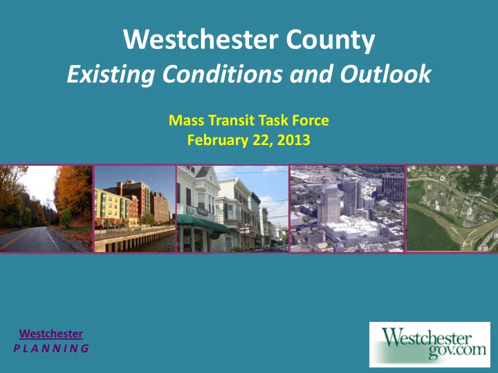
Westchester County
Existing Conditions and Outlook
Mass Transit Task Force February 22, 2013
Westchester P L A N N I N G
Westchester County Existing Conditions and Outlook Mass Transit - - PowerPoint PPT Presentation
Westchester County Existing Conditions and Outlook Mass Transit Task Force February 22, 2013 Westchester P L A N N I N G Development patterns Population and housing Employment characteristics Commute patterns Land use trends Transit
Westchester P L A N N I N G
1850 1974 1950 1920
WHITE PLAINS
NEW ROCHELLE
YONKERS RYE TARRYTOWN BRONXVILLE OSSINING (VILLAGE) PEEKSKILL YORKTOWN HEIGHTS JEFFERSON VALLEY
Open Space Waterbodies Low Density
Open Space Waterbodies Low Density Middle Density High Density Urban Center Density
100,000 200,000 300,000 400,000 500,000 600,000 700,000 800,000 900,000 1,000,000 1950 1960 1970 1980 1990 2000 2010
YEAR: COUNTY POPULATION: 625,816 808,891 894,104 866,599 874,866 923,459 949,113 CHANGE FROM PREVIOUS DECADE:
9% 29% 11%
1% 6% 3%
Source: Decennial Census 1950-2010
850,000 900,000 950,000 1,000,000 1,050,000 1,100,000 1,150,000 2010 2015 2020 2025 2030 2035 2040
YEAR: COUNTY POPULATION: 949,100 970,900 990,400 1,020,300 1,055,100 1,091,100 1,133,700 CHANGE FROM PREVIOUS DECADE:
3% 2% 2% 3% 3% 3% 4%
Source: NYMTC, January 2013
Source: Decennial Census 2000-2010
After a boom in the child population in the 1990s, there’s been a decrease in children under 10 years in the past decade. The “baby boomers” are now entering their 50s and 60s. The number of residents in their 30s has greatly decreased.
Change in 10-year age cohorts from 2000 to 2010
10,000 20,000 30,000 0 to 9 10 to 19 20 to 29 30 to 39 40 to 49 50 to 59 60 to 69 70+ Increase Decrease
Source: Decennial Census 1970-2010
100,000 200,000 300,000 400,000 500,000 600,000 700,000 800,000 White Black Asian Hispanic
1970
100,000 200,000 300,000 400,000 500,000 600,000 700,000 800,000 White Black Asian Hispanic
2010
The non-Hispanic White population decreased by 30% between 1970 and 2010, while the Black, Asian and Hispanic populations all increased significantly. 23,359 county residents identified as Hispanic or Latino in the 1970 Census. By 2010, this number grew to 207,032.
50,000 100,000 150,000 200,000 250,000 300,000 350,000 400,000 1950 1960 1970 1980 1990 2000 2010
YEAR: HOUSING UNITS: 187,257 254,766 291,550 316,658 336,727 349,445 370,821 CHANGE FROM PREVIOUS DECADE:
16% 36% 14% 9% 6% 4% 6%
Source: Decennial Census 1950-2010
100,000 120,000 140,000 160,000 180,000 200,000 220,000 1970 1980 1990 2000 2010
Owner-Occupied Housing Units
100,000 110,000 120,000 130,000 140,000 150,000 1970 1980 1990 2000 2010
Renter-Occupied Housing Units Many older rental units were converted to co-op and condo
Source: Decennial Census 1970-2010
Total housing units increased by 64,603 (22%) between 1970 and 2010 Owner-occupied units increased by 68, 007 (47%) while renter-occupied units decreased by 3,404 (2%)
YEAR: EMPLOYED PERSONS: 261,064 344,430 384,763 398,573 370,953 405,439 410,833 398,919
CHANGE:
N/A
32% 12% 4%
9% 1%
Source: NYS Department of Labor
50,000 100,000 150,000 200,000 250,000 300,000 350,000 400,000 450,000 1975 1980 1985 1990 1995 2000 2005 2010
2,000 4,000 6,000 Construction Manufacturing Wholesale trade Professional, scientific & technical services Educational services Health care and social assistance Accommodation & food services
+12% +20%
+13%
Source: Census County Business Patterns, 2000 and 2010
Westchester, like much of the country, has seen a decline in traditional industries such as manufacturing, but growth in service jobs, healthcare, education and the tech industry. +7%
100,000 200,000 300,000 400,000 500,000 600,000 2010 2015 2020 2025 2030 2035 2040
YEAR: EMPLOYED PERSONS: 414,500 440,200 462,600 489,700 511,800 533,600 560,200
CHANGE:
N/A
6% 5% 6% 5% 4% 5%
Source: NYMTC, January 2013
100,000 200,000 300,000 400,000 500,000 600,000 700,000 800,000 2010 2015 2020 2025 2030 2035 2040
YEAR: EMPLOYED PERSONS 555,699 594,642 628,795 664,362 693,429 721,566 754,562 CHANGE FROM PREVIOUS DECADE: N/A
7% 6% 6% 4% 4% 5%
Source: NYMTC, January 2013
Source: US Census Bureau 1990, LEHD On-the Map 2010
2010 data excludes self-employed workers and may reflect the downturn in the economy from 2007.
2010 1990
2010
Source: US Census Bureau 1990, LEHD On-the Map 2010
1990
2010 data excludes self-employed workers and may reflect the downturn in the economy from 2007.
Adopted by the Westchester County Planning Board December 1995
Adopted by the Westchester County Planning Board May 6, 2008 Amended January 5, 2010
Based on
Interstates Parkways Major road not built Rail Rail not built
Map of I-287
Tarrytown Greenburgh White Plains Harrison
Harrison Rye Brook
Port Chester
1995
1979 48,790 86,300 1989 100,570 2000 115,776 2010
Annual Average Daily Traffic (AADT) I-287 between I-684 and Hutchinson River Parkway
500 ft. 400 ft. 300 ft. 200 ft. 100 ft.
City Center
City of White Plains 355 feet Completed 2001
Renaissance Square
City of White Plains 457 feet Completed 2007
Trump Plaza
City of New Rochelle 390 feet Completed 2006
Lecount Square
City of New Rochelle 493 feet Approved
River Park Center
City of Yonkers 542 feet Approved
Avalon II
City of New Rochelle 390 feet Completed 2007 500 ft. 400 ft. 300 ft. 200 ft. 100 ft.
Ridge Hill Village
City of Yonkers 165 feet In Construction
Palisades Point
City of Yonkers 300 feet Approved
Bank Street Commons
City of White Plains 247 feet Completed 2003
Playland Music Tower
City of Rye 110 feet Completed 1927
County Courthouse
City of White Plains 265 feet Completed 1973
Avalon
City of White Plains 165 feet Completed 2008
Kensico Dam
Town of Mt. Pleasant 168 feet Completed 1917
2nd largest bus system in New York State, after MTA NYC Transit 329 buses – 30, 40 and 60 foot plus commuter coaches 60-plus bus routes – local and express, railroad feeders, shuttles to corporate parks, seasonal routes, commuter express to Manhattan 110,000 average weekday riders 31.5 million annual riders in 2011 32 million annual riders in 2012 3,000 bus stops
1X – Riverdale/Downtown Yonkers to Grasslands via Sprain 3 – Riverdale/Downtown Yonkers to White Plains/Platinum Mile via Sprain and 287 17 – Peekskill/Cortlandt to White Plains via 9A and 287 43 – Wakefield/Mount Vernon to Grasslands via Cross County and Sprain 62 – Fordham/Pelham Manor/New Rochelle to Platinum Mile/White Plains via 95 and 287 77 – Carmel/ Yorktown Heights to White Plains via Taconic, Sprain and 287 TZX – Rockland to Tarrytown and White Plains via 287 OWL – Orange/Rockland to Grasslands, White Plains and Platinum Mile via 287 Lepprechaun Connection – Western Dutchess County to White Plains/Platinum Mile via 9A and 287 I-Bus – Stamford to Platinum Mile/White Plains via 287
Route 13 between Tarrytown and Port Chester through White Plains – up to 4,200 daily and 132,000 monthly passengers Route 5 between Yonkers and White Plains via Route 119 – up to 3,000 daily and 92,700 monthly passengers Route 14 between Cortlandt and White Plains via Route 119 – up to 3,000 daily and 89,000 monthly passengers Route 40 between Mount Vernon and Grasslands Campus through White Plains and via Route 119 – up to 5,600 daily and 168,000 monthly passengers Six shuttle loop services to Platinum Mile, Tarrytown and Armonk
Orlando, Florida Europe
04/02/2009
Eugene, Oregon
BRT Route
BRT Route
A new Hudson Line train station could
be built under the Tappan Zee Bridge
Tappan Zee Express Bus would unload
passengers at a stop on the bridge
Elevators would take passengers to the
new station under the bridge.