
SLIDE 1
Date
WELCOME
T&ES
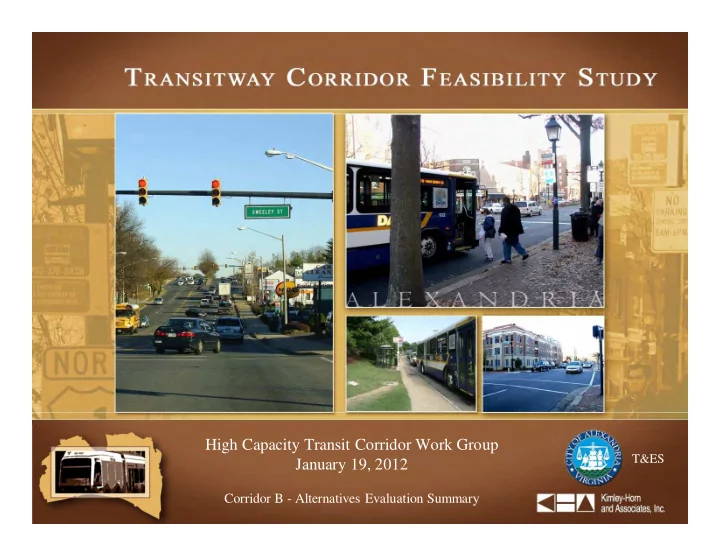
High Capacity Transit Corridor Work Group January 19, 2012
Corridor B - Alternatives Evaluation Summary
WELCOME Date High Capacity Transit Corridor Work Group T&ES - - PowerPoint PPT Presentation
WELCOME Date High Capacity Transit Corridor Work Group T&ES January 19, 2012 Corridor B - Alternatives Evaluation Summary Meeting Agenda Introduction and Background Corridor B Discussion Recap of Preliminary Alternatives
Date
T&ES
High Capacity Transit Corridor Work Group January 19, 2012
Corridor B - Alternatives Evaluation Summary
Recap of Preliminary Alternatives Alternatives for Secondary Screening Criteria Secondary Screening Summary
Major destinations
Landmark Mall Cameron Station Old Town Van Dorn Street Eisenhower Ave Eisenhower East King Street Fox Chase Alexandria Commons
Duke Street Modification Project
pedestrian refuges
Add Lanes?
(in 4-lane sections)
Location? In traffic?
Curb Curb Curb Median Curb Median No No No Add Lanes Mixed Mixed and
Dedicated
Dedicated Alternative A B C E D F
Alternative A: Curb Running in Mixed Flow Alternative B: Curb Running in Mixed Flow and Dedicated Lanes Alternative C: Curb Running in Dedicated Lanes without New Lanes
and service roads to accommodate queue jumps
and service roads to accommodate queue jumps
lane per direction in 4-lane segments (2 miles total)
and service roads
Alternative D: Curb Running in Dedicated Lanes with New Lanes Alternative E: Median Running in Dedicated Lanes without New Lanes Alternative F: Median Running in Dedicated Lanes with New Lanes
segments (2 miles total)
service roads
lane per direction in 4-lane segments (2 miles total)
and service roads
segments (2 miles total)
service roads
General Evaluation Criteria Grouping Criteria Sub-Group Evaluation Criteria Preliminary Screening Measurement Method
Effectiveness -
Addresses stated transportation issues in the corridor Coverage Transit Connectivity
Operations Avoidance of Congestion
Transit Travel Time
Intersection Priority
successfully - notation of where it cannot be implemented successfully Alignment Runningway Status
Phasing Phasing
Impacts -
Extent to which economics, environment, community, transportation are affected Natural Environmental Natural Environment
floodplains, T&E, streams, and similar) Neighborhood and Community Property
level of impact (ROW only, partial take, total take) Streetscapes
Noise and Vibration
and corridor configurations Transportation Traffic Flow Impact
Multimodal Accommodation
Parking
Cost Effectiveness -
Extent to which the costs are commensurate with their benefits Cost Capital cost
Operating cost
Cost Per Rider
Financial Feasibility -
Extent of funding is driven by cost Funding Funding
Screening Criteria Legend:
Level of service and queuing evaluation together is best representation of potential future operations Existing six-lane section have the potential to be reduced to four-lanes with left-turn lanes and operate acceptably (D or better) Benefit to increased capacity on Duke Street in vicinity of Quaker Lane and Telegraph Road Four general purpose through lanes are needed on Duke Street between Quaker Lane and Telegraph Road Widening to accommodate transit would have some benefit in specific locations along Duke Street For dedicated lane transitway implementation, some compromise between widening four-lane sections and not widening four-lane sections of Duke Street seems logical as a “best fit” option
Public Comments
CWG Member Comments
and Roth Streets
Alternative B: Curb Running in Mixed Flow and Dedicated Lanes
service road right-of-way Alternative C: Curb Running in Dedicated Lanes without New Lanes
direction (combo with D) Alternative D: Curb Running in Dedicated Lanes with New Lanes
direction (combo with C) Alternative F: Median Running in Dedicated Lanes with New Lanes
Description
property driveways
Jordan Street to Wheeler Avenue Landmark Mall to Jordan Street / Roth Street to King Street Metro
Description
segments (2.5 miles total)
Jordan Street to Wheeler Avenue Landmark Mall to Jordan Street / Wheeler Avenue to King Street Metro
Description
roads (described on following slide)
Jordan Street to Wheeler Avenue Landmark Mall to Jordan Street / Wheeler Avenue to King Street Metro
LEGEND = Existing Edge of Pavement = Proposed Edge of Pavement
Description
Jordan Street to Wheeler Avenue Landmark Mall to Jordan Street / Wheeler Avenue to King Street Metro
Description
Street Metro
Street and Roth Street
Jordan Street to Roth Street
Reversible Lane Peak Hour & Direction Transit Lane Peak Hour & Direction Transit Lane
Description
Jordan Street to Wheeler Avenue Landmark Mall to Jordan Street / Wheeler Avenue to King Street Metro
General Evaluation Criteria Grouping Criteria Sub-Group Evaluation Criteria For Use in Preliminary Screening of Concepts For Use in Comparative Evaluation of Concepts Measurement Method
Effectiveness -
Addresses stated transportation issues in the corridor Coverage Service to Regional Destinations
Service to Population, Employment, and Other Destinations
by option Transit Connectivity
Operations Running-way Configuration(s)
mixed flow Corridor Length
Capacity
headways, and other conditions Interoperability
mode technology are compatible with regionally planned systems Avoidance of Congestion
Transit Travel Time
Intersection Priority
successfully - notation of where it cannot be implemented successfully Ridership
Alignment Geometrics
Runningway Status
Phasing Phasing
Screening Criteria Legend:
Rating:
Best
Fair
Poor
Evaluation Criteria Alternative 1 2 3 4
Description
Existing Configuration Uses Service Road ROW Reversible Lane Median Running
Coverage
Service to Regional Destinations
Service to Population, Employment, & Retail in the Corridor
Transit Connectivity
Operations
Running-way Configuration(s)
Corridor Length
Capacity
Interoperability
Avoidance of Congestion
Transit Travel Times
Ridership
Intersection Priority
Align- ment
Alignment Quality
Runningway Status
Phasing
Note: Illustrations show a general comparison of cross-sectional width. Actual service road location varies depending upon whether service roads are located north or south of Duke Street
Note: Illustrations show a general comparison of cross- sectional width. Actual service road location varies depending upon whether service roads are located north
Note: Illustrations show a general comparison of cross-sectional width. Actual service road location varies depending upon whether service roads are located north or south of Duke Street
General Evaluation Criteria Grouping Criteria Sub-Group Evaluation Criteria For Use in Preliminary Screening of Concepts For Use in Comparative Evaluation of Concepts Measurement Method
Impacts -
Extent to which economics, environment, community, transportation are affected Economic Development Incentive
potential Natural Environmental Natural Environment
floodplains, T&E, streams, and similar) Parks and Open Space
Neighborhood and Community Property
level of impact (ROW only, partial take, total take) Streetscapes
Community Resources
archaeological resources affected Demographics
Noise and Vibration
and corridor configurations Transportation Traffic Flow Impact
Traffic Signals
identification of need for new signal phases, and number/location of new traffic signals needed to accommodate transit Multimodal Accommodation
Parking
Cost Effectiveness -
Extent to which the costs are commensurate with their benefits Cost Capital cost
Operating cost
Cost Per Rider
Financial Feasibility -
Cost of system/concept is in alignment with available funding Funding Funding
Private Capital Incentive
capital investment and innovative procurement Screening Criteria Legend:
Alternative 1 2 3 4
Description: Existing Configuration Uses Service Road ROW Reversible Lane Median Running
< 0.25 acres < 0.25 acres < 0.25 acres < 0.5 acres
< 0.1 acres < 0.1 acres < 0.1 acres < 0.1 acres
1.75 acres 3.5 acres 4 acres 7 acres
Rating:
Best
Fair
Poor
Evaluation Criteria Alternative
1 2 3 4
Description:
Existing Configuration Uses Service Road ROW Reversible Lane Median Running
Econ-
Development Incentive
Natural Enviro- nment Natural Environment
Parks and Open Space
Neighborhood and Community Property
Existing Streetscapes
Community Resources
Demographics
Noise and Vibration
Transportation Traffic Flow Impact
Traffic Signals
Multimodal Accommodation Pedestrian
Bike
Parking
Day of Week Headway Duration Total Duration of Operation Weekdays Peak
7.5 min 8 hours 18 hours
Off-Peak
15 min 10 hours
Saturdays
15 min 18 hours 18 hours
Sundays/ Holidays
20 min 12 hours 12 hours
Alternative 1 2 3 4
Assumed Transit Mode:
BRT BRT BRT BRT
Description: Existing Configuration Uses Service Road ROW Reversible Lane Median Running
6,000 to 9,000 riders/day 8,000 to 12,000 riders/day 9,000 to 13,000 riders/day 12,000 to 16,000 riders/day
Notes
Alternative 1 2 3 4
Assumed Transit Mode:
BRT BRT BRT BRT
Description: Existing Configuration Uses Service Road ROW Reversible Lane Median Running
$3.9 M $3.5 M $3.5 M $2.7 M
$67 M $60 M $60 M $47 M
$4.00 $2.70 $2.50 $1.50
Notes 1. Planning level cost estimates are shown in year 2012 dollars and do not include additional contingency or escalation to a future year mid-point of construction. Totals listed do not include costs for major utility relocations/new service, or the capital costs for roadway/streetscape improvements that may be implemented concurrently, but are not required for the transit project.
Alternative 1 2 3 4
Assumed Transit Mode:
BRT BRT BRT BRT
Description: Existing Configuration Uses Service Road ROW Reversible Lane Median Running
Capital Cost Estimate1
(exclusive of vehicles, based on cost per-mile within the City)
$22 M $27 M $26 M $37 M
25-year Fleet Cost Estimate2
$20 M $16 M $16 M $13 M
Right-of-Way Cost Estimate
$5 M $21 M $22 M $33 M
25-year Operating Cost $67 M $60 M $60 M $47 M Planning-Level Cost Estimate1
$114 M $124 M $124 M $130 M
Rating:
Best
Fair
Poor
Evaluation Criteria Alternative 1 2 3 4
Description:
Existing Configuration Uses Service Road ROW Reversible Lane Median Running
Cost Effectiveness Capital Cost
Right-of-Way Cost
Operating Cost
Order of Magnitude Cost Per Rider
Notes 1. Planning level cost estimates are shown in year 2012 dollars and do not include additional contingency or escalation to a future year mid-point of construction. Totals listed do not include costs for major utility relocations/new service, or the capital costs for roadway/streetscape improvements that may be implemented concurrently, but are not required for the transit project.
Small Starts
–
35% to 80% federal funding
–
Maximum participation (Small Starts, 80% or $75 million, whichever is less)
Rail Transit Projects (generally FTA New Starts)
–
40% to 60% federal funding
–
Maximum participation – varies, generally in 50% to 60% range
Project Assumed Transit Mode Total Capital Cost (millions) Federal Share (millions) Local Share (millions) Federal Percent Section 5309 Project Type Alternative 1
Existing Configuration
BRT $36 M $29 M $7 M 80% Small Starts Alternative 2
Uses Service Road ROW
BRT $56 M $44 M $11 M 80% Small Starts Alternative 3
Reversible Lane
BRT $55 M $44 M $11 M 80% Small Starts Alternative 4
Median Running
BRT $76 M $61 M $15 M 80% Small Starts
Jordan Street to Wheeler Avenue Landmark Mall to Jordan Street / Roth Street to King Street Metro
Advantages Disadvantages
Alternative 1 – Existing Configuration
(including property)
to shared lanes
congestion on Duke Street
Jordan Street to Wheeler Avenue Landmark Mall to Jordan Street / Roth Street to King Street Metro
Advantages Disadvantages
Alternative 2 – Uses Service Road ROW
for transit
disrupt transit operations
streetscape as a result
Jordan Street to Wheeler Avenue Landmark Mall to Jordan Street / Roth Street to King Street Metro Advantages Disadvantages
Alternative 3 – Reversible Lane
help traffic flow
transit impact
condition
Alternative 3 - Variation
condition
lane use condition
Jordan Street to Wheeler Avenue Landmark Mall to Jordan Street / Roth Street to King Street Metro
Advantages Disadvantages
Alternative 4 – Median Running
elimination of conflicts with driveways and traffic
congestion
parking (in front of 28 homes)
impacts
For access to the information that was presented tonight, as well as other study information, please visit the project website at: http://alexandriava.gov/HighCapacityTransit Once there, follow the link for the “High Capacity Transit Corridor Work Group”