
SLIDE 1
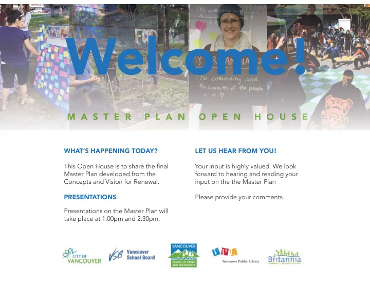
WHAT’S HAPPENING TODAY?
- PRESENTATIONS
- LET US HEAR FROM YOU!
- M A S T E R P L A N O P E N H O U S E
O U S E O P E N H O M
Welcome! M A S T E R P L A N O P E N H O U S E M O P E N H O - - PowerPoint PPT Presentation
Welcome! M A S T E R P L A N O P E N H O U S E M O P E N H O O U S E WHATS HAPPENING TODAY? LET US HEAR FROM YOU!
WHAT’S HAPPENING TODAY?
O U S E O P E N H O M
PROJECT PARTNERS The City of Vancouver and Partners – Vancouver School Board, Vancouver Public Library, Vancouver Park Board, Britannia Community Services Centre – are working together to develop a Master Plan for the renewal of Britannia’s facilities and site. WHAT IS A MASTER PLAN? The Master Plan includes:
and future design work.
social development, arts & culture, and library spaces to meet future needs at Britannia.
the site.
developed over the multi-year Britannia Renewal project. The Master Plan will be used as the basis for site rezoning and the realization of Britannia’s renewal. WHERE ARE WE AT NOW?
A distillation of many voices, it is a record
Britannia’s renewal and is rooted in the shared values below:
all
individual and community
The Vision was the result of a major engagement process with site Partners, community members, service providers and staff. The mix of spaces and places the Vision are illustrated below: The sum is greater than the parts - Colocation of facilities builds upon the syngeries of programming and services at Britannia today.
In acting on and striving for reconciliation and meeting the needs
is critical that the process of developing and realizing the design and delivering programs undertakes this work with the proper engagement going forward. Continued engagement will be key to the responsive development of spaces, delivering programs and designing an appropriate and welcoming environment. This Master Plan also creates opportunities for Indigenous visibility on the land - this includes naming, public art, sharing contemporary stories told from MST perspective, and Indigenous expression on the site and in the facilities. ENGAGEMENT
the local Coast Salish Nations including Musqueam, Squamish, and Tsleil-Waututh. Regular consultation and communication should be establish throughout the project’s development.
engagement with Urban Indigenous communities.
community and service providers.
ELDERS ADVISORY
Advisory for both Britannia in its operations and for this project as it evolves. This could be the beginning of an Elders in Residence Program.
the needs of Indigenous community members, especially in creating opportuntities for Indigenous community members to practice ceremony, culture, gatherings: funerals, ceremonies (naming, coming of age,feasts) etc.
NAMING
educating their users about the history of colonial naming.
SPACES + PLACES
Indigenous community are: a Healing Space, quiet consultation room, Elders
VSB HIGH SCHOOL CLASSROOMS + SHOPS To facilitate the development of a
2
2 NON-PROFIT SERVICES OFFICES
2038 m2 (22,000 ft2)
1396 m2 (15,000 ft2)
GYMNASIA
2755m2 (29,655 ft2 )
a combination of the City policy requirements and community needs as summarized in the Vision.
1285 m2 (13,832 ft2)
PLAY
Opportunities will be provided throughout the site for all ages play including a water park, a play zone connecting Grandview Park to the community facilities,
Access to keys views, increased green space and
inside the facility and throughout the site. Priority to be given to native planting and a naturalized landscape.
DAILY LIFE
The site will support an energized daily life at Britannia, whether passing through using the facilities or just hanging out, the spaces will facilitate both connectivity and contemplation.
GATHERING + EVENTS
The creation of a large gathering space to host performances, celebrations and a wide variety of events is a central feature of the Concept Options.
Various site experiences are being planned for to activate the site and create a sense of place and community.
ACTIVE LANEWAYS
Improve laneway experience - transforming Commercial and Venables lanes into active people places, by locating the art gallery, art studios, housing entries, and drop off areas on these laneways.
USING ROOFTOPS
Inhabit and activate roof tops with urban agriculture, sport courts, child care play areas, and community gathering space. Allow non-market, mid-rise housing above community centre facilities.
SITE CONSTRAINTS
The site slopes down 21 metres (69 feet) from the south east corner to the north west corner. This affords the opportunity for “grand views” from the site and community around.
access and connectivity. There is a large BC Hydro power cable running down the Parker Street right of way beside the Rink. Nothing can be built on top of it, so it effectively divides the site.
EXISTING BUILDINGS
Many of the existing buildings are slated for replacement. Some Vancouver School Board (VSB) facilities will be upgraded or relocated as part of this renewal plan.
LEGEND
VSB Portables to be removed or relocated BCSC facilities to be replaced VSB facilities to be upgraded or replaced VSB facilities to be remain
These diagrams illustrate the key site considerations that form the concept options.
LEGEND
Retaining Walls 10 to 20 feet in height BC Hydro Duct Bank
These diagrams illustrate the key site considerations that form the concept options.
MINIMIZE HEIGHT IMPACT ON NEIGHBOURHOOD
Higher buildings will be located to the north and east, while lower buildings will be located to the south to minimize shadowing of public spaces and the impact of building heights on neighbourhood. Building height will follow the topography of the site, stepping down the hill.
BRITANNIA AREA ZONING & ALLOWABLE BUILDING HEIGHTS
RM-4 Multi-Family Residential Character Cluster - 4 storey maximum height RM-4 Multi-Family Residential - 6 storey maximum height I-2 Light Industrial Zone - 100’ maximum height LOWER HIGHEST HIGHER
AVAILABLE SITES + PROGRAM FIT
with red outlines.
C-2C1 Commercial Zone 4 storey maximum height I-2 Light Industrial Zone 100’ maximum height C-2C1 Commercial Zone - 4 storey maximum height RM4 Residential Zone 6 storey maximum height RM4 Character Cluster 4 storey maximum height
PROVIDE A HEART
Throughout the Vision process people told us about the importance for a renewed Britannia to have some kind of “heart” or central space. Today, most people think of the Napier square in front of the library and Info Centre as the heart. A key goal of the master plan is to provide a much larger central gathering space that support activities, orients the visitor to all parts of the site, and is a great place to hang
CONNECT TO COMMUNITY
Through the Vision process we heard about how hidden and poorly connected Britannia is to the larger community. The renewal process presents an opportunity to re-imagine and remake connections to the community. A key planning principle is to tie site circulation to the existing street grid to create an easily accessed and navigated site, open up view corridors, improve site safety, and improve circulation and visibility to and through the site. All site routes to be regraded to a maximum of 5% slope to facilitate accessibility.
Key site planning principles that guide the Concept are:
Other planning principles incorporated in the Master Plan are:
MAXIMIZE OPEN SPACE The community has consistently advocated for maintain existing
gather and for more green space. To retain and create more open space, the community facilities will need to be stacked up. PRIORITIZE GROUND PLANE FOR PUBLIC USE Locate any non-market housing above community facilities and access from laneways. This will provide overlook of public spaces after hours and activate the laneways. ACTIVATE PUBLIC SPACES Creating a safe, vibrant and well used public place is a key priority in the Vision. Some strategies help achieve this and to activate public spaces include:
CAPITALIZE ON TOPOGRAPHY The sloped site presents opportunities to:
the facility and blend the multi-storey buildings into the site
and community gathering.
MASTER PLAN
VISION
SPACE NEEDS
POLICIES
URBAN DESIGN BEST PRACTICES
SITE OPPORTUNITIES AND CONSTRAINTS TECHNICAL REQUIREMENTSCONCEPT OPTIONS COMMUNITY FEEDBACK
The Master Plan has been evolved from a combination
space needs, policies, good urban design best practices, and incorporates community input from the Visioning and the Concept Options consultations.
PROGRAM
INDIGENOUS VISION RECREATION LIFELONG LEARNING SOCIAL DEVELOPMENT ARTS + CULTURE HOUSING GREENWAYS CONNECTIVITY GATHERING NATURAL SYSTEMS + ECOLOGY ZONING INFRASTRUCTURE + TOPOGRAPHY HERITAGE NET ZERO ENERGY
PUBLIC REALM SITE SUSTAINABILITY SITE CONDITIONS
LAYERS OF CONSIDERATION
Thank you to everyone who provided input on the Concepts.
The survey responses (400+), input provided at the February 13th Design Concepts open house, and input collected at the
COMMUNITY SPACE PRIORITIES
PUBLIC SPACES
Community feedback from the Concept Open House and Survey has formed a key component of the Master Plan and is summarized below:
FEEDBACK ON THE CONCEPTS
Three concept options were presented and the community was asked what they liked and disliked about each option. The Master Plan combines the feedback from all concept options. Key preferences that emerged on the concepts:
each other
the community (Grandview Park, Commercial Drive) for pedestrians and cyclists
minimize disruption
COMMON THEMES
the community. Most people who provided feedback supported inclusion of affordable housing on the site. Generally, concerns included preserving views and access to sunlight, crowding on the site, and form of development
Many seniors and Elders expressed that they were pleased with the dedicated Elders/Seniors space in the
to serve an aging population.
In addition to the need to focus on Indigenous values, many community members also noted the diversity of Indigenous nations and cultures that are present in the
Connecting to Nature Daily Life Play Active Laneways Utilize Rooftops Gathering + Events
There was a clear preference for the Parker Street Concept for each key criterion, including connections to other community destinations, location of the facilities on the site, and outdoor open spaces.
PUBLIC SPACES
Key planning elements include:
space
connecting the site to Grandview Park
the site as fully accessible Pedestrian Promenades
views of the city and mountains from key places.
Centre
gathering space
create a vibrant sharing and caring place
through a central food hub
housing
VENABLES STREET COMMERCIAL DRIVE MCLEAN DRIVE WILLIAM STREET GRANDVIEW PARK
ICE RINK POOL, FITNESS, GYM C LIBRARY, ART GALLERY SOCIAL + ARTS + CULTURE SPACES HIGH SCHOOL ELEMENTARY SCHOOL Y
FEATURES
located along the Parker Promenade
space
3 do not interrupt operations or impact VSB spaces and allows the majority of the Renewal to be undertaken immediately.
minimizing shadowing on the site and transitioning to adjacent allowable Industrial Zone height.
including Childcare and housing is stepped back from face of community facilities to minimize visual impact.
lines from Grandview Park public spaces spilling out
lane
access to a new Sport Park above the Rink.
three community centre buildings provides much-needed affordable housing, while maximizing access to daylight and key view corridors.
Focused on the east side of the site and along the Parker Street right-of-way, the proposed facilities cascade down the length of the site to McLean Drive.
PUBLIC SPACES
USES Building 4
High School Shops + Classrooms All Weather Sports Field above
Building 1
Aquatics Fitness + Gym C Childcare Non-market housing
Building 2
Rink Rooftop Sport Park Non-market housing
Building 3
Library Art Gallery Childcare Non-market housing
2 1 5 3
W I L L I A M NAPIER PARKER GRANDVIEW PARK C O T T O N MCLEAN DRIVE WOODLAND Building 5
Event Spaces + Food Hub Social Hub + Art Studios Meeting Rooms + Gym D
4
H I G H S C H O O L E L E M E N T A R Y S C H O O L
Note: This diagram illustrates the general arrangement of buildings and spaces on the site. Dashed lines show the envelope within which non- market housing could be developed and are not intended to represent building form or design. Building forms will be developed at future phases with partner and community input. **
COMMERCIAL VENABLES
WOODLAND COTTON
COMMERCIAL
MCLEAN
COMMERCIAL LANE
RKER NAPIER NAPIER PARKER WILLIAM
VENABLES LANE
GALLERY
AQUATICS
FITNESS GYM
CULTURE
SOCIAL
CLASS
ROOMS
PLAY WAY
GYM A+B CAFETERIA
ELEMENTARY HIGH SCHOOL FIELD 1
COMMONS
FIELD 2
PARKER PROMENADE NAPIER GREENWAY
FIELD 3 100’ MAXIMUM HEIGHT ON ADJACENT LIGHT INDUSTRIAL ZONE
AQUATICS
FITNESS
CRU
CHILDCARE
GYM
RINK
MCLEAN WOODLAND COTTON LANE COMMERCIAL
P ARKING
H O U S I N G
LIBRARY
CHILDCARE
H O U S I N G
GALLERY
PARKINGPARKING PARKING
SPORT PARK R A SPORT PARK
HOUSING
SECTION The community facilities are located on the site to reinforce community connectivity and activation.
PUBLIC SPACES
COMMERCIAL ZONE UP TO 4 STOREYS RESIDENTIAL WITH REZONING UP TO 6 STOREYS
4 5 2 1 3 2 1 3
ORGANIZATION
The organization of key spaces on the site prioritizes the following:
event spaces.
particularly Arts Studios and Gallery.
link all key community centre facilities.
Napier Greenway, consolidating school addresses and enhancing security.
and relocating Specialty Classrooms and Trades Shops for the High School below in Building 4.
mechanical services between the rink and pool.
to maximize passive design opportunities.
spaces in Buildings 1, 2 and 3, in a mid-rise form of
for public use and provide eyes on the public open spaces after hours.
WOODLAND COTTON
COMMERCIAL LANE
GRANDVIEW PARK
VENABLES LANE
GRANDVIEW PARK
P P L
GRANDVIEW PARK
WO WO WO WO WO WOOD OD OD OD OD OD OD AN AN AN AN AN AN AN WOODLAND COTTON COTTON COTTON COTTON COTTON COTTON COTTON
COMMERCIAL COMMERCIAL
C A MCLEAN PARKER PARKER PARKER PARKER PARKER PARKER PARKER NAPIER NAPIER NAPIER NAPIER NAPIER NAPIER NAPIER NAPIER NAPIER NAPIER NAPIER NAPIER NAPIER NAPIER
VENABLES VENABLES
PARKER PARKER PARKER PARKER PARKER PARKER PARKER M LL LL LL LL LL LL LL WILLIAM
GRANDVIEW PARK NA 5 MIN WALK F R O M M A I N E N T R Y 3 MIN WALK F R O M M A I N E N T R Y
The circulation on and to the site has been organized to support ease of access, pedestrian priority, and community connectivity.
PUBLIC SPACES
KEY CIRCULATION PRINCIPLES
Circulation on the site will be as follows: PEDESTRIAN
close to transit and Commercial Drive.
slope of 5% to facilitate accessibility for all, including those in wheelchairs, on scooters, or pushing strollers
main entry to the community services centre facilities VEHICULAR
Street along Cotton and Woodland.
Commercial lane.
Woodland. BICYCLE
west along William.
4 5 2 1 3
DROP OFF VEHICULAR ACCESS
P
PARKING ENTRY UNDERGROUND PARKING
L
LOADING EMERGENCY VEHICLE PEDESTRIAN PATH BUILDING ACCESS BIKE PATHS BUS ROUTES BUS STOPS
Through the process of renewal and redevelopment, the new Britannia site will be a leader in regenerative design and resilience.
Through the redevelopment of the site, numerous opportunities (illustrated in the combined sustainability measures diagram on the right) arise to:
roofs, natural landscapes, preservation and enhancement of the tree canopy, and stormwater management
levels of performance wherever possible
carbon, renewable sources of energy, including solar panels, geo-
building social connectivity and designing for “passive survivability”
refuge and support for vulnerable people.
non-market housing that supports low-income residents and . The new buildings on the site will also be designed to be both simple to
PUBLIC SPACES
C-2C1 Commercial Zone 45’ (4 stories) maximum height I-2 Light Industrial Zone 30.5m (100ft) maximum height RM4 Character Cluster 4 storey maximum height RM4 Residential Zone GW PLan Rezoning Policy 6 storey maximum height
Building 5, framing the Common next to Commercial Drive, will be up to 60’ in height, stepping up from the maximum height of 45’ along the Drive.
NON-MARKET HOUSING AND
ADJACENT PROPERTY HEIGHTS Urban design analysis supports the inclusion of non-market housing above community facilities on the Britannia
mid-rise - not slab-form, with building heights calibrated to the adjacent I-2 maximum building heights of 30.5m (100 feet).
site are indicated with dotted blue lines ---- on the drawing. Buildings 1, 2 and 3 lining Parker will
best practices for urban design including access to daylight and views. Housing would be included in keeping with the principles outlined on the Non-Market Housing Boards. The shapes shown indicate the available locations for non-market mid-rise housing recommended for the site and do not represent building
inclusion of mid-rise forms within the area indicated by dotted blue line on Buildings 1, 2, and 3.
W I L L I A M NAPIER PARKER GRANDVIEW PARK C O T T O N MCLEAN DRIVE WOODLAND COMMERCIAL VENABLES
2 1 5 3 4
RM4 Character Cluster 4 storey maximum height
DECISIONS ON NON-MARKET HOUSING THAT WILL BE MADE AFTER THE MASTER PLAN
future rezoning phases supported by site Partner and community engagement processes.
include:
how many will be housed?
provided?
housing heights and building form (e.g. shadows, views)?
PUBLIC SPACES
DIRECTIONS ON NON-MARKET HOUSING IN THE MASTER PLAN
with other public facilities on site with no loss of green space.
housing above community facilities
community on housing has been included in the Vision Document and will be included in the Master Plan report.
COMMUNITY DIRECTION ON HOUSING AT THE BRITANNIA SITE THROUGH THE GRANDVIEW WOODLAND PLAN:
in Grandview Woodland; including affordable rental housing for key groups such as low-income artists, families, seniors and members
achieve plan objectives for social housing through co-location with other public facilities, provided there is no loss of green space”.
Initial urban design analysis is supportive of a mid-rise form of development that utilizes airspace parcels above community centre facilities, maximizes access to sunlight and key views, and which could deliver approximately 200-300 units of non-market housing.
PUBLIC SPACES
PRINCIPLES: These non-market housing design principles are intended to provide guidance to future consultants responsible for rezoning and detailed design:
and resilient community character of the neighborhood.
urban design practices including mid-rise form of development to break up massing, provide visual interest, and provide public realm access to daylight and views.
community facilities
the public realm space for civic uses.
and/or childcare spaces.
at the rezoning stage based on further technical analysis, community input and related city policies. Initial analysis supports building heights that are calibrated to adjacent I-2 zone maximum height allowance (30.5 metres, or 100 feet). Locate non-market housing above community facilities and set back to minimize impact of massing on public spaces Mid-rise massing Create opportunities for accessible roofs for public use and/or childcare spaces. Note: The images above are for illustrative purposes only.
The numbers shown on the plan below indicate potential Renewal phasing priority. Development that impacts Vancouver School Board (VSB) spaces could slow down the development process. Projects that affect VSB spaces will need to align with VSB’s seismic upgrade program and
PUBLIC SPACES
4 2 1 5
PHASE 1 PHASE 2 PHASE 3 PHASE 4 PHASE 5
3
Phase with no impact on VSB spaces Phase requiring project alignment with Vancouver School Board (VSB) space Phase construction or temporary relocation New building Existing buildings to remain Deconstruction of existing building
Building 4
High School Shops + Classrooms All Weather Field above
Building 1
Aquatics Fitness + Gym C Childcare Non-market housing Relocation of carving centre
Building 2
Rink Rooftop Sport Park Non-market housing
Building 3
Library + Gallery Childcare Non-market housing
Building 5
Event Spaces + Food Hub Social Hub + Art Studios Meeting Rooms + Gym D
Urban Farm
Deconstruction
Pool + Fitness Centre
Deconstruction
Rink Portable
Deconstruction
Library Preteen centre
Deconstruction
High School Shops + Classrooms VSB portable
Deconstruction
Gyms C + D Teen Centre Info Centre Senior Centre Childcare Family place
LEGEND
REZONING (2018 - 2019) Rezoning changes how a property can be used or developed. A rezoning
Site Partners and the community to develop an application to rezone the Britannia Site. City Council decides on all rezoning applications.
maximum 0.45 FSR (Floor Space Ratio), and does not allow uses in the Master Plan including social spaces (e.g. intergenerational hub, food hub,
address form of development considerations for buildings including building setbacks. PHASE 1 DETAILED DESIGN & CONSTRUCTION (2020 - TBD) Once the site is rezoned, detailed design work will proceed on a phased basis to realize the Master Plan building-by-building. Work will include the following:
each phase of work.
REZONING APPLICATION REPORT TO PARTNER BOARDS + COUNCIL
Look for opportunities to provide input during the Rezoning process.