WELCOME Virtual Public Meeting SH-82 in Cherokee County June 5 to - - PDF document

welcome
SMART_READER_LITE
LIVE PREVIEW

WELCOME Virtual Public Meeting SH-82 in Cherokee County June 5 to - - PDF document

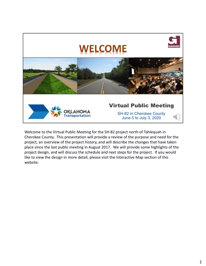
WELCOME Virtual Public Meeting SH-82 in Cherokee County June 5 to July 3, 2020 Welcome to the Virtual Public Meeting for the SH 82 project north of Tahlequah in Cherokee County. This presentation will provide a review of the purpose and need


slide-1
SLIDE 1

Virtual Public Meeting

SH-82 in Cherokee County June 5 to July 3, 2020

WELCOME

Welcome to the Virtual Public Meeting for the SH‐82 project north of Tahlequah in Cherokee County. This presentation will provide a review of the purpose and need for the project, an overview of the project history, and will describe the changes that have taken place since the last public meeting in August 2017. We will provide some highlights of the project design, and will discuss the schedule and next steps for the project. If you would like to view the design in more detail, please visit the Interactive Map section of this website.

1

slide-2
SLIDE 2

Purpose of the Meeting

1. Present the Plans for the SH-82 Project North

  • f Tahlequah to the Public and Obtain Input

2. Explain the Changes that Have Occurred to the Project Since the Last Public Meeting 3. Outline the Next Steps and Schedule for the Project

The purpose of this meeting is to present the plans for the SH‐82 project north of Tahlequah and obtain public input. We will discuss changes that have occurred to the project since the last public meeting, and will then outline the next steps and schedule. We will also explain how to ask questions or make comments on the project.

2

slide-3
SLIDE 3

Purpose of the Project

Improve Safety and Mobility in the SH-82 Corridor, and Complete the 4-Lane Loop around Tahlequah

Traffic on SH-82 Will Become More Congested and Experience Significant Delays by 2045

  • Current Traffic (2020):
  • Urban 9,690 Vehicles/Day
  • Rural 5,160 Vehicles/Day
  • Projected Traffic (2045):
  • Urban 16,040 Vehicles/Day
  • Rural 5,710 Vehicles/Day
  • Corridor Traffic Numbers include 10% Trucks

The purpose of the project is to improve safety and mobility in the SH‐82 corridor, and to complete the 4‐lane loop around Tahlequah. Traffic data suggests that SH‐82 will become more congested and will experience significant delays by 2045. Current traffic in the corridor is almost 9,700 vehicles per day in the urban areas, and over 5,100 vehicles per day in the rural areas. By 2045, traffic is expected to grow to over 16,000 vehicles per day in the urban area, and to almost 6,000 vehicles per day in the rural areas of the corridor. Trucks make up approximately 10% of the vehicles on SH‐82. Depending on speed and access, a 2‐lane highway can typically only handle about 10,000 vehicles per day before it becomes severely congested.

3

slide-4
SLIDE 4

Purpose of the Project

Reduce Collisions and Improved the Safety of the Roadway

  • 227 Collisions between 2006-2016
  • Over Half of These Involved Either Injuries (166 People) or Fatalities (9 People)
  • Rates of Severe Collisions (Injury or Fatality) are 50% Higher Than the State Average
  • Designated Safety Corridor by Oklahoma Highway Patrol

City of Tahlequah Gideon

Moody Rd.

3

17

2 7 2

Rollover Fixed Object Head-on Animal Other Collision History: 8/1/2006 – 7/31/2016

2 2 2 5 3 2 2 7

14

3

Red Outline - Fatality

The project is also intended to reduce collisions and improve the safety of the roadway. Between 2006 and 2016, there were 227 documented collisions on this portion of SH‐82. As shown on the map, these collisions were widespread across the corridor. Over half of the collisions involved either injuries or fatalities. This is over 50% higher than the state average for severe collisions. The rate of collisions in the corridor has prompted the Oklahoma Highway Patrol to designate SH‐82 as a Safety Corridor. A Safety Corridor is subject to increased patrols to discourage speeding.

4

slide-5
SLIDE 5

2012 2013 2014 2015 2016 2017 2018 2019 2020

ODOT Initiates Preliminary Engineering Study

Apr 2012

Stakeholder Meeting

Apr 2013

1st Public Meeting

Jul 2013

2nd Public Meeting

Jan 2015

Environmental Assessment (EA)

Jul 2017

Public Hearing

Aug 2017

FHWA Approval of the Preferred Alternative

Apr 2018

Detailed Environmental Studies Completed

Jan 2020

Preliminary Right-of-Way Plans Completed

Apr 2020

Today's Public Meeting

Jun 2020

Project History

This slide shows a timeline of the project development activities that have taken place. ODOT began studying this segment of SH‐82 in 2012. The first Stakeholder and Public meetings were held in April and July of 2013. In response to public input, ODOT developed some additional project alternatives and held a second public meeting in January of 2015. After receiving public input, ODOT identified two alternatives to analyze in the Environmental Assessment. That document was completed in July of 2017 and a public hearing was held in August. After all comments were addressed, ODOT identified the preferred alternative and this was approved by the Federal Highway Administration in April

  • f 2018. Since that time, ODOT has been refining the design of the preferred alternative,

which is what you will see today referred to as the “Proposed Alignment”. In January 2020 ODOT completed detailed environmental studies on the proposed alignment, and completed preliminary right‐of‐way plans. The environmental studies and plans are available for public review as part of this virtual public meeting.

5

slide-6
SLIDE 6

Corridor Improvements

  • Four-Lane Divided Roadway

(From Allen Road to SH-51 Spur)

  • Limited Access to new SH-82 Roadway
  • Existing Roadway Will Provide Local Access

Proposed Corridor Improvements

Tahlequah Gideon 51 Spur Proposed Two Lane

  • Two-Lane Undivided Roadway

(From SH-51 Spur to End of Project)

  • Properties Will Have Direct Access to SH-82

The proposed corridor improvements include a four‐lane divided roadway from Allen Road to the SH‐51 Spur. This portion of the roadway will have limited access. That is, access to SH‐82 will only be provided at intersections. The existing SH‐82 roadway will continue to provide local access to homes and businesses. North of the SH‐51 Spur, ODOT will construct a two‐lane, undivided highway for the remainder of the project. Properties will have direct access to the highway like they do today.

6

slide-7
SLIDE 7

Corridor Improvements

  • Ultimate Four-Lane Divided Roadway

(From SH-51 Spur to End of Project)

  • A Four-Lane Roadway Will be Completed as Traffic Demands in the Future
  • Add Additional Two Lanes North of SH-51 Spur
  • ODOT Plans to Purchase the Needed Right-of-Way for Four Lanes Now

Future Corridor Improvements

Tahlequah Gideon 51 Spur Proposed Two Lane Future Four Lane

Future corridor improvements will include adding two lanes north of the SH‐51 Spur to complete a four‐lane divided highway between Tahlequah and Gideon. These future improvements will be completed as traffic demands increase and as funding is available. ODOT plans to purchase the needed right‐of‐way for the proposed and future four lanes this year.

7

slide-8
SLIDE 8

Corridor Improvements

  • Reduce Collisions
  • Eliminate Signals
  • Reduce Maintenance Needs & Costs
  • Locations:
  • SH-82 & Grand Ave. – 2 Lanes
  • SH-82 & SH-51 Spur – 2 Lanes
  • Jones Rd. & Jarvis Rd. – 1 Lane

Addition of Roundabouts

New corridor improvements include the addition of roundabouts. Modern roundabouts

are a common form of unsignalized intersection control in use throughout the

  • world. In a roundabout intersection, there is one‐way circulation of traffic around a

central island where entering traffic must yield to circulating traffic. Modern roundabouts maximize safety by significantly reducing collisions and minimize traffic delays. Roundabouts are also more cost effective than traffic signals as they eliminate hardware, maintenance and electrical costs associated with the signals.

There are three proposed roundabouts for this project, two on SH‐82 at major intersections and one where two local roads intersect near the highway. Additional information about Roundabouts can be found on the public meeting website.

8

slide-9
SLIDE 9

Development of Construction Plans

Proposed Right-of-Way

  • Design Development has Advanced to Include:
  • Highway/Local Roads
  • Drainage
  • Driveways
  • Proposed Right-of-Way for Purchase Has

Been Laid Out According to ODOT Guidelines.

Questions About Right-of-Way Purchase

See Public Meeting Website for Additional Information

Proposed Right‐of‐Way Temporary Right‐of‐Way

N

The design for the highway has advanced to the point where we can determine the proposed right‐of‐way. Right‐of‐way is property that ODOT will purchase to build the

  • highway. The design to this point includes the layout of the highway both horizontally and

vertically, crossing drainage structures and driveways with side drains. The proposed right‐

  • f‐way is shown with orange lines in the snapshot on the screen. Temporary right‐of‐way is

shown in light green. The proposed right‐of‐way line on the south side of the road is offset further from the highway to allow for the future two lanes to be added. The public meeting website includes an Interactive Map that shows the design and proposed right‐of‐ way for the entire project. You can use the Interactive Map to view your property and leave

  • comments. The public meeting website also includes additional information on the Right‐
  • f‐Way purchase process.

9

slide-10
SLIDE 10

Development of Construction Plans

Project Overview

  • Starts In Tahlequah, OK
  • Northwest Alignment
  • 7 Miles
  • 3 Roundabouts
  • 4 Bridge Class Structures
  • Ends in Gideon, OK

N

  • E. Allen Rd.

BEGIN PROJECT END PROJECT

Gideon Tahlequah Exist SH‐82

PROPOSED SH‐82

N

The map on the slide shows the project limits. The proposed highway will start in Tahlequah and extend to the northwest for approximately 7 miles, ending in Gideon. The yellow dots represent the locations for the three roundabouts and the light blue rectangles indicating the bridge structures.

10

slide-11
SLIDE 11

Development of Construction Plans

Project Walk Through

  • Begin of Project
  • End of Current 4 lane

(Bertha Parker Bypass)

BEGIN PROJECT

N

  • E. Allen Rd.
  • N. Cedar Ave.

Next we will step through the project, showing key elements or points of interest along the proposed highway. The project begins on the northeast side of Tahlequah where the four lane Bertha Parker Bypass ends just west of Cedar Avenue.

11

slide-12
SLIDE 12

Development of Construction Plans

Project Walk Through

SH-82 & Grand Ave. Roundabout

  • Two Lane Roundabout Along SH-82
  • Designed to Accommodate a Semi-Truck
  • Special Signs
  • Lighting

ROUNDABOUT

  • NO. 1

N

Wheeler St.

Example 2-Lane Roundabout

Further to the northwest the proposed highway starts to veer away from the existing

  • highway. Grand Ave. will have a new connection to SH‐82 with the first roundabout. SH‐82

will be two lanes for both directions as it passes through the roundabout. This roundabout is designed for a semi‐truck and will have lighting with special signs to help direct traffic. Wheeler Street will have access to existing SH‐82, which will connect to the new highway further north. The picture in the lower left shows an example of a similar two‐lane roundabout.

12

slide-13
SLIDE 13

Development of Construction Plans

Project Walk Through

SH-82 & SH-51 Spur Roundabout

  • Two Lane Roundabout All Directions
  • Designed to Accommodate a Semi-Truck
  • Special Signs
  • Lighting

ROUNDABOUT

  • NO. 2

N

Roundabout Sign (Concept)

SH‐51 Spur

As the proposed highway continues to the northwest it will cross SH‐51 Spur, where the second roundabout will be located. This roundabout will have two lanes for all directions and is also designed for a semi‐truck. Vinita Street will be relocated to connect with SH‐51 Spur outside of the roundabout limits. In the lower left‐hand corner you will see an example of the special signs that may be used to help direct traffic. Like the first roundabout, this one will have lighting along with flashing warning signs to indicate that a driver is approaching the roundabout.

13

slide-14
SLIDE 14

Development of Construction Plans

Project Walk Through

Jarvis Rd. and Jones Rd. Roundabout

  • Single Lane Roundabout
  • Designed to Accommodate a School Bus
  • Special Signs
  • Bridge Box under SH-82
  • Span Bridge over Double Spring Creek

N

  • W. Jones Rd.
  • N. Jarvis Rd.

SPAN BRIDGE BRIDGE BOX

Double Spring Creek

ROUNDABOUT

  • NO. 3

The final roundabout is located at the intersection of Jarvis Road and Jones Road and is west of the proposed highway. A roundabout was chosen for this intersection to provide a more continuous path for Jones Road. This roundabout will be a single lane roundabout designed to accommodate a school bus. Traffic traveling on Jarvis Road will take SH‐82 to continue north or south. Two bridges are in the vicinity with a bridge box under the intersection of SH‐82 and Jones Road and further northwest is a span bridge over Double Spring Creek.

14

slide-15
SLIDE 15

Development of Construction Plans

Project Walk Through

SH-82 & W. 710 Rd. Intersection

  • Existing Highway to be Removed

North of W. 710 Rd.

  • Existing Highway to the East of

the Proposed Highway will Remain for Local Access N

  • W. 710 Rd.

Continuing to the northwest the proposed highway crosses over the existing highway near

  • W. 710 Road. The new lanes will be built northeast of the existing highway with an offset
  • f approximately 50 feet. The existing highway pavement will be removed north of W. 710

Road while the existing highway will remain to the east to provide local access.

15

slide-16
SLIDE 16

Development of Construction Plans

Project Walk Through

End of Project

  • Connect to Fourteen Mile Creek Bridge

END PROJECT

N

Fourteen Mile Creek

The proposed highway will end at the new bridge constructed over Fourteen Mile Creek.

16

slide-17
SLIDE 17

Environmental Studies

Detailed Environmental Studies Have Been Completed

  • ODOT Completed Studies of:
  • Waters and Wetlands
  • Threatened and Endangered Species
  • Cultural Resources (Historic and

Archeological)

  • Hazardous Materials
  • Traffic Noise
  • Commitments to Avoid and/or Minimize

Impacts to the Environment will be Included in the Project

  • ODOT will Complete a Re-Evaluation of the

2017 Environmental Assessment for Federal Highway Administration Approval

As part of the commitments outlined in the 2017 Environmental Assessment, ODOT has completed detailed environmental studies of the proposed alignment, and has consulted with the appropriate agencies for approval. Studies of waters and wetlands, threatened and endangered species, cultural resources, hazardous materials, and traffic noise were

  • completed. As a result of these studies, additional commitments to avoid and/or minimize

impacts to the environment will be added to the project. In order to authorize construction of the project, ODOT will update the Environmental Assessment prepared in

  • 2017. This is called a Re‐Evaluation and will require Federal Highway Administration

approval.

17

slide-18
SLIDE 18

Environmental Studies

Study Results

  • No Additional Investigations are Required for:
  • Cultural Resources
  • Hazardous Materials
  • Impacts to Waters and Wetlands will be

coordinated with the US Army Corps of

  • Engineers. A Clean Water Act Section 404

permit will be obtained for the project.

  • Measures to avoid or minimize impacts to

protected wildlife species will be added to the project plans.

  • See the “Environmental Studies” section of

this website for more information.

As a result of the detailed environmental studies, it was found that there will be no impacts

  • n cultural resources or hazardous materials. No additional investigations of these

resources will be necessary. Impacts to waters and wetlands will occur as they are crossed by the new roadway and bridges. These impacts will be coordinated with the U.S. Army Corps of Engineers and ODOT will obtain a Clean Water Act Section 404 permit for the

  • project. Measures to avoid or minimize impacts to protected wildlife species will be added

to the project plans. These species include bats and the American Burying Beetle. More detail on the environmental studies can be found on the “Environmental Studies” section

  • f this website.

18

slide-19
SLIDE 19

Environmental Studies

Study Results

A Noise Study was Completed According to FHWA Regulations and ODOT Noise Policy

  • The study utilized FHWA Traffic Noise Model (TNM)

to predict future noise levels, factoring in 2045 traffic volumes (future 4-lane), terrain and receptor site locations.

  • Model validation was performed by measuring

existing noise levels and counting existing traffic volumes at several locations in the corridor.

  • The model was based on the existing and proposed

future roadway network including the future 4 lanes

  • n SH-82, SH-51 Spur, and local roads.
  • 101 noise locations were modeled, representing

121 homes, 4 places of worship, and 1 cemetery.

ODOT completed a traffic noise study according to Federal Highway Administration (FHWA) and ODOT Noise Policy. The study utilized FHWA Traffic Noise Model to predict future noise levels, factoring in 2045 traffic volumes, terrain and receptor site locations. Model validation was performed by measuring existing noise levels and counting existing traffic volumes at several locations in the corridor. The model was based on the existing and proposed future roadway network including the future 4‐lanes on SH‐82, the SH‐51 Spur, and local roads. One hundred one locations were modeled, representing 121 homes, 4 places of worship, and 1 cemetery.

19

slide-20
SLIDE 20

Environmental Studies

Study Results

  • Noise Impacts Occur When:
  • Exterior future noise levels are 66 dB(A) or above; or
  • Exterior future noise levels are 15 dB(A) or more

above existing levels

  • Based on the proposed project, no noise level

impacts are expected. The average sound level in the corridor is expected to be 52.4 dB(A),with levels ranging from 36.5 to 61.3 dB(A).

  • Six (6) residential receptors are anticipated to

experience a substantial noise increase by 2045.

Noise Impacts occur when future noise levels are at least 66 decibels; or future noise levels are 15 dB(A) or more above existing levels. Based on the proposed project, no noise level impacts are expected. The average sound level in the corridor is expected to be 52.4 decibels, with levels ranging from 36.5 to 61.3 decibels. Six (6) residential receptors are anticipated to experience a substantial noise increase by 2045, which means they will experience noise levels 15 decibels or more higher than today. However, all noise levels will remain below 66 decibels.

20

slide-21
SLIDE 21

Environmental Studies

Study Results

  • Two (2) noise walls were modeled near the

impacted receptors.

  • In order to be considered, walls must meet

criteria for feasible and reasonable, meaning they must be effective at reducing noise and must be cost effective.

  • Installation of noise walls would not meet

feasible and reasonable criteria due to:

  • Long distances between the walls and the

affected homes

  • Insufficient number of benefitted homes
  • No noise walls will be included in the project

Wall #2 Wall #1 Non‐Impacted Receiver Impacted Receiver

Whenever noise impacts are predicted by the model, noise abatement is considered. In this case, two noise walls were modeled near the impacted homes. In order to be considered, walls must meet criteria for feasible and reasonable, meaning they must be effective at reducing noise and must meet cost criteria. The model showed that installation

  • f noise walls on the SH‐82 project would not meet feasible and reasonable criteria due to

long distances between the walls and the affected homes and an insufficient number of benefitted homes. Therefore no noise walls will be included in the project.

21

slide-22
SLIDE 22

2020 2021 2022 2023 2024

Public Comments Due

July 3, 2020

NEPA Re-Evaluation

Sep 2020

Construction

June 2022

Next Steps

Spring 2021

Right-of-Way Acquisition

This slide shows the next steps for the project. We ask that you submit your comments by July 3 so that we may incorporate your feedback and finalize the design plans. If your property is affected by the project, you can expect to hear from ODOT right‐of‐way agents beginning in Spring of 2021. Currently construction of the project is programmed to begin in June of 2022. Construction is anticipated to last approximately 2 to 2‐1/2 years.

22

slide-23
SLIDE 23

Thank You!

Please visit the other areas of the website for more information

  • Project History – more information about past public meetings
  • Environmental Studies – more information about the studies conducted and environmental

commitments

  • Interactive Map – view the design on an aerial photograph, zoom in and out, find your property, etc.
  • Right-of-Way Acquisition – information and contact information for right-of-way acquisition and

relocations

  • Frequently Asked Questions – for common questions and answers about the project
  • Submit a Comment – submit your comment or questions on this page or send by email or mail

Thank You for Participating in our Virtual Public Meeting!

Thank you for participating! Please visit the other areas of this website for more

  • information. This concludes the meeting presentation.

23