
vancouver.ca/georgiagatewaywest
November 2017
GEORGIA GATEWAY WEST
COMPLETE STREET PROJECT
Why Georgia Street? What’s happening today? Georgia Street is a busy transportation corridor and an important gateway into the city of Vancouver. But traffic can be a challenge, and the street can be uninviting for people walking, rolling, and cycling. We are beginning a transportation planning process to explore how to make Georgia a Complete Street - a street that is safe, efficient, and welcoming for people
- f all ages and abilities, and using all modes of travel.
This open house is an opportunity to:
- Learn about the project
- Explore the issues
- Ask questions & share feedback
Feedback from this open house will help the transportion planning team understand the issues and explore solutions.
- Georgia Street is an important
gateway into the city.
- More people will make this area and
region home.
- We have an important opportunity
to make sustainable travel reliable, safe, and comfortable.
- We want to make a plan for the
transportation network that will move more people, goods, and services smoothly and efficiently.
Welcome
1
Phase 1 Listen & Learn Phase 2: Explore Options & Design Choices Learn from road users, businesses, and residents about their experience, and how Georgia Street could be improved. Work with residents, businesses, and road users to assess the transportation network options and street design choices that will work best for Georgia Street. W e a r e h e r e
N
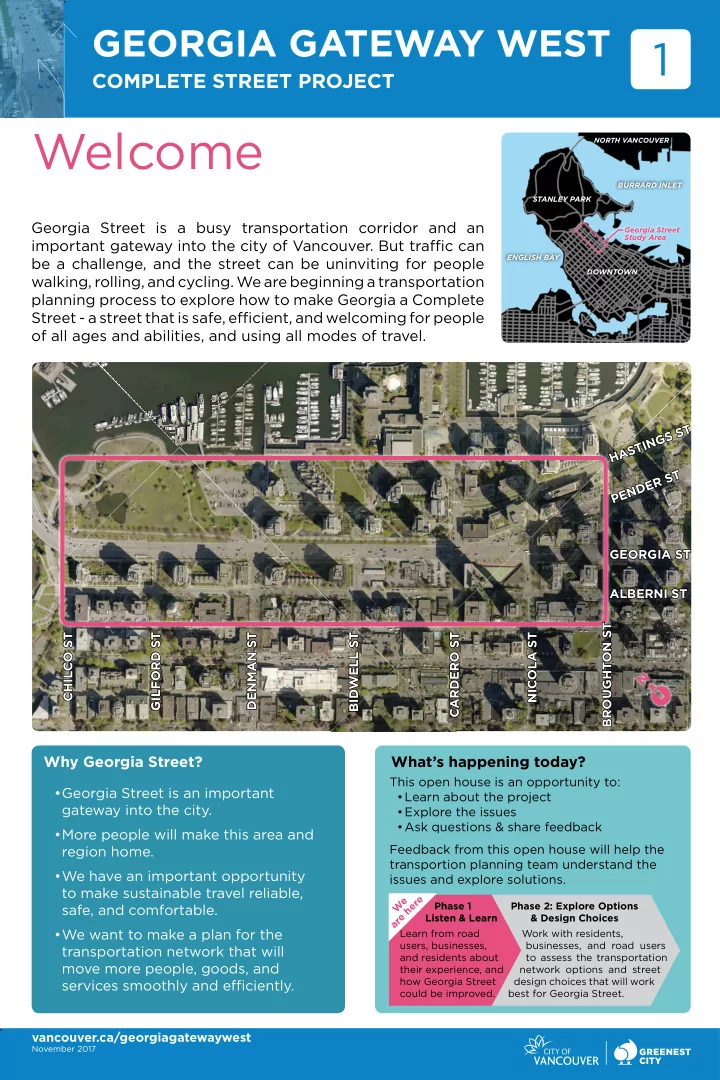
ALBERNI ST CHILCO ST GILFORD ST DENMAN ST BIDWELL ST CARDERO ST NICOLA ST BROUGHTON ST PENDER ST HASTINGS ST GEORGIA ST
BURRARD INLET Georgia Street Study Area STANLEY PARK
NORTH VANCOUVER
DOWNTOWN ENGLISH BAY