
Land South of Farnham Road, Odiham
developments living space tion ts
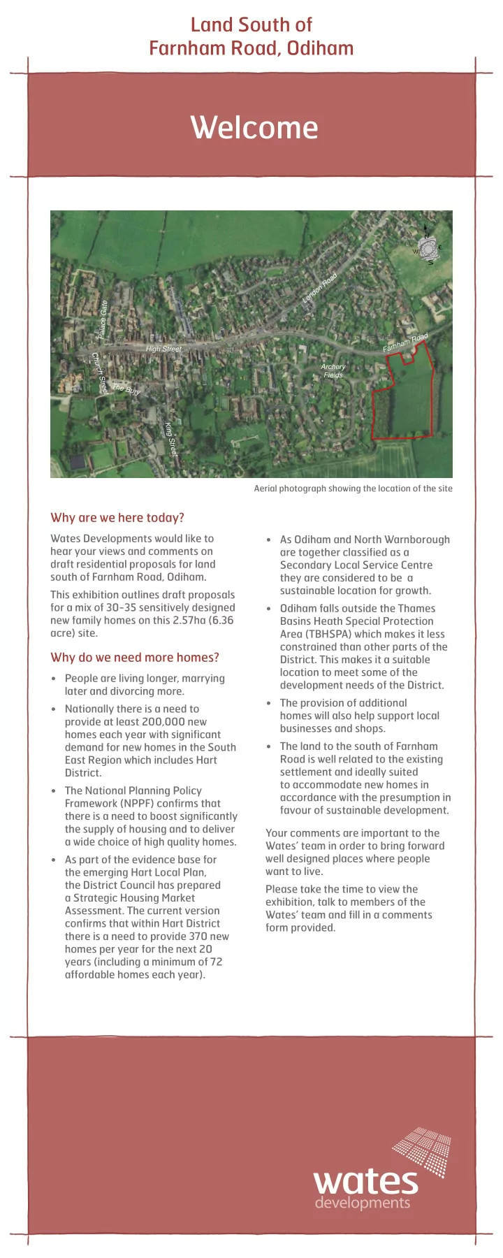
Aerial photograph showing the location of the site
Why are we here today?
Wates Developments would like to hear your views and comments on draft residential proposals for land south of Farnham Road, Odiham. This exhibition outlines draft proposals for a mix of 30-35 sensitively designed new family homes on this 2.57ha (6.36 acre) site.
Why do we need more homes?
- People are living longer, marrying
later and divorcing more.
- Nationally there is a need to
provide at least 200,000 new homes each year with significant demand for new homes in the South East Region which includes Hart District.
- The National Planning Policy
Framework (NPPF) confirms that there is a need to boost significantly the supply of housing and to deliver a wide choice of high quality homes.
- As part of the evidence base for
the emerging Hart Local Plan, the District Council has prepared a Strategic Housing Market
- Assessment. The current version
confirms that within Hart District there is a need to provide 370 new homes per year for the next 20 years (including a minimum of 72 affordable homes each year).
- As Odiham and North Warnborough
are together classified as a Secondary Local Service Centre they are considered to be a sustainable location for growth.
- Odiham falls outside the Thames
Basins Heath Special Protection Area (TBHSPA) which makes it less constrained than other parts of the
- District. This makes it a suitable
location to meet some of the development needs of the District.
- The provision of additional
homes will also help support local businesses and shops.
- The land to the south of Farnham
Road is well related to the existing settlement and ideally suited to accommodate new homes in accordance with the presumption in favour of sustainable development. Your comments are important to the Wates’ team in order to bring forward well designed places where people want to live. Please take the time to view the exhibition, talk to members of the Wates’ team and fill in a comments form provided.
Welcome
High Street Farnham Road The Bury London Road Archery Fields King Street Church Street Palace Gate