Unit 2 Global Networks and Interconnections Overview Ben Curtis - - PowerPoint PPT Presentation

unit 2 global networks and
SMART_READER_LITE
LIVE PREVIEW

Unit 2 Global Networks and Interconnections Overview Ben Curtis - - PowerPoint PPT Presentation

Unit 2 Global Networks and Interconnections Overview Ben Curtis Unit Starter Ideas #1 Balloon Globes Unit Starter Ideas #2 Orange Globes Great for teaching about mapping projections! Quick Quiz! Get your devices at the ready


slide-1
SLIDE 1

Unit 2 – Global Networks and Interconnections

Overview – Ben Curtis

slide-2
SLIDE 2

Unit Starter Ideas #1 – Balloon Globes

slide-3
SLIDE 3

Unit Starter Ideas #2 – Orange Globes

Great for teaching about mapping projections!

slide-4
SLIDE 4

Quick Quiz!

  • Get your devices at the ready now for a rapid

fire quiz!

slide-5
SLIDE 5

Contents

  • Unit Description
  • Key Concepts
  • Learning Outcomes and Activities
  • Unit Content – Top Tips and Overview
  • Activity 1 – Give One, Get One
  • Depth Study 1 – Commodity
  • Depth Study 2 – Cultural Element
  • Activity 2 – Assessment Review
  • Acknowledgements
slide-6
SLIDE 6

SCSA Unit Description

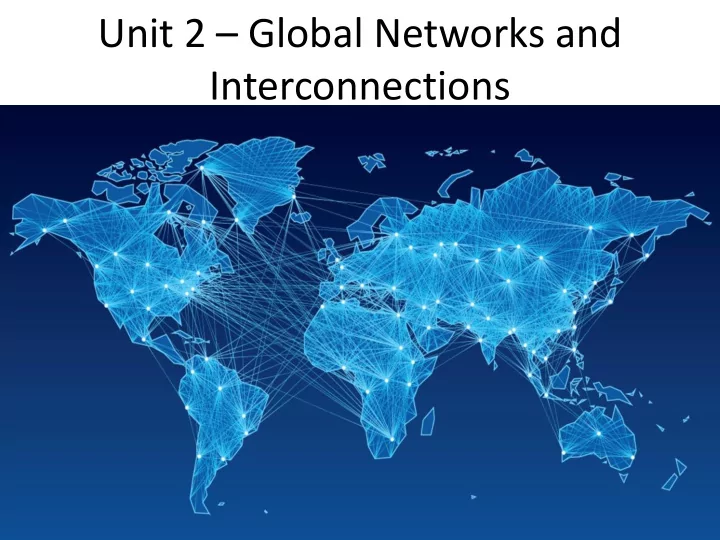
Cultural groups that may have been isolated in the early twentieth century are now linked across an interconnected world in which there is a ‘shrinking’ of time and space. Of particular interest are the ways in which people adapt and respond to these changes. This is a world in which advances in transport and telecommunications technologies have not only transformed global patterns of production and consumption but also facilitated the diffusion of ideas and elements of

  • cultures. The unit explains how these advances in transport and

communication technology have lessened the friction of distance and have impacted at a range of local, national and global scales. This unit focuses on the process of international integration (globalisation) and is based on the reality that we live in an increasingly interconnected

  • world. It provides students with an understanding of the economic and

cultural transformations taking place in the world today, the spatial

  • utcomes of these processes, and their political and social consequences.
slide-7
SLIDE 7

The Shrinking World

slide-8
SLIDE 8

Global Patterns of Consumption

International Tea Market Expansion Board Limited - Gill MacDonald 1940

slide-9
SLIDE 9

Impact on Peoples North Sentinelese – Andaman Islands

slide-10
SLIDE 10

SCSA - Learning outcomes

By the end of this unit, students:

  • understand the nature and causes of international integration and

its spatial, economic, political and social consequences

  • understand the ways people embrace, adapt to and resist the forces
  • f international integration
  • understand and apply key geographical concepts – including place,

space, environment, interconnection, sustainability, scale and change – as part of a geographical inquiry

  • think geographically, based on an understanding of the complexities
  • f an increasingly interdependent world
  • apply geographical inquiry skills and a range of other geographical

skills, including spatial technologies and fieldwork, to investigate the complexity of the integrated world

  • evaluate the sustainability of alternative futures, drawing on an

understanding of an integrated global society.

slide-11
SLIDE 11

Unit 2 Learning Outcomes

  • Students can describe

globalisation, explain it’s causes and discuss it’s

  • impact. E.g. European

Imperialism and Colonialism.

  • *Field trip suggestion –

Maitland Brown Memorial, Esplanade Park, Fremantle. Tied in to field skills day in Fremantle.

  • Cross Curriculum Priority
slide-12
SLIDE 12

Unit 2 Learning Outcomes

  • Students can explain global

interdependence:

  • Australia exports minerals to

China i.e. Iron Ore

  • Australia imports complex

manufactured goods i.e. Cars.

  • Backward Mapping Idea – Y8

excursion to Roy Hill Mining ROC-ED Centre

  • Geography with

Science/Engineering puts us in the STEMOSPHERE

slide-13
SLIDE 13

Unit 2 Learning Outcomes

  • Explain adoption and

adaptation of cultural elements and commodities/technologies with reference to specific examples, e.g. McDonalds, and discuss why there may be some resistance.

  • Activity suggestion –

McDonalds webquest comparing international menus / products. E.g. Compare and Contrast Australia and India

slide-14
SLIDE 14

Unit 2 Learning Outcomes

  • Complete a Geographical

Inquiry

  • Assessment suggestion –

Inquiry into Diffusion of Football / Music

  • Fieldtrip Suggestion – Optus

Stadium Tour

  • Y12 backward mapping

bonus – a short hop over the river to walk through Claisebrook development in East Perth – Link to Unit 4

slide-15
SLIDE 15

Unit 2 Learning Outcomes

  • Consider how the three pillars
  • f sustainability (economic,

environment and social) can be applied within the context of increased globalisation

  • E.g. China reducing pollution

levels while US steps away from ‘climate change’ – America First Energy Plan advocates fossil fuels inc. coal

  • Weave sustainability into each

topic you cover as a key concept

  • Sustainability - cross curricular

priority

slide-16
SLIDE 16

SCSA Unit 2 content

Overview of international integration

  • The application of the concept of sustainability when considering the outcomes
  • f increased globalisation
  • The process of international integration, especially as it relates to the

transformations taking place in the spatial distribution of the production and consumption of commodities, goods and services, and the diffusion and adaptation of ideas, meanings and values that continuously transform and renew cultures.

  • Advances in transport and telecommunications technologies as a facilitator of

international integration, including their role in the expansion of world trade, the emergence of global financial markets, and the dissemination of ideas and elements of culture

  • The economic and cultural importance of world cities in the integrated global

economy and their emergence as centres of cultural innovation, transmission and integration of new ideas about the plurality of life throughout the world

  • The concept of global shifts with the re-emergence of Asia, particularly China

and India, as global economic and cultural powers, and the relative economic decline, but sustained cultural authority, of the United States of America and Europe

slide-17
SLIDE 17

Top Tips!

  • Book field trips early
  • Use data sources (Graphs, Chart, Models etc.)

throughout this module to maximise source analysis skills growth

  • Try to build in Y12 links where possible e.g.

ALCOA excursion – Land cover change. Your aim is to prepare the students for Y12. Y11 is the warm up.

  • Currently running a 15 week program in order to

allow time for Y12 workshops in term 4.

slide-18
SLIDE 18

Diffusion, Adoption, Adaptation & Glocalisation

slide-19
SLIDE 19

Transport

  • The concept that improvements in transport technology and infrastructure

have shrunk the world – Space Time Convergence

  • Class Activity – Ask students to spend the week attempting to use as many

different modes of transport as possible and record their journey times and costs involved. Graph their data and draw conclusions on the best, cheapest and most sustainable modes of transport.

  • Excursion suggestion – Leeuwin

– 2 hr class room hire – Day sails – 5 / 7 day voyages – Whole WACE unit in 5 days –

  • approx. cost $1500
slide-20
SLIDE 20

Interdependence - World Trade Game

https://www.economicsnetwork.ac.uk/showcase/sloman_game

A B C D E F Envelope Contents 2 pairs of scissors 2 rulers 1 compass 1 set square (the exact size of the large triangular shape) 1 protractor (the exact size of the semi- circular shape) 2 pencils 1 sheet of A4 paper 6 × £100 notes 2 pencils 1 ruler 10 sheets of A4 paper 3 × £100 notes 2 pencils 4 sheets of A4 paper 2 × £100 notes

Scenario examples:

  • Climate Change / Natural Disasters
  • Change in Global Markets
  • Discrimination / Internal Dispute /

Conflict

  • Land Grabbing
  • Availability of Raw materials
  • New Technology
slide-21
SLIDE 21

Shifts in Global Economic Power

slide-22
SLIDE 22

Shifts in Global Economic Power

slide-23
SLIDE 23

World Cities

  • New York / London
slide-24
SLIDE 24

Cultural and Social Influence

slide-25
SLIDE 25

Economic Power

slide-26
SLIDE 26

Activity – Give One, Get One

  • Open a new page or use a blank sheet of

paper.

  • Write the title ‘Factors That Make London

A World City’ at the top of the page.

  • Divide your page in two.
  • Subtitle ‘Economic Factors’ on the left

and ‘Cultural Factors’ on the right of your page.

  • Those of you on the left of the room

(towards the door) will research economic factors, on the right (towards the window), cultural factors.

  • Read the article “What makes London a

World City” provided on your table and list five key points / examples in your allocated category i.e. economic OR

  • cultural. You have 5 minutes!
  • Now you have five, one minute blocks to

move around the room and find five

  • ther people with the alternate
  • information. You will trade one key point
  • f your information for one key point of

theirs.

  • You must move on to a new person after

each trade!

slide-27
SLIDE 27

Depth Study 1 - Commodity

Using fieldwork and/or secondary sources students investigate the reasons for, and consequences of, the changing spatial distribution of production and consumption (and, where appropriate, reuse) of at least one commodity, good or service from one of the following groups:

  • a mineral ore or fossil-based energy resource – iron ore, coal, bauxite, natural

gas or oil OR

  • a food or fibre-based good – wheat, timber, wine, rice, sugar, beef, seafood,

cotton or wool OR

  • a complex manufactured good – consumer electronics, automobiles,

engineered wood products, a clothing brand, soft drink/food production OR

  • tourism – business, eco-tourism or recreational
slide-28
SLIDE 28

Bauxite

  • Alcoa Field Trip, Pinjarra

– Local, Affordable, Very Helpful – Curriculum focussed so will adapt tours to individual schools needs e.g. Inquiry or focus questions – Useful to look at land cover change to prepare for Y12

  • Backward Map Mining

– Y9 Kalgoorlie Gold Mines (History Curriculum links) – Y8 Roy Hill Mining ROC-ED Iron Ore (Geography and Science Links)

slide-29
SLIDE 29

Automobiles – Y12 General

Depth Study Works well for Y12 general variant

  • Student Interest
  • Current relevance with

closure of Holden On Site Field Work Idea Survey makes and models in staff carpark Tabulate and Graph Data Students then research origin of manufacturer and model and map findings Interview staff members regarding Automobile habits, ownership and changing trends ABC Holden 4 corners documentary – available on Youtube

slide-30
SLIDE 30

Global Car Ownership

slide-31
SLIDE 31
slide-32
SLIDE 32

Depth Study 2 -

  • Using fieldwork and/or secondary sources, students investigate the

diffusion, adoption and adaptation of at least one of the following elements of culture (this list is not exhaustive):

  • Fashion > Chapter 14 in new GAWA text is superb. Current content, themes and

student activities

OR

  • a sport or leisure activity

OR

  • music

OR

  • religion

OR

  • language

OR

  • architecture

OR

  • political/social ideas.
slide-33
SLIDE 33

Football

slide-34
SLIDE 34

Music Depth Study

slide-35
SLIDE 35

Inquiry – Moderation Activity

  • Part 1 - 10 mins to review and mark a Unit 2, Depth Study 2

assessment example from the selection on your table.

  • Use the assessment outline and marking key.
  • Complete the mark sheet with any comments you have.
  • Part 2 - Say hello to your shoulder partner and swap your

assessment and marking sheet with them.

  • 5 mins to review your partner’s assessment and mark sheet

and give them feedback.

  • A table has been set up with a range of limited, satisfactory

and high achievement. Please place your assessment and mark sheet on the table where you think is belongs and take time to review the findings of other markers.

slide-36
SLIDE 36

GAWA – Broadsheets and Exam resources

  • Do you suffer from MLE?
  • Ever felt the burden of too much free time?
  • Back catalogue of broadsheets and exam
  • papers. Best. Resource. Ever.
slide-37
SLIDE 37

Acknowledgements

  • Gemma Garbutt – Atwell College
  • Payman Hasani – Atwell College
  • Lorrie Smith - GAWA
  • GAWA Council and Executive
slide-38
SLIDE 38

Sample Questions and Marking Guides

1. Explain how one advancement in telecommunications and one advancement in transport has facilitated international integration. Provide an example of an advancement for each. (4 marks)

Advancements in transport: Advancements in telecommunications:

  • sailing ships to steam ships
  • steam trains
  • propeller aircraft to jet aircraft
  • horse-drawn carriages to cars
  • containerisation
  • invention of the radio; telephone etc.
  • invention of the internet
  • fibre optics and broadband
  • live streaming
  • social media

Description Marks Correctly explains one example of advancement in transport in facilitating international integration, with the use of a specific example. Award 1 mark only if no example is used. 2 Correctly explains one example of advancement in telecommunications in facilitating international integration, with the use of a specific example. Award 1 mark only if no example is used. 2 TOTAL 4

Teacher Notes: Students should explain their answers accurately and in full sentences, using appropriate geographical language. For full marks, students should provide a specific example of one advancement in transport and one advancement in telecommunications. Example: Generally, the advancements in both transport and telecommunications have increased international integration. For example, information is now able to be transmitted instantly by the internet over greater distances, and distributed more widely. Transport technology has reduced travel time (and costs) for passengers and goods. Marking Key:

slide-39
SLIDE 39

Sample Assessment Outline

Assessment type and weighting (from syllabus) Assessment task weighting When Assessment task Geographical inquiry (20%) 10% Semester 1 Week 8–9 Task 3: Geographical inquiry investigating bushfires Part A: Fieldwork /practical skills collecting and interpreting primary information and or data/Geographical inquiry skills relating to Parkerville Bushfire. Field report based on excursion/Parkerville bushfire. Part B: In class extended response based on fieldwork and inquiry on the natural hazard. Causes, effects, mitigation and adaptation. 10% Semester 2 Week 9–11 Task 8: Geographical inquiry investigating music Part A: Geographical inquiry skills Part B: Report communicating findings using appropriate written, cartographic and graphic forms (5% A&B) Part C: In class extended response based on inquiry to validate report – inquiry validation (5% C) Fieldwork/ practical skills (20%) 5% Semester 1 Week 3 Task 1: In-class test based on Geographical skills/mapping skills 10% Semester 1 Week 7 Task 2: In-class test based on Geographical skills/mapping skills and the overview of natural and ecological hazards 5% Semester 2 Week 13 Task 9: In-class test based on Geographical skills/mapping skills Short and extended response (30%) 7.5% Semester 2 Week 4 Task 6: Short and extended response test based on the overview of global networks and interconnections 10% Semester 1 Week 13 Task 4: Short and extended response test based on an ecological hazard, malaria 7.5% Semester 2 Week 8 Task 7: Short and extended response test based on content from Depth study one, a mineral ore - bauxite 5% Semester 2 Week 14 Task 10: Extended response test based on content from Units 1 and 2. Examination (30%) 10% Semester 1 Week 15 Task 5: Semester 1 examination – 3.0 hours plus 10 minutes reading time. Same format as for ATAR Year 12. Section One: multiple-choice 20 questions, 20% of the total examination Section Two: short response, 7–12 questions, 40% of the total examination Section Three: extended response, 40% of the total examination 20% Semester 2 Week 15 Task 11: Semester 2 examination – 3.0 hours plus 10 minutes reading time. Same format as for ATAR Year 12. Section One: multiple-choice 20 questions, 20% of the total examination Section Two: short response, 7–12 questions, 40% of the total examination Section Three: extended response, 40% of the total examination Total 100%

slide-40
SLIDE 40

Teaching Program

Week Key teaching points 1–2 ▪ Overview of international integration

  • the application of the concept of sustainability when considering the outcomes of increased

globalisation

  • the process of international integration
  • the transformations taking place in the spatial distribution of the production and consumption of

commodities, goods and services

  • the diffusion and adaptation of ideas, meanings and values that continuously transform and

renew cultures. 3–4 ▪ Advances in transport and telecommunications technologies and how they facilitate:

  • international integration
  • expansion of world trade
  • emergence of global financial markets and the
  • dissemination of ideas and elements of culture

▪ The economic and cultural importance of world cities in the integrated global economy ▪ World cities as centres of cultural innovation, transmission and integration of new ideas about the plurality of life throughout the world ▪ The concept of global shifts with the re-emergence of Asia, particularly China and India, as global economic and cultural powers, and the relative economic decline, but sustained cultural authority,

  • f the United States of America and Europe

Task 6: Short and extended response test based on the overview of global networks and interconnections (Wk4 7.5%).

slide-41
SLIDE 41

5–6 Depth study one – Using fieldwork and/or secondary sources, students investigate the reasons for, and consequences of, the changing spatial distribution of production and consumption (and, where appropriate, reuse) of bauxite (mineral ore) ▪ Fieldwork skills (use of field observations and measurements)

  • collect primary data using field techniques, including: surveys and interviews, observing and recording,
  • listening, questioning, sketching and annotating, measuring and counting, photographing and note-taking
  • collate primary data using techniques, including: listing, tabulating, report writing, graphing, constructing

diagrams and mapping

  • analyse and interpret primary data

▪ The nature of bauxite as a commodity, good or service ▪ The process of diffusion of bauxite and its spatial outcomes ▪ The changes occurring in the spatial distribution of the production and consumption of bauxite in Australia and overseas, and the geographical factors responsible for these changes ▪ The role played by technological advances in transport and/or telecommunications in facilitating these changes in the spatial distribution 7–8 ▪ The role played by governments and enterprises in the internationalisation of the production and consumption of bauxite, such as the reduction or elimination of the barriers to movement between countries ▪ Implications of the changes in the nature and spatial distribution of the production and distribution of bauxite for people, places and the biophysical environment at a variety of scales, including the local ▪ Likely future changes in the nature and spatial distribution of the production and consumption of bauxite ▪ The impact of these changes on less developed countries (LDC) in terms of sustainability ▪ The ways people and places embrace, adapt to, or resist the forces of international economic integration, and the spatial, economic, social and geopolitical consequences of these responses Task 7: Short and extended response test based on content from Depth study one, a mineral ore – bauxite (Wk8 7.5%).

slide-42
SLIDE 42

9–11 Depth study two – Using fieldwork and/or secondary sources, students investigate the diffusion, adoption and adaptation of music ▪ Geographical inquiry skills

  • formulate geographical inquiry questions
  • plan a geographical inquiry with clearly defined aims and appropriate methodology
  • collect geographical information, incorporating ethical protocols, from a range of primary sources (interviews, questionnaires,

student’s own experiences, and field observations) and secondary sources (online maps, websites, spatial software applications, print resources and visual media)

  • record observations in a range of graphic representations using spatial technologies and information and communication technologies
  • evaluate the reliability, validity and usefulness of geographical sources and information
  • acknowledge sources of information and use an approved referencing technique
  • analyse geographical information and data from a range of primary and secondary sources, and a variety of perspectives, to draw

reasoned conclusions and make generalisations

  • identify and analyse relationships, spatial patterns and trends, and make predictions and inferences
  • communicate geographical information, ideas, issues and arguments using appropriate written and/or oral, cartographic, multimodal

and graphic forms

  • use geographical language in appropriate contexts to demonstrate geographical knowledge and understanding
  • apply generalisations to evaluate alternative responses to geographical issues at a variety of scales
  • propose individual and collective action, taking into account environmental, social and economic factors, and predict the outcomes of

the proposed action ▪ Skills in the use of information and communications technology and geographical information systems (in a geographic context)

  • use the internet as a tool for geographical research
  • use simple applications, software and online resources (including Google Earth and Google Maps) to access atlases and remote

sensing products (photographs, radar imagery and satellite imagery) for the purpose of describing and interpreting spatial patterns and relationships

  • access databases, such as Australian Bureau of Statistics, and Bureau of Meteorology, for spatial and statistical information
  • use geospatial technologies, including global positioning systems (GPS), to collect and map spatial data

▪ The process of diffusion of the element of music and its spatial outcomes ▪ The role played by technological advances in transport and/or telecommunications in the diffusion of music ▪ The role played by transnational institutions and/or corporations in the dispersion of the element of culture ▪ The role played by media and emerging technologies in the generation and dispersion of music ▪ Implications of the changes in the nature and spatial distribution of music for peoples and places at a range of scales, including the local ▪ Likely future changes in the nature and spatial distribution of music ▪ The ways people embrace, adapt to, or resist the forces of international cultural integration ▪ The role of the media and new technologies in shaping people’s perceptions of place and events through the images and information presented ▪ The impact of the breaking up of multinational states as a result of a rise in specific nationalism ▪ The likely future changes to the sustainability of indigenous cultures in an increasingly integrated world ▪ The spatial, economic, social and geopolitical consequences of changes to music Task 8: Geographical inquiry investigating music – part A inquiry skills, part B report communicating findings, Part C inquiry validation – extended response (Wk12 due, 10%).

slide-43
SLIDE 43

12–13 Geographical skills ▪ Mapping skills

  • identify and interpret a variety of topographic maps at different scales
  • understand the significance of map projections (cylindrical, conical and azimuthal) for mapping the Earth
  • interpret and apply data from different types of statistical maps (isopleth/isoline maps, choropleth maps, proportional circle maps, overlay and dot

distribution maps)

  • interpret marginal information on maps
  • establish position on a map using alphanumeric grid coordinates, eastings and northings, four figure area references, six figure grid references, and

latitude and longitude expressed in degrees and minutes

  • compass directions and bearings
  • interpret and express scale and convert scale from one format to another
  • calculate time, speed, distance and area
  • interpret relief on a map using contours and height information (spot heights), to describe the steepness and shape of a slope (concave, convex and

uniform)

  • calculate gradient
  • interpret, construct and annotate cross sections to show natural and cultural features
  • identify different relief features (landforms, including hills, valleys, plains, spurs, ridges, escarpments, saddles, cliffs), types of natural vegetation

cover and hydrological features (land subject to inundation, perennial and intermittent water bodies)

  • describe site and situation
  • construct simple annotated sketch maps
  • identify, describe and interpret spatial patterns (including land use, settlement and transport), and spatial relationships between natural and

cultural features on maps

  • interpret and describe changing patterns and relationships that have taken place over time

▪ Geographical and statistical data skills

  • calculate and interpret descriptive statistics, including central tendency (arithmetic mean, median, mode), variation (maximum, minimum and

range) and frequency

  • interpret indexes
  • identify correlations between variables
  • interpret and apply data from different types of statistical maps (isopleth/isoline maps, choropleth maps, proportional circle maps, overlay and dot

distribution maps)

  • interpret and construct tables and graphs, including: picture graphs; line, bar and compound graphs; histograms; scattergrams; climatic graphs; pie

graphs; flowcharts and population pyramids

  • use systems and flow diagrams to organise thinking about relationships
  • understand that statistical or spatial association does not prove a causal relationship
  • extrapolate trends over time to forecast future conditions

▪ Remote sensing skills (use of remote sensing products, such as ground level photographs, aerial photographs, radar imagery and satellite imagery)

  • identify and describe natural and cultural features and their patterns on the Earth’s surface using ground level photographs, aerial photographs

(vertical and oblique), radar imagery and satellite imagery (Landsat, weather satellites and Google Earth)

  • compare the different types of information available from remote sensing products with the information depicted on a topographic map
  • use remote sensing products as an aid to interpreting natural and cultural features shown on topographic maps
  • determine direction on remote sensing products
  • apply scale to the calculation of distance on remote sensing products
  • interpret the difference in scale between a photograph and a topographic map of the same place
  • use combinations of remote sensing products and topographic maps to provide information based on change over time

Task 9: In class Fieldwork/Practical skills test based on Geographical skills (Wk13 5%).

slide-44
SLIDE 44

14 ▪ Revision of all content/skills from syllabus Units 1 and 2. Task 10: Extended Response test on Units 1 and 2 (Wk14 5%). 15 Task 11: Semester 2 examination (Units 1 and 2) (Wk15 20%).

slide-45
SLIDE 45
slide-46
SLIDE 46

Do Now! – Balloon Globe Ten Minutes

  • Say hello to a person at your table that you’ve not yet spoken with (much).
  • Congratulations! You’re a pair! Odd one out? Find a buddy at another table ☺
  • Inflate your balloon and take a permanent marker.
  • Draw a world map (continents, oceans, major islands, polar icecaps, equator

and Greenwich meridian / intl. date line) on your globe as accurately as possible.

  • Use two different colours to locate, outline and label the following countries:

Group A: Argentina, Liberia, Namibia, Kenya, South Africa, Mozambique, Oman, Australia, Venezuela. Group B: Germany, England, Austria, Norway, Croatia, Cyprus, Belarus

  • Try to work out the uniting factor that the grouped countries (A and B) have in

common.

  • Prize awarded for the best globe - all entries considered (briefly) – place on the

table up the front right, use a sticker to tag your balloon.

slide-47
SLIDE 47

Do Now! – Balloon Globe

Hint! Use atlases when you do this with the kids

Group A: Argentina, Liberia, Namibia, Kenya, South Africa, Mozambique, Oman, Australia, Venezuela. Best Selling Car: Toyota Hilux Group B: Germany, England, Austria, Norway, Croatia, Cyprus, Belarus Best Selling Car: Volkswagen Golf

Classroom Activity 1: Venn Diagram of similarities and differences between the two vehicle types – Curriculum Language compare and contrast Classroom Activity 2: Placemat, TPS etc. and promote discussion of factors impacting adoption and adaptation of automobiles.

slide-48
SLIDE 48

Music

slide-49
SLIDE 49

Task! Identify the elements of International Integration (Globalisation) in the following video

slide-50
SLIDE 50

Sepultura – Bloody Roots

  • The Portuguese word for burial,

Sepultura was formed by brothers Max and Igor Cavalera, the sons of an Italian diplomat and a Brazilian model in Belo Horizonte, Brazil.

slide-51
SLIDE 51

Adoption

  • Heavily influenced by:
  • Led Zeppelin, Black Sabbath,

Motorhead and Iron Maiden (UK); and

  • Slayer, Metallica, Van Halen

and Megadeth (USA)

slide-52
SLIDE 52

Timbalada

slide-53
SLIDE 53

Adaptation

  • Developed the “Nu” genre of metal in the 1990s by incorporating indigenous

music styles into a previously ‘white’ genre. Most clearly demonstrated in the song, video and lyrics of Roots Bloody Roots.

OLD ‘NU’

slide-54
SLIDE 54

Capoeira

  • Capoeira developed in Brazil,

derived from traditions brought across the Atlantic Ocean by enslaved Africans. It was widely practiced on the plantations as a means of breaking the bonds of slavery.

  • The art was officially prohibited by

the Brazilian Penal Code. The identification of “the outlaw” with capoeira was so widespread that the word became a synonym for “bum,” “bandit,” and “thief.”

  • They moved to marginal places and

camouflaged the martial art as a form of dance.

– Juan Goncalves-Borrega, Smithsonian Center for Folklife and Cultural Heritage

slide-55
SLIDE 55

Religion – Candomble

  • Candomblé is a religion based on

African beliefs which is particularly popular in Brazil. It is also practised in other countries, and has as many as two million followers.

  • The religion is a mixture of

traditional Yoruba, Fon and Bantu beliefs which originated from different regions in Africa. It has also incorporated some aspects of the Catholic faith over time.

  • http://www.bbc.co.uk/religion/religions/candomble/ataglance/g

lance.shtml

slide-56
SLIDE 56

Religion – Catholicism

  • Statistics from the Vatican's official publication,

Statistical Yearbook of the Church, 2015. Vatican City: Librera Editrice Vaticana, 2017.

  • Baptized Catholics:
  • 172,222,000
  • Baptized Catholics as % of

Total Population:

  • 84.24%
  • Baptisms per Year (Under age

7):

  • 1,184,123
  • Catholicism was the state

religion of Brazil from 16th – 19th centuries.

  • Brazil remain the world’s

largest catholic nation.

slide-57
SLIDE 57

Afro-Brazilians – Salvador, Slavery and the Catacombs

Slaves arriving in Salvador, Brazil would be ‘stored’ in the catacombs beneath the city’s Custom House while they waited to be sold at market. The bloody roots referred to by Sepultura are here laid bare.

slide-58
SLIDE 58

Dickies Workwear

1922 – Dickie and Williamson purchase the U.S. Overall Company 1930 – US sales top USD 500’000 1940’s – Supply uniform to US military during WWII 1950s – Texas Oil workers take their favourite workwear to the oilfields of the Middle East 2000s – Distribution through over 100 countries globally

slide-59
SLIDE 59

Diffusion

slide-60
SLIDE 60

Summary - International Origins

slide-61
SLIDE 61

Rammstein?

slide-62
SLIDE 62

Cornell Notes

slide-63
SLIDE 63

Suggested Extended Answer Structure

  • Nature
  • Process, Rate and Extent
  • Explain – Cause and Effect
  • Examples
  • Links / Connections / Interconnections
  • Scale: Local / Regional / Global
slide-64
SLIDE 64

Flipped Classroom - Pedagogy

  • Issue: the course has a large amount of content and

(relatively) little time to teach it

  • Suggested Solution: Put note taking out of the

classroom

  • Form Triads – three students
  • Use standardised note taking format e.g. Cornell Notes
  • Triad rotates so that one student covers the relevant content each week

and shares the notes

  • Benefit 1: This frees up your contact for focussed application of pre-learnt

knowledge which can the be used to answer practice questions and refine exam writing skills.

  • Benefit 2: Deep learning comes from application of knowledge, not just

being a passive recipient. The classroom is where they come to apply their knowledge.