U.S. 17 Trail Project Development & Environment (PD&E) Study - - PDF document

u s 17 trail project development environment pd e study
SMART_READER_LITE
LIVE PREVIEW

U.S. 17 Trail Project Development & Environment (PD&E) Study - - PDF document

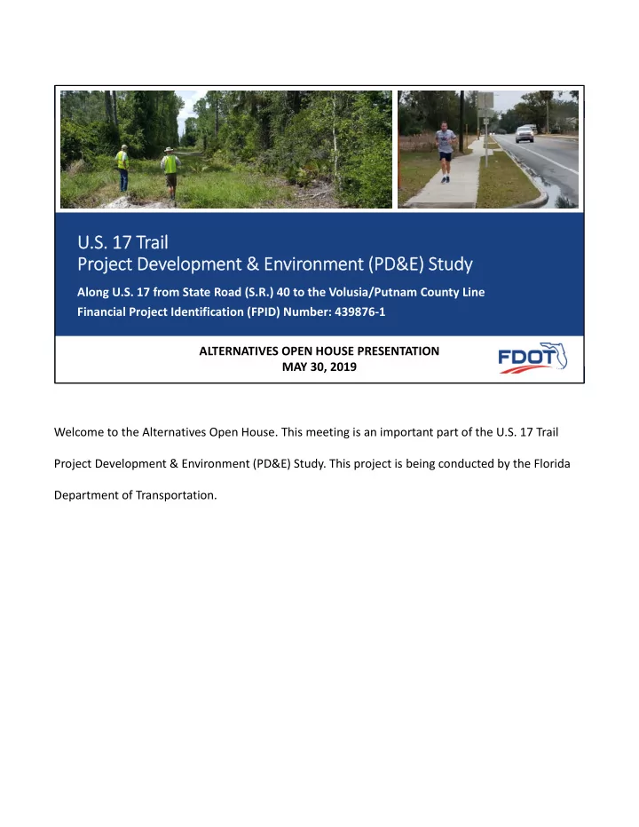
U.S. 17 Trail Alternatives Open House May 30, 2019 U.S. 17 Trail Project Development & Environment (PD&E) Study Along U.S. 17 from State Road (S.R.) 40 to the Volusia/Putnam County Line Financial Project Identification (FPID) Number:


slide-1
SLIDE 1

U.S. 17 Trail Alternatives Open House ‐ May 30, 2019

U.S. 17 Trail Alternatives Open House U.S. 17 Trail Alternatives Open House

U.S. 17 Trail Project Development & Environment (PD&E) Study

Along U.S. 17 from State Road (S.R.) 40 to the Volusia/Putnam County Line Financial Project Identification (FPID) Number: 439876‐1 ALTERNATIVES OPEN HOUSE PRESENTATION MAY 30, 2019 Welcome to the Alternatives Open House. This meeting is an important part of the U.S. 17 Trail Project Development & Environment (PD&E) Study. This project is being conducted by the Florida Department of Transportation.

slide-2
SLIDE 2

U.S. 17 Trail Alternatives Open House ‐ May 30, 2019

U.S. 17 Trail Alternatives Open House U.S. 17 Trail Alternatives Open House

WELCOME

Alternatives Open House

Pierson Community Center 124 W Washington Ave, Pierson, FL 32180

The purpose of this meeting is to provide you the opportunity to review project information, ask questions and offer comments about the proposed trail from S.R. 40 to the Volusia/Putnam County line. Maps, display boards and other project information are on display here this evening. Project representatives are available throughout the meeting area to discuss the study and answer your questions about the proposed project.

The purpose of this Alternatives Open House is to provide you the opportunity to review project information, ask questions and offer comments about the proposed trail from S.R. 40 to the Volusia County/Putnam County line. Maps, display boards and other project information are on display here this evening. Project representatives are available throughout the meeting area to discuss the study and answer your questions about the proposed project. Comment forms are available at the sign‐in table and at the comment table for your use. We encourage you to complete a form and drop it into one of the boxes.

slide-3
SLIDE 3

U.S. 17 Trail Alternatives Open House ‐ May 30, 2019

U.S. 17 Trail Alternatives Open House U.S. 17 Trail Alternatives Open House

Title VI of the Civil Rights Act of 1964

The Florida Department of Transportation complies with various non‐discrimination laws and regulations including Title VI of the Civil Rights Act of 1964. Public participation is solicited without regard to race, color, national origin, age, sex, religion, disability, or family status. Persons wishing to express their concerns about Title VI may do so by contacting either: District Five Florida Department of Transportation District Five Title VI Coordinator Jennifer Smith 719 S. Woodland Boulevard DeLand, Florida 32720-6384 (386) 943-5367 jennifer.smith2@dot.state.fl.us Tallahassee Office Florida Department of Transportation State Title VI Coordinator Jacqueline Paramore Equal Opportunity Office 605 Suwannee Street, MS 65 Tallahassee, Florida 32399-0450 (850) 414-4753 jacqueline.paramore@dot.state.fl.us All inquiries or complaints will be handled according to FDOT procedure in a prompt and courteous manner.

As stated by Title VI of the Civil Rights Act of1964 and practiced by the Florida Department of Transportation; public participation is solicited without regard to race, color, national origin, age, sex, religion, disability, or family status. Persons wishing to express their concerns about Title VI may do so by contacting either: Jennifer Smith of Florida Department of Transportation, District 5 OR Jacqueline Paramore also of Florida Department of Transportation in the Tallahassee Office. All inquiries or complaints will be handled according to FDOT procedure in a prompt and courteous manner.

slide-4
SLIDE 4

U.S. 17 Trail Alternatives Open House ‐ May 30, 2019

U.S. 17 Trail Alternatives Open House U.S. 17 Trail Alternatives Open House

Project Overview

  • Close existing trail gap in the St. Johns River to Sea

(SJR2C) Loop between S.R. 40 to the Volusia/Putnam County Line, just north of Seville

  • Shared Use Nonmotorized (SUN) Trail project
  • Promote non‐motorized travel, increase mobility,

improve connectivity, enhance economic prosperity, and promote healthy living

  • Users: bicyclists, pedestrians, skaters, runners and
  • thers
  • A 12‐foot‐wide trail is generally proposed
  • Potentially reduced to 8 feet in highly constrained areas

The purpose of the U.S. 17 Trail PD&E Study is to close the existing trail gap in the St. Johns River to Sea Loop between S.R. 40 to the Volusia County and Putnam County Line, just north of Seville. It is a shared use Nonmotorized (SUN) Trail project that promotes; non‐motorized travel, increased mobility, improved connectivity, enhanced economic prosperity, and healthy living. The intended trail users include bicyclists, pedestrians, skaters, runners and others. The Trail is proposed to be 12 feet wide, with the potential to be reduced to 8 feet in highly constrained areas.

slide-5
SLIDE 5

U.S. 17 Trail Alternatives Open House ‐ May 30, 2019

U.S. 17 Trail Alternatives Open House U.S. 17 Trail Alternatives Open House

SUN Trail Program

  • The Florida Shared-Use Nonmotorized (SUN) Trail

Program was established for FDOT to develop a statewide network of paved trails which allows nonmotorized vehicles and pedestrians to access a variety of origins and destinations with limited exposure to motorized vehicles.

  • The SUN Trail Network is created as a component of the

Florida Greenways and Trails System (FGTS), which is planned by the Florida Department of Environmental Protection (FDEP)

The SUN Trail Program stands for Shared‐Use Nonmotorized Trail Program and was established for Florida Department of Transportation to develop a statewide network of paved trails. This allows nonmotorized vehicles and pedestrians to access a variety of origins and destinations with limited exposure to motorized vehicles. The SUN Trail Network is created as a component of the Florida Greenways and Trails System (FGTS), which is planned by the Florida Department of Environmental Protection (FDEP)

slide-6
SLIDE 6

U.S. 17 Trail Alternatives Open House ‐ May 30, 2019

U.S. 17 Trail Alternatives Open House U.S. 17 Trail Alternatives Open House

SUN Trail Regional System – SJR2C Loop

The St. Johns River-to-Sea Loop is a partially completed 260-mile trail system that will link together five counties and several communities including

  • St. Augustine, Daytona Beach,

Titusville, DeLand, and Palatka along Florida’s Atlantic Coast and the St. Johns River corridor.

The St. Johns River‐to‐Sea Loop is a partially completed 260‐mile trail system that will link together five counties and several communities including St. Augustine, Daytona Beach, Titusville, DeLand, and Palatka along Florida’s Atlantic Coast and the St. Johns River corridor.

slide-7
SLIDE 7

U.S. 17 Trail Alternatives Open House ‐ May 30, 2019

U.S. 17 Trail Alternatives Open House U.S. 17 Trail Alternatives Open House

Project Location

  • St. Johns River to Sea (SJR2C) Loop
  • U.S. 17 between S.R. 40 and the Volusia/Putnam

County Line, just north of Seville

  • Approximately 14 miles

*today our meeting is at the location indicated by the star

The project spans approximately 14 miles and is located along U.S. 17 between S.R. 40 and the Volusia County/Putnam County Line, just north of Seville. The star indicates where we are this evening at the Pierson Community Center.

slide-8
SLIDE 8

U.S. 17 Trail Alternatives Open House ‐ May 30, 2019

U.S. 17 Trail Alternatives Open House U.S. 17 Trail Alternatives Open House

Purpose and Need

  • Purpose: Provide a multi‐use trail that meets

Florida Shared‐Use Nonmotorized (SUN) Trail Network criteria.

  • Need: Provide pedestrian and bicycle

accommodations for local and regional users by providing a multi‐use trail that fills an approximately 14‐mile gap in the St. Johns River to Sea Loop Trail, between State Road 40 and the Volusia/Putnam County line. The purpose is to provide a multi‐use trail that meets SUN Trail Network criteria. The need is for pedestrian and bicycle accommodations for local and regional users. This need will be met by providing a multi‐use trail that fills the approximate 14‐mile gap in the St. Johns River to Sea Loop Trail, between State Road 40 and the Volusia County/Putnam County line.

slide-9
SLIDE 9

U.S. 17 Trail Alternatives Open House ‐ May 30, 2019

U.S. 17 Trail Alternatives Open House U.S. 17 Trail Alternatives Open House

Summary of Challenges

  • Proximity to rail line
  • Proximity to high‐speed motor vehicle traffic
  • Potential for conflicts at driveways and side

street crossings

  • Right of way
  • Utilities impacts
  • Wetlands impacts
  • Drainage and traversing cross drains

There are a number of challenges associated with a proposed trail in this corridor. The challenges include, the proximity of the rail line; Proximity to high‐speed motor vehicle traffic; potential conflicts at driveways and side street crossings; Right of way availability; potential utilities impacts; wetlands impacts; and drainage and traversing cross drains

slide-10
SLIDE 10

U.S. 17 Trail Alternatives Open House ‐ May 30, 2019

U.S. 17 Trail Alternatives Open House U.S. 17 Trail Alternatives Open House

Stakeholder Engagement

l

There are a number of valuable and important stakeholders involved with this project including; Volusia County, The Town of Pierson, River to Sea Transportation and Planning Organization, River

  • f Lakes Heritage Corridor and the St Johns River to Sea Loop Alliance.
slide-11
SLIDE 11

U.S. 17 Trail Alternatives Open House ‐ May 30, 2019

U.S. 17 Trail Alternatives Open House U.S. 17 Trail Alternatives Open House

PD&E Components

  • Engineering Analyses
  • Environmental Impact Analyses
  • Archaeological/Historic Resources Evaluations
  • Alternatives Development & Refinement

Listed here are the 4 notable components of a PD&E study. They are: Engineering Analyses; Environmental Impact Analyses; Archaeological/Historic Resources Evaluations; and Alternatives Development & Refinement.

slide-12
SLIDE 12

U.S. 17 Trail Alternatives Open House ‐ May 30, 2019

U.S. 17 Trail Alternatives Open House U.S. 17 Trail Alternatives Open House

Typical Sections ‐ Rural

Segments 1, 3 & 7 Segments 1, 3, 4 & 7 Segments 2 & 8

There are a number of typical sections being considered in this study corridor. In the rural highway segments, the section for Alternative “A” is for a 12‐foot wide pathway to be located as far from the highway as possible while maintaining the needed cross‐sectional geometry according to the Florida Design Manual. The Alternative “B” typical section maintains the same needed pathway cross‐sectional geometry, but would place the pathway at the minimum distance away from the highway edge.

slide-13
SLIDE 13

U.S. 17 Trail Alternatives Open House ‐ May 30, 2019

U.S. 17 Trail Alternatives Open House U.S. 17 Trail Alternatives Open House

Typical Sections ‐ Urban

Segments 5 & 6

In the urban highway segments of the corridor, the typical section for Alternative “A” on the northbound, or east side of the roadway (and for Alternative “D” which would be on the southbound, or west side of the roadway) would consist of a 12‐foot wide pathway. To implement this typical section, however, additional right of way would be required. The alternative typical section, shown as Alternative “B” and “C” for the northbound, and southbound sides, respectively, would fit within the existing right of way. For this typical section, the pathway width would be reduced to the Florida Design Manual minimum – 8 feet – and the existing bike lanes within the roadway itself would supplement accommodating some of the anticipated bicyclists.

slide-14
SLIDE 14

U.S. 17 Trail Alternatives Open House ‐ May 30, 2019

U.S. 17 Trail Alternatives Open House U.S. 17 Trail Alternatives Open House

Segmentation for Alternatives Analysis

  • Eight analysis segments emerged from

application of the typical sections

  • Rural Typical Sections considered in:

Segments 1, 2, 3, 4, 7, and 8

  • Urban Typical Sections considered in:

Segments 5 and 6 (within Town of Pierson) Depicted here is the Segmentation for the Alternatives. Eight analysis segments emerged from application of the typical sections. Rural Typical Sections are considered in Segments 1, 2, 3, 4, 7, and 8. Urban Typical Sections are considered in Segments 5 and 6 within the Town of Pierson. The segments were also created considering right of way and features such as streets, road cross‐ sections, existing pathways and other structures. The portion of the corridor with the newly constructed trail in Pierson and the designed pathway section just north of S.R. 40 are excluded.

slide-15
SLIDE 15

U.S. 17 Trail Alternatives Open House ‐ May 30, 2019

U.S. 17 Trail Alternatives Open House U.S. 17 Trail Alternatives Open House

Evaluation of Alternatives

See full‐sized Alternatives Evaluation Matrix on display board

General Evaluative Criteria

  • Benefits to Users
  • Social Impacts
  • Potential Natural or Cultural

Environmental Effects

  • Potential Physical Effects
  • Safety
  • Estimated Project Costs

Within each of the segments, the alternatives were evaluated using general evaluative criteria within these six categories: Benefits to Users; Social Impacts; Potential Natural or Cultural Environmental Effects; Potential Physical Effects; Safety; and Estimated Project Costs. Please see the full‐sized Alternatives Evaluation Matrix on the display board for details.

slide-16
SLIDE 16

U.S. 17 Trail Alternatives Open House ‐ May 30, 2019

U.S. 17 Trail Alternatives Open House U.S. 17 Trail Alternatives Open House

Schedule, Funding, & Next Steps

Future phases include:

  • Design (Partially programmed 2021)
  • Right of Way (Currently not funded)
  • Construction (Currently not funded)

2017

  • Project Initiation

(Late 2017)

2018

  • Env. & Eng. Data

Collection (Early 2018)

  • Kickoff Meeting

(Spring 2018)

  • Alternatives

Development (Spring 2018)

  • Env. & Eng. Analyses

(Summer/Fall 2018)

2019

  • Specific Purpose

Survey Completion (Spring 2019)

  • Alternatives Open

House (Spring 2019)

  • Refine Alternatives

(Summer 2019)

  • Finalize Env. & Eng.

Documents (Fall 2019)

2020

  • Non‐Major State

Action (NMSA) Approval (Early 2020 ‐ tentative)

This slide highlights the schedule, funding, and next steps. In 2017 the PD&E Study was initiated. Then in 2018 an Environmental & Engineering Data Collection was completed along with the Kickoff Meeting, Alternatives Development, and Environmental & Engineering Analyses. This year a Specific Purpose Survey is being completed and we are currently at the Alternatives Open House step. The remainder of 2019 will be occupied with Refining Alternatives and Finalizing the Environmental & Engineering Documents. Closing out this project in 2020 will be a Non‐Major State Action (NMSA)

  • Approval. Some future phases include Design (Partially Programmed for 2021), and Right of Way

and Construction, both of which are currently not funded.

slide-17
SLIDE 17

U.S. 17 Trail Alternatives Open House ‐ May 30, 2019

U.S. 17 Trail Alternatives Open House U.S. 17 Trail Alternatives Open House

Provide Comments

Comment forms are available at the sign‐in table and the comment table for your use. We encourage you to complete a form and drop it into one of the boxes provided, or if you prefer, you may mail (or email) your comments, written statements, or exhibits, postmarked by June 10, 2019 to be included in the public record, to the address

  • n the comment form.

David Graeber, P.E. FDOT Project Manager 719 South Woodland Boulevard DeLand, FL 32720‐6834 (386) 943‐5182 David.Graeber@dot.state.fl.us

Your comments are welcome! You are encouraged to provide feedback on the Comment Forms available at the sign‐in table and the comment table. Once completed the form can be dropped into

  • ne of the boxes provided. Or if you prefer, you may mail (or email) your comments, written

statements, or exhibits to David Graeber, FDOT Project Manager, at the address on the comment

  • form. Submissions must be postmarked by June 10, 2019, to be included in the public record.

Thank you for your participation tonight. This slideshow will repeat momentarily.