tsunami construction risks in the mediterranean outlining
play

TSUNAMI CONSTRUCTION RISKS IN THE MEDITERRANEAN - OUTLINING MALTAS - PDF document

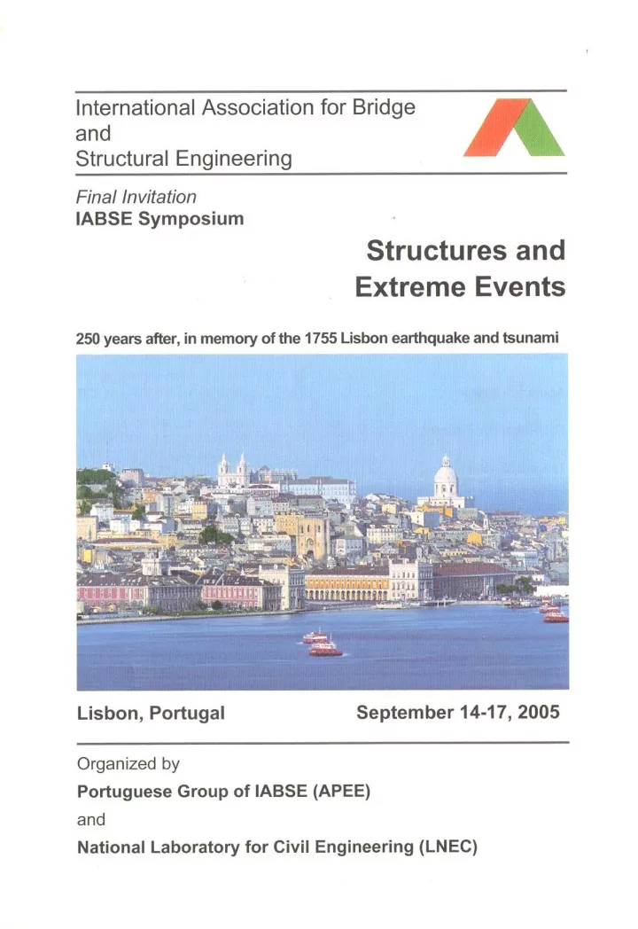
TSUNAMI CONSTRUCTION RISKS IN THE MEDITERRANEAN - OUTLINING MALTAS SCENARIO LISBON 2005 - The Mediterranean region is active with earthquakes and volcanoes, some of them generating tsunamis, 20% which have been damaging. DENIS H CAMILLERI


  1. TSUNAMI CONSTRUCTION RISKS IN THE MEDITERRANEAN - OUTLINING MALTA’S SCENARIO LISBON 2005 - The Mediterranean region is active with earthquakes and volcanoes, some of them generating tsunamis, 20% which have been damaging. DENIS H CAMILLERI - Tsunamis reach local coasts soon after they have been generated, giving little time, 1 to 30 MALTA minutes for warning. The run-up height & inundation zones are important parameters to consider. - Due to the vast development that has occurred around the Mediterranean shoreline over the past century, economic measures are now required to reduce in a reasonable manner the risks from a tsunami event. LIS 123 LIS 123

  2. PHYSICS OF TSUNAMI LISBON 2005 • Tsunami waves are distinguished from ordinary ocean waves by long DENIS H CAMILLERI wavelength often exceeding 100km and time between crests ranging from MALTA 10mins to 1 hour • Wind driven waves have a wavelength of 100m to 200m with time between crests varying from 5 sec to 20 sec LIS 123

  3. BATHYMETRY DATA OF THE MEDITERRANEAN SEA LISBON 2005 • Max. depths encountered in Ionian Sea exceeding 4000m • This is to be compared to 10,000m in the DENIS H CAMILLERI Pacific • In the Tyrrhenium & Ligurian Seas rarely MALTA exceeds 2,000m • Malta plateau between Malta & Sicily & Tunisian Plateau reaching Lampedusa rarely exceeds 200m. • Velocity for a 2,000m depth approximated to 504 km/hr & for a 200m to 159km/hr LIS 123

  4. BATHYMETRY DATA OF THE 72,850 sq m CONTINENTAL SHELF OF MALTA LISBON 2005 • Varies from a gentle slope (1:35) along Pembroke-Salina stretch Marfa Ridge & Dahlet Qorrot to Marsalforn DENIS H CAMILLERI • (1:20) slope Sliema – M’Scala stretch & Ghar Lapsi area MALTA • (1:12.5) slope Comino all round • (1:5) steep slope on the cliff S-W side of Malta & Gozo • Deep waters of 10-18m encountered in 5- figured shape Grand Harbour LIS 123

  5. TSUNAMI FORCES LISBON 2005 • As Tsunami approaches land, the wave slows down, height of wave increases. • Deep water close to the shore hampers the build-up of a high wave DENIS H CAMILLERI • Build-up may be 30m for tsunami waves near earthquake’s epicentre or 15m for tsunamis MALTA of distant origin • Boulders with masses around 200tons can be displaced by tsunami surges only 10m deep • Wind-driven waves not higher than 12m with 15 tons boulders being washed over 4m sea- walls • Flow velocity in recent tsunami ranged from 17- 47 km/hr as compared to 10km/hr for fast LIS 123 flowing river

  6. TSUNAMI MAGNITUDE SCALES LISBON 2005 m=> K o => Runup Comments log 2 H 1/2 log 2 H m -2 i 0.25 Very light –perceptible only on very sensitive tide gauges DENIS H CAMILLERI 0 ii 1.00 Light – noticed by those living along the flat shore 1 iii 2.00 Rather strong – generally noticed due MALTA to flooding of gently sloping coasts. Light sailing vessels carried away on shore. IV 2 4.00 Strong – flooding of the shore to some depth. Solid structures on the coast injured. Coasts littered with floating debris. V 4 16.00 Very strong – general flooding of the shore to some depth. Harbour works damaged. People drowned. Wave accompanied by strong roar. LIS 123

  7. RUNUPS IN METRES WITH THEIR RETURN PERIOD IN YEARS FOR VARIOUS SEAS LISBON 2005 Run Mediterra Black South up- nean/New Sea/Indian America m Zealand Ocean/North /Hawaii/ DENIS H CAMILLERI America/ South West MALTA Caribbean Pacific 10 250 1000 200 15 1000 - 750 20 - - 1000 For wave height < 5m & velocity < 5m/s, tsunami force exceeds 5000 kg/m 2 with windows & masonry panels expected to fail at 10-20% of this LIS 123 level

  8. MEDITERRANEAN TSUNAMI CHARACTERISTICS LISBON 2005 In 365AD an M7.7 in Crete created a tsunami reaching Libya, Egypt, Calabria DENIS H CAMILLERI and as far as Spain – only tsunami to have propagated across entire MALTA Mediterranean 1.5m run up - return period 100 years 4.0m run up - return period 500 years 7.0m run up - return period 1000 years LIS 123

  9. MEDITERRANEAN REGIONS TSUNAMI HAZARDS LISBON 2005 • W. Mediterranean is less prone than EAST DENIS H CAMILLERI • Strongest tsunamis are excited in the Aegean Sea, Hellenic & Calabrian areas MALTA • Greece has had more than 160 events catalogued over 2000 years, although geological record suggests tsunami may have been smaller than described. Even for the 1956 Aegean Tsunami (V) scientific reports considered inaccurate. LIS 123

  10. CENTRAL MEDITERRANEAN REGIONS TSUNAMI HAZARDS LISBON 2005 • 1000AD – 1975AD 70 tsunamis (II – III) 20 tsunamis (IV) return period 50 DENIS H CAMILLERI years 7 tsunamis (V) return period 133 MALTA years 3 tsunamis (VI) return period 350 years • 78 triggered by earth quakes 20 triggered by volcanic eruptions 2 triggered by slumps The above has recently been revised with LIS 123 the 100 entries reduced to 70

  11. WESTERN MEDITERRANEAN REGION LISBON 2005 • Tsunamis triggered by North African earthquakes with epicenies close to shoreline (especially Algerian) DENIS H CAMILLERI Recent catalogue has MALTA 24 entries over period 220BC – 1980AD In France 25 entries over period 200BC – 1991AD, with 21 recorded in the 19 th Century But all tsunami run-up heights do not measure 10’s of cm. LIS 123

  12. HISTORICAL TSUNAMI HAZARD - MALTA LISBON 2005 Agius de Soldanis recounts how the sea at Xlendi • rolled out to about 1 mile sweeping back “con grande impeto e mormorio” (MMXI) 1693 DENIS H CAMILLERI • 1908 Messina (MMXI) flooding occurred an hour later in Msida & M’Xlokk, number of fishing boats damaged MALTA high sea level recorded in Grand Harbour. 1973 a recession occurred in Salina bay lowering • depth by 0.6m event accompanied with rumbling noise • 1983 sea in front of the Msida parish church flooded the road LIS 123

  13. Characteristics of the Principal Mediterranean Tsunamigenic Zones – Soloviev 1990 LISBON 2005 Coastal Region Average Intensity-I Year of Probability recurre AverageMaximal last of next nce Tsunami tsunami (years) N. Aegean 22 2.4 III 1978 Low DENIS H CAMILLERI Eastern Greece 26 3.1 IV 1956 High S. Turkey 18 2.6 III 1961 High Aegean Sea 9 3.7 X 1968 High HellenicIsland arc 21 3.5 VI 1948 High MALTA Cyprus 17? 3.5 V? 1979 Low E Mediterranean 106 3.2 V 1870 Medium W. Greece 14 - VI 1953 High Corinthian Gulf 20 - V 1981 Low Albania 31 3.2 IV 1920 High Yugoslavia 20 3.3 V 1979 Low Venetian Gulf 180? 3.0 VI 1511 - Eastern Italy 52 3.2 V 1889 High Calabria/Sicily 12 3.8 VI 1954 High W. Italy 46 3.5 V 1870 High Ligurian Sea 17 2.8 IV 1914 High Spain 100 3.0 III-IV 1860 High LIS 123

  14. MEDITERRANEAN TSUNAMI VULNERABILITY ASSESSMENT LISBON 2005 Disaster and emergency planners will be interested in determining maximum wave run-ups, horizontal inundation and their effect on wave flooding in terms of numbers of deaths and injuries, the need for response, recovery and rehabilitation activities. This type of flooding disaster would require antidiarrhoeals and DENIS H CAMILLERI antibiotics treatment, together with splints and plaster of Paris for fractures and cuts. Site specific evaluations to tsunami hazard should be drawn up for MALTA large and important risks situated in low-lying coastal areas. These might be defined as <3-5m above sea-level or 7-10m in the case of the most hazardous regions. It is of vital importance that disaster managers have detailed information on which buildings, infrastructural works and groups of people are particularly vulnerable to tsunami impacts. When such data is available, cost effective mitigation measures may be developed and applied. This is to be used as a tool for local planning and to determine post-tsunami emergency disaster response. LIS 123

  15. VULNERABILITY OF THE BUILT ENVIRONMENT LISBON 2005 • Number of storeys on each building • Description of ground floor DENIS H CAMILLERI • Building material age, design MALTA • Building surroundings • Moveable objects • Sociological data • Economic land use data • Land vegetation cover LIS 123

  16. ANTICIPATED TSUNAMI DAMAGE - MALTA LISBON 2005 • Touristic beach concessions & watersports facilities DENIS H CAMILLERI • Yacht marinas • Agricultural land – Pwales/Burmarrad villages MALTA with a shoreline bathymetry slope of 1:100 soil erosion & increase in salinity • Infrastructural power stations harbour works Grand Harbour & M’Xlokk – tieing down of equipment important • Sea craft in bays more at risk than out at sea LIS 123

Download Presentation
Download Policy: The content available on the website is offered to you 'AS IS' for your personal information and use only. It cannot be commercialized, licensed, or distributed on other websites without prior consent from the author. To download a presentation, simply click this link. If you encounter any difficulties during the download process, it's possible that the publisher has removed the file from their server.

Recommend


More recommend