
SLIDE 1
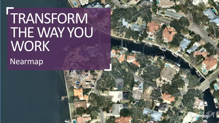
TRANSFORM THE WAY YOU WORK Nearmap WHAT MAKES NEARMAP DIFFERENT? - - PowerPoint PPT Presentation
TRANSFORM THE WAY YOU WORK Nearmap WHAT MAKES NEARMAP DIFFERENT? CURRENT High-res aerial imagery of U.S. urbanized areas are updated frequently CLEAR Nearmap imagery is 2.8 (7cm) GSD CHANGE All historical captures are maintained for easy
WHAT MAKES NEARMAP DIFFERENT?
CURRENT High-res aerial imagery of U.S. urbanized areas are updated frequently CHANGE All historical captures are maintained for easy change detection and analysis CLEAR Nearmap imagery is 2.8” (7cm) GSD CLOUD-BASED HD aerial maps are accessible instantly through the cloud CONSISTENT All forms of Nearmap imagery are provided at the same specs across all locations AWARD-WINNING INTEGRATION
HOW NEARMAP CREATES AERIAL MAPS
LARGE AREA AERIALS
HyperCamera
imagery
from one sensor
SCALABLE PROCESSING
points
INSTANT ACCESS
service
Captured: 1 Oct 2017 Louisville, KY
RAPID, INDUSTRY-LEADING DELIVERY
NEARMAP HYPERCAMERA
Vertical and 4-Way ObliqueImagingSystem
VERTICAL
PANORAMA
OBLIQUE
& width
directions
VERTICAL
PANORAMA
3D derived from high quality imagery
OBLIQUE
images
PANORAMA
without “geo-fencing”
VERTICAL
3D
visualization
DSM
Models
Captured: 13 Dec. 2017 Lutz, FL
Captured: 20 June 2017 Kansas City, MO
from a single patented sensor system consistent across imagery to 3D!
never seen before in mapping industry enable change detection current year!
enables Reality-as-a-Service respond to emerging issues quickly
provides basis for analyzing data in 4D time and location drive fast correlation!
Captured: 20 June 2017 Kansas City, MO
Nearmap in Local Gov.
▪
Fixed Price
▪
3 captures per year
▪
3 Ortho’s, 1 Oblique
▪
11 Historical Captures
▪
GIS/CAD integration
▪
Imagery online in days
▪
Instant access on first day
We capture, manage, and deliver current, consistent location content faster than anyone.
Benefits
▪
Reduce IT costs
▪
No effort to get new captures
▪
Faster Base Layers
▪
Easy Integration via API’s
▪
Seamless Obliques
▪
Offload ML tasks
We capture, manage, and deliver current, consistent location content faster than anyone.
Nearmap - The Right Partner for…
Nearmap 3D
▪ HyperCamera2 ▪ 3D Point Cloud
▪ DSM
▪ 3D Mesh
We capture, manage, and deliver current, consistent location content faster than anyone.
Nearmap 3D
▪ HyperCamera2 ▪ 3D Point Cloud ▪ DSM ▪ 3D Mesh
▪ Offload ML tasks
We created the largest 3D Mesh covering 50%
Nearmap 3D
▪ HyperCamera2 ▪ 3D Point Cloud ▪ DSM ▪ 3D Mesh ▪ Offload ML tasks
better accuracy
We capture, manage, and deliver current, consistent location content fast! Finally allowing your to systematically classify changes that matter in the current year!
3D Mesh in Chicago
Highest-accuracy, fastest turnaround, lowest cost parcel change detection
21
ALL CHANGES
NOT JUST BUILDINGS
< 4 WEEK
TURNAROUND
15¢
PER PARCEL
COMPETITION
Automated Manual
REVIEW RESULTS OUTLINE OLD BUILDINGS OUTLINE NEW BUILDINGS COMPARE OUTLINES
PUSHPIN
SPLIT PROJECT INTO BATCHES AUTOMATICALLY CLASSIFY BATCHES REVIEW BATCHES MANUALLY CLASSIFY ANY REJECTED BATCHES
HOW CAN WE HELP?
22
Automatic classifier
TRAIN USING PUSHPIN PARCEL DATASET
image pairs manually classified as changed or unchanged
(addition, construction, deck, demolished, flatwork, garage, new, other, pool, shed)
3
START WITH A CUSTOM NEURAL NETWORK BASED ON RESNET 50
won the ImageNet Large Scale Visual Recognition Competition (ILSVRC) in 2015
change detection (e.g. supporting two input images)
7x7 conv, 64, /2 3x3 conv, 64 3x3 conv, 64 3x3 conv, 64 3x3 conv, 64 3x3 conv, 64 3x3 conv, 64 3x3 conv, 128, /2
···
Image Pool/2 FC 1000 3x3 conv, 512 3x3 conv, 512 3x3 conv, 512 3x3 conv, 512 3x3 conv, 512 3x3 conv, 512 3x3 conv, 256
···
Average Pool
1
PRETRAIN USING IMAGENET DATASET
ImageNet dataset
everyday objects manually classified into 1,000 categories
2
Fast, Affordable Change Detection
▪ Nearmap & Pushpin ▪ 11 historic captures ▪ Resolution AND leaf-off is
key
▪ New captures online fast ▪ Delivery in 4 weeks ▪ 12 classification types ▪ Detects subtle changes ▪ 15 cents a parcel! ▪ Free for 1000 parcels!
We capture, manage, and deliver current, consistent location content faster than anyone.
Captured: 27 Oct 2017 Roadways near JFK Airport
See latest captures, read blogs, & watch videos Learn more at http://go.nearmap.com