
SLIDE 1
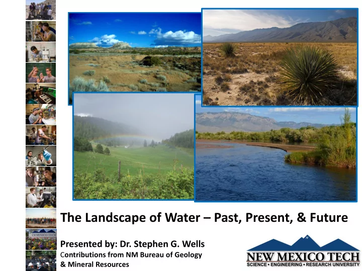
The Landscape of Water – Past, Present, & Future
Presented by: Dr. Stephen G. Wells
Contributions from NM Bureau of Geology & Mineral Resources
The Landscape of Water Past, Present, & Future Presented by: - - PowerPoint PPT Presentation
The Landscape of Water Past, Present, & Future Presented by: Dr. Stephen G. Wells C ontributions from NM Bureau of Geology & Mineral Resources New Mexico Tech at a Glance Our Institution: Our Students: Total Revenue = $144M
Presented by: Dr. Stephen G. Wells
Contributions from NM Bureau of Geology & Mineral Resources
Our Institution:
government (among the lowest in NM)
including faculty, researchers, staff
nationwide among all universities in value in Engineering & Physics.
Mexico, No. 1 in the Southwest, and 17th among all public universities nationally. Our Students:
undergrad; 610 grad
American Native (undergrad)
retained following fall semester
at NMT
State Universities By Salary Potential for graduating students
Blue = Public Universities Black = Private
playa floor Latest Pleistocene to Holocene Shorelines Historic Shorelines Latest Pleistocene to Modern Shorelines of Lake Mojave, Silver Lake Basin, CA Pleistocene & Modern Groundwater Levels Sinkhole Plains, KY
(from K.E. Trenberth, et al, 2007, 2011)
Drainage Basin Systems: Owens River (glaciated mts.) Amargosa River (continental interior) Mojave River (unglaciated coastal
mts)
Continental Scale Drainage Basins in Arid Southwestern USA: Past & Present Hydrologic Systems
1938 flood event lake level
(from Wells et al, 2003; Enzel & Wells, 1997)
Late Quaternary Paleohydrology of the Eastern Mojave River Drainage, Southern California: Quantitative Modeling of Late Quaternary Hydrologic Cycle in Large Arid Watersheds; U.S.G.S. and NM Water Resources Research Institute; 1986-1989
Oblique aerial photo of Silver Lake playa during 1938 flood event
11.4 ka - 8.7 ka = Intermittent III 13.7 ka – 11.4 ka = Mojave II 16.6 ka – 13.7 ka = Intermittent II (15.5 ka – 14.6 ka = major drying event) 18.4 ka – 16.6 ka = Mojave I 22.6 ka – 18.4 ka = Intermittent I to Incipient 8.7 ka – present = Holocene 16.6 ka – 13.7 ka = Intermittent II (from Brown, 1989; Wells et al, 2003) Estimated Ages of Lake Phases Silver Lake Basin, CA
(from Brown, 1989; Enzel, 1990; Enzel & Wells, 1997)
January 1916 flood inundating Silver Lake town. (from Enzel, 1990; Enzel & Wells, 1997)
(from Enzel, 1990; Enzel & Wells, 1997)
Modeling Results of 4 Different Hydrologic Conditions and Associated Climatic Scenarios
(from Enzel, 1990; Enzel & Wells, 1997)
Modern extreme flood & lake-building events form basis for
paleohydrologic analysis of pluvial lakes
Using simplified precipitation-discharge/evaporation model, infer late
Pleistocene hydrologic conditions resulting in lake filling and overflow to Death Valley
We infer that late Pleistocene hydrologic regime lies between following
conditions:
50% increase in precipitation in headwater catchments resulting in
annual flood events & 3 times flood Q of modern extreme events with 50% decrease from modern evaporation
100% increase in catchment precipitation with 50% decrease in
modern evaporation from modern with annual floods 2 times Q of modern extreme
Recent geologic past
provides critical perspective
variability of the hydrologic cycle and the landscape of water
Use of modern hydrologic
conditions to model past systems
Quantifying changes in
hydrologic cycle over time provides a framework for understanding the potential boundaries/limits on future conditions
(NASA)
“When Samuel Taylor Coleridge wrote “water, water, everywhere, nor any drop to drink,” he did not have the 21st century’s global water situation in mind. But allowing for poetic license, he wasn’t far from correct. Today, the availability of water for drinking and other uses is a critical problem in many areas of the world.” National Academy of Engineering, 2017
Some Global Facts:
for more deaths in the world than war.
today do not have adequate access to water.
basic sanitation, for which water is needed.
population does not have access to safe drinking water, and hence is afflicted with poor health.
5,000 children worldwide die from diarrhea-related diseases, a toll that would drop dramatically if sufficient water for sanitation was available.
* National Academy of Engineering, 2017
Polluted Fresh
each dot represents 1 million people each dot represents 1 million people Maps are from an article by John H. Tanton, "End of the Migration Epoch," reprinted by The Social Contract, Vol IV, No 3 and Vol. V, No. 1, 1995.
each dot represents 1 million people Maps are from an article by John H. Tanton, "End of the Migration Epoch," reprinted by The Social Contract, Vol IV, No 3 and Vol. V, No. 1, 1995.
Maps are from an article by John H. Tanton, "End of the Migration Epoch," reprinted by The Social Contract, Vol IV, No 3 and Vol. V, No. 1, 1995.
Maps are from an article by John H. Tanton, "End of the Migration Epoch," reprinted by The Social Contract, Vol IV, No 3 and Vol. V, No. 1, 1995. dot represents 1 million people
each dot represents 1 million people Maps are from an article by John H. Tanton, "End of the Migration Epoch," reprinted by The Social Contract, Vol IV, No 3 and Vol. V, No. 1, 1995.
Maps are from an article by John H. Tanton, "End of the Migration Epoch," reprinted by The Social Contract, Vol IV, No 3 and Vol. V, No. 1, 1995. dot represents 1 million people
beginnings of agriculture first irrigation first dam constructed documentation of air pollution pollution of rivers by Romans
Seager et al., 2007
Modern Drought Conditions
century due to a combination
human forcing.
Saharan and southern Africa, eastern Brazil, and Iran (brown) (Map adapted from the IPCC Fourth Assessment Report.).
“widespread agreement that Southwestern North America - and the subtropics in general - are on a trajectory to a climate even more arid than now” “In the Southwest the levels of aridity seen in the 1950s multiyear drought, or the 1930s Dust Bowl, become the new climatology by mid-century: a perpetual drought” - Seager et al., 2007
Dust Bowl, USA: National Archives 114 SC 5089
“ The Dust Bowl… happened in New Mexico in t wo ways. First , t he nort heast ern part of t he st at e was affect ed as a kind of ext ension of t he Oklahoma
econd, New Mexico (especially Tucumcari and Albuquerque) was on t he rout e of escape from t he Dust Bowl. S
had first hand experience of t he largest migrat ion in U.S . hist ory.” (from S anta Fe Journal, 5/ 17/ 2009) The Road West , New Mexico, by Dorothea Lange (1935)
into rivers and streams are another expected consequence of climate change by the late 21st Century.
runoff in blue, and decreases in brown and red.
Chris Milly, NOAA Geophysical Fluid Dynamics Laboratory.)
A "bathtub ring" of white rock marks a 39-meter drop in the water level
1985 2010 16km 1985 Colorado River & Lake Mead
Warming - thermometers (NOAA coop
surface data network)
Warming - thermometers (NOAA upper air
data network)
Warming - thermometers (subsurface,
western boreholes)
Snowpack decrease in spring months
(Snotel network)
More rain / less snow in winter months
(NOAA coop network)
Earlier snowmelt runoff pulse (date shift,
USGS stream gage network)
Earlier blooming of lilacs and honeysuckles
(phenology networks)
Mountain glacier recession and mass loss Upward movement of plant / animal
habitat zones
Warmer river and lake temperatures
Landscape Responses to Drought:
Changes to River Systems Increased Wildfire Frequency
<10” to >20”, with wide annual variation
streams)
variability
AND quality
Surface water 55% Groundwater 45% Agriculture uses ~79% of water resources
Water use in 2010 from Longworth et al., 2013
Climate change = less water
recharge to groundwater
abundant.
availability can be highly variable spatially, seasonally and annually.
delivery and compact agreements
the available groundwater in storage in most regions, and its water quality
adequate data to characterize the basic hydrology and geologic framework of the basin or region
“Challenge is the pathway to engagement and progress in our lives.” Brendon Burchard
US Bureau of Reclamation, Los Alamos NL, Sandia NL, US Bureau of Indian Affairs, US Fish & Wildlife Service, US Bureau of Land Management, US Forest Service, NASA
Districts, Water Utilities, Tribes
Statewide Water Assessment
and WRRI
RESULTS
declines in eastern NM, Pecos Slope, Mimbres, Tularosa, Albuquerque, and Mesilla Basins.
due to sparse data
PI: Alex Rinehart, NMBGMR
NM TECH COLLABORATIONS TOWARD STATE WATER CHALLENGES
biogeochemical processing Goals:
river hydrogeomorpohology and its cumulative influence on water quality
changes to water quality
and transport in US rivers
PI: Jesus Gomez-Velez, E&ES
after Gomez-Velez et al., WRR, 2014 and Harvey & Gooseff, WRR, 2015
Statewide Groundwater Recharge Model
Statewide Water Assessment
and WRRI
Mountain Block Recharge Model
WRRI and NSF
Uranium in Groundwater near Mines
Energize New Mexico
San Juan College and Navajo Tech
Deep Basin Characterization
San Agustin Plains-Upper Alamosa Creek Hydrogeology
limited funding
Healy Foundation, USGS National Cooperative Geologic Mapping Program (Statemap), and NMOSE
Hydrologic model of the Rio Hondo watershed, Taos, NM.
Leveraging the challenges in water resource management with state- wide intellectual capital in water sciences to:
industry R&D
businesses in water resources and technology space
and development for managing water resources at state, national & global level.
technological solutions to mediate future changes in the hydrologic cycle and water resources
New Mexico has an
abundance of challenges and talent in understanding state-wide, national and global challenges in water resources
New Mexico’s collaboration
and growing knowledge base is exceptional in the space of water resources and technology
Leveraging of talent,
collaboration, and knowledge base could allow New Mexico to lead in Innovation-Based Economic Development in WATER!
WaterStart was established in 2013 to address these issues. With world- renowned experts at the helm, WaterStart is poised to become a leading resource for global and municipal water management and sustainability