
SLIDE 1
The Future in the Environmental Field is Looking Down Aerial - - PowerPoint PPT Presentation
The Future in the Environmental Field is Looking Down Aerial Photographys Origins The first known aerial photograph was taken in 1858 by French photographer and balloonist Gaspar Felix Tournachon (aka- Nadar). Nadar patented the idea of
Aerial Photography’s Origins
The first known aerial photograph was taken in 1858 by French photographer and balloonist Gaspar Felix Tournachon (aka- Nadar). Nadar patented the idea of using aerial photographs in mapmaking and surveying, but it took him 3 years Of experimenting before he successfully produced the very first aerial photograph.
Aerial Photography’s Origins
Kites used in 1882 Pigeons used in Germany in 1903 Rockets used in 1897 by Alfred Nobel
Aerial Photography’s Origins
First photograph from an airplane in 1909 by Wilbur Wright Fairchild created first aerial map of Manhattan Island in 1921. First non- military purpose aerial photograph with Widespread commercial success.
Drones have become the newest, fairly low-cost and effective tools for environmental practitioners and property managers.
controlled by ‘pilots’ from the ground or increasingly, autonomously following a pre-programmed mission. While there are dozens of different types of drones, they basically fall into two categories: those that are used for reconnaissance and surveillance purposes and those that are armed with missiles and bombs.
A British Military Magazine “Dronewars.net” Definition
camera, monitor or smartphone.
fully charged? Is it too cold to fly?
permission.
and firework shows.
distract drivers.
Environmental, Engineering, Property Management, Construction, Disaster Response
that makes them economically efficient
landmarking makes pictures more technically useful
effectively within established guidelines
Lightweight Take video and still photography Purchase for under $1,500
commercial 500 meters 2 km range on small commercial Easily controlled with GPS reference (home)
Disaster Response + Search and Rescue + Marine Search and Rescue + Wildfire + Flooding + Damage assessment + Rapid response / 911 + Emergency Uses (delivery of equipment e.g. Defibrillator) + Surf Lifesaving (floatation delivery) + Fire Detection (e.g. fire towers)
+ Carbon capping + Renewable energy + Environmental Monitoring (dumping) + Waterway Monitoring + Ice Flow Monitoring + Parks (Asset management) + Wildlife Conservation + Conservation drones + Wildlife counts / Mapping of animal population + Anti-Poaching + Marine Biology – Whale health
monitoring
Construction / Pre-construction + Virtual view from new construction (Vantage Point) + Aerials documenting whole site + Construction Planning – Identify potential issues. + Construction Progress Monitoring + Marketing for Construction + Surveying
Engineering + Civil Engineering Design Mapping + Asset monitoring (Bridge maintenance needed?) + Photogrammetry Services + Measurements (Lidar Services) + Digital elevation modeling + 3D Feature extraction / Contour generation + Thermographic Imaging + Lidar Services Mining / OIL & GAS + Oil spill tracking + Pipeline monitoring + Environmental assessment + Pit Survey Miscellaneous + Natural History Surveys GPS/time/mapping. + Image Geo-referencing + Google map & Google earth mapping + Marine Algae bloom and Proliferation Detection
Plume Monitoring Wildlife Surveillance Fire “Hot Spots” “Wilder” Life Surveillance
Nest Relocation Pollution Monitoring
Initial uses were primarily promotional and marketing
Staff researched what was out there and at what cost. DJI Phantom 3 Professional was determined best bang for buck for us. Examined issues like fly-aways; ease of use; technical requirements; etc…
Established a preliminary budget of $1500 to get us into market
Fairly soft market, locally. Priced online through three local large chain outlets.
Purchased our through Staples based on cost/availability and supplier
Staff had to train via DJI Users Manual
$100,000 liability insurance required
Includes Transport Canada Exemption; Insurance Verification; Release Notes/Update Records; Quick Start Guide; User Manual; Pilot Training Guide; Key literature
Cap Monitoring Resource Monitoring
Property Inspection
Sydney RibFest Action Week Fireworks OHP Flags of Remembrance
Sydney River Dam
Pictou Wharf
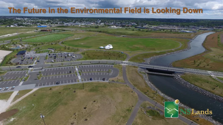
Harbourside Commercial Park Standpipe Grand Lake Water System Tank
TIR Tank Marconi Campus
Donnie.Burke@novascotia.ca