
SLIDE 1
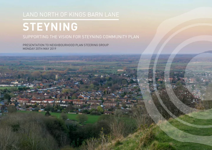
LAND NORTH OF KINGS BARN LANE
STEYNING
SUPPORTING THE VISION FOR STEYNING COMMUNITY PLAN
PRESENTATION TO NEIGHBOURHOOD PLAN STEERING GROUP MONDAY 20TH MAY 2019
STEYNING SUPPORTING THE VISION FOR STEYNING COMMUNITY PLAN - - PowerPoint PPT Presentation
LAND NORTH OF KINGS BARN LANE STEYNING SUPPORTING THE VISION FOR STEYNING COMMUNITY PLAN PRESENTATION TO NEIGHBOURHOOD PLAN STEERING GROUP MONDAY 20TH MAY 2019 01 Introduction Richborough Estates Developer In-house planning and design
SUPPORTING THE VISION FOR STEYNING COMMUNITY PLAN
PRESENTATION TO NEIGHBOURHOOD PLAN STEERING GROUP MONDAY 20TH MAY 2019
Winsford Neighbourhood Plan
Richborough Estates
builders Sites
Neighbourhood Planning experience
Plan Groups and cooperation with many
Neighbourhood Plans
Cheshire Local Neighbourhood Plan Engagement with key stakeholders and local community Design Codes and development briefs
sound basis for Reserved Matters
Eccleshall Neighbourhood Plan
N W E S
Greenfield site
Agricultural and pasture land
Additional land in ownership
Situated rear of Glebe Farm
Situated adjacent to built up (residential) edge of Kings Barn Lane
Situated outside the South Downs National Park Steyning Bypass borders to the west Access to existing footways and wider public footpath network to the north, south and west
Site boundary Other land in ownership Parish boundary Built Up Area boundary Scheduled Monuments South Downs National Park
600m - approx. 7 minute walk
right of way network
800m - approx. 10 minute walk
store/ supermarket
Linkages
Downs Link - east
N W E S
400m 800m 1200m 1600m 400m 800m
Topography
Views
footpaths
Church
such as Steyning Round Hill Built Heritage
within site
Landscape and ecology
Utilities
JARVIS LANE
The Site
R O M A N R O A D K I N G S B A R N L A N E S T E Y N I N G B Y P A SS A B B E Y R O A D
N W E S
Site and contextual views
1 2 3 4
Preserve & enhance heritage
settlement edge
landmarks into new streets and open spaces
patterns into public open space
High quality housing which meets local needs and aspirations
affordable homes
complements existing character
home
lasting appeal
proud of
Support local facilities & services
such as the footpath crossing Steyning Bypass
sustainable modes of travel
service via S106 financial contributions
existing schools and health facilities
facilities via Steyning Neighbourhood Plan
Improve and enhance connections
places helping movement from one place to another
which promote wider footpath network and connections to local facilities
service via S106 financial contributions
Encourage social interaction
spaces for new and existing communities
stop and meet
green spaces
that respect privacy of existing homes
Supporting local economy
indirect)
period
expenditure by new community
services such as broadband/ internet connections
Site boundary Highway land Existing Proposed footpath link
N W E S
Proposed roundabout junction to be lit. Lighting design to be provided at detailed design stage Existing service lay-by to be realigned. Additional signage to be provided to prevent parking for non- service vehicles Proposed footway link to connect to existing
footway to be graded at 1:20 to tie in to bottom
Potential for additional stepped access to connect to proposed footway link Existing foliage within forward visibility splays to be trimmed or removed to ensure visibility can be provided in line with DRMB guidance
215m Forward visibility 215m Forward visibility
Quantum
dwellings
50 additional dwellings Housing type and mix
bedroom houses
provision, including starter homes Density
dwellings per hectare Building heights
N W E S
Principal access
Highways Authority
Other access
Street hierarchy
forms of Steyning
surfaces
landmark buildings- wayfinding
Pedestrian connections
and cycle route
across Steyning Bypass
increased accessibility
N W E S
Linked public open space
hedgerows and trees
existing landscape features
ecology and biodiversity
Equipped play
Natural play Community Orchard Wildlife corridor & sustainable drainage Green buffers and extended new garden spaces
Glimpsed view to
Church
N W E S