status of the optical payload and processor development
play

Status of the optical payload and processor development of ESAs - PowerPoint PPT Presentation

Status of the optical payload and processor development of ESAs Sentinel 3 B. Berruti, J. Frerick, C. Mavrocordatos, J. Nieke , H. Rebhan, J. Stroede and the S3 Team, European Space Agency, ESTEC, Keplerlaan 1, 2200AG Noordwijk ZH, The


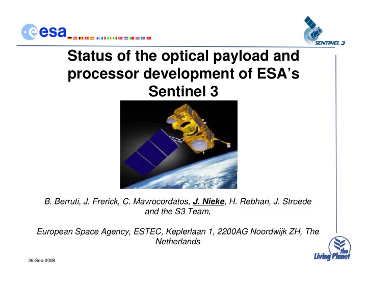
  1. Status of the optical payload and processor development of ESA’s Sentinel 3 B. Berruti, J. Frerick, C. Mavrocordatos, J. Nieke , H. Rebhan, J. Stroede and the S3 Team, European Space Agency, ESTEC, Keplerlaan 1, 2200AG Noordwijk ZH, The Netherlands 26-Sep-2008

  2. Outline - Programmatics - Satellite / Orbit - Optical Payload - Key Processors - Conclusion 26-Sep-2008

  3. ESA GMES Space Segment Definition of 5 series of satellite missions: – Sentinel 1: C-band SAR (possible 2 satellite constellation) – Sentinel 2: Super-spectral Imager at 10-30 m resolution – Sentinel 3: Altimeter plus multi-spectral Vis/IR imager (OC & SST) – Sentinel 4: Atmosphere Monitoring from geostationary orbits – Sentinel 5: Atmosphere Monitoring from low-earth orbits S1 S2 S3 S4 S5 Marine & Coastal Environment * * * Land Cover state & changes * * * Global Change Issues * * * * * Atmos. Pollution Management * * * Risk Management * * * Forest Monitoring * * * Food Security * * * * * Marine Security * * Humanitarian Aid * * * 26-Sep-2008 3

  4. Mission Overview Sentinel- 3 is designed to become an operational mission in low earth orbit. Sentinel-3 will provide consistent, long-term collection of remotely sensed Marine and Land data to support operational services. 26-Sep-2008

  5. Marine Services 26-Sep-2008

  6. Land Services 26-Sep-2008

  7. Mission Overview Sentinel-3 implements three core P/L systems in continuity of existing ones, delivering: 1. Sea and land colour data, at least at the level of quality of the Medium Resolution Imaging Spectrometer (MERIS) instrument, 2. Sea and Land surface temperature, at least at the level of quality ( ε < 0.3K) of the Advanced Along-Track Scanning Radiometer (AATSR) instrument, 3. Sea surface topography data, at least at the level of quality of the Radar Altimeter (RA) system. In addition, the foreseen optical payload will allow to a certain degree - data continuity of the Vegetation instrument (on SPOT4/5), - enhanced fire monitoring capabilities. Operational aspects: - Global ocean coverage in 1 to 3 days (taking into account sun-glint), and co-registration of Color and Temperature measurements - NRT data delivery (< 3 hours) for fundamental products 26-Sep-2008

  8. Orbit and S/C Orbit characteristics - Average altitude ~815 km MWR MWR - LTDN between 10 – 10:30 OLCI -Near-Polar frozen Sun-Synchronous -(98.6 deg. inclination) SLSTR - 27 days exact repeat cycle - 4 day global coverage (optical DORIS - mission) with 1 Satellite (less than - 2 days with two Satellites) X band antenna X band antenna Main satellite characteristics - 1198 kg maximal mass - Volume in 3.89 m x 2.202 m x 2.207 m SRAL antenna SRAL antenna - Average power consumption of 1100 W LRR LRR - 7.5 years lifetime (fuel for 5 add. years) S band antenna - Large cold face for optical instruments Observation Data Management - thermal control - 200 Gb of observation data per orbit - Modular accommodation for a simplified - Space to ground data rate of 450 Mb/s - management of industrial interfaces - 1 contact per orbit - Launch second half 2012 - 3h timeliness 26-Sep-2008

  9. Industrial Team SLSTR related ITTs: FPA (Selex Galileo) - IR Detectors - Vis Detectors - Cryo Cooler - CPE Selex Galileo OME (Jena Optronik) - Structure - Black bodies - Visible Calibration Unit - Thermal Hardware - Telescope optics - Scanner Mechanisms - Flip mechanism - OME/EGSE … 26-Sep-2008

  10. Data Acquisition Geometry Instrument operations are repetitive according to the satellite position - SLSTR incl. nadir & backward view - OLCI FOV optimised to avoid sun glint - SLSTR & OLCI will be available as L1C co-registered product - SLSTR (IR channels) and TOPO are always acquiring data - SRAL modes are fixed over specific geographical zones 26-Sep-2008

  11. Coverage & Timeliness - Coverage: Ocean surface: < 4 days (with Sun-glint, without clouds) Land surface: < 2 days (without Sun-glint and clouds) - Timeliness: Level 1: NRT 3 hours product, assuming 1 hour for ground processing and 2 hours for satellite acquisition and downlink 1 S/C 2 S/C Max. of Longitude Sea 4.0 2.0 Averaged Land 3.0 1.0 Maximum Rev. Time Max. of Longitude Sea 3.8 1.9 Averaged Land 1.4 0.8 Mean Rev. Time Coverage performance (in days) of the OLCI OLCI mean revisit time map (14+7/27 orbit), with 1 satellite. payload on sea and land with 1 and 2 spacecrafts: 26-Sep-2008

  12. Ocean & Land Color Instrument (OLCI) VIS-NIR programmable imaging spectrometer: – 5 cameras in fan-shaped form, – overall instrument FoV is 68.5 degrees, i.e., ~1300km – instrument assembly tilted by about 12 deg across-track away from Sun avoiding sun-glint effects. 26-Sep-2008

  13. OLCI Technical: Basic set-up: 5 fan-arranged Camera Optical Sub Assemblies (COSA), 5 Focal Plane Assemblies (FPA), 1 Scrambling Window Assembly (SWA), 5 Video Acquisition Modules (VAM), 1 OLCI Electronic Unit (OEU) managing all the instrument functions, 1 calibration assembly allowing a radiometric and spectral calibration. OLCI Optical layout 26-Sep-2008

  14. OLCI Performance Spectro-radiometric performance req.: Absolute radiometric accuracy < 2% Stability (during day time part of the orbit) < 0.1% < 0.0014 μ m Spectral misregistration Inter-channel spatial co-registration < 0.4 FR SSD (400 - 900 nm) Inter-channel radiometric accuracy < 1% Out-of-band signal < 1% Polarization sensitivity < 0.01 Geometric performance req.: – FOV: 68.4º – Sampling Distance (in km): Open Ocean 1.2 1.2 RR Coastal Zone 0.3 0.3 FR Land 0.3 0.3 FR – Distortion < 1.4 % – MTF > 0.28 (at Nyquist) 26-Sep-2008

  15. OLCI (vs. Meris) Bands λ center Band # Width Lref Lsat radiance SNR nm nm W/(m².sr.µm) Lsat/Lmax W/(m².sr.µm) [-] additional bands still O1 400 15 62.95 0.8 413.5 2188 subject to O2 412.5 10 74.14 1 501.3 2061 change for O3 442.5 10 65.61 0.8 466.1 1811 better app/s, O4 490 10 51.21 0.8 483.3 1541 SNR/s and O5 510 10 44.39 0.8 449.6 1488 data-rates. O6 560 10 31.49 1 524.5 1280 O7 620 10 21.14 0.8 397.9 997 O8 665 10 16.38 0.8 364.9 883 O22 673.75 7.5 15.70 1 443.1 707 O9 681.25 7.5 15.11 0.8 350.3 745 O10 708.75 10 12.73 0.8 332.4 785 O23 767.5 2.5 7.58 0.68 250.0 330 O11 753.75 7.5 10.33 1 377.7 605 O14/15 778.75 15 9.18 0.8 277.5 812 O12 761.25 2.5 6.09 1 369.5 232 O13 764.375 3.75 7.13 1 373.4 305 O16/17 865 20 6.17 0.8 229.5 666 O18 885 10 6.00 1 281.0 395 O19 900 10 4.73 0.9 237.6 308 MERIS heritage O20 940 20 2.39 0.7 171.7 203 OLCI new bands O21 1020 40 3.86 0.8 163.7 152 26-Sep-2008

  16. Comparison MERIS-OLCI Close heritage to MERIS (spectral bands - and radiometric performances) Improvement of MERIS performances: - number of spectral bands (from 15 to 21) - Reduced sun glint by camera tilt in west direction - Full Resolution (FR, 300m) also over land/ocean, - Reduced Resolution (RR, 1200m) over Ocean binned on ground (L1B) - improved stray light characterisation - improved coverage Ocean < 4 days, Chlorophyll Atlas of the Land < 3 days (MERIS eff. 15 days!) North Sea (MERIS) - Timeliness: 3 hours NRT Level 1 product - 100% overlap with SLSTR => improved L2 products (e.g., Cla, PFTs, HAB, Transparency, Sediment loading, Turbidity, NDVI, MGVI, MTCI, faPAR, LAI) 26-Sep-2008

  17. Sea and Land Surface Temperature Radiometer (SLSTR) SLSTR Objectives - Strong heritage from - A(A)TSR (spectral - channels and rad. - performances) - Continue high precision IR SST series from A(A)TSR! - Land Surface - Temperatures - Surface albedo over - water/land - Synergy between OLCI and SLSTR (new products) - For Level 2 products, same or better performance as ENVISAT - Support of VEGETATION-type products (option) - IR channels adapted to support Fire Monitoring (option) 26-Sep-2008

  18. SLSTR Swath Geometry • 2 observation views (dual view): – Near-nadir view: FOV allowing a swath: ~1700km – Inclined view with an OZA of 55º, i.e., swath: ~750km • looking in backward direction • On ground resolution (SSD): – 500 m (solar, 0.55-2.2 μ m) – 1000 m (TIR, 3.7/10.95/12 μ m) • Inter-channel spatial co-registration: < 0.1 SSD 26-Sep-2008

  19. SLSTR Overview Technical: - 7 AATSR & 2 additional bands -(1.375 , 2.2 μ m) - NEDT < 0.08K (TIR) - SNR = 20 (solar @ L min ) - Absolute accuracy < 2-5%, 0.2K - Radiom. Stability < 0.1%, 0.08K - Polarisation sensitivity < 0.07 Compared to AATSR: - 3 instead of 1 mechanism - (2 scanners and one flip mechanism) - More complex front-end and electronics - New detector technology (multiple pixels) 26-Sep-2008

  20. Instrument Principle - dual view, each having its own scanner (flat scan mirrors) - scan of 2 x Earth and calibration sources (BBs, VISCAL) - views are seen by the front collecting and refocusing optics (Primary Mirrors) - recombination optics to bring 2 optical paths into a single set of Focal Plane Assemblies (FPA) after a common field plane used as intermediate field stop - FPA consists of a cryogenically cooled dewar, hosting the 6 (SW)IR and 3 VIS bands 26-Sep-2008

Download Presentation
Download Policy: The content available on the website is offered to you 'AS IS' for your personal information and use only. It cannot be commercialized, licensed, or distributed on other websites without prior consent from the author. To download a presentation, simply click this link. If you encounter any difficulties during the download process, it's possible that the publisher has removed the file from their server.

Recommend


More recommend