
SLIDE 1
SPRINGFIELD GARDENS/SOUTH JAMAICA TRANSPORTATION STUDY PUBLIC - - PowerPoint PPT Presentation
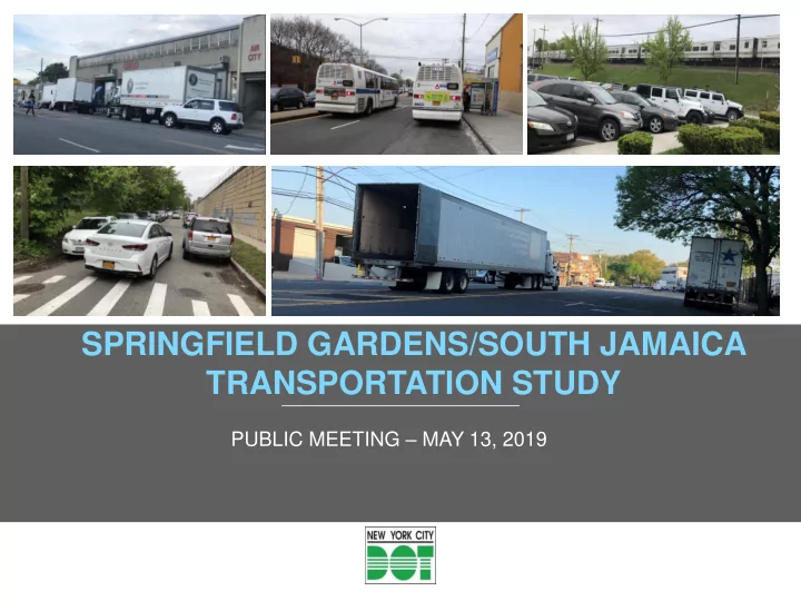
SPRINGFIELD GARDENS/SOUTH JAMAICA TRANSPORTATION STUDY PUBLIC MEETING MAY 13, 2019 STUDY OVERVIEW 1 2 nyc.gov/dot STUDY GOAL & OBJECTIVES Goal: The goal of the study is to improve travel conditions for all street users and to
nyc.gov/dot
2
nyc.gov/dot
3
nyc.gov/dot
4
Data Collection Study Initiation & Scope of Work Existing Conditions Analysis (Problem Identification & Short Term Recommendations) Future Conditions Analysis & Long Term Recommendations Community Input Develop and Evaluate Improvement Measures Draft Final Report Final Report We are here Meetings Presentations Web Portal/E-mails Project Development, Design and Implementation
nyc.gov/dot
5
DOWNTOWN JAMAICA TRANSPORTATION STUDY
N Conduit Av
Legend
Springfield Gardens/S. Jamaica Study Boundary Springfield Gardens/JFK Study Boundary Downtown Jamaica Transportation Study
CROSS ISLAND PKWY
SPRINGFIELD GARDENS/ JFK TRANSP.STUDY (Completed)
BELT PKWY
JFK
SPRINGFIELD GARDENS/ SOUTH JAMAICA TRANSPORTATION STUDY
nyc.gov/dot
6
nyc.gov/dot
7
CD12 CD13
Expressway/Parkway Major Arterial Local Connector Community District Boundary Legend
nyc.gov/dot
8
nyc.gov/dot
9
2015 Demographics:
59,254 58,857 59,447 60,155 60,286
58,500 59,000 59,500 60,000 60,500 2000 2010 2015 2020 2025
Population Journey to Work by Mode
nyc.gov/dot
10
(PM – Worst Peak Period)
Corridors with Highest Traffic Volumes:
Legend
Approach Volume High Volume (1000+)
905 1785 740 1970
nyc.gov/dot
11
Legend
LOS F (80+ secs of delay) LOS E (55-80 secs of delay)
(PM - Worst Peak Period)
nyc.gov/dot
12
Through Truck route Local Truck Route Industrial / JFK IBID Commercial Study Area boundary
Legend JFK IBID JFK IBID
nyc.gov/dot
13
(AM - Highest Peak Period) 630 515 365 300 350 530 300 Pedestrian Volume > 300 100 - 300 < 100
High pedestrian volumes correspond to trip generating land uses (Schools, Transit Hubs/stations, Commercial uses, Parks)
nyc.gov/dot
14
2014(M) 2014(M) 2015(P) 2015(P) 2015(M) 2015(M) 2015(P) 2017(M) 2017(M) 2018(P) 2019(P) 2012(P) 2012(M) 2012(M) 2013(P) 2013(P)
Vision Zero Priority Corridor (2) Vision Zero Priority Intersection (3) High Crash Location (3) Fatality 2012-2019 (16)
(M- Motorist, P- Pedestrian, B- Bicyclist)
Legend
2012-2015 Average 3 fatalities per year 2016-2019 Average 1 fatality per year (after Vision Zero Plan initiated)
nyc.gov/dot
15
Focus Area 1
> 95% 80 – 95% < 80% Metered Parking Focus Area
Parking Utilization
Major Corridors – 83% (AM) | 85% (PM) Focus Area 1 (Industrial) – 85% | 88% Focus Area 2 (LIRR) – 92% | 95% Focus Area 3 (LIRR) – 94% | 96%
Focus Area 2 Focus Area 3
nyc.gov/dot
16
LIRR LIRR
Legend Bus route (11) LIRR line/station (2)
3
nyc.gov/dot
17
2,000 4,000 6,000 8,000 10,000 12,000 14,000 Q3 Q5 Q6 Q7 Q77 Q85 Q111 Q113 Q114 X63 QM21
Top 4 Bus Ridership Routes & O&D: Q111: Jamaica to/from Rosedale Q85/Q5: Jamaica to/from Rosedale/Green Acres Q6: Jamaica to/from JFK Q113: Jamaica to/from Five Towns & Far Rockaway
Travelers per day Bus lines (Passing through Study Area)
nyc.gov/dot
18
nyc.gov/dot
19
ISSUES:
parking); COMMUNITY INPUT:
nyc.gov/dot
LIRR Stations contribute to pedestrian trips and high parking demand
Congestion Safety High Curb Usage LIRR Station Area
Legend
20
nyc.gov/dot
21
18 Intersections w 1+ Approach LOS E 5 Intersections w 1+ Approach LOS F 7 Intersections+ 300 Pedestrian AM Volume 4 VZ/HC Intersections 3 Approaches E/F 2 Approaches E/F 1 Approach E/F
+ 300 Pedestrians (AM) VZ/HC Intersection
Legend
nyc.gov/dot
22
nyc.gov/dot
23
Implemented/or to be implemented: Street Improvement Project Intersection improvement Signal re-timing corridor Bus Priority Candidate Bicycle lane All-Way Stop Control Installed traffic signal Truck route S
S
nyc.gov/dot
24
Potential locations for improvement: Corridor / Intersection (14) Signal timing adjustment (7) One-way Conversion (3) Parking regulation change (22) Bus Stop relocation (2) Truck route (1)
S
S S S S S
D: Intersection Improvement- Foch Blvd & 167/Smith Sts A: Corridor Improvement- Baisley Blvd B/C: Area of Improvement- Laurelton LIRR Station JFK
S S
nyc.gov/dot
25
See detail A
Potential improvement: Corridor Intersection (3) Signal timing modification (3) One-way Conversion (1) Parking regulation change (4) Loading/unloading zone (1)
S
S S S
nyc.gov/dot
26
Proposal:
Proposal:
Proposal:
Farmers Blvd & 125th Ave
Existing Proposed
Issues:
channelization
Issues:
WB through movement
Issues:
(WB LT phase exists but no designated LT lane)
crosswalks
PS 354
LIRR Overpass
Playground
LIRR Overpass
PS 354
Playground
nyc.gov/dot
27
Potential locations for improvement: LIRR Station Area Intersection Request for All-Way Stop One-way Conversion Parking regulation change N N Conduit Av
See detail C See detail B
nyc.gov/dot
Potential improvements:
Conduit Ave
143rd Aves Issues:
Conduit Ave at 225th St
Existing Proposed 28
nyc.gov/dot
Proposed
Issues:
roadway on 141st Av
Potential improvements:
calming/safety
NB/SB approaches & install crosswalks/ADA ramps
Existing 29
nyc.gov/dot
Issues:
unstriped
Potential Improvements:
corner to shorten crosswalks
PS 140 - 1 block north at 116th Av & 167 St
30
nyc.gov/dot
31 Street segments selected for potential one-way conversion
Legend
Potential One-way Conversion
Study Area Boundary
161st Pl btw Baisley Blvd & 222nd St Smith St btw 165th St & 120th Ave Prospect Ct btw 225th & 224th Sts
nyc.gov/dot
32
Proposed Existing: Prospect Ct, looking SB
N Conduit Ave
Issues:
way with parking on both curbs.
Proposal:
Existing: Prospect Ct, looking NB
24’
Existing
nyc.gov/dot
Proposed
33
Issues:
two-way with parking on both curbs (no regulations).
Proposal:
Existing: 161st Pl, looking NB Existing: 161st Pl, looking SB Existing
nyc.gov/dot
34
Issues:
convergence of Smith St at 165 St (mid-block), both streets operate as two-way with parking on both curbs. Proposal:
restripe SB to make RT lane at convergence point.
Proposed Existing: Smith St, looking SB Existing: 165th & Smith Sts, looking NB
32’ 20’
Existing
nyc.gov/dot
35
Existing Proposed
nyc.gov/dot
36
Legend
Parking regulation change
(Capacity/Visibility)
Loading/unloading zone Study Area boundary
nyc.gov/dot
37
nyc.gov/dot
38
38
nyc.gov/dot
39
NYCDOT nyc_dot nyc_dot NYCDOT
Questions?