
SLIDE 1
Southeast could become an overdeveloped megalopolis in the next - - PowerPoint PPT Presentation
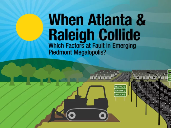
Southeast could become an overdeveloped megalopolis in the next half century , 2014 Giant urban sprawl could pave over thousands of acres of forest and agriculture, connecting Raleigh to Atlanta by 2060 U.S. Geological Survey The
Southeast could become an
the next half century
, 2014
Giant urban sprawl could pave over thousands of acres of forest and agriculture, connecting Raleigh to Atlanta by 2060 –U.S. Geological Survey
Piedmont sprawl as a case study on the validity of 1996 findings of the Population and Consumption Task Force of Pres. Clinton's Council on Sustainable Development: The United States can't meet its environmental goals without stabilizing its population.
GROWTH in POPULATION
ACRES of LOST OPEN SPACE
GROWTH in POPULATION
ACRES of LOST OPEN SPACE
2010 2060
The green shading is the size and shape
study area.
2060 Piedmont 2010 NE Megalopolis
– U.S. Geological Survey & North Carolina State University
Red-cockaded Woodpecker Longleaf Pine Ecosystem, a Type of Pine Savanna
– U.S. Geological Survey & North Carolina State University
– U.S. Geological Survey & North Carolina State University
– U.S. Geological Survey & North Carolina State University
2010 2016
The National Resources Inventory (NRI) Since 1982, conducted by the Natural Resources Conservation Service of the U.S. Department of Agriculture.
Average acreage to provide each resident with:
government buildings
recreation, worship
treatment systems
Change in Per Capita Land Consumption in Each State of the Piedmont Study Area 1982–2010
County Fraction of Acre per Resident - 1982 Fraction of Acre per Resident - 2010 % Change in per Capita Land Consumption, 1982-2010
42 North Carolina Counties
0.381 0.450 18%
23 South Carolina Counties
0.428 0.573 34%
63 Georgia Counties
0.358 0.404 13%
All 128 Counties in 3-State Piedmont Study Area
0.382 0.454 18%
Causes of Changes In Per Capita Land Consumption
housing, offices and retail facilities
land consumption, and fees and taxes that discourage consumption
for highways, streets and mass transit
mobility and flexibility offered by using private vehicles rather than public transit
sprawl)
(ability to hold onto residents)
marriage
to live separately
Change in Per Capita Land Consumption in Each State of the Piedmont Study Area 1982–2010
County Fraction of Acre per Resident - 1982 Fraction of Acre per Resident - 2010 % Change in per Capita Land Consumption, 1982-2010
42 North Carolina Counties
0.381 0.450 18%
23 South Carolina Counties
0.428 0.573 34%
63 Georgia Counties
0.358 0.404 13%
All 128 Counties in 3-State Piedmont Study Area
0.382 0.454 18%
County Fraction of Acre per Resident – 2002 Fraction of Acre per Resident - 2010 % Change in Per Capita Land Consumption, 2002-2010 Baldwin
0.608 0.726 19%
Banks
1.020 1.168 14%
Barrow
0.518 0.433 (-16%)
Bartow
0.501 0.454 (-9%)
Bibb
0.420 0.432 3%
Butts
0.605 0.579 (-4%)
Carroll
0.631 0.619 (-2%)
Cherokee
0.613 0.549 (-10%)
Clarke
0.356 0.341 (-4%)
Clayton
0.244 0.252 3%
Cobb
0.269 0.258 (-4%)
Columbia
0.502 0.429 (-14%)
Coweta
0.732 0.660 (-10%)
Crawford
0.868 0.921 6%
Dawson
0.605 0.501 (-17%)
DeKalb
0.200 0.203 1%
Recent Trend in Per Capita Land Consumption in Piedmont Study Area’s Counties – 2002 and 2010
Recent Trend in Per Capita Land Consumption in Piedmont Study Area’s States – 2002 and 2010
County Fraction of Acre per Resident – 2002 Fraction of Acre per Resident– 2010 % Change in Per Capita Land Consumption, 2002-2010
42 North Carolina Counties
0.486 0.450 (-7%)
23 South Carolina Counties
0.595 0.573 (-4%)
63 Georgia Counties
0.424 0.404 (-5)
All 128 Counties in 3-State Piedmont Study Area
0.478 0.451 (-6%)
Population Growth in Piedmont Study Area Counties – 1982 to 2010
State Population Growth % Growth
North Carolina
South Carolina
Georgia
All 128 Counties in 3-State Piedmont Study Area
Growth in Population vs. Growth in Per Capita Land Consumption in Piedmont Study Area, 1982-2010
69% 46% 94% 18% 34% 13%
North Carolina South Carolina Georgia
% Population Growth, 1982-2010 % Growth in Per Capita Land Consumption
Total for All 3 States' Growth in Population vs. Growth in Per Capita Land Consumption in Piedmont Study Area, 1982-2010
74% 18%
All 128 Counties in 3-State Piedmont Study Area % Population Growth, 1982-2010 % Growth in Per Capita Land Consumption
Population Per Capita Land Use
A MORE MATHEMATICALLY SOPHISTICATED ANALYSIS:
by Prof. John Holdren, Director of the White House Office of Science & Technology Policy
Apportioning overall resource consumption between population growth and per capita consumption growth.
Percentages of Sprawl Related to Population Growth and Per Capita Sprawl in Piedmont Study Area’s 128 Counties, 1982–2010
POPULATION GROWTH (68% of 1982-2010 Piedmont sprawl related to increase in residents) PER CAPITA SPRAWL (32%
sprawl related to increasing per capita land consumption)
Percentages of Sprawl Related to Population Growth and Per Capita Sprawl in Piedmont Study Area’s 128 Counties, 2002-2010
POPULATION GROWTH (86% of new Piedmont sprawl related to increase in residents) PER CAPITA SPRAWL (14% of new Piedmont sprawl related to increasing per capita land consumption)
Sprawl in 48 states, ranked by area of rural land lost
Ranking (by area) 2002-2010 Total Sprawl (square miles), 2002-2010 Recent State Total Sprawl (square miles), 1982-2010 Overall Total Sprawl Ranking by Area, 1982-2010
1 1,572 TEXAS 5,591 1 2 853 FLORIDA 4,168 2 3 656 CALIFORNIA 3,323 5 4 646 GEORGIA 3,735 4 5 581 NORTH CAROLINA 3,771 3 6 490 ARIZONA 1,763 13 7 434 TENNESSEE 2,274 7 8 413 VIRGINIA 2,027 10 9 386 ALABAMA 1,964 12 10 381 OHIO 2,033 9 11 354 SOUTH CAROLINA 2,020 11
The Past Shows Factors to Tackle to Keep Raleigh from Bumping into Atlanta
consumption
population growth
Piedmont experience displays near-impossibility of stopping loss of habitat…
…without dealing with rapid population growth.
–1996 Interim Report of Pres. Clinton's Population and Consumption Task Force
–1996 Interim Report of Pres. Clinton's Population and Consumption Task Force
Rapid population growth was the major driver… Rapid population growth has continued until now…
…of Piedmont sprawl by time of Task Force.
Rapid population growth has continued until now…
…and is on pace to produce this.
Regional Population Growth Caused By:
replacement level since 1971 and is not a source of long-term population growth.
term population growth in the U.S.
27.9 million – Total Population Growth 13.5 million – New Immigrants + 9.0 million – New Births to Immigrants = 22.5 million – Due to Immigration = 80% of the Total Population Growth
“This is a sensitive issue, but reducing immigration levels is a necessary part of population stabilization and the drive toward sustainability.”
Would Piedmont Residents Support Changing Factors Behind Open-Space Loss?
Pulse Opinion Research commissioned by this study Margin of error: +/- 2 percentage points with 95% level of confidence
Q: Which would you prefer as a way to protect farmland and natural habitats in the Piedmont?
39% Slow down population growth 12% Push people to live in higher density 27% Both slower population growth and higher density 18% Neither 9% Not sure
Q: Should governments protect farmland and natural habitats with regulations that push a growing population to live in higher-density houses and apartment and condo buildings which take up less space? 42% Yes 34% No 25% Not sure
Q: A study of government data found that most reduction in Piedmont open spaces over the last decade was related to rapid population growth. What do you prefer? 13% Piedmont population continue to grow at recent rapid rate 48% Grow much more slowly 25% Population stay about the same size as it is now (no growth)
Support Cutting Immigration to Slow Growth
Q: Census data show that about 40% of population growth in the Piedmont—and 80% nationally—is from new immigrants and births to
60% Reduce new immigration to slow down Piedmont population growth 26% Keep new immigration and population growth at current rate 5% Increase immigration and population growth 9% Not sure
Q: Another large source of Piedmont population growth is Americans moving in from other
the Piedmont make it more difficult for people to move to the region by restricting development?
30% Yes 52% No 18% Not sure
Q: How important is it to save the natural areas and
currently between the cities
61% Very important 27% Somewhat important 6% Not very important 1% Not at all important
Q: Is it unethical to pave over and build on good farmland or is the demand for more housing for a growing population a legitimate reason to pave over and build on farmland? 64% Unethical to build on good farmland 19% The demand for more housing is a legitimate reason to build on farmland
Q: Do you prefer that the Piedmont's towns and small cities remain separated from each other and keep their own identity or does it not matter too much if they are absorbed by larger cities? 76% Prefer towns & small cities remain separate and with own identity 17% It doesn't much matter if they are absorbed by larger cities