
SLIDE 1
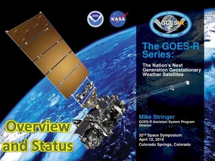
The GOES-R Series:
The Nation’s Next Generation Geostationary Weather Satellites
Mike Stringer
GOES-R Assistant System Program Director
32nd Space Symposium April 12, 2016 Colorado Springs, Colorado
Series: The Nations Next Generation Geostationary Weather - - PowerPoint PPT Presentation
The GOES-R Series: The Nations Next Generation Geostationary Weather Satellites Mike Stringer GOES-R Assistant System Program Director 32 nd Space Symposium April 12, 2016 Colorado Springs, Colorado A History of GOES Weather Satellites
The GOES-R Series:
The Nation’s Next Generation Geostationary Weather Satellites
Mike Stringer
GOES-R Assistant System Program Director
32nd Space Symposium April 12, 2016 Colorado Springs, Colorado
A History of GOES Weather Satellites
2
40 Years of Geostationary Operational Environmental Satellites (GOES) Satellites (GOES-1 Launched Oct, 1975)
Why GOES-R ?
Visible & IR Imagery Lightning Mapping Space Weather Monitoring Solar Imaging
The GOES-R series will provide significant improvements in the detection and observations of meteorological phenomena that directly impact public safety, protection of property, and our Nation’s economic health and prosperity.
3
ABI GLM SEISS and MAG EXIS and SUVI
GOES-R Spacecraft
4 Extreme Ultraviolet and X-Ray Irradiance Sensor (EXIS) Space Environment In Situ Suite (SEISS) Magnetometer Advanced Baseline Imager (ABI) Geostationary Lightning Mapper (GLM) Solar Ultraviolet Imager (SUVI)
Advanced Baseline Imager (ABI)
GOES-R series
the visible and near- infrared wavelengths
capabilities in spectral information (3X), spatial coverage (4X), and temporal resolution (5X)
5
GOES-13/14/15 Spectral Bands GOES-R Spectral Bands
6
Three X More Spectral Information
7
minutes
every 15 minutes + 5 min CONUS images + 30 sec mesoscale
Five Times Faster Coverage
Full Disk CONU S MESOForecasters can monitor the interactions between air masses, outflow boundaries and storms leading to increased situational awareness and confidence
Geostationary Lightning Mapper (GLM)
Specifications
the Western Hemisphere: in cloud, cloud-to-cloud, and cloud-to-ground ― Provides coverage over oceans and land – Complements today’s land based systems that only measures cloud to ground (~15% of the total lightning)
8
awareness and confidence resulting in more accurate severe storm warnings (improved lead time, reduced false alarms) to save lives and property
Living with a star can be dangerous!
GOES Orbit 9
Extreme Ultraviolet and X-ray Irradiance Sensors (EXIS)
10
radiation:
monitors solar variations that affect satellite drag, and ionospheric changes impacting communication and navigation operations
beginning, duration, and magnitude of solar X-ray flares
Solar Flare EUV Composite Solar Image
navigation disruption
astronauts, and airline passengers on polar routes, and provides input on possible impacts to power grid performance
Solar UltraViolet Imager (SUVI)
11
GOES-13 Solar X-Ray Imager: Current Capability Future Capability: GOES-R Solar UltraViolet Imager (using Solar Dynamics Observatory data)
C9 flare from AR 2297 at 01:55 UT C9 flare from AR 2297 at 02:14 UT
Space Environment in-Situ Sensor Suite (SEISS)
12
sensors to monitor proton, electron and alpha particle fluxes to provide:
energetic particles responsible for radiation hazards to humans and spacecraft
ionizing responsible for spacecraft charging
events, mitigating damage to radio communication
Magnetometer
13
the magnitude and direction of Earth's ambient magnetic field
impact of geomagnetic storms at geosynchronous orbit (key for interpreting solar radiation storm measurements by SEISS)
Magnetopause Crossing Detection and automated Sudden Impulse Detection
Magnetometer Sensor Magnetometer Boom Magnetometer Installation
– Relay distress signals from 406 MHz emergency beacons
– Emergency Managers Weather Information Network services – Delivers selected imagery, charts, data products, and text messages (NWS Watches and Warnings) to users throughout western hemisphere.
– Relays data transmissions from over 20,000 in situ environmental data platforms from across the hemisphere
– Data from each of the GOES-R series instruments is processed on the ground, then bounced back through GOES-R satellites to users throughout the hemisphere.
14 Remote Automated Weather Stations transmitting to GOES Emergency Beacons
GOES-R Unique Payload Services
15
GOES-R Integration
Assembled GOES-R Spacecraft
16
Flight Segment Progress
17
EXIS and SUVI installed on the sun-pointing platform
completed December 2‒3
December 21
integrated
vacuum, mechanical, and acoustic testing
GOES-S system module (left) and core module (right)
GOES-R Architecture Overview
Ground Segment Progress
19
Facility are complete
support current GOES and future GOES-R operations
Backup completed System Certification Reviews
launch
processing & distribution hardware completed
Operations Readiness
√ ETE1a: Aug. 4, 2014 √ ETE1b: Apr. 15, 2015 √ ETE2: June 2, 2015 √ ETE3: July 28, 2015 √ ETE4a: Nov. 18‒20, 2015
√ DOE 0: Nov. 1‒4, 2014 √ DOE 1&2: June 15‒30, 2015 √ DOE 3: Aug. 17‒Sept. 8, 2015
√ #1: Oct.5‒Nov. 11, 2015 √ #2: Jan-Feb, 2016
GOES-R Flight Operations Review Nov. 2‒6, 2015
10/15/15
NWS AWIPS four- panel display from Ground Readiness Exercise #1
20
GOES-R Flight Operations Review
22
Post-Launch Testing and Validation
days
months post-LOR
6 months post-PLT
validation period at TBD orbit location
Training and User Education Materials www.goes-r.gov
Online Training
(COMET, SPoRT, VISIT, WMO)
Printed Materials
http://www.goes-r.gov/education/ABI- bands-quick-info.html
Users’ Guides
Reports and Annual Reports
2323
Sample Data
Thank you!
For more information visit www.goes-r.gov
www.facebook.com/GOESRsatellite www.youtube.com/user/NOAASatellites twitter.com/NOAASatellites www.flickr.com/photos/noaasatellites
GOES-R Series Products
Radiances* Cloud and Moisture Imagery (KPP) Solar Imagery: EUV* Rainfall Rate / QPE Energetic Heavy Ions* Legacy Vertical Moisture Profile Magnetospheric Electrons and Protons: Low Energy* Legacy Vertical Temperature Profile Magnetospheric Electrons and Protons: Medium and High Energy* Derived Stability Indices Solar and Galactic Protons* Total Precipitable Water Geomagnetic Field* Clear Sky Masks Solar Flux: EUV* Downward Shortwave Rad.: Surface Solar Flux: X-Ray* Fire / Hot Spot Characterization Lightning Det: Events, Groups, Flashes* Land Surface (Skin) Temperature Aerosol Detection (including Smoke & Dust) Sea Surface Temperature (skin) Aerosol Optical Depth Reflected Shortwave Rad.: TOA Volcanic Ash: Detection & Height Snow Cover Cloud Optical Depth Derived Motion Winds Cloud Particle Size Distribution Hurricane Intensity Cloud Top Phase Cloud Top Pressure Cloud Top Height Cloud Top Temperature Key ABI GLM SEISS EXIS SUVI Magnetometer * Included in GRB
L1b Products L2+ Products are remainder
Key Performance Parameter (KPP)
ABI Visible/Near-Infrared Bands
Schmit et al, 2005
27
ABI Infrared Bands
Schmit et al, 2005
28