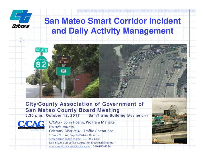
san mateo smart corridor incident and daily activity
play

San Mateo Smart Corridor Incident and Daily Activity Management - PowerPoint PPT Presentation

San Mateo Smart Corridor Incident and Daily Activity Management City/County Association of Government of San Mateo County Board Meeting 6:30 p.m., October 12, 2017 SamTrans Building (Auditorium) C/CAG - John Hoang, Program Manager


  1. San Mateo Smart Corridor Incident and Daily Activity Management City/County Association of Government of San Mateo County Board Meeting 6:30 p.m., October 12, 2017 SamTrans Building (Auditorium) C/CAG - John Hoang, Program Manager jhoang@smcgov.org Caltrans, District 4 – Traffic Operations S. Sean Nozzari, Deputy District Director sean.nozzari@dot.ca.gov 510-286-6345 Min Y. Lee, Senior Transportation Electrical Engineer min.y.lee.dot.ca.gov@dot.ca.gov 510-286-4624

  2. Outline San Mateo Smart Corridor Background Needs, Goals and Objectives  Process Taken and Implementation  Caltrans’ Mobility Focus Areas San Mateo Smart Corridor Briefing Incident Management   PG&E High Voltage Tower Collapse  Recreational Vehicle Fire  Police Action near Routes 92 Day-to-Day Usage  Moving Forward  Questions 

  3. San Mateo County Smart Corridor Project Background

  4. San Mateo County Smart Corridor Needs  Coordinate operations and sharing of resources between Caltrans and Local Agencies to address recurrent congestion  Remote management capability of traffic signals from City and Caltrans TMC  Ability to monitor traffic conditions and collect traffic data along corridor 4

  5. San Mateo County Smart Corridor Goals Implement Intelligent Transportation Systems (ITS) solutions and strategies for countywide traffic management Establish cross jurisdictional coordination and cooperation Enable cities and Caltrans to proactively manage day-to-day traffic, during special events, and facilitate traffic impacts due to major incidents on the freeway Implement infrastructure that allows for expansion to meet future demands, capabilities, and integration with new technology 5

  6. San Mateo County Smart Corridor Objectives Enable ability to monitor real time traffic conditions and adjust signal timing remotely Enable shared control and operation Improve traffic flow, Improve mobility, Optimize vehicle throughput, Reduce traffic delays, Improve travel time reliability 6

  7. San Mateo County Smart Corridor Process Taken Assembled Working Group (2007)  City traffic engineers, Law Enforcement, Fire, Caltrans Together established Alternative Routes Inter-Agency Agreements  MOU on ownership and maintenance of equipment  Coop Agreements between Caltrans and cities Established Stakeholder Working Group ( All cities on the corridor are represented)  Reviewed and approved incident response plan  Continue to meet (quarterly)  Improve communication on the ground level  Continue to fine-tune incident response practice  Share lessons learned 7

  8. San Mateo County Smart Corridor Project Background Implementation Phases I, II, and III  25 miles of interconnected communication network Next Step: Portions of Phase IV and Phase V (South San Francisco, Brisbane, Daly City, Colma) 8

  9. San Mateo County Smart Corridor Project Background Constructed Phase Smart Corridor Route • Stakeholders identified alternate routes known as “Smart Corridor Routes” 9

  10. San Mateo County Smart Corridor Project Background What We Have Done Deploy infrastructure along major arterials corridors parallel to freeways Install fiber optics communication network  Implement new signal system software  integrating city-owned and Caltrans traffic signals Install CCTV cameras, signage, vehicle detection  TMC Regional Communications System Integration 10

  11. San Mateo County Smart Corridor Project Field Elements: Traffic Signal Controller Upgrades 11

  12. San Mateo County Smart Corridor Project Field Elements: Trailblazer Signs • Alternate route guidance • Installed at decision points 12

  13. San Mateo County Smart Corridor Project Field Elements: Arterial Dynamic Message Signs • Additional traveler information  Route guidance  Lane closures  Travel times  Incidents • El Camino Real @ 84, 92, 380 13

  14. San Mateo County Smart Corridor Project Field Elements: CCTV Cameras • At Critical Locations • Connected to Video Management System 14

  15. San Mateo County Smart Corridor Project Field Elements: Vehicle Detection Stations • Collect traffic data • Help detect congestion incidents 15

  16. San Mateo County Smart Corridor Project San Mateo Hub and TMC’s • San Mateo Hub ( in San Mateo Police Department)  Communications equipment  Servers • City TMC  Connected to San Mateo Hub via fiber  Operator Workstation • Caltrans TMC  Connected to San Mateo Hub  BART fiber (future) 16

  17. San Mateo County Smart Corridor Project Incident Response Process END : Operator System Operator Operator Operator START: Confirms Offers Confirms Deploys Monitors Resume Incident Incident Strategies or Strategy and Conditions Normal Detection on or Operator Modifies Notifies and Adjusts Operations Freeway Looks-up Strategy Affected Strategy Strategies Local Agencies • Turn ON Trailblazers and DMS • Monitor Incident CCTV at Critical Locations • Implement preapproved signal timing plans 17

  18. Caltrans’ Mobility Focus Areas 18

  19. Transportation System Management & Operations (TSMO) • Transportation Management System  Build-out (TMS)  Adaptive Ramp Metering • Emergency Management Mobility  System Monitoring & Performance Measurement  Incident Management & Disaster Planning Focus  Traveler Information (Regional & Statewide) Areas • Integrated Corridor Management  Integrated Freeway & Arterial Operations  Transit/Rail, Pedestrians, & Bicyclists • Operational Improvements & System Completion  Managed Lanes (High Occupancy Vehicle/Toll Lanes)  Strategic Improvements • Embrace New Technology  Connected/Automated Vehicles & Infrastructure 19

  20. San Francisco Bay Area: Integrated Corridor Management I-80 Smart Corridor Freeway Information 8/25/16 to 8/31/17 Display Board Activations: 308 Freeway: Electronic signs on overhead WB I-80: 220 gantries turn ON upstream of an EB I-80: 88 incident, and immediately past. Typ. Duration: 30’ Open Arterial: Trailblazer Signs turn ON and Merge signal “flush plan” X implemented along main arterial to guide traffic back Blocked to freeway Incident Open 22

  21. San Francisco Bay Area: Integrated Corridor Management State Route 4 Smart Corridor • Approximately 30 miles from I-80 to SR-160 through seven cities • In planning stage • 18 month schedule: Prepare Concept of Operations & High Level System Requirements for:  Corridor Ramp Metering  Incident Management  Travel Demand Management 21

  22. San Francisco Bay Area Integrated Corridor Management 32 miles 25 miles Alameda I-880 Smart Corridor Contra Costa I-680 Smart Corridor Oakland – San Jose Benicia Bridge-Alameda Co. Line) 22

  23. San Mateo Smart Corridor Briefing 23

  24. Incident Management We used the Smart Corridor for the incidents below  PG&E High Voltage Tower Collapse in Burlingame on August 28, 2015  Recreational Vehicle Fire in San Carlos on October 20, 2016  Police action near Route 92 in San Mateo on April 28, 2017. 24

  25. Incident Management PG&E Power Transmission Tower Collapse Construction contractor hit PG&E Tower causing it to collapse on Friday night in both directions August 28, 2015. Southbound lanes were reopened the next day. Northbound lanes were reopened on Monday at 4:15 a.m. Broadway over crossing was reopened on Monday at 9:00 a.m. 25

  26. Incident Management Police Action near Route 92 Police action on April 28, 2017 closed northbound US 101 around 6:15 p.m. Friday evening Drivers were diverted off the freeway at Ralston Ave. Freeway reopened on Saturday at 12:45 a.m. 26

  27. Incident Management RV Fire Freeway Closure US101 was closed at 5:15 p.m. in San Carlos on October 20, 2016 due to a fully engulfed recreational vehicle carrying 50 gallon propane tank, and 5 to 10 pound model rockets. Northbound drivers were diverted at Woodside Rd. Southbound drivers were diverted at Holly St. Northbound drivers were diverted at Woodside Rd. Southbound US 101 was reopened at 6:24 p.m. and two northbound left lanes reopened at 6:58 p.m. At 9:00 p.m., US 101 was fully opened. 27

  28. US 101 Typical Day Congestion (4:00 p.m. to 9:00 p.m., October 13, 2016) Millbrae Ave. Route 92 University Ave. Southbound Northbound 28

  29. US 101 RV Fire Day Congestion (4:00 p.m. to 9:00 p.m., October 20, 2016) Millbrae Ave. Route 92 INCIDENT University Ave. Southbound Northbound 29

  30. El Camino Real Typical Day Congestion (4:00 p.m. – 9:00 p.m., October 13, 2016) Millbrae Ave. Route 92 University Northbound Southbound Ave. 30

  31. El Camino Real RV Fire Day (4:00 p.m. to 9:00 p.m., October 20, 2016) Millbrae Ave. Route 92 University Southbound Northbound Ave. 31

  32. Day-to-Day Applications 32

  33. Day-to-Day Applications Typical Monitor traffic conditions Update signal timing remotely Coordinate signals with local agencies Address complaints 33

  34. Day-to-Day Applications Recent Examples Ralston Ave. and El Camino Real southbound left turn complaint. Coordinating of two closely spaced signals of Harbor Blvd. with El Camino Real and Old County Rd. Northbound and southbound US 101 off ramps to Marsh Rd. Half Moon Bay retiming. 34

Download Presentation
Download Policy: The content available on the website is offered to you 'AS IS' for your personal information and use only. It cannot be commercialized, licensed, or distributed on other websites without prior consent from the author. To download a presentation, simply click this link. If you encounter any difficulties during the download process, it's possible that the publisher has removed the file from their server.

Recommend


More recommend