
SLIDE 1
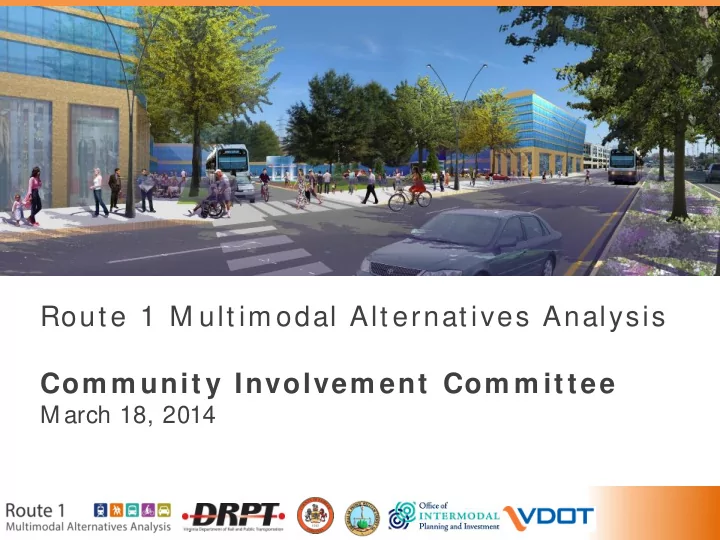
Rout e 1 M ult im odal Alt ernat ives Analysis Com m unit y Involvem ent Com m ittee
M arch 18, 2014
Rout e 1 M ult im odal Alt ernat ives Analysis Com m unit y Involvem - - PowerPoint PPT Presentation
Rout e 1 M ult im odal Alt ernat ives Analysis Com m unit y Involvem ent Com m ittee M arch 18, 2014 Agenda 1. Introductions 2. Background and Process 3. Proposed Alternatives for Further Evaluation & Land Use Scenario Development 5.
Rout e 1 M ult im odal Alt ernat ives Analysis Com m unit y Involvem ent Com m ittee
M arch 18, 2014
Agenda
Land Use Scenario Development
Project Corridor
4Route 1
Project Schedule
We are here 2013 2014 Outcome of the Study
implementation in the Route 1 corridor by the technical team
elements:
– Transit: M ode and alignment – Vehicular: Number of automobile travel lanes – Bike/ Ped: Facilities and location
Vehicular Travel Lanes Bike/ped Transit Vehicular Travel Lanes Bike/ped
6 Purpose and Need
Needs:
development Purpose: Provide improved performance for transit, bicycle and pedestrian, and vehicular conditions and facilities along the Route 1 corridor that support long-term growth and economic development.
Existing Corridor Travel Patterns (Auto plus Transit)
Daily trips (auto and transit) to, from, and within Route 1 corridor
8Fairfax County Prince William County Arlington County DC Route 1
Route 1 From/To Total Trips
Total % of Total Transit ShareDC 52,000 6% 29% Arl/Alex 116,000 13% 6% Within Rt.1 Corridor
310,000 34% 1%Fairfax Other
216,000 24% 0%Prince William Other
124,000 14% 0%Other Areas
95,000 10% 2%Total 913,000 100% 3%
34% 24% 13% 14% 6%
City of Alex.
Transit Travel Markets
commuting to Downtown, using Metrorail
Arlington or Downtown
Metrorail/ Bus to Metro Bus Only Commuter Rail78% 14% 8% On an average weekday, where do people who travel to the corridor come from? On an average weekday, where do people who live in the corridor travel to?
use the bus
corridor
Metrorail/ Bus to Metro Bus Only Commuter RailTransit Users 30% 64% 5% Transit Users
Reminder: Highlights of Last Meeting
want to solve
– Transit modes – Vehicular lanes – Bike/Ped facilities
Step 1: Identify the best transportation options
Range of Alternatives Initial Alternatives Refined Alternatives Step 2: Combine options into multimodal alternatives
Complete Technical Analysis + Evaluate Alternatives against Goals and Objectives Arriving at Recommended Multimodal Alternative: How do we choose one?
13improvements
project
future needs
community resources Identify goals and
Develop evaluation factors Perform technical analysis Evaluate alternatives
Multimodal Evaluation Process
Today’s meeting answers How do we get from Screen 1 to Screen 2? Discuss the process for evaluating options under each category: Transit, Vehicular, and Bike/Ped At the end of the presentation, we will have confirmed: Which alternatives will be further evaluated? (We’ll have filled in the boxes!)
One of these options will ultimately be the recommended alternative.
14 & Land Use Scenario Development
Vehicular Travel Lanes Alternatives
Existing Lanes Expanded Lanes:
Three or four lanes, depending on location along the corridor
Converted Lanes Consistent Lanes
16Key Evaluation factors:
Other, qualitative factors:
crossing distance/time
Vehicular Lane Evaluation
Other, qualitative factors:
Vehicular Lanes Evaluation: Overview
(VDOT and Fairfax County Comprehensive Plan):
Consistent, 6 vehicular lanes along the entire corridor
using quantitative and qualitative measures
Bicycle and Pedestrian Alternatives
Sidewalk + bike lane Sidewalk + bus/bike lane
19 General Purpose LaneSidewalk + buffered bike lane Multiuse path (bike and ped)
Key Evaluation factors:
cyclists of all abilities
Measures and factors:
and Bicycle Level of Service
incrementally / flexible over time
8’ Bicycle and Pedestrian Evaluation
In-street bike lane and sidewalk Shared bus/bike lane and sidewalk Buffered bike lane and sidewalk Multiuse path
Legend for ratings:Provides access along full corridor
Improves walk & bike access to destinations Improves walk & bike access to destinations Improves walk & bike access to destinations Improves walk & bike access to destinationsProvides safety and comfort given high auto speeds and volumes
In-street bike lane not recommended for 45 mph+ Shared bike/travel lane not recommended for 45 mph+ Bike lane buffered from 45 mph traffic Bike lane buffered from 45 mph traffic with curb and landscape stripRequires additional right-
Bicycle and Pedestrian Evaluation: Overview
Confirmed recommendation based on trade-offs among accessibility, safety, and required right-of-way 10-foot M ultiuse Path
Note: implementation of recommended section varies along corridor
21 Transit Evaluation: Overview
alternatives based on basic project requirements to arrive at four initial alternatives
to identify the most promising modes (e.g. rail, bus) and routes for further evaluation
22 Range of Alternatives Initial Alternatives Refined Alternatives Initial Alternatives
Four Initial Transit Alternatives:
How do we refine the initial alternatives for further evaluation?
Analysis
Initial Modes Refined Alternatives for Further Evaluation 24 T ransportation Investment helps to increase economic viability and vitality of the corridor
Land use planning Transportation investment Support high quality community development Demand for new residential units and commercial space Employment growth Population growth
25 Land Use: Transit-Supportive Activity Densities
26Scenario 1: “ Base Land Use Scenario” = 2035 MWCOG regional forecast Scenario 2: What is a reasonable growth expectation for a corridor that invests in high-quality transit (BRT or LRT)? Scenario 3: How much do population and employment need to increase to achieve density levels typically supportive of Metrorail?
Large Town/Suburban Center (Express Bus) P Medium Town/Suburban Center (Fixed Route Bus) Rural or Village Center (Demand Response)+25% over 2035 regional forecast
+15% +25% +246% +531% +202%
+169% over 2035 regional forecast
Source: DRPT Multimodal Design Guidelines (2013) 26 Scenario 1: 2035 MWCOG Population and Employment Forecast
27forecast anticipates high growth that varies along the corridor
potential FTA grant application
mile) in the north and at Woodbridge are supportive of express bus; areas near Fort Belvoir are less dense
+77% +155% +20% 2010 Population+ Employment 2035 MWCOG (regional) Forecast +38% +41% +46% +28% Large Town/Suburban Center (Express Bus) Medium Town/Suburban Center (Fixed Route Bus) Rural or Village Center(Demand Response) Urban Center (BRT/ LRT) Source: DRPT Multimodal Design Guidelines (2013) Urban Core (Rail) 19,700 4,600 20,300 6,600 6,100 2,900 10,800 Beacon: Bird’s Eye View Today
Source: Bing Maps Beacon Hill: Land Use Scenario One (2035 COG Projection)
Beacon Hill: Land Use Scenario One (2035 COG Projection)
Scenario 2: Reasonable Response to High-Quality Transit Investment
31What is a reasonable growth expectation for a corridor that invests in high-quality transit (BRT or LRT)?
increase in activity levels due to premium transit investment, coupled with strong land use planning and development incentives
and Prince William County planners: − 25% increase in activity level densities in the north portion and at Woodbridge − 15% increase for stations near Lorton
support a higher capacity transit mode (BRT
Woodbridge
+25% over 2035 regional forecast +25% +15%
Large Town/Suburban Center (Express Bus) Medium Town/Suburban Center (Fixed Route Bus) Rural or Village Center(Demand Response) Urban Center (BRT/ LRT) Source: DRPT Multimodal Design Guidelines (2013) Urban Core (Rail) Land Use Scenario 2
322035 MWCOG Population and Employment Forecast
19,700 20,300 10,800 4,600 6,100 6,600 2,900 +77% +122% +20% +50% +38% +59% +41% +62% +38% +58% +68% +46% +155% +219% 2010 Population and Employment P 2035 Population and Employment Forecast (MWCOG) Scenario 2: Proposed +25% Growth XX% = % increase over 2010 Population and Employment Growth Large Town/Suburban Center (Express Bus) Medium Town/Suburban Center (Fixed Route Bus) Rural or Village Center(Demand Response) Urban Center (BRT/ LRT) Source: DRPT Multimodal Design Guidelines (2013) Urban Core (Rail) Beacon Hill: Land Use Scenario Two (additional growth increment)
Beacon Hill: Land Use Scenario Two
Beacon Hill: County Comprehensive Plan
Beacon Hill: Bird’s Eye View Today
Beacon Hill: Scenario Two Bird’s Eye View
Scenario 3: Land Use Supportive of Metrorail
Densities around stations would need to increase dramatically beyond the 2035 regional forecast to meet development levels typically associated w ith M etrorail as defined in the DRPT M ultimodal Design Guidelines
19,700 20,300 10,800 6,100 6,600 2,900 +78% +377% +20% +316% +40% +479% +38% +436% +28% +1117% +46% +824% +187% +671% 4,600 Large Town/Suburban Center (Express Bus) Medium Town/Suburban Center (Fixed Route Bus) Rural or Village Center(Demand Response) Urban Center (BRT/ LRT) Source: DRPT Multimodal Design Guidelines (2013) Urban Core (Rail) 2010 Population and Employment P 2035 Population and Employment Forecast (MWCOG) Scenario 3: Metrorail Supportive XX% = increase over 2010 Population and Employment Growth Beacon Hill Station: Scenario 3
Beacon Hill Station: Scenario 3
Transit Alternatives Refinement
41 Summary of Initial Alternatives
42Enhanced Bus Bus Rapid Transit Light Rail Transit Metrorail Average Weekday Ridership (2035) 9,500 16,600 18,400 38,500 Conceptual Capital Cost $180 M $780 M $1.20 B $4.80 B Annual O&M Cost $14 M $17 M $24 M $84 M Cost Per Rider* $10 $15 $21 $37
*Assumes Annualized Capital Cost + Operating Costs divided by total boardings (2035) Note: FTA Cost Effectiveness measure averages current (2015) and horizon year (2035) costs and boardings Four Refined Alternatives for Further Evaluation
Alternative 1: Bus Rapid Transit 1- Curb
lanes from Huntington to Fort Belvoir
Alternative 2: Bus Rapid Transit 2- Median
lanes for entire length of corridor and in mixed-traffic in Prince William County Alternative 3: Light Rail Transit
in dedicated lanes for entire length of corridor Alternative 4: Metrorail- BRT Hybrid
connecting BRT service to Woodbridge
43 Huntington Penn Daw Beacon Hill Lockheed Blvd Hybla Valley Woodbridge VRE Proposed P&R Metrorail (Underground) LRT in Dedicated Lanes BRT in Dedicated Lanes BRT in Mixed Traffic Alternative 1: Bus Rapid Transit 1 – Curb
44BRT operates in dedicated curb lanes to Pohick Road North BRT operates in mixed traffic from Pohick Road North to Woodbridge
Huntington Penn Daw Beacon Hill Lockheed Blvd Hybla Valley Woodbridge VRE BRT in Dedicated Lanes BRT in Mixed Traffic Proposed P&R Alternative 2: Bus Rapid Transit 2 - Median
BRT operates in median in dedicated lanes in Fairfax County; transitions to mixed traffic through Prince William County
45 Huntington Penn Daw Beacon Hill Lockheed Blvd Hybla Valley Woodbridge VRE BRT in Dedicated Lanes BRT in Mixed Traffic Proposed Park & Ride Alternative 3: Light Rail Transit (Median)
Light Rail operates in median in dedicated lanes for entire corridor
46 Huntington Penn Daw Beacon Hill Lockheed Blvd Hybla Valley Woodbridge VRE LRT in Dedicated Lanes Proposed Park & Ride Alternative 4: Metrorail- BRT Hybrid
47T ransfer to BRT service at Hybla Valley BRT operates in dedicated lanes and transitions into mixed-traffic in Prince William County
Huntington Beacon Hill Hybla Valley Woodbridge VRE BRT in Dedicated Lanes BRT in Mixed Traffic Metrorail (Underground) Proposed Park & Ride Key Indicators: Refined Transit Alternatives
– –
* Corridor ridership, excluding transfers between Metrorail and BRT portions **Assumes Annualized Capital Cost + Operating Costs divided by total boardings (2035) Note: FTA Cost Effectiveness measure averages current (2015) and horizon year (2035) costs and boardings 48Bus Rapid Transit 1 - Curb Bus Rapid Transit 2- Median Light Rail Transit- Median Metrorail/BRT- Median Hybrid
Average Weekday Ridership (2035) 15,200 16,600 18,400 26,500*
(BRT 10,600; Metro 22,900)
Conceptual Capital Cost $500 M $780 M $1.20 B $1.57 B Annual O&M Cost $18 M $17 M $24 M $31 M Cost Per Rider** $12 $15 $21 $18
BRT- Curb Running BRT- Median Running LRT Metrorail-BRT (Hybrid)
Transit Elements
lanes north portion of corridor
treatments at key locations south portion of corridor
lanes for entire corridor
transitway
Prince William County
lanes for entire corridor
transitway
extension for a short northern segment
dedicated lanes
through Prince William County
Vehicular Lanes
three lanes
three lanes
three lanes
three lanes
Bike/Ped Elements
multi-use path
multi-use path
multi-use path
multi-use path
Summary: Refined Multimodal Alternatives
Evaluation of Alternatives
Evaluation Criteria: Project Goals and Objectives
Goals and Objectives Multimodal Measures
GOAL 1: Expand attractive multimodal travel options to improve local and regional mobility Increase transit ridership Transit ridership Improve transit to reduce travel times Transit travel time, Automobile travel time Increase transportation system productivity Total person throughput Improve bicycle and pedestrian networks Continuous sidewalk and bike pathway Integrate with other transit service Connections to existing and planned transit GOAL 2: Improve safety; increase accessibility Provide accessible pathways Continuous sidewalk and bike pathway Reduce modal conflicts Separate facilities for separate modes Improve pedestrian crossings Average pedestrian delay to cross, Adequate pedestrian refuges Maintain traffic operations Traffic LOS GOAL 3: Increase economic viability and vitality of the corridor Support higher activity levels Accommodate 2035 density (growth scenarios) Investments are financially feasible to construct and operate Project costs, cost effectiveness, Allows incremental implementation High-capacity transit facilities at appropriate locations Serves low-income residents, value added to adjacent properties GOAL 4: Support community health and minimize impacts on community resources Minimize negative impacts to the natural environment ROW impacts on environmental and historic resources Contribute to improvements in regional air quality Change in VMT Increase opportunities for bicycling and walking Continuous sidewalk and bike pathway 51 Project Justification Criteria
Economic Development: Transit supportive plans and policies; plans to preserve affordable housing Mobility Improvements: Total project boardings; transit-dependent ridership is weighted 2x Cost Effectiveness: Annualized cost per annual linked trip on the project Land Use: Quantitative analysis of station area development, proportion of legally binding affordability Environmental Benefits: Environmental benefits are monetized and compared to the annualized costs Congestion Relief: Project sponsors will receive a medium rating until further guidance is released
Financial Commitment Criteria
Current Condition (capital and operating) Commitment of Funds (capital and operating) Reasonableness of Assumptions and Financial Capacity (capital and operating)
Evaluation Criteria: FTA New Starts/Small Starts
Calendar of Meetings
Meeting Date Technical Advisory Committee March 6, 10:00 - 11:30am South County Center Executive Steering Committee March 13, 3:30 - 5:00 pm Mount Vernon Government Center Community Involvement Committee March 18, 4:00 – 5:30 pm Mount Vernon Government Center Public Meeting #2 March 26, 6:00 – 8:00 pm South County Center
Outreach for Public Meeting #2
– E-mails to 250 contacts – Hard Copies (English and Spanish)
Outreach for Public Meeting #2
– Grocery stores (standard and Hispanic) – Walmart and Costco – Libraries – South County Center,
– Huntington Metro station and bus stops – Apartment complexes
Outreach for Public Meeting #2
(21 public schools near the corridor)
– VOICE – Progreso – Ventures in Community – Good Shepherd Church – Community Involvement Committee Committee
Outreach for Public Meeting #2 Community Involvement Committee:
Multimodal Alternatives Analysis: Steps to Study Completion
forward to next phase of implementation