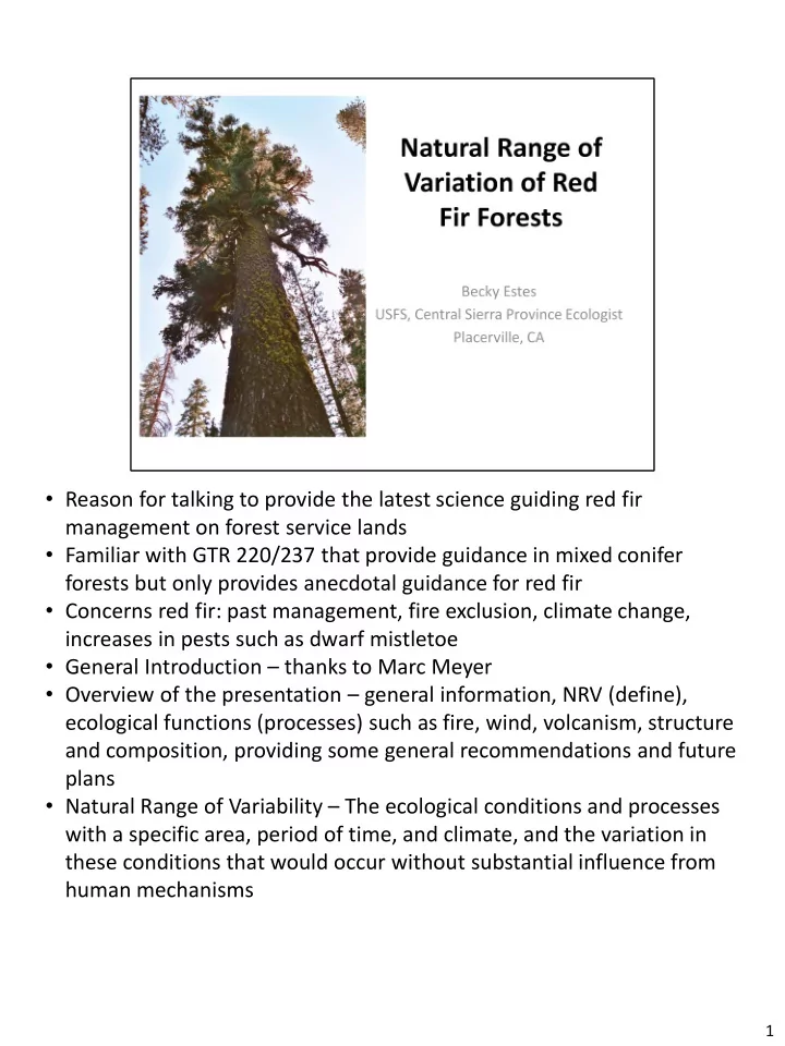
Reason for talking to provide the latest science guiding red fir - - PDF document

reason for talking to provide the latest science guiding
SMART_READER_LITE
LIVE PREVIEW

Reason for talking to provide the latest science guiding red fir - - PDF document

Reason for talking to provide the latest science guiding red fir management on forest service lands Familiar with GTR 220/237 that provide guidance in mixed conifer forests but only provides anecdotal guidance for red fir Concerns red


slide-1
SLIDE 1
  • Reason for talking to provide the latest science guiding red fir

management on forest service lands

  • Familiar with GTR 220/237 that provide guidance in mixed conifer

forests but only provides anecdotal guidance for red fir

  • Concerns red fir: past management, fire exclusion, climate change,

increases in pests such as dwarf mistletoe

  • General Introduction – thanks to Marc Meyer
  • Overview of the presentation – general information, NRV (define),

ecological functions (processes) such as fire, wind, volcanism, structure and composition, providing some general recommendations and future plans

  • Natural Range of Variability – The ecological conditions and processes

with a specific area, period of time, and climate, and the variation in these conditions that would occur without substantial influence from human mechanisms

1

slide-2
SLIDE 2
  • Red fir (Abies magnifica) forests are distributed

throughout the Sierra Nevada immediately above the montane mixed-conifer and below the subalpine forest zones

  • Red fir forests occupy cool sites with substantial winter

snow

  • Red fir forest typically occurs on gentle to moderate

slopes but also occurs on raised stream benches, terraces, steeper slopes, and ridges

  • The second variety, A. m. var. magnifica, exists in the

northern and central Sierra Nevada and has a hidden- bract cone type

2

slide-3
SLIDE 3
  • Common associates of red fir include white fir (Abies

concolor) at lower elevations and lodgepole pine, Jeffrey pine, and mountain hemlock (Tsuga mertensiana) at higher elevations (Potter 1994, 1998).

  • Western white pine (P. monicola) is also a common

associate of red fir throughout the Sierra Nevada (Rundel et al. 1988).

  • Describe figure

3

slide-4
SLIDE 4

4

slide-5
SLIDE 5
  • Red fir forests provide a diverse array of ecosystem services,

including watershed protection, erosion control, carbon sequestration, and habitat for a diverse array of species in the Sierra Nevada.

  • These forests are particularly important for 28 birds and 26

mammals, including several sensitive and rare species such as American marten (Martes caurina)

  • Red fir also provides important denning habitat for the

northern flying squirrel (Glaucomys sabrinus), a keystone and management indicator species in many western forests including the Sierra Nevada (Meyer et al. 2005).

  • Red fir provides habitat for several species of arboreal lichens

(Rambo 2010, 2012) and a diverse community of ectomycorrhizal fungi (Izzo et al. 2005).

5

slide-6
SLIDE 6

6

slide-7
SLIDE 7
  • Fire Seasonality - In red fir-white fir forests of the

southern Cascades, the position of fires on presettlement annual growth rings indicated that 77%

  • f historic fires burned during the late summer and

fall, and the remaining 23% of fires burned during the early to mid-summer

  • Fire Size/Pattern - These fire patterns indicate a

climate-limited fire regime for red fir forests especially at mid- and high-elevations. Climate-limited fire regimes always have sufficient fuel to carry fire, but fire occurrence depends primarily on whether climate

  • r weather is suitable for ignition and fire spread
  • Historic Fire Return Interval (FRI) estimates for red fir

forests in the Sierra Nevada were highly variable and dependent on several factors, including elevation,

7

slide-8
SLIDE 8

forest type, and geographic location in the region

7

slide-9
SLIDE 9
  • Fire return interval - Time in years between two successive fires in a

designated area; i.e. the interval between two successive fire occurrences (syn. fire-free interval). Mean FRI - the average period between fires under the presumed historical fire regime; median FRI - an approximation of the center of pre-Euroamerican FRI distributions

  • In general, mean and median FRI values increased with elevation and

latitude, and intervals tended to be longer in more mesic red fir forest types (e.g., red fir and mountain hemlock)

  • Estimates of FRI in the northern Sierra Nevada and southern Cascades

(Mean FRI = 50.8 years; range: 9–71 years) were generally greater than FRI estimates for the southern/central Sierra Nevada (Mean FRI = 41.7 years; range: 5–60 years; Table 5), possibly owing to the drier conditions and more xeric red fir types at lower latitudes (Potter 1998).

  • Topography - Based on a reconstruction of the annual area burned, mean

and maximum FRI estimates for red fir forests in Sequoia and Kings Canyon National Parks tended to be greater on relatively mesic north-facing slopes (mean and maximum FRI = 30 and 50 years) compared to xeric south-facing slopes (mean and maximum FRI = 15 and 25 years; Caprio and Graber 2000, Caprio and Lineback 2002)

8

slide-10
SLIDE 10

Fire rotation—Length of time necessary for an area equal to the entire area of interest (i.e. the study area) to burn (syn. fire cycle). Size of the area of interest must be clearly specified. This definition does not imply that the entire area will burn during a cycle; some sites may burn several times and others not at all.

  • In the southern Cascades (pre-1905 period), fire

rotation varied from 50 years in red fir–white fir forests to 147 years in red fir–mountain hemlock forests (Bekker and Taylor 2001)

  • In Yosemite National Park, contemporary fire rotation

estimates based on lightning fires that were allowed to burn under prescribed conditions in red fir forests was 163 years (van Wagtendonk 1985 in van Wagtendonk

9

slide-11
SLIDE 11

and Fites-Kaufman 2006).

9

slide-12
SLIDE 12
  • Fire Return Interval Departure Condition Class - The

departure of current FRI from reference mean FRI in percent

  • This absence of fire has led to an increase in FRI and

fire rotation in contemporary compared to presettlement red fir forests

  • For example, Taylor and Solem (2001) and Taylor

(2000) estimated presettlement (1735–1849), settlement (1850–1904), and fire-suppression (1905– 1994) fire rotations of 76, 117, and 577 years, respectively, in red fir and other upper montane forests in the southern Cascades.

10

slide-13
SLIDE 13
  • Fire regimes of red fir forests in contemporary reference sites

have been classified as “mixed” or “moderate” severity

  • The proportion of area burned at high severity in

contemporary reference sites in Yosemite, Sequoia, and Kings Canyon National Parks averaged 8% (range: <1–15%)

  • Re-burned red fir stands in Yosemite National Park tended to

burn at higher severity compared to stands not recently burned

  • Unmanaged wildfires also tended to burn at greater severity

relative to prescribed fires and “wildland fire use” fires across upper and lower montane forests in Yosemite National Park during 1974–2005

  • Miller et al. (2009) and Miller and Safford (2008, 2012)

examined trends (1984–2004 and 1984–2010, respectively) in percent high severity and high severity fire area for all fires ≥80 ha in the Sierra Nevada and found a marginally significant increase in total area of high severity fire in red fir forests; this pattern was best explained by decreases in spring precipitation

11

slide-14
SLIDE 14

What was the approximate size of this high severity patch? 9 acres in size 12

slide-15
SLIDE 15
  • In the Illilouette Creek Basin of Yosemite National Park,

the mean patch size of stand-replacing, high-severity burned patches (>95% tree mortality) following the Hoover Fire (2001) and Meadow Fire (2004) was 9.1 ha (3.6 acres) (median = 2.2 ha (1 acre); Collins and Stephens 2010).

  • Most (>60%) of the stand-replacing patches in their

study were ≤4 ha (<2 acres) in size, but a few large patches accounted for ~50% of the total stand- replacing patch area (Figure 7).

13

slide-16
SLIDE 16
  • In another study using LiDAR to examine structural patterns in burned

stands of Yosemite National Park, the frequency distribution of canopy gap sizes in red fir forest generally shifted toward the right (increased gap sizes) with increasing fire severity (Kane et al. 2013; Figure 8).

  • In addition, the majority (>60%) of canopy gaps were greater than 10

ha (4 acres) in size within high severity burned red fir stands.

  • Very little historic information available detailing precise patch sizes
  • Miller et al. (2012) found that lower and upper montane forests

(including red fir forest) had a mean patch size of 10.4 acres (median = 1.11 acres; range: 0.22–2469 acres) in Yosemite National Park, but a mean patch size of 22.2 to 40.8 acres (median = 1.11 to 1.56 acres; range: 0.22 to 11473 acres) in the Sierra Nevada national forests.

  • The average size of high-severity patches tended to be smaller

following prescribed fires (4.5 acres) and wildland fire use fires (5.7 acres) compared to wildfires (16.8 acres) in lower and upper montane forests of Yosemite National Park (van Wagtendonk and Lutz 2007).

14

slide-17
SLIDE 17

15

slide-18
SLIDE 18
  • Based on these studies and reports, dwarf mistletoe
  • ccurrence in Sierra Nevada red fir forests is generally

similar between historic (1600–1960) and current (1960–2005) periods.

16

slide-19
SLIDE 19

17

slide-20
SLIDE 20

18

slide-21
SLIDE 21

19

slide-22
SLIDE 22
  • Overall, the proportion of the landscape containing

canopy patches decreased and the proportion of canopy gaps increased with increasing fire severity in red fir stands of Yosemite National Park

  • These results suggest that in the absence of fire over

the past century, current red fir forests landscapes have: (1) shifted from a spatially-heterogeneous partially-open canopy to a closed canopy structure, and (2) experienced substantial canopy ingrowth that led to a reduction in the portion of canopy gaps (Kane et al. 2013).

20

slide-23
SLIDE 23
  • Historic mean canopy cover is estimated as a product of

LiDAR-derived canopy cover values from Yosemite National Park (YNP) for each fire severity class (based on data presented in Figure 13) and fire severity class estimates based

  • n reference sites and models presented in Table 7.
  • Current red fir forests are represented by Forest Inventory

and Analysis data (FIA 2013; includes logged and unlogged stands) and current late-seral (unlogged) stands based on 13 studies presented in Table 8.

  • Error bar for contemporary reference stands are based on

canopy cover estimates for red fir forests of YNP exclusively and does not represent the full range of variation in canopy cover for the entire assessment area.

  • These combined results suggest that modern unburned red fir

forest landscapes have considerably more cover in the lower strata, lower canopy base heights, greater canopy bulk density, and reduced dominant tree heights than either contemporary reference landscapes that burned at low-

21

slide-24
SLIDE 24

severity or presettlement reference stands.

21

slide-25
SLIDE 25
  • Average tree densities (all species pooled) were similar

between historic and current red fir forests based on a broad comparison of all unlogged stands across the entire assessment area (Table 8, Figure 18).

  • Basal area averaged 43% greater in historic reference

than modern red fir forests, but most modern forests were within the historic range of variation

23

slide-26
SLIDE 26
  • The average size of trees (red fir, western white pine, and lodgepole pine) in red

fir–western white pine forests was greater in presettlement than contemporary stands (Table 8). 24

slide-27
SLIDE 27
  • The density of larger-diameter red fir trees in Sierra Nevada red fir

forests was often greater in historic than contemporary periods.

  • Dolanc et al. (in review) compared extensive historic (early 1930s) and

modern (USFS Forest Inventory and Analysis; FIA) forest inventories in the northern and central Sierra Nevada and found that the density of large (>60 cm dbh) red fir trees had declined by 40% (68 to 41 trees/ha) and the density of smaller (10–30 cm dbh) red fir trees had increased by approximately 60% over a 70-year time period.

  • Size class distribution in red fir forests have shifted to smaller size

classes between historic and current periods.

  • Patterns of increased mortality rates in large diameter trees were also

apparent in late-seral forests in the southern Sierra Nevada (Smith et

  • al. 2005, van Mantgem and Stephenson 2007) and throughout the

western United States (van Mantgem et al. 2009).

  • In most cases, these changes in the density of red fir trees were

attributed to recent increases in temperature and climatic water deficit (Dolanc et al. 2012, in press; van Mantgem et al. 2009).

25

slide-28
SLIDE 28

29

slide-29
SLIDE 29

30

slide-30
SLIDE 30

Climatic Water Deficit - 31

slide-31
SLIDE 31

32

slide-32
SLIDE 32

Figure 26 – Future projections (end of century: 2070– 2099) of red fir forest climate exposure in the southern Sierra Nevada based on the PCM model (warmer and similar precipitation). Levels of climate exposure indicate bioclimatic areas that are projected to be: (1) inside the 66th percentile (Dark Green), (2) in the marginal 67–90th percentile (Light Green), (3) in the highly marginal 90–99th percentile (Yellow), or (4)

  • utside the extreme 99th percentile (Red) for the current

bioclimatic distribution. Areas in green are suggestive of climate refugia for red fir forests by the end of the century.

33

slide-33
SLIDE 33

34

slide-34
SLIDE 34

35

slide-35
SLIDE 35

36

slide-36
SLIDE 36

37

slide-37
SLIDE 37

38