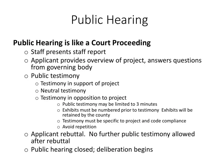
public hearing
play

Public Hearing Public Hearing is like a Court Proceeding o Staff - PowerPoint PPT Presentation

Public Hearing Public Hearing is like a Court Proceeding o Staff presents staff report o Applicant provides overview of project, answers questions from governing body o Public testimony o Testimony in support of project o Neutral testimony o


  1. Public Hearing Public Hearing is like a Court Proceeding o Staff presents staff report o Applicant provides overview of project, answers questions from governing body o Public testimony o Testimony in support of project o Neutral testimony o Testimony in opposition to project o Public testimony may be limited to 3 minutes o Exhibits must be numbered prior to testimony Exhibits will be retained by the county o Testimony must be specific to project and code compliance o Avoid repetition o Applicant rebuttal. No further public testimony allowed after rebuttal o Public hearing closed; deliberation begins

  2. Comprehensive Plan Amendment & Zone Change AM0001-20 & ZC0001-20: Richardson Bonner County Commissioners May 13, 2020

  3. Comp Plan & Zone Change AM0001-20 & ZC0001-20: Richardson o The applicant is requesting a comprehensive plan amendment from Urban Growth Area/Rural Residential to Urban Growth Area, and a zone change from Suburban/Rural-5 to Suburban. The property is currently split zoned Suburban and Rural-5. o The property is assessed at 4.67 acres with a portion submerged in Lake Pend Oreille. The property abuts Lake Pend Oreille, and contains mapped wetlands and Special Flood Hazard Zone AE. o Current structures were built in 1970 and the dock and slip were established in 1980 per assessor records (Proval). o The property is located Section 35, Township 57 North, Range 2 West, off of Pierce Lane, an unpaved, private road, off Birch Haven Drive (county owned and maintained)

  4. Comp Plan & Zone Change AM0001-20 & ZC0001-20: Richardson o Environmental features: Project Summary: o Site does not contain mapped slopes. (USGS) o Site Data: o Site does contain mapped wetlands. (USFWS) o Residential use o Site does contain waterfront on Lake Pend Oreille. (NHD) o Unplatted o This is a proposal for a density increase in Special Flood Hazard Areas (SFHA), per submitted application and o Size: 4 acres FIRM Panel 16017C0950E, Effective Date 11/18/2009. o Zone: Suburban & Rural-5 Approval of this application may render Bonner County ineligible to continue as a member-in-good-standing in o Land Use: Urban Growth Area (<=2.5 the NFIP CRS. (See agency comments) AC) & Rural Residential (5-10 AC) o Soil: Pend Oreille Silt Loam, 5 To 45 Percent Slopes o Legal per: Instrument #572132 o Classification: Not Prime Farmland o Drainage: Well Drained o Access: The property is access off Pierce o Site Services: Lane (private road) from Birch Haven o Water: Individual system, Mountain Springs Water Drive (county owned and maintained). District, and adjacent to Southside Water and Sewer. o Sewage: Individual system and adjacent to Southside Water and Sewer o Fire: Selkirk Fire District o Power: Avista o School District: Bonner School #84

  5. Site Plan

  6. Aerial View

  7. Comprehensive Plan Designation

  8. Zone Designation

  9. Comp Plan & Zone Change AM0001-20 & ZC0001-20: Richardson o Agencies Routed: o Replied No Comment • • City of Clark Fork All Taxing Districts • • Idaho Department of U.S. Army Corps (Coeur d’Alene) • Bonner County Road Department Environmental Quality • • Idaho Department of Fish Idaho Department of Lands (Sandpoint) and Game • Avista Utilities • Bonner County Road • BNSF Railway Department • • Idaho Department of Lands Idaho Department of Lands, Nav. Waters • Independent Highway • U.S. Fish and Wildlife Service District • Idaho Department of Fish and • Kootenai-Ponderay Sewer Game District • Idaho Department of • U.S. Fish and Wildlife Environmental Quality Service • Idaho Department of Water Resources

  10. Comp Plan & Zone Change AM0001-20 & ZC0001-20: Richardson Agency Comments • Floodplain Manager – Jason Johnson, February 24, 2020 • This is a proposal for a density increase in Special Flood Hazard Areas (SFHA), per submitted application and FIRM Panel 16017C0950E, Effective Date 11/18/2009. • Membership in the National Flood Insurance Program Community Rating System (NFIP CRS) requires Bonner County to maintain existing low-density zoning within all regulated SFHAs within Bonner County. Bonner County is required to re-certify continued CRS eligibility annually. Part of this recertification process includes confirmation from the Bonner County Floodplain Manager that Bonner County continues to maintain existing low-density zoning within the regulated SFHA. This proposal is contrary to this required maintenance of low density. • Approval of this application may render Bonner County ineligible to continue as a member-in-good-standing in the NFIP CRS, and may require withdrawal by Bonner County from the NFIP CRS. This would result in Bonner County losing existing NFIP flood insurance discounts, which are currently 10% below full- prices. This would lead to an increase in flood insurance costs county-wide. • Panhandle Health District – Timothy French, February 25, 2020. • Stated they do not have a comment for the file but wanted to submit a reminder to the applicant to ensure any land division or development obtain a valid septic permit.

  11. Comp Plan & Zone Change AM0001-20 & ZC0001-20: Richardson Public Comments • Ann M. Hargis & H. Denny Liggitt, February 26, 2020 – Has concerns regarding increased density and future subdivisions affecting narrow private road and only venue for emergency access; pollution of their artesian well; and regulations on septic development. They addressed previous subdivision proposals in the area that were denied and may have a basis in this file decision. • David and Caroline Argo, February 27, 2020 – Has concerns regarding future subdivisions, traffic impacts for narrow road, snow removal, lack of urban services for subject property, pollution from new septic systems. Requests that decision consider previous denials of subdivisions in the area. • Robert & Carolyn Gumerman, February 27, 2020 – Has concerns regarding future subdivisions, traffic impacts for narrow road, snow removal, lack of urban services for subject property, pollution from new septic systems. Requests that decision consider previous denials of subdivisions in the area. Stated the Richardson Property cannot obtain a hook up to Mountain Springs Water Company without other property owner’s approval.

  12. Comp Plan & Zone Change AM0001-20 & ZC0001-20: Richardson Standards of Review: BCRC 12-215: Applications for Zone Changes and Comprehensive Plan Map Amendments, Contents o The application was considered complete and routed to agencies accordingly. BCRC 12-216: Evaluation of Amendment Proposals o Staff and the governing bodies shall review the particular facts and circumstances of each proposal submitted and shall determine whether there is adequate evidence that the proposal is in accordance with the general and specific objectives of the comprehensive plan.

  13. Comp Plan & Zone Change AM0001-20 & ZC0001-20: Richardson Standards of Review: Comprehensive Plan: Comparative Analysis • Urban Growth Criteria • Recognizes the historic developments of communities and neighborhoods ✔ • Served by either urban water or sewer services or are located within the fringes of incorporated cities where such services have or can be extended to serve these areas ✔ • Generally level to moderately sloped ✔ • Served by a network of primary transportation systems ✔ • Rural Residential Criteria • Where urban services are not available ✖ • Slopes may vary up to 30% ✖ • Areas include hazard areas and critical wildlife habitats, where lower densities reduce potential impacts to resources and exposures to loss of property or lives ✔ • Small-scale agricultural uses and residential development are permitted.

  14. Comp Plan & Zone Change AM0001-20 & ZC0001-20: Richardson Standards of Review: Zoning District: Comparative Analysis • Suburban Criteria • Comprehensive plan is urban growth area ✔ • Located on the edges of the incorporated cities or other developed communities or areas ✔ • Where urban sewer and water services are either available or have the potential to become available in the near future by reason of their inclusion in service districts, city service areas, or are adjacent to those areas or areas of city impact. ✔ • Access to primary transportation routes with system of hard surfaced roads ✔ • Rural-5 Criteria • Limiting residential densities and permitted uses to those that are compatible with rural character and nearby resource production districts and sites and can be adequately supported by rural service levels ✖ • Allows small scale farming and forestry activities, and tourism and recreation uses that can be supported by rural service levels and are compatible with rural character ✖ • Encouraging conservation development configurations that create permanent open space or farming areas, protect sensitive environmental features, reduce infrastructure costs and/or enhance recreational opportunities ✖ • R-5 in areas designated rural residential in the comprehensive plan that are already developed at or near the one dwelling unit per five (5) acre density ✖

Download Presentation
Download Policy: The content available on the website is offered to you 'AS IS' for your personal information and use only. It cannot be commercialized, licensed, or distributed on other websites without prior consent from the author. To download a presentation, simply click this link. If you encounter any difficulties during the download process, it's possible that the publisher has removed the file from their server.

Recommend


More recommend