Project Status and Needs Joint BTC Meeting May 8, 2014 Green - - - PowerPoint PPT Presentation
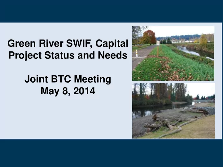
Green River SWIF, Capital Project Status and Needs Joint BTC Meeting May 8, 2014 Green - Duwamish River Facilities (RM 5.5-44) What is a System Wide Improvement Framework (SWIF)? USACE SWIF policy (November 2011): A plan prepared by levee
Green - Duwamish River Facilities (RM 5.5-44)
What is a System Wide Improvement Framework (SWIF)?
USACE SWIF policy (November 2011):
“A plan prepared by levee sponsors and approved by USACE to implement system-wide improvements to multiple levee systems w/in a watershed to address system-wide issues, including correction of unacceptable inspection items to
- ptimize flood reduction.”
“…facilitates the development of solutions to issues that cannot be accomplished through routine corrective actions…solutions will satisfy multiple requirements that apply to levee systems (ESA, CWA, Tribal Treaty Rights) while allowing levee sponsors to remain eligible for PL84-99 funding while addressing deficiencies.”
Lower Green River: Context
Socio-Economic
- $7.3 billion in floodplain
including:
- 100,000 jobs
- 100 million square feet
warehouse and distribution space (2nd largest on West Coast)
- Comprises 1/8th of the
GDP for WA State
- Annual taxable
revenue of $8 billion
Lower Green River: Context
Salmon Populations & Habitat
- All species of salmon
present, including federal ESA-listed Chinook salmon
- Limited spawning in Lower
Green (above RM 24)
- Lethal water temperatures
(> 23oC) have occurred in Green River mainstem (July 2006); TMDL water quality standard is 16oC
- Tribal fishing rights
Location Levees (#/miles) Revetments (#/miles) Total Miles Duwamish (RM 5.5-11) 3 (0.6 miles) 22 (3.3 miles) 3.9 Lower Green (RM 11-32) 41 (17.7 miles) 45 (9.8 miles) 27.5 Middle Green (RM 32-44) 12 (1.9 miles) 13 (2.9 miles) 4.8 Total 56 (20.2 miles) 80 (16.0 miles) 36.2 miles PL 84-99 levees (RM 12.4-30.8) 12 (16 miles)
Green River Flood Facilities Overview
Levees and Revetments
- Aging system of levees – built to protect agricultural
land uses, not regionally significant urban areas
- Slope stability and toe scour issues
- Other deficiencies – vegetation, encroachments,
animal burrows, etc.
What is the Green River SWIF?
Technical planning, analyses and participatory process to achieve:
- 1. Desired level of protection from flooding
- 2. Reach agreement on a prioritized list of
capital projects to provide flood protection while improving habitat, and
- ther goals (e.g., recreation, agriculture)
- 3. Vegetation management plans to
address ESA, CWA, and PL 84-99 stds
- 4. Achieve integrated river and floodplain
management objectives
Green SWIF – Advisory Structure
Flood Control District decisions and SWIF products informed by:
- Advisory Council
- Technical Advisory
Committee
- Citizen input solicited
at public meetings
8
Green SWIF: Who is Involved?
- King County Flood Control
District, lead agency
- King County
- Green River Cities
- Muckleshoot Tribe
- USACE, FEMA, NOAA
- WRIA 9
- PSP, Ecology, WDFW
- Business community
- Environmental organizations
- Citizens
9
Green SWIF Vision and Goals
Vision: Improve flood protection, for current and future generations, in a way that builds economic, ecological and community resiliency Goals:
- Integrated River and Floodplain
Management
- Flood Protection
- Vegetation Management
- Ecological Resiliency
- Economic Resiliency
- Community Resiliency
10
Current Conditions Report: Hydraulic Assessment (Inundation)
12,600 cfs 18,800 cfs 15,100 cfs
Current Conditions Report: Flood Risk
Economic Modeling Areas Overtopping with Breach Map
Current Conditions Report
Key Findings – Economic Analysis
Expected Annual Damage (EAD) for National and Regional Damage Categories:
Damage Category Auburn (Upstream Left Bank) Tukwila (Downstream Left Bank) Kent/Renton (Right Bank) Duwamish (Downstream) TOTAL NED Damage Categories Total $3,449,000 (36.6%) $240,000 (22.9%) $10,430,000 (38.6%) $3,359,000 (46.8%) $17,478,000 (39.1%) RED King County Regional Output Effect $5,970,000 (63.4%) $810,000 (77.1%) $16,580,000 (61.4%) $3,815,000 (53.2%) $27,175,000 (60.9%) TOTAL $9,419,000 (100%) $1,050,000 (100%) $27,010,000 (100%) $7,174,000 (100%) $44,653,000 (100%) Table 2 – Existing Condition Estimated Annual Damage for Overtopping Scenario and Damage Areas
System-wide ($ EAD) $47,155,000 System-wide ($ PV) $1,106,050,000
* 3.75% interest rate and 50-year period of analysis
Green River SWIF Products & Timeline
- Technical Committee and Advisory
Council (2013 –2015)
- Current Conditions Report: flood
risk assessment, vegetation/habitat, socio-economic (May 2014)
- SWIF Alternatives Analysis
(Sept/Oct 2014)
- Capital project development and
priorities (Dec 2014)
- Complete SWIF (Feb 2015)
- SWIF funding and implementation
(March 2015 on)
Green River Capital Projects
Recently Completed or Planned for Construction (2013-2014)
- Reddington setback levee (2013)
- Black River Pump Station (2013-15)
- Upper Russell North Reach
secondary berm (2013) and intersection reach (2014)
- Briscoe-Desimone flood walls
Reaches 2 and 3 (2014)
- Reddington Levee Extension (2014)
Briscoe Project site-prep work April 2014
Reddington setback construction Sept 2013
Green River Capital Projects Proposed for Construction in 2015-2016
- Lower Russell Rd. levee setback (2016)
- Upper Russell South Reach secondary
berm (2015)
- Briscoe-Desimone flood walls -
Reaches 1 and 4 (2015)
- Boeing ERP and Levee improvements
(increased LOP) (2015-16)
- Horseshoe Bend early action (RM 24.5-
24.7) (2015-16)
- SWIF Implementation (2016 on)
Lower Russell Levee Project
- Right Bank