
SLIDE 1
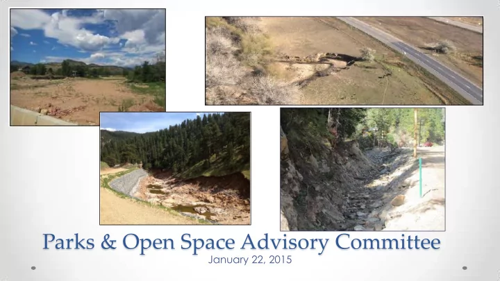
Parks & Open Space Advisory Committee
January 22, 2015
Parks & Open Space Advisory Committee January 22, 2015 - - PowerPoint PPT Presentation
Parks & Open Space Advisory Committee January 22, 2015 Watershed Recovery Future Creek Long-Term Immediate Emergency Projects Vision Threat Response Assessment and Mitigation Funding and Watershed Implementation Master Plans
January 22, 2015
Future Creek Projects Funding and Implementation Emergency Response Immediate Threat Assessment and Mitigation Long-Term Vision Watershed Master Plans
recovery and restoration
mitigation projects
master planning process
Little Thompson River
Emergency Response
Long-Term Vision Watershed Master Plans
Emergency Response
Long-Term Vision Watershed Master Plans
Left Hand Creek
Emergency Response
Long-Term Vision Watershed Master Plans
Fourmile Creek
Emergency Response
Long-Term Vision Watershed Master Plans
Coal Creek (Upper Reaches)
Emergency Response
Long-Term Vision Watershed Master Plans
Plan Completion: November
Enabling Flood Recovery through Watershed Planning
*Funding needed for project implementation, including
local match
Emergency Response
Long-Term Vision Watershed Master Plans
process and kick-off community meetings
workshops
master plans
Emergency Response
Long-Term Vision Watershed Master Plans
Poor Excellent Recommendations: Consider opportunities for improved meanders, habitat, vegetation, etc.; need to create more complexity within the channel No further management recommended
Long-Term Vision Watershed Master Plans
Left Hand Creek
Good
In tact section of lower Left Hand Creek (on BoCo Open Space). This reach largely in tact due to functioning, connected floodplain.
Poor
Tight bedrock pinch led to stripping of alluvium in James Canyon, ultimately destroying the roadway and the pre-flood channel.
Long-Term Vision Watershed Master Plans
Project Descriptions
Long-Term Vision Watershed Master Plans
Long-Term Vision Watershed Master Plans
Fourmile Creek Master Plan
Tier 1 - Projects reducing flood risk due to post-flood conditions Reach 1 – Removal of Sediment aggradation from the channel near Mile Marker 1.1 Reach 1 – Fourmile Creek restoration project (CWCB Grant) Reach 3 – Assessing the stability of existing walls and modifying if necessary Reach 3 – Filling and revegetating avulsion areas Reach 3 – Installing debris racks and stabilizing the banks of Ingram Gulch Reach 4 – Removal of sediment aggradation from the channel and floodplain near Mile Markers 5.1, 5.8, and 6.3 Reach 4 – Removing a debris jam in a high avulsion risk area near Mile Marker 7.7 Tier 2 - Projects that improve stream stability and promote ecological recovery All Reaches – Low flow channel restoration All Reaches – Increasing in-stream habitat All Reaches – Revegetation Reaches 1, 3, and 4 – Bank Protection Reach 3 – Relocating Fourmile Creek in the vicinity of Salina Junction Reach 4 – Removing a temporary berm near Mile Marker 7.2 and bank protection Tier 3 - Projects that affect areas with low risk to infrastructure Reach 2 – Filling the pre-flood channel to reduce avulsion risk
$68 million*
$20 million**
$2.6 million*
and cost estimates
$1.6 million
*Cost estimates for all Tier 1 projects with unmet needs **Cost estimates for all of the top 5 projects with unmet needs
Long-Term Vision Watershed Master Plans
actions
Emergency Response
Lon-Term Vision Watershed Master Plans
Long-Term Recovery
participate/give approval for any projects
Emergency Response
Long-Term Vision Watershed Master Plans
Long-Term Recovery
Emergency Response
Long-Term Recovery
Two Programs for Creek Recovery (DOLA/CWCB)
January Planning program: Projects (up to 30% design) Planning program: Staff Watershed program: Watershed Coordinators March Watershed program: Small scale or pilot projects November Watershed program: Large projects
County Applications- January
applications
restoration (roadway design integration)
Emergency Response
Long-Term Vision Watershed Master Plans
Long-Term Recovery
Next Steps: Creek Recovery and Restoration Program Activities (Winter-Spring)
funding applications
when funding secured
implementation
activities
Emergency Response
Long-Term Vision Watershed Master Plans
Long-Term Recovery
Feedback on Plans
January 21
January 22 Adoption
February 26
Long-Term Vision Watershed Master Plans
Julie McKay Phone: 720-564-2662 Email: jmckay@bouldercounty.org Website: www.BoulderCountyCreekPlan.org
– St. Vrain Creek Coalition – Michael Baker Jr., Inc. Consulting Team
meetings
damage assessment information
throughout process
Element (Boulder County 2014)
Plan (2003)
Ranch)
– Highlighted significant resources along creek designated as “Sensitive”
– Well-developed complex cottonwood-willow gallery forest – Most important native fisheries along Front Range – Numerous species of special concern
(Biohabitats 2009)
– 6 out of 14 reaches “High Functioning”, remaining 8 = “Moderate Functioning”
Breach Repair (Breaches 6-9) Low-flow Channel Reconstruction Bank Protection / Stabilization Habitat Restoration
Breach Repair (Reservoirs) Bank Protection / Stabilization Habitat Restoration
Breach Repair (Breach 2) Bank Protection / Stabilization Habitat Restoration
Breach Repair (Breach 1) Low-flow Channel Reconstruction Bank Protection / Stabilization Habitat Restoration
Natural Channel and Floodplain Bench Restoration Bank Protection / Stabilization Habitat Restoration
Natural Channel and Floodplain Bench Restoration Bank Protection / Stabilization Habitat Restoration
Natural Channel and Floodplain Bench Restoration Bank Protection / Stabilization Habitat Restoration
Work with City of Longmont Natural Channel Design and Floodplain Bench Bank Protection / Stabilization Habitat Restoration