
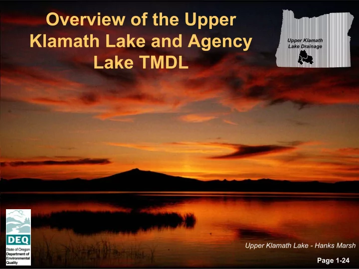
SLIDE 1
Overview of the Upper Klamath Lake and Agency Lake TMDL
Page 1-24
Upper Klamath Lake Drainage
Upper Klamath Lake - Hanks Marsh
Overview of the Upper Klamath Lake and Agency Upper Klamath Lake - - PowerPoint PPT Presentation
Overview of the Upper Klamath Lake and Agency Upper Klamath Lake Drainage Lake TMDL Upper Klamath Lake - Hanks Marsh Page 1-24 Why is DEQ doing a Total Maximum Daily Load (TMDL)? 1. The federal Clean Water Act requires that water quality
Page 1-24
Upper Klamath Lake Drainage
Upper Klamath Lake - Hanks Marsh
Williamson River Page 2-24
Upper Klamath Lake Page 3-24
Page 4-24
Algal Bloom in Upper Klamath Lake
Page 5-24
Drying sucker fish at the Lost River. Tribal fishing for suckers was stopped in the mid-1980’s. "We thought nothing of catching a five- or six-pound trout," recalls Basin resident Ivan Bold, remembering days
guides are also noting declining catches as the Basin's waterways struggle to support the demands placed
Historically, the Karuk people of the Klamath River harvested fish. Contemporary Karuk fishermen continue to dip net at Ishi Pishi Falls on the Klamath River. There, they may still harvest salmon and winter steelhead for subsistence purposes (NCIDC Photo Gallery).
Page 6-24
# S # S # S # S # S # S # S # S # S # S# S # S # S # S # S # S # S # S # S # S # S # S # S# S # S # S # S # S # S # S # S # S # S # S # S # S # S # S # S # S # S # S # S # S # S # S # S # S # S # S # S # S # S # S # S # S # S # S # S # S # S # S # S # S # S # S # S # S # S# S # S # S # S # S # S # S # S # S # S # S # S # S # S # S # S # S # S # S # S # S # S # S # S # S # S # S # S # S # S # S # S # S # S # S # S # S # S # S # S # S # S # S # S # S # S # S # S # S # S # S # S # S # S # S # S # S # S # S # S # S # S # S # S # S # S # S # S # S # S # S # S # S # S # S # S # S # S # S # S # S # S # S # S # S # S # S # S # S # S # S # S # S # S # S
Sun Creek S y c a n R i v e r W
R i v e r Williamson River Annie Creek S p r a g u e R i v e r Williamson River N . F . S . F . Fishhole Creek U p p e r K l a m a t h M a r s h S y c a n M a r s h
% 25 % 50 % 75 % 100 % Jan Feb M ar Apr M ay Jun Jul Aug Sep O ct N
ec Excursion Frequency pH > 9.0 pH > 9.5 D O < 4 D O < 6
50 100 150 200 250 300 350 400 450 1991 1992 1993 1994 1995 1996 1997 1998 1999 Total Phosphorus (ppb)
Outflow Lake
50 100 150 200 250 300 350 400 1991 1992 1993 1994 1995 1996 1997 1998 1999
Chlorophyll-a (ppb)
7.0 7.5 8.0 8.5 9.0 9.5 10.0 10.5 1991 1992 1993 1994 1995 1996 1997 1998 1999 pH
WQ Standard
Mean Lake Data (Kann and Walker, 2001)
Lake WQ Standard Excursion Frequency
Water Quality Monitoring Sites – Nutrients & Flow (USBR, USGS, Klamath Tribes, OSU, ODEQ) Page 7-24
Chlorophyll-a v. Phosphorus
Yearly lake mean total phosphorus is associated with chlorophyll-a to derive a TMDL target for total phosphorus.
Lake Mean pH v. Chlorophyll-a
Chlorophyll-a correlates to lake mean pH. To achieve the pH standard of 9.0, a target concentration of chlorophyll-a is necessary. Violations of water quality standards for pH and dissolved oxygen are directly related to algal productivity which in turn, is a function of phosphorous loading. Statistical Relationships support total phosphorus load reduction as the management goal for Upper Klamath and Agency Lakes Page 8-24
“The view of the lake as a naturally hypereutrophic system is consistent with its shallow morphology, deep
development, beginning in the late-1800’s and accelerated through the 1900’s, is strongly implicated as the cause of its current hypereutrophic character.”
5 10 15 20 25 0% 3% 6% 9% 12% 15% 5 10 15 20 25 5 10 15 20
1800 1825 1850 1875 1900 1925 1950 1975 2000 5 10 15 20
Aphanizomenon
Sediment core analysis demonstrates that sediment accumulation rates have increased over that past 120 years
Distribution of Blue Green Algae in Sediment Core Sediment Accumulation Rate (g/m2 yr) Sediment Depth (cm) Sediment Depth (cm) Depositional Year
Nitrogen fixing blue-green algae are now more abundant indicating an increase in phosphorus availability
Sediment Core Data (Eilers 2001) Page 9-24
Total Phosphorus Load as a Function of External and Internal Loads (Walker 2001)
Internal Loading 285 mtons/yr 61% of total External Loading 182 mtons/yr 39% of total Average Annual TP Loading 466 mtons/yr
294 265 195 394 212 376 257 113 208 112 169 241 220 208 285 182 100 200 300 400 500 600 1992 1993 1994 1995 1996 1997 1998 Average Total Phosphorus Loading (mtons/year)
External Load Internal Load
Page 10-24
Ex tern al Ph o sp ho ru s Lo ad Ex tern al Ph o sp ho ru s Un it A rea L o a d
48 .7 37 .8 86 .4 21 .7 13.5 3 5.2 16 .5 2 0.5 18 .1 4.9 0.6 1.9 17 6.7 181 .6 2 0 40 6 0 80 100 12 0 140 16 0 1 80 20 0 Spragu e River Williamson Rive r Williamson Rive r To ta l W oo d River ab ove W e ed Rd. Wo od River b elow W e ed Rd. W ood Rive r To ta l S eve nMile Cre ek A gricu ltural Pu mps Directly to La ke S prin gs, Un gag ed Trib s & Misc Sou rces Pre cipitatio n Ch iloq uin S TP Cro oked Cre ek Hatch ery W etlan d Sou rces Total Tribu ta ry/S pring Inflow Total Inflow
To tal Ph osp ho rus L oad Expo rt (1000 kg p er year) C urrent Pho sph oru s L oad Facto red into N o npo int Sou rce A reas
11 .5 10 .8 1 1.2 64.9 237 .0 90 .0 156 .2 18 8.2 15.8 18 .0 18.6 50 1 00 15 0 20 0 25 0 Spragu e River Williamson Rive r Williamson Rive r To ta l W oo d River ab ove W e ed Rd. Wo od River b elow W e ed Rd. W ood Rive r To ta l S eve nMile Cre ek A gricu ltural Pu mps Directly to La ke S prin gs, Un gag ed Trib s & Misc Sou rces Pre cipitatio n Ch iloq uin S TP Cro oked Cre ek Hatch ery W etlan d Sou rces Total Tribu ta ry/S pring Inflow
T otal Pho sp ho ru s U n it L oad E xp or t (kg /km 2 per year) C urr ent Ph osph oru s U nit Area L oad N /A N /A Factored into No np oint Sou rce Ar eas
throughout the Upper Klamath Lake drainage.
source areas and that contribute directly to the lake phosphorus levels.
“hot spots” or source areas.
0% 10% 20% 30% 40% 50% 60% 70% 80% 90% 100% External Phosphorus Load Drainage Area Inflow Volume to Lake Distribution of Total
Crooked Creek Hatchery Chiloquin STP Precipitation Springs, Ungaged Tribs & Misc Sources Agricultural Pumps Directly to Lake SevenMile Creek Wood River Sprague River Williamson River Portion of External Phosphorus Load, Drainage Area and Inflow Volume to Lake
Distributions of External Phosphorus Loading, Drainage Area and Flow Input to Upper Klamath and Agency Lakes Page 11-24
Agricultural Returns and Nutrient Leaching from the Lower Williamson River Delta Wood River Canal Wood River Reclaimed Wetland at Modoc Point Road Agriculture Pumps on Reclaimed Wetlands
1) Reclaiming/draining near lake wetlands for agricultural uses. Wetland reclamation and use may account for 29% of the external total phosphorous loading to the lake (ODEQ 2001), and 2) Increased water yields and runoff rates in the Williamson and Sprague River Drainages have been documented in the 1951-1996 period that are independent of climatic conditions (Riseley and Laenen 1998). The increase in water yield is likely caused by channelization, wetland/riparian area conversions and reductions evapotranspiration in the watershed. Increased water yields are associated with increased erosion and particulate total phosphorus transport. These increased water yields are likely the result human land use and may account for 18% of the external phosphorus loading to the lake (ODEQ 2001).
Turn of the century canal construction & wetland draining Erosion and Particulate Total Phosphorus Transport
Anthropogenic sources of external loading (loading from sources other than natural background and sediments in the lake) have increased total loading to the lake via: Page 12-24
Williamson River Upper Klamath Lake
Dikes Gravity Drainage
Upper Klamath Lake
Example of an Upper Klamath Lake Reclaimed Wetland Williamson River Delta Dikes are constructed to disassociate the wetland from the river and lake waters. Gravity drainage and agriculture pumps maintain lower water surface elevations below the dikes. The difference between water surface elevation between the lake and the reclaimed wetlands can reach 7-8 feet. Subsidence is a commonly experienced in these
(1997) report subsidence values ranging from 1 to 13 feet. Rectified Aerial Photo August, 1998 Landsat Image (August, 2000)
Reclaimed Wetland Dike Lake Water Column Water Table
Example of an Upper Klamath Lake Reclaimed Wetland Williamson River Delta
Dikes are constructed to disassociate the wetland from the river and lake
agricultural pumps maintain lower water surface elevations below the
water surface elevation and the reclaimed wetland can reach 7-8 feet. Subsidence is commonly experienced in these areas due to soil loss, decomposition and loss of buoyancy (Snyder, personal communication). Maximum subsidence in this area is reported as 9-10 feet (TNC, personal communication).
Page 13-24
Extensive wetland draining has occurred around Upper Klamath Lake and Agency Lake, starting in 1889 and continuing through 1971. Drained wetlands are a large source of nutrients to Upper Klamath Lake (data and image from Snyder, 2001 ).
August 1, 2000 (Landsat 7 Image)
Upper Klamath Lake Agency Lake Klamath Falls Chiloquin Rocky Point
Undrained Wetlands Drained Wetlands Restoration in progress
Estimated Phos phorus Loss from Re claimed Wetlands (Based on Calculated First Order Decay Rates)
5000 10000 15000 20000 25000 1880 1890 1900 1910 1920 1930 1940 1950 1960 1970 1980 1990 2000 2010 2020 2030 2040
Year Drained Wetlands that Connected to Upper Klamath Lake (acres)
16 32 48 64 80
Estimated Phosphorus Loss from Reclaimed Wetlands (1000 kg per year)
Reclaimed Wetland Area
Without Wetland Restoration With Wetland Restoration
Phosphorus losses from reclaimed wetlands peaked in 1963 at 68,200 kg per year. Estimated year 2001 estimates are greatly reduced to ≈11,000 kg per year due to wetland restoration that is in progress. This represents a best-case scenario where restored wetlands not longer contribute to peat soil decomposition. Calculations that estimate a condition in which no restoration is occurring substantially increase the losses in phosphorus to ≈52,000 kg per year. It is important to note that the average total external phosphorus load to Upper Klamath Lake is 181,600 kg per year. Therefore, total phosphorus derived from reclaimed wetlands potentially account for 29% of the external load. Page 14-24
50 100 150 200 250 300 350 400 450 1993 1994 1995 1996 1997 1998 1999 Total Phosphorus (ppb)
RM 0 RM 5.9 Lake Mean TP Mean Spring (77 ppb)
50 150 250 350 450 1993 1994 1995 1996 1997 1998 1999 Wood River Change in Total Phosphorus RM 5.9 to RM 0 (ppb) Yearly Median
tributaries and rivers are elevated above headwater spring (background) conditions.
along Wood River over a five-year period showed that nutrient concentrations increased consistently as the river traveled through heavily impacted areas in the lower watershed (i.e. downstream from Weed Road Bridge) (Kann and Walker, 2001).
increases summarized by year (1993 to 1999) range from 45 to 17 µg/l.
associated with winter and spring flows.
25% 50% 17% 8% 0% 10% 20% 30% 40% 50% Jan-Mar Apr-Jun Jul-Sep Oct-Dec Seasonal Distribution of Measured Increases in Total Phosphorus Greater than 50 ppb in the Lower Wood River (RM 5.9 to RM 0)
Page 15-24
100 200 300 400 500 600 700
January March May July September November
100 200 300 400 500 600 700
January March May July September November
Total Phosphorus Loading (kg day-1)
Sprague River at Mouth (n = 151) Williamson River Upstream of Sprague Rive Confluence (n = 146) Total Phosphorus Loading Monthly Comparison 75th Percentile, Median Value and 25th Percentile
(Al), both of which suggest major increases in erosion inputs to Upper Klamath Lake in the last century (Eilers et al. 2001).
be correlated to both runoff events and suspended solids concentrations.
phosphorus loading rates.
source of erosional and runoff phosphorus loading. When summarized by monthly values, the Sprague River phosphorus loading is a function of season and high flow timing.
1 10 100 1,000 10,000 1 10 100 1,000 10,000 Q - Flow Volume (cfs) LTP - Daily Total Phosphorus Loading (kg day-1)
Williamson River Upstream Sprague River Confluence LTP = 1.3983.Q0.8838 R2 = 0.46, n = 146 Sprague River at Mouth LTP = 0.0433.Q1.2086 R2 = 0.89, n = 151 Daily Total Phosphorus Loading v. Flow Rate
Page 16-24
200 250 300 350 400 450 500 Williamson R. Subbasin Sprague R. Subbasin Mean Yearly Runoff (1000 acre-feet) 30% 32% 34% 36% 38% 40% 42% 44% Observed Increase in Mean Yearly Runoff 1922-1950 1951-1996 Average Increase
Two Sample Tests for Differences in Williamson and Sprague River Annual Runoff for Two Periods (1922-1950 and 1951-1996) (Risley and Laenen, 1998)
Sprague River drainages suggest that runoff patterns have changed as a result of human land use patterns (Riseley and Laenen 1998).
temperature) were included in the analysis to account for the influence of climate on historical runoff data.
measured below the confluence and at the mouth of the Sprague River near Chiloquin.
34% in the Williamson River subbasin and 42% in the Sprague River subbasin (Riseley and Laenen 1998).
18.0% 32.7 86.5 37.8% Total 11.1% 20.2 48.7 41.6% Sprague River Subbasin 7.1% 12.9 37.8 34.2% Williamson River Subbasin Potential Total Phosphorus Load Reduction as a Percent of the Total External Load (181,600 kg/year) External Phosphorus Load Associated with Increased Water Yield (1000 kg/year) Current External Total Phosphorus Load (1000 kg/year) Increase in Water Yield from 1922-1950 Period to 1951- 1996 Period
Williamson River and Sprague River Drainage Water Yields and Associated Total Phosphorus Loading Rates Page 17-24
Hydrology Total Phosphorus Loading Other Variables
Solar Radiation Lake Depth Water Temperature Julian Day
Non-Algal Phosphorus pH Sediments Outflow Burial Algal Phosphorus Chlorophyll-a Phosphorus Flux Control Pathway Conceptual Diagram of the pH Model (Walker, 2001) The response of pH levels at various phosphorus loading levels for Upper Klamath and Agency Lakes was developed using a dynamic mass-balance model that simulates phosphorus, chlorophyll-a and pH variation as function of external phosphorus loads and other controlling factors (see Conceptual Diagram). The model is calibrated with extensive monitoring data collected for the Lake and its tributaries between 1992 and 1998.
Page 18-24
25,000 50,000 75,000 1991 1992 1993 1994 1995 1996 1997 1998 1999 TP Load (kg / 14 days) Inflow Outflow Gross Sed Recycle Burial Net Flux
Inflow Outflow Gross Sedimentation Recycling Upper Klamath Lake Phosphorus Sources, Losses and Sinks Precipitation Net Retention
Phosphorus sources to the lake water column result from inflow (including precipitation) and recycling from lake
pathways (i.e. inflows, outflows, gross sedimentation, recycling and burial) combine to control the total available phosphorus concentration in the lake at any given time (see black line). Seasonally, external loading dominates in the spring and internal loading is dominant in the summer, while the fall is period when gross sedimentation creates a negative flux from the lake water column.
Lake Mean Total Phosphorus Concentration data from Kann and Walker (2001) 50 100 150 200 January February March April May June July August September October November December Total Phophorus Concentration (ug/l)
Average
Page 19-24
Lake Total Phosphorus Flux Pathways
Simulation results are expressed as relationships between percent reductions in external total phosphorus loads and pH excursion frequencies, computed using various spatial and temporal averaging methods. Total phosphorus reduction simulation results for external phosphorus loading reductions ranging from 0% to 55%. Analytical outputs suggest that excursion frequencies for the pH standard can theoretically be reduced to ~0%, if the load for total phosphorous is reduced by 50% (Walker 2001). However, there is evidence that such a load reduction is not possible/feasible.
Lake-Mean pH Frequency as a Function of Phosphorus Load Reduction (Walker, 2001)
Page 20-24
0% 0% 55% 0% 0% 50% 3% 0% 45% 6% 4% 40% 11% 5% 35% 19% 15% 30% 28% 16% 25% 75% 29% 0% Summertime Mean June-July Year Round Mean Reduction in External Loading Frequency of pH Values > 9.0 0% 0% 55% 0% 0% 50% 3% 0% 45% 6% 4% 40% 11% 5% 35% 19% 15% 30% 28% 16% 25% 75% 29% 0% Summertime Mean June-July Year Round Mean Reduction in External Loading Frequency of pH Values > 9.0
Loading Capacity is: “the greatest amount of loading that a water can receive without violating water quality standards.” (40 CFR § 130.2(f)). The load capacity is estimated for purposes of this TMDL as the external total phosphorus loading into Upper Klamath and Agency Lakes that corresponds to a reduction of approximately 40% from current conditions. A Load Allocation (LA) is the amount of pollutant that non-point sources can contribute to the stream without exceeding state water quality standards. The Waste Load Allocation (WLA) is the amount of pollutant that point sources can contribute to the water body without violating water quality standards. In light monitoring and analytical limitations and the complexity of the lake and drainages, the selection of a TMDL targeted loading condition and compliance frequency ultimately becomes a professional judgment. As is the case in any such professional judgment, there are varying perspectives on an appropriate targeted
represents the targeted condition for this TMDL. This target acknowledges external load reductions that range from 33% to 47% as well as, other potential external loading reductions that demonstrates a potential 29% reduction in external total phosphorus loading from near-lake wetland restoration and an additional 18% reduction in external total phosphorus loading resulting from upland hydrology and land cover restoration. Page 21-24
0.6 1.9 179.2 181.6 0.3 1.3 109.1 107.5
20 40 60 80 100 120 140 160 180 200 Chiloquin STP Crooked Creek Hatchery External NPS Loading Total External Load Total Phosphorus Load (metric tons per year)
Current Condition TMDL Targeted Condition
Nonpoint Source Loading Allocations Point Source Waste Load Allocations Loading Capacity
Upper Klamath Lake sampled June 17, 2001 - Extensive blooms of the cyanobacterium Aphanizomenon flos- aqaue (AFA) are apparent. Image courtesy USGS EROS Data Center. Page 22-24
Spring Creek Page 23-24
30 3(d) Listings Initial TMDL/W Q MP Im plem entation Tim e W ater Quality C ondition Poor WQ Standards Analyze and Adjust TMDL, WQMP or Targeted WQ Con dition WQ Benchmark WQ Benchmark Ta rgeted W Q Condition Good WQ Monito rin g, Expand Scientific U nderstanding and Im prove Im plementation Strategy
Adaptive Management
information
the TMDL targets and implementation strategy and refine where appropriate.
Page 24-24