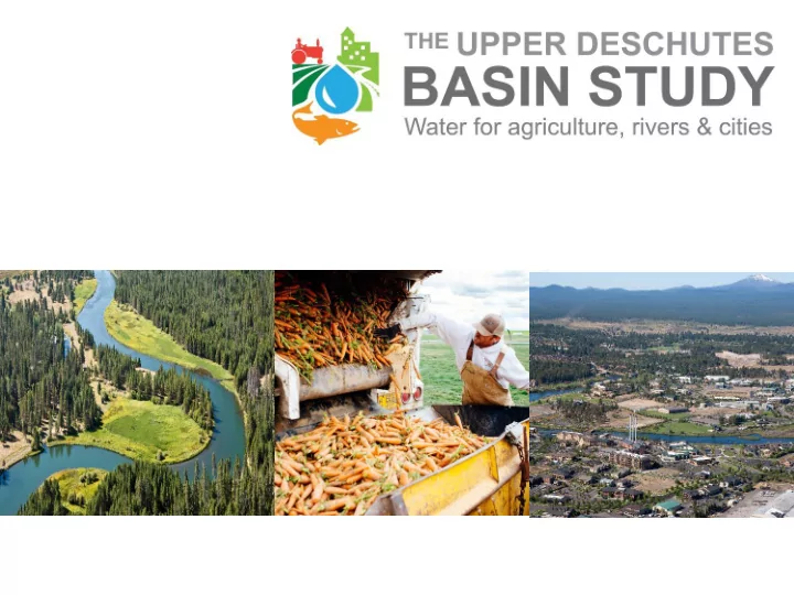
OUTLINE Context- why a Basin Study? What the Basin Study is/isnt - - PowerPoint PPT Presentation

outline
SMART_READER_LITE
LIVE PREVIEW

OUTLINE Context- why a Basin Study? What the Basin Study is/isnt - - PowerPoint PPT Presentation

OUTLINE Context- why a Basin Study? What the Basin Study is/isnt Key information from the Basin Study How to learn more/provide input Q & A Poster Open House History/Context Starting in the 1800s, federal and


slide-1
SLIDE 1
slide-2
SLIDE 2

OUTLINE

 Context- why a Basin Study?  What the Basin Study is/isn’t  Key information from the Basin Study  How to learn more/provide input  Q & A  Poster Open House

slide-3
SLIDE 3

History/Context

 Starting in the 1800s,

federal and state policies encouraged westward settlement by making land and irrigation water accessible

 This led to a diverse

agricultural economy and culture in Central Oregon

slide-4
SLIDE 4

Unintended Consequences

 State granted more water

rights for out of stream use than exist instream in summer months in some cases

 Low or altered streamflows  Instream flows not awarded

‘beneficial use’ under state water law until 1987

slide-5
SLIDE 5

Collaborative Progress Restoring Flows

Whychus Creek Middle Deschutes

0 cfs 130 cfs 30 cfs 20 cfs

slide-6
SLIDE 6

Remaining Issues

 Streamflow restoration

needs still exist

 Restoring the Upper

Deschutes River is a particularly complex and significant issue

slide-7
SLIDE 7

Additional Demands for Water

Growing urban communities

slide-8
SLIDE 8

Upper Deschutes Basin

How do we meet current and future water needs?

Basin stakeholders chose to apply for and secure a Basin Study to provide information on solutions

slide-9
SLIDE 9

Basin Study Work Group

  • Central Oregon Irrigation District
  • North Unit Irrigation District
  • Arnold Irrigation District
  • Swalley Irrigation District
  • Lone Pine Irrigation District
  • Tumalo Irrigation District
  • Ochoco Irrigation District
  • Three Sisters Irrigation District
  • City of Bend
  • Avion
  • City of Madras
  • City of Redmond
  • City of LaPine
  • City of Prineville
  • USDA Forest Service
  • Department of Environmental Quality
  • US Fish and Wildlife Service
  • Confederated Tribes of Warm Springs
  • Deschutes County
  • Coalition for the Deschutes
  • Crooked River Watershed Council
  • Upper Deschutes Watershed Council
  • Sunriver Anglers
  • Central Oregon Flyfishers
  • Deschutes River Conservancy
  • Trout Unlimited
  • Native Reintroduction Network
  • Bureau of Reclamation
  • Oregon Water Resources Department
  • Oregon Land and Water Alliance
  • Oregon Department of Agriculture
  • Deschutes Soil and Water Conservation

District

  • Portland General Electric
  • WaterWatch
  • Deschutes Water Alliance
  • Bend Paddle Trail Alliance
slide-10
SLIDE 10

 3 Year Study  $1.5 Million (Funded by Reclamation & Oregon

Water Resources Department)

 Bureau of Reclamation Study Framework  Co-managed by Bureau of Reclamation & Basin

Study Work Group

Basin Study Basics

slide-11
SLIDE 11

Other Supporting Funders

 Meyer Memorial Trust  Bella Vista Foundation  Oregon Community Foundation  National Fish and Wildlife Foundation  Collins Foundation  Lamb Foundation

slide-12
SLIDE 12

Objectives of Basin Study

 Evaluate and quantify current and future water supply and

demand, including climate change projections

 Develop and analyze potential tools that could be

considered for addressing identified imbalances in supply and demand

 Evaluate potential water management tools in terms of

effectiveness, cost, environmental impact, risk, stakeholder response and other factors

slide-13
SLIDE 13

What the Basin Study is not

 Implementation Plan

 The study will not propose or recommend any

particular action

 Habitat Conservation Plan  NRCS Watershed Plans

slide-14
SLIDE 14

Basin in Study - Overview

Historic Climate Climate Change Models Water Resource Model Water Cons Assessment Reservoir Optimization Storage Assessment Policy, Legal, Socio- Economic Middle D Ecological Crooked Ecological Whychus Ecological Upper D Ecological Inflow Forecasting Impacts Water Use Water Rights Future Existing Other Develop Scenarios Evaluation/Recommendations BSWG Workshop BSWG Workshop Multi-Criteria Evaluation BSWG Workshop Water Resource Alternatives Groundwater/Surface Water Model

slide-15
SLIDE 15

Study Take-Aways

 We have a good set of water supply tools to meet

needs; all have opportunities and barriers

 To address shortages, particularly in dry years, we

will need to consider all the available tools

 This will require significant investment, financially

and culturally

slide-16
SLIDE 16

Water Supply Goals

 Secure and maintain

streamflows and water quality for the benefit of fish, wildlife and people

 Secure and maintain a

reliable and affordable supply of water to sustain agriculture

 Secure and maintain a

safe, affordable and high quality water supply for urban communities

slide-17
SLIDE 17

Irrigation Demand

 Acre-foot = water needed to cover an acre with a foot of

water

 Average annual surface water diversion for major irrigation

districts is 724,000 AF

 Goal to maintain existing water supply reliability  More challenging for “junior” irrigation districts

Total Annual Inflows to the Basin

  • 860,000 to 2.3 million AF
slide-18
SLIDE 18

Municipal Demand

 Current annual demand: 40,000 AF (mostly

groundwater)

 Projected 50-year demand will require 16,000 AF

  • f water dedicated instream for groundwater

mitigation

Total Annual Inflows to the Basin

  • 860,000 to 2.3 million AF
slide-19
SLIDE 19

Instream Demand

 Instream demands were modeled at 2 levels Current State Instream Water Rights In some reaches, higher flows that may provide

broader ecological benefits

Total Annual Inflows to the Basin

  • 860,000 to 2.3 million AF
slide-20
SLIDE 20

Shortages

 Median shortages associated with meeting instream water

rights and existing irrigation demands are ~130,000 AF. Shortages range up to 300,000 AF in dry years.

 To meet higher flows that may contribute to broader ecological

benefits in some reaches, median shortages are ~200,000 AF, ranging up to 400,000 AF in dry years.

Total Annual Inflows to the Basin

  • 860,000 to 2.3 million AF
slide-21
SLIDE 21

The need for integrated solutions

 8 irrigation districts  5 reservoirs  Low and altered

streamflows

 Cities and private water

suppliers

 A finite supply of water

slide-22
SLIDE 22

Water Supply Tools Studied

  • 1. Water Conservation Infrastructure
  • 2. Market-Based Approaches
  • 3. Storage Concepts
slide-23
SLIDE 23

Water Conservation Infrastructure

 Actions that increase

efficiency of irrigation water delivery and use

 Piping canals  Piping private laterals  On-farm infrastructure

upgrades

 Total opportunity is

~200,000 AF; $986M

 Cost-effectiveness varies

widely by project

*Opportunities and costs vary widely between and within districts.

slide-24
SLIDE 24

Water Conservation Infrastructure

 Benefits

 Upgrading infrastructure improves management and

  • perations

 No impact to irrigated acres  Piping canals and laterals increases opportunities for other

tools like water marketing

 Barriers

 Piping district canals is expensive  Potential opposition  Work on private laterals and on-farm requires action by

multiple private parties

slide-25
SLIDE 25

Water Conservation Infrastructure

A Proven Tool in the Deschutes

slide-26
SLIDE 26

Market-Based Solutions

 Using price incentives to change water use behavior

 Temporary lease of water rights  Voluntary duty reduction  Permanent water transfers

Water generated can move from farm to farm, or farm to river

~164,000 acre-feet may be available; $65M Costs range from $132/AF- $685/AF

slide-27
SLIDE 27

Market-Based Solutions

 Benefits

 Water may be available now at relatively low cost  Temporary tools are flexible and can be scaled in dry

years

 Barriers

 District operational issues  Need policies/programs to facilitate  Costs may increase due to the need to coordinate with

multiple private parties

slide-28
SLIDE 28

Market-Based Solutions

A proven tool in the Deschutes

slide-29
SLIDE 29

Storage Concepts

Why Storage?

 It may be possible to improve

streamflows by relocating existing storage and/or adding water storage capacity to provide flexibility in water operations

 Challenges  Land acquisition  Environmental impacts  Site-specific conditions  Permitting  Existing utilities &

infrastructure

 Historic properties  Cost  Fish Passage  Dam safety considerations  Other issues

slide-30
SLIDE 30

Storage Concepts

*Years of investigations would be needed before any particular project could be advanced

slide-31
SLIDE 31

 Insert toolbox overview

slide-32
SLIDE 32

Water Management Scenarios

 Purpose: to give us information about what putting different

combinations of tools together can achieve. Hypothetical scenarios to inform evaluation of solutions. Not implementation plans or prescriptions.

 4 Water Management Scenarios:

 2 designed to meet instream water rights  2 designed to try to meet higher flows  All try to meet irrigation demands, which are reduced through water

supply actions

 Various proportions of market-based and infrastructure tools  All move water between senior and junior users and to the rivers

slide-33
SLIDE 33

Water Management Scenarios Modeling

slide-34
SLIDE 34

Modeling Inputs

slide-35
SLIDE 35

Example Results

slide-36
SLIDE 36

Example Results

slide-37
SLIDE 37

Meeting Future Groundwater Needs

Municipal, Industrial, Commercial, Irrigation

 16,000 AF of

groundwater mitigation needed for municipal

 Comes from dedicating

water instream

 Study will evaluate

how well the tools and scenarios meet this need

40,000 16,000 130,000 724,000

100,000 200,000 300,000 400,000 500,000 600,000 700,000 800,000

City and Private Water Providers' Diversions (2014) Estimated Mitigation Needed to Meet 50-year City and Private Water Provider Demands Estimated Amount of Water Needed to Meet ODFW Minimum Instream Flow Targets in a Median Year Average Annual Irrigation District Diversions (2006-2014)

Acre feet per year Deschutes Basin Annual Diversion Volumes and Projected Future Demands for Mitigation 1 acre foot = 325,851 gallons

slide-38
SLIDE 38

Instream Studies

 Upper Deschutes Habitat Modeling  Flow-Temperature Assessments (Middle Deschutes,

Tumalo Creek, Whychus Creek, Lower Crooked River)

slide-39
SLIDE 39

Other Study Elements

 Additional Snow Telemetry Stations  Gaging at diversions  Potential Forecasting Improvements  Groundwater/Surface Water Switches and Aquifer

Recharge

 Legal and Policy Issues

slide-40
SLIDE 40

Next Steps

 Gather input  Evaluate results  Draft report  Study results can be used to inform continued

implementation of solutions

slide-41
SLIDE 41

How to get involved

 Provide input today (comment box)  Email input: bor-pnr-udbasinstudy@usbr.gov  Sign up for BSWG email list  https://www.usbr.gov/pn/studies/deschutes/  Posters available online at: www.deschutesriver.org

slide-42
SLIDE 42

Questions & Poster Open House