
SLIDE 1
www.benham.com
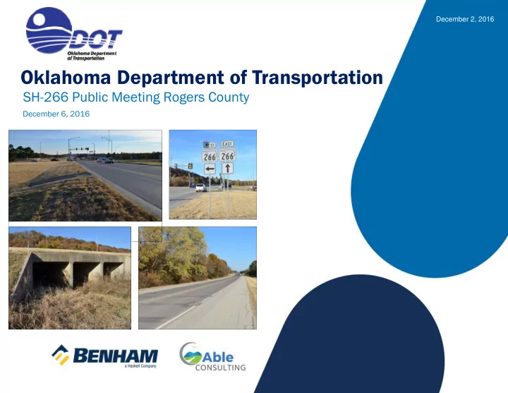
Oklahoma Department of Transportation
SH-266 Public Meeting Rogers County
December 6, 2016
December 2, 2016
Oklahoma Department of Transportation SH-266 Public Meeting Rogers - - PowerPoint PPT Presentation
December 2, 2016 Oklahoma Department of Transportation SH-266 Public Meeting Rogers County December 6, 2016 www.benham.com SH-266 Public Meeting December 2, 2016 Purpose of the Meeting Inform the Public of the proposed improvements to
www.benham.com
December 6, 2016
December 2, 2016
Inform the Public of the proposed improvements to SH-266 beginning east of Tulsa County Line and continuing east to SH-266 / SH-167 Junction | 2.3 Miles
Present the Results of the Environmental Studies
Solicit Input to aid ODOT in moving forward with the completion of the environmental studies, design and construction
2
December 2, 2016
Phase 1 is the portion of SH-266 beginning east of US 169 and continuing east 2.5 Miles
Under Construction
3
December 2, 2016
Phase 2 is the portion of SH-266 beginning east of the Tulsa County Line and continuing east 2.3 Miles to the SH-266 / SH-167 Junction
Grade & Drain for three new lanes
Scheduled to be let for construction in 2022
Planned improvements to SH-266 are a continuation of an ODOT commitment to improve this heavily used truck and commuter route
4
December 2, 2016
Phase 3 is the surfacing project for the same portion of SH-266 as Phase 2
Surfacing three new lanes
Reconstructing the Existing Lanes
Delayed to allow for fill consolidation
5
December 2, 2016
www.benham.com
December 2, 2016
Functional Classification
Urban/Rural Major Highway Collector | Flat Terrain
National Highway System Intermodal Connector C Major Port Facility
Indian Nation Metropolitan Planning Organization
INCOG Roadways Enhanced Plan Map
Planned Multi-Use Trail and Bikeway
7
December 2, 2016
Existing Typical Section
Two 12-foot Driving Lanes
10-foot Outside Shoulders
Open Section
Posted Speed Limit 45 to 65 mph
City of Tulsa owned Spavinaw Water Line Corridor along SH-266 to the North
8
December 2, 2016
Crooked Creek Bridge (National Bridge Inventory 17988)
Existing: Triple 12 ft X 10 ft X 116 ft Long Reinforced Concrete Box
Constructed in 1971
Sufficiency Rating - 82 (Not Deficient)
Located 2.2 miles East of Tulsa County Line
Hydraulic Study Completed
9
December 2, 2016
Hydraulics
Bird Creek Watershed
Federal Emergency Management Agency Zone AE Regulated Floodplain
No rise in Water Surface Elevation
Flood Insurance Rate Map
10
December 2, 2016
Existing Accident Rate
121 Accidents (2005-2015)
65% of Accidents are Intersection Related
Traffic Data
2016 Annual Average Daily Traffic (AADT) = 10,200
Warrants 4 Lanes
Truck % = 28
High Commuter Traffic
11
December 2, 2016
193rd East Avenue Intersection
Construction for Realignment Awarded in April 2016 by Rogers County
12
December 2, 2016
SH-167 Intersection
13
December 2, 2016
Deficient Roadway Section Warrants Improvement
Roadside Safety
No Left Turn lanes along SH-266 | Vehicles Stop in Through Lane
Restricted SH-266 Traffic Flow | Measured in Level of Service (LOS)
14
December 2, 2016
Improve Safety
Improve Traffic Flow
15
December 2, 2016
www.benham.com
December 2, 2016
Traffic Volumes Continue to Increase
Current 2016 Traffic Volume = 10,200 Vehicles per Day
Future 2036 Traffic Volume = 14,280 Vehicles per Day
Future Congestion Increases Without Improvements
Current 2016 Level of Service = D (at Minimum Accepted Value)
Future 2036 Level of Service = E (Below Minimum Accepted Value)
Analyzed how to Achieve an Acceptable Level of Service
4-Lane Roadway With Continuous Left Turn Lane
Improvements Result in Future Level of Service = A
17
December 2, 2016
Proposed Design Criteria | Roadway Typical Section
New Construction Extends Paved Section South of Existing
Four 12-foot wide Driving Lanes (2 Each Direction)
16-foot wide Center Turn Lane (With Rumble Strips at Edge of Lane)
10-foot wide Shoulders
Design Speed of 65 mph
Vertical Sight Distance
Horizontal Curves
Crooked Creek Bridge Box Extended
Proposed Improvements will be within existing Right of Way
18
December 2, 2016
193rd E. Avenue
North leg
(Awarded in April 2016) relocates Junction with SH-266 to the west
south of E 520 Road
South leg
19
December 2, 2016
www.benham.com
December 2, 2016
Environmental Resources that Require Studies and/or Coordination For this Project Area Includes:
Jurisdictional Waters and Wetlands with the US Army Corps of Engineers
Floodplains – Oklahoma Water Resources Board (OWRB) Permit
Threatened and Endangered Species – US Fish and Wildlife Service
Cultural Resources
Tribal Coordination
Farmlands
Hazardous Materials
Federal Aviation Administration (FAA) Permit
Noise
INCOG’s Long Range Plan | Multi-use trails / bikeway
Relocation Impacts / Right-of-Way Acquisition
Public Involvement / Solicitations
21
December 2, 2016
Jurisdictional Wetlands
22
December 2, 2016
Threatened and Endangered Species
American Burying Beetle
Northern Long-Eared Bat
Arkansas Darter
Interior Least Tern
Neosho Mucket
Rabbitsfoot Mussel
Whooping Crane
Piping Plover
Red Knot
Arkansas Darter
23
December 2, 2016
Bald Eagle and Swallows
Bald Eagles and Golden Eagles are protected by the Bald and Golden Eagle Protection Act
16 through May 31)
Cliff and Barn Swallows are protected by the federal Migratory Bird and Treaty Act
March 31, when nests are not occupied. If work cannot be completed during that time, the structure must be protected (netting) from new nest establishment prior to April 1, to avoid impacts to birds
24
December 2, 2016
Cultural Resources
− Studies completed according to Section 106 of the National Historic Preservation Act − Concurrence from the Oklahoma State Historic Preservation Office and Oklahoma Archeological Survey − No Historic Properties affected − No Archeological Sites found
Tribal Consultation
− Consultation completed according to Section 106 of the National Historic Preservation Act completed − Consulted with Caddo Nation, Muskogee Creek Nation, Cherokee Nation, Delaware Tribe of Indians, Kialegee Tribal Town, Creek Nation, Thlopthlocco Tribal Town, United Keetoowah Band
− No issues were noted in the Tribal Consultation
25
December 2, 2016
26
Hazardous Waste / Leaking Underground Storage Tank Sites
− Initial Site Assessment Completed − One Gas Station at Intersection − Low Risk for Potential Contamination Issues within Project Area
Agency Coordination
− Solicitation Letters
FAA Permit Likely
− Gundy’s Airport (2.6 miles north)
December 2, 2016
Noise Study
− Noise Analysis of the Project Limits was conducted according to Federal Highway Administration regulations and the Oklahoma Department of Transportation Noise Policy. − Utilized FHWA Traffic Noise Model to determine Existing (2016) and Future (2036) Noise Levels based on Traffic Data, Roadway Geometry, and Receiver Site Locations. − The Noise Model was validated based on Sound Level Meter Readings taken within the Project Limits. − Area is mostly undeveloped with a Rock Quarry, City of Tulsa Water Pumping Station and Railroad adjacent to SH-266. − Noise-Sensitive Receptors consist of 3 Residential Dwellings, all of which are located at the east end of the Project, 500- 800 feet North of SH-266 at higher elevation. − For Residential Receptors, an impact occurs when the Future Noise Levels meet or exceed 66.0 decibels, or when there is a substantial increase in Future Levels exceeding Existing Levels by 15 decibels or more. − Based on the proposed roadway improvements and future traffic volumes, none of the 3 Residential Receptors will have noise impacts with a highest Future Noise Level being 62.5 decibels. − Further, there is no substantial increase, with the highest increase at 4.2 decibels over Existing Levels.
27
December 2, 2016
This Project Will Have NO IMPACTS To:
− Cultural Resources − Historic Sites − Archeological Sites − Wild or Scenic Rivers − Farmlands (Coordination with Local National Resources Conservation Service Office) − Parks − Wildlife or Waterfowl Refuges − Tribal Lands
28
December 2, 2016
www.benham.com
December 2, 2016
Traffic Flow and Safety Improved with New Roadway Section
New Construction Extends South from Existing Roadway
Extension of Crooked Creek Bridge
No Right-of-Way Acquisition is Required
Environmental Considerations
− Threatened and Endangered Species Mitigation/Commitments
− Migratory Birds
− Bald Eagle Survey − Section 404 Permit with US Army Corps of Engineers & Wetland Mitigation − Oklahoma Water Resources Board (OWRB) Permit − Airport Permit with Federal Aviation Administration
Two Lanes Maintained During Construction
30
December 2, 2016
31
December 2, 2016
Leave Your Comment Form Here Tonight Mail the Comment Form Back to ODOT
Submit Your Comments
32
December 2, 2016