Objectives Announce the availability of the draft Northeast Ocean - - PowerPoint PPT Presentation

objectives
SMART_READER_LITE
LIVE PREVIEW

Objectives Announce the availability of the draft Northeast Ocean - - PowerPoint PPT Presentation

Objectives Announce the availability of the draft Northeast Ocean Plan Draft Northeast Ocean Plan Provide an overview of the draft Northeast Ocean Plan Public Release Webinar Describe the public comment process and upcoming opportunities


slide-1
SLIDE 1

1

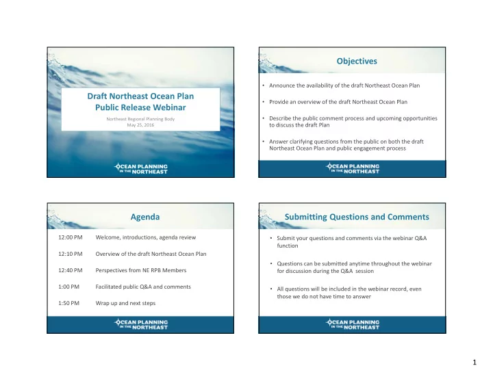
Draft Northeast Ocean Plan Public Release Webinar

Northeast Regional Planning Body May 25, 2016

Objectives

  • Announce the availability of the draft Northeast Ocean Plan
  • Provide an overview of the draft Northeast Ocean Plan
  • Describe the public comment process and upcoming opportunities

to discuss the draft Plan

  • Answer clarifying questions from the public on both the draft

Northeast Ocean Plan and public engagement process

Agenda

12:00 PM Welcome, introductions, agenda review 12:10 PM Overview of the draft Northeast Ocean Plan 12:40 PM Perspectives from NE RPB Members 1:00 PM Facilitated public Q&A and comments 1:50 PM Wrap up and next steps

Submitting Questions and Comments

  • Submit your questions and comments via the webinar Q&A

function

  • Questions can be submitted anytime throughout the webinar

for discussion during the Q&A session

  • All questions will be included in the webinar record, even

those we do not have time to answer

slide-2
SLIDE 2

2

NORTHEAST OCEAN PLAN

Why do we ne e d a n o c e a n pla n?

  • Ocean is a busy place
  • Need to manage for new uses
  • Understand changing ecosystems and

economies

  • Need for government to work together better
  • Focused regional discussion on future of the
  • cean

Why do we need this plan?

Wha t do e s the No rthe a st Oc e a n Pla n do ?

What Does the Northeast Ocean Plan Do?

  • Enables regional characterization of marine life, habitat and human activities using

unprecedented online library of peer‐reviewed regional data

  • Sets expectation for federal government to use this information to guide and inform

regulatory and management decisions within existing authorities

  • Supports identification of potential conflicts and compatibility, and affected resources
  • Employs best practices for regulatory/management processes through interagency

coordination, stakeholder engagement, use of data

  • Identifies future priority science and research needs

NORTHEAST OCEAN PLAN

slide-3
SLIDE 3

3

Northeast Regional Planning Body

  • Six New England states
  • Six federally‐recognized tribes
  • Nine federal agencies
  • New England Fishery Management Council
  • Two ex‐officio members: NYand Canada

NORTHEAST OCEAN PLAN

Northeast Ocean Plan goals

  • 1. Healthy ocean and coastal ecosystems
  • 2. Effective decision-making
  • 3. Compatibility among past, current and

future ocean uses

NORTHEAST OCEAN PLAN NORTHEAST OCEAN PLAN

Ho w wa s the No rthe a st Oc e a n Pla n de ve lo pe d?

NORTHEAST OCEAN PLAN

Regional Stakeholder forums + workshops

3–6 we e ks b e fo re e a c h RPB me e ting F

  • c us o n upc o ming RPB

de c isio ns

State public meetings + advisory groups

Inte ra c tive a nd info rma l T hro ug ho ut Ne w E ng la nd

Subject specific projects + targeted outreach + work groups

Cumula tive ly re a c he d tho usa nds o f pe o ple a c ro ss ma ny issue a re a s E xpe rt/ sc ie ntific re vie w o f me tho ds, pro duc ts

Existing meetings + events

L e ve ra g e d e xisting

  • ppo rtunitie s to re a c h

sta ke ho lde rs Va rio us to pic s, thro ug ho ut Ne w E ng la nd

Website + social media + eblasts

Ca le nda r a nd RPB upda te s Pro je c t re po rts, me e ting summa rie s, o the r pro duc ts

OUTREACH + ENGAGEMENT

slide-4
SLIDE 4

4

NORTHEAST OCEAN PLAN

NORTHEAST OCEAN DATAPORTAL

MARINE LIFE & HABITAT RESTORATION CULTURAL RESOURCES MARINE TRANSPORTATION NATIONAL SECURITY COMMERCIAL & RECREATIONAL FISHING RECREATION ENERGY & INFRASTRUCTURE AQUACULTURE OFFSHORE SAND RESOURCES NORTHEAST OCEAN PLAN

OCEAN RESOURCES & ACTIVITIES

NORTHEAST OCEAN PLAN

Wha t a re the diffe re nt pa rts

  • f the pla n?

NORTHEAST OCEAN PLAN

1 2

Plan process and development

  • f Data Portal

Northeast region and need for

  • cean planning

3

Using plan data in regulatory and management decisions across 10 ocean management topics

4

Plan implementation

5

Future science and research priorities

slide-5
SLIDE 5

5

Federal agency actions to update and use Plan data and information in regulatory and management decisions within existing authorities.

USING PLAN DATA TO INFORM DECISIONS

Plan Describes Top Ten Primary Ocean Resources and Activities

1. Overview of importance of each ocean resource or activity to ocean management 2. Regulatory and management landscape of that resource/activity 3. Peer-reviewed maps and data available on portal 4. Regulatory and management actions identified by RPB agencies

 Maintain, update and develop additional data for the Portal  Inform regulatory/environmental review and management decisions  Identify potentially affected stakeholders and resources  Enhance interagency coordination

NORTHEAST OCEAN PLAN NORTHEAST OCEAN PLAN

MARINE LIFE & HABITAT

Marine Life & Habitat

This section of the plan describes the process for developing and the status of an unprecedented library

  • f regional data products characterizing marine life and

habitat including:

  • Maps of species
  • Maps of habitat types
  • Draft maps of species groupings developed to assist

decision-making

slide-6
SLIDE 6

6

NORTHEAST OCEAN PLAN L

  • ng-tail

ed duck : pr edi cted annual r el ative abundance

MARINE LIFE & HABITAT

Cor als Mammal s sensitive to high fr equency sound NORTHEAST OCEAN PLAN

MARINE LIFE & HABITAT

Marine Life & Habitat

Defines Important Ecological Areas as habitat areas and species, guilds, or communities critical to ecosystem function, recovery, and resilience. They are further divided by five components:

  • Areas of high productivity
  • Areas of high biodiversity
  • Areas of high species abundance
  • Areas of vulnerable marine resources
  • Areas of rare marine resources

NORTHEAST OCEAN PLAN

ML

  • 1 Upda te ma rine life da ta

ML

  • 2 Upda te ha b ita t da ta

ML

  • 3 I

de ntify o ppo rtunitie s to upda te ma rine life a nd ha b ita t da ta e ve ry five ye a rs ML

  • 4 Adva nc e the ma pping o f I

mpo rta nt E c o lo g ic a l Are a s

MARINE LIFE & HABITAT

O V E RV I E W AC T I O N S

NORTHEAST OCEAN PLAN

ML

  • 5 Use ma rine life a nd ha b ita t

da ta a s ke y inputs to mo nito r e c o syste m he a lth ML

  • 6 Use ma rine life a nd ha b ita t da ta to info rm a pplic a b le

re vie w pro c e sse s unde r fe de ra l e nviro nme nta l a nd re g ula to ry la ws ML

  • 7 Use ma rine life a nd ha b ita t da ta to info rm re spo nsib ilitie s

within ma na g e d a re a s ML

  • 8 Use ma rine life a nd ha b ita t

da ta to info rm o the r ma na g e me nt a c tivitie s

MARINE LIFE & HABITAT

O V E RV I E W AC T I O N S

slide-7
SLIDE 7

7

NORTHEAST OCEAN PLAN NORTHEAST OCEAN PLAN

MARINE TRANSPORTATION

Passengervessels T ug T

  • w vessels

Appr

  • ac h to

B

  • ston H

ar bor NORTHEAST OCEAN PLAN

MT

  • 1 Ma inta in e xisting m a p s a nd d a ta o n the Po rta l

MT

  • 2 Pro vid e a d d itio na l d a ta thro ug h ne w a na lyse s

MT

  • 3 Use the Po rta l a nd Pla n to info rm re g ula r o p e ra tio ns

a nd m a na g e m e nt o f the MT S MT

  • 4 Use the Po rta l a nd Pla n to id e ntify p o te ntia l

c o nflic ts, im p a c ts a nd p o te ntia lly a ffe c te d m a ritim e sta ke ho ld e rs d uring p e rm itting a nd le a sing fo r ne w p ro p o se d a c tivitie s MT

  • 5 Use the Pla n to info rm d re d g ing a nd fe d e ra l

na vig a tio n p ro je c ts MT

  • 6 C o ntinue o utre a c h to m a ritim e sta ke ho ld e rs to

und e rsta nd c urre nt tre nd s a nd the p o te ntia l e ffe c ts

  • f ne w a c tivitie s to the MT

S O V E RV I E W AC T I O N S

MARINE TRANSPORTATION

NORTHEAST OCEAN PLAN

slide-8
SLIDE 8

8

NORTHEAST OCEAN PLAN

COMMERCIAL & RECREATIONAL FISHING

All VMS S c al l

  • p Vessels 2011-2014

L

  • bster

T r ap E nd L ine Density

CF

  • 1 Ma inta in e xisting ma ps a nd da ta o n the po rta l

CF

  • 2 De ve lo p a dditio na l re g io na l ma ps a nd da ta o f c o mme rc ia l a nd re c re a tio na l fishe rie s

CF

  • 3 I

nfo rm re g ula to ry a nd e nviro nme nta l re vie ws o f a g e nc y a c tio ns fo r the ir po te ntia l impa c ts to c o mme rc ia l a nd re c re a tio na l fishe rie s CF

  • 4 I

de ntify po te ntia lly a ffe c te d c o mme rc ia l fishing sta ke ho lde rs O V E RV I E W AC T I O N S

NORTHEAST OCEAN PLAN COMMERCIAL & RECREATIONAL FISHING NORTHEAST OCEAN PLAN NORTHEAST OCEAN PLAN ENERGY & INFRASTRUCTURE NORTHEAST OCEAN PLAN

ENERGY & INFRASTRUCTURE

Wind r esour c es in the Nor theast U .S. fr

  • m a

2010 DOE study. Renewable ener gy planning ar eas.

slide-9
SLIDE 9

9

NORTHEAST OCEAN PLAN

ENERGY & INFRASTRUCTURE

T anker Vessel Density National S ec ur ity U se Ar eas Multispec ies F ishing Vessel Density

E I

  • 1 Ma inta in e xisting ma ps a nd da ta o n the Po rta l

E I

  • 2 Pro vide a dditio na l re g io na l da ta re la te d to e ne rg y a nd

infra struc ture pe rmitting whe n a va ila b le E I

  • 3 I

nfo rm c o mme rc ia l le a sing fo r o ffsho re re ne wa b le e ne rg y de ve lo pme nt O V E RV I E W AC T I O N S

ENERGY & INFRASTRUCTURE NORTHEAST OCEAN PLAN NORTHEAST OCEAN PLAN

O V E RV I E W AC T I O N S

ENERGY & INFRASTRUCTURE

EI-4 Inc o rp o ra te Pla n m a p s a nd d a ta into e nviro nm e nta l re vie w s a sso c ia te d with ne w o ffsho re e ne rg y o r sub m a rine c a b le p ro p o sa ls E I

  • 5 I

de ntify a nd no tify po te ntia lly a ffe c te d sta ke ho lde rs E I

  • 6 I

mpro ve o utre a c h to industry a nd sta ke ho lde rs re la te d to re ne wa b le e ne rg y de ve lo pme nt E I

  • 7 E

nsure the pla n a nd po rta l a re use d b y a g e nc ie s a nd pro je c t pro po ne nts E I

  • 8 I

nfo rm re se a rc h a nd de ve lo pme nt E I

  • 9 E

nha nc e inte rg o ve rnme nta l c o o rdina tio n re la te d to o ffsho re e ne rg y de ve lo pme nt

NORTHEAST OCEAN PLAN

Pla n I mple me nta tio n

slide-10
SLIDE 10

10

NORTHEAST OCEAN PLAN

  • 1. Intergovernmental Coordination
  • 2. Plan Administration
  • Portal Maintenance
  • 3. Monitoring and Evaluation

PLAN IMPLEMENTATION

NORTHEAST OCEAN PLAN

E ARL Y AGE NCY COORDINAT ION Entities that participate in early agency coordination in the Northeast typically include (or should include) some combination of the following:

  • DOI (inc luding

BOE M, USF WS, NPS, USGS)

  • FERC
  • USACE
  • NOAA

(inc luding NMF S)

  • USEPA
  • DHS (inc luding USCG

a nd F E MA)

  • Navy
  • DOT (MARAD)
  • NEFMC and

Mid‐Atlantic Fishery Management Council

(de pe nding o n lo c a tio n)

  • Atlantic States Marine

Fisheries Commission

  • Federally‐recognized

tribes

  • State agencies

(pe rmitting , wildlife , a nd fishe rie s a g e nc ie s, CZM pro g ra ms, SHPO). F ishe rie s a g e nc ie s ma y a lso c o o rdi- na te thro ug h NE F MC, MAF MC, o r ASMF C.

Best practices provide flexible but consistent guidance to help enhance value of agency coordination by supporting:

  • Broad understanding across agencies of early use of relevant info from portal,

plan, stakeholders, other sources,

  • Clear and efficient direction for the applicant,
  • Initial understanding of proposed project among and between agencies and

initial broad understanding of issues,

  • Informed stakeholders engagement,
  • Coordinated federal, state, tribal review as appropriate.

Plan administration and oversight

  • Data Portal

Monitoring and evaluation

NORTHEAST OCEAN PLAN

PLAN IMPLEMENTATION

NORTHEAST OCEAN PLAN

  • 1. Improve understanding of marine life and habitats
  • 2. Improve understanding of tribal cultural resources
  • 3. Improve understanding of human activities, coastal communities,

socioeconomics, and interactions between uses

  • 4. Characterize the vulnerability of marine resources to specific

stressors

  • 5. Characterize changing environmental conditions, particularly

resulting from climate change, and characterize resulting impacts to existing resources and uses

  • 6. Advance ecosystem-based management (EBM) by building on

the previous priorities and also including cumulative impacts and ecosystem services

SCIENCE AND RESEARCH PRIORITIES

slide-11
SLIDE 11

11

NORTHEAST OCEAN PLAN

Ho w do e s the pla n a ddre ss the g o a ls?

NORTHEAST OCEAN PLAN

  • 1. Healthy ocean and coastal ecosystems
  • Agency commitments to use an unprecedented,

scientifically- and expert-developed amount of marine life, habitat, and human use data

  • Development of an IEA Framework and

commitments to advance it

  • Commitment to develop indicators of ecosystem

health, including the OHI

  • Identification of potential restoration projects that

could advance a healthy ecosystem

  • Identification of six science and research

priorities

NORTHEAST OCEAN PLAN

  • 2. Effective decision-making
  • Commitments to using the Portal in regulatory and

management decision-making

  • Commitments to maintain and advance the Portal
  • Best practices to enhance intergovernmental

coordination

  • Identify and engage stakeholders
  • Continuation of the RPB as a regional forum for

continued coordination

NORTHEAST OCEAN PLAN

  • 3. Compatibility among past, current

and future ocean uses

  • Commitment to continuing work groups
  • Commitment to use best practices and regional

data to identify potentially affected stakeholders to further understand compatibility issues

  • Pursue science and research priorities to

advance compatibility, including better understanding resource vulnerability, use conflicts, important socioeconomic connections, cumulative impacts, and ecosystem services

slide-12
SLIDE 12

12

NORTHEAST OCEAN PLAN

Wha t’ s ne xt?

NORTHEAST OCEAN PLAN

  • Public comment period begins May 25th and will

conclude on July 25th at 5pm

  • Public comment will be collected via:
  • Public listening sessions
  • Comments submitted online at

neoceanplanning.org/plan

  • Via email: comment@neoceanplanning.org
  • Comments submitted in writing to:
  • Betsy Nicholson, Northeast Regional Planning Body, 55 Great Republic

Drive, Gloucester, MA 01930

  • The RPB will submit revised plan to National Ocean

Council for review and certification, at which point the plan will be in effect

PUBLIC COMMENT

NORTHEAST OCEAN PLAN

Monday, June 6 – Rockland, ME: 5PM to 8PM Wednesday, June 8 – Old Lyme, CT: 7PM – 9PM Monday, June 13 – Gloucester, MA: 6PM‐8:30PM Tuesday, June 14 – Boston, MA: 2PM – 4:30PM Wednesday, June 15 – New Bedford, MA: 6PM – 8:30PM Monday, June 20 – Ellsworth, ME: 5PM – 8PM Monday, June 27 – Portsmouth, NH: 6PM – 8:30PM Wednesday, June 29 – Narragansett, RI: 6PM – 8:30PM Thursday, June 30 – Portland, ME: 5PM – 8PM Go to neoceanplanning.org for details

PUBLIC COMMENT

Perspectives from NE RPB Members

slide-13
SLIDE 13

13

Benefits to States

 Access to a library of marine life products to provide a regional perspective and a framework for advancing the use of data  Regional maps for federally managed fisheries and shipping density using high resolution and verifiable data  Commitments from federal partners to refresh data as available/on a schedule  Early notification and coordination with federal agencies (e.g. NEPA and CZMA opportunities)  Regional research agenda to support planning

Ocean Plan Tribal Content

Chapter 3: Cultural Resources

  • Regulation and Management

– Describes federal statutes relevant to cultural resources (NHPA ‐ Section 106, NEPA) – Describes role of Tribal Historic Preservation Officers and consultation

  • Maps and Data

– Used to identify potential impacts to cultural resources and affected tribes – Tools for ecosystem based management – Data cited by tribes with particular relevance include:

  • Marine life characterization for species distribution and abundance
  • Restoration sites to highlight importance of habitats for species of sustenance
  • Climate change data to cite changing conditions on habitats and resources with

tribal importance (e.g. fisheries, shellfish, eelgrass, erosion to cultural sites)

Ocean Plan Tribal Content

Chapter 4: Federal‐Tribal Coordination Best Practices

  • Early coordination for federal management and regulatory actions
  • Transfer protocols to reconstruct submerged paleocultural landscapes ‐

identifying ancient Native American marine archeological sites

  • Use existing partnerships and forums to improve:
  • Tribal capacity and technical skills ‐ Portal and other spatial data training
  • Engagement on habitat and/or water quality restoration projects through

Restoration Subcommittee activities

  • Coordination with Mid‐Atlantic tribal ocean planning activities
  • NE RPB and EPA RTOC are examples of partnerships to continue

New England Fishery Management Council

“The NEFMC will use the plan data, as appropriate, to supplement traditional internal, state and NOAA data sources to conduct analyses related to FMP development, and to satisfy the requirements of NEPA, MSA and other applicable laws.“

“The Portal may also inform NEFMC when considering climate change impacts to fisheries, developing and implementing ecosystem‐based fisheries management, and resolving use conflicts .”

slide-14
SLIDE 14

14

New England Fishery Management Council

  • Chapter 3 – Data Portal
  • Data portal provides a high degree of

visibility for fishing interests and fishery resources

  • Prescribed “Actions” ensure active use,

maintenance and enhancement of the portal

  • Chapter 4 – Best Practices
  • Early interagency coordination
  • Fishing industry/community engagement
  • Plan & ecosystem monitoring and

evaluation

  • Chapter 5 – Science & Research Priorities

National Security Example

Navy and USCG worked closely to draft Ch 3 National Security:

  • Describes regional military

presence and concerns

  • Management programs &

regulatory coordination

  • Maps and data updates,

maintenance, and use – development of a National Security Portal theme

Federal Perspective

  • Unified approach to developing and using Plan content
  • RPB engagement over 4 years with many stakeholders through

public meetings, workshops, forums, and industry‐specific projects to gather information and input

  • Federal agency commitments to use of data:

– Natural resource conditions – Ocean use activities and trends – Supports identification of potential conflicts/compatibility

  • Early engagement and coordination on proposed projects

Questions? Comments?

Please submit your questions or comments via the webinar Q&A function

slide-15
SLIDE 15

15

Wrap Up and Next Steps

Webinar Recap Materials

The following will be posted on the RPB website (http://neoceanplanning.org/news/draft‐plan‐and‐rpb‐webinar‐ may‐25/) after the webinar:

  • A recording of the webinar
  • A transcript of the webinar
  • The full slide presentation
  • A record of all chat questions and comments from the public
  • A list of webinar participants

Public Comment

  • Monday, June 6 – Rockland, ME: 5PM to 8PM
  • Wednesday, June 8 – Old Lyme, CT: 7PM – 9PM
  • Monday, June 13 – Gloucester, MA: 6PM‐8:30PM
  • Tuesday, June 14 – Boston, MA: 2PM – 4:30PM
  • Wednesday, June 15 – New Bedford, MA: 6PM – 8:30PM
  • Monday, June 20 – Ellsworth, ME: 5PM – 8PM
  • Monday, June 27 – Portsmouth, NH: 6PM – 8:30PM
  • Wednesday, June 29 – Narragansett, RI: 6PM – 8:30PM
  • Thursday, June 30 – Portland, ME: 5PM – 8PM

Go to neoceanplanning.org for details

Thank you!