SLIDE 1 www.dcnr.state.pa.us
Natural Resource Management of Pipeline Infrastructure
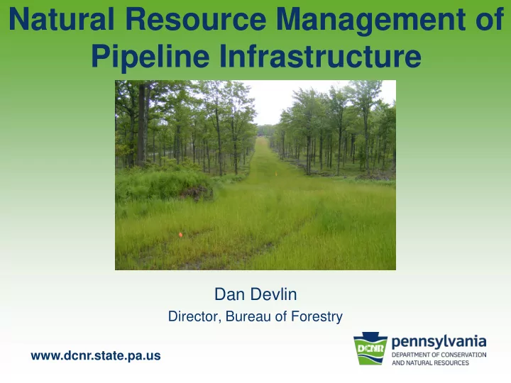
Dan Devlin
Director, Bureau of Forestry
SLIDE 2 Connection between Pipelines & DCNR
– Fragmentation or reduction in forest cover
– Jurisdiction of Endangered & Threatened Plants – Invasive species—reduction of native plants
– Largest landowner in PA: 2.2 million acres
- State Park land
- LWCF & C2P2
- PNDI Tool
SLIDE 3
Bureau of Forestry
Mission:
“Ensure the long-term health, viability and productivity of the Commonwealth’s forest and to conserve native wild plants.”
SLIDE 4 The Bureau accomplishes our mission by:
- Managing state forests under sound ecosystem management, to retain their
wild character and maintain biological diversity while providing pure water,
- pportunities for low-density recreation, habitats for forest plants and animals,
sustained yields of quality timber, and environmentally sound utilization of mineral resources.
- Protecting forestlands, public and private, from damage and/or destruction by
fires, insects, diseases and other agents.
- Promoting forestry and the knowledge of forestry by advising and assisting
- ther government agencies, communities, landowners, forest industry, and the
general public in the wise stewardship and utilization of forest resources.
- Protecting and managing native wild flora resources by determining status,
classifying, and conserving native wild plants.
SLIDE 5 Focus of Today’s Presentation
State Forest system
- Established in 1898
- 2.2 Million Acres
- 48 of 67 Counties
- Created for:
– Continuous supply of timber & wood products – Protect watersheds & conserve the waters – Furnish opportunities for healthful recreation
SLIDE 6
SLIDE 7 www.dcnr.state.pa.us
State Forest land Management Zoning
11 % 0.6 % 23 % 53 % 4 % 0.4 % 8 %
SLIDE 8 www.dcnr.state.pa.us
State Forest Values
Clean Water
- ver 5,000 miles of streams on SFL
SLIDE 9 www.dcnr.state.pa.us
State Forest Values
Wood products
14,000 acres harvested annually producing nearly 80 million board feet of lumber and pulpwood
SLIDE 10 www.dcnr.state.pa.us
State Forest Values
Recreation & Tourism
- ver 5,000 miles of trails open for public use
SLIDE 11 www.dcnr.state.pa.us
State Forest Values
Habitat for thousands of plants and animals
SLIDE 12
State Forest Values
Scenic and aesthetic beauty
SLIDE 13 www.dcnr.state.pa.us
State Forest values
Energy
natural gas, biomass, firewood
SLIDE 14 www.dcnr.state.pa.us
Pipeline and Rights-of-Way Infrastructure on SF Lands
SLIDE 15
Pipeline Infrastructure on SF Lands
Types of Pipelines
Gathering: from well to transmission line Transmission: from gathering line or storage facility to an oil or gas market, regulated by the Federal Energy Regulatory Commission (FERC) Distribution: from transmission system directly to the customer, regulated by the Public Utility Commission (PUC)
SLIDE 16 ROW Infrastructure on SF Lands
Substances Pipelines Could Carry:
- Oil
- Gas
- Water
- Petroleum Products (gasoline, diesel, etc.)
- Natural Gas Liquids (propane, butane, etc.)
- Municipal Waste Water
Other ROW:
SLIDE 17
ROW Infrastructure on SF Lands
~1,700 miles of ROW’s on State Forest lands
Miles mostly pipelines Of those miles… ~1,100 miles of ROW’s assoc. with BOF license for ROW agreements ~500 miles pipelines on gas leases or severed rights ~60 transmission lines (20-36 in; most over 24) ~3 gas storage areas: Wharton, Leidy and Greenlick
SLIDE 18 Pipeline Infrastructure on SF Lands
– 2008-2012 data collected – 7 Forest Districts in gas play (core forest area)
- Acres converted to non-forest by infrastructure:
– Well Pad: 786 acres (53%) – Pipeline: 459 acres (31%) – Road: 242 acres (16%)
SLIDE 19 www.dcnr.state.pa.us
SLIDE 20
A closer Look – Existing Agreements
SLIDE 21 www.dcnr.state.pa.us
SLIDE 22 Management Challenges
All pipelines have an impact
- Surface disturbance
- Forest fragmentation
- Habitat loss & species impacts
- Invasive plants spread
- Loss of wild character
- Soil Erosion & Sedimentation
SLIDE 23 Management Challenges
Most Impacts Considered Negative…but are Positive as well
- Provide energy to citizens of PA
- Less truck traffic transporting
- Wildlife openings
- Recreation Opportunities
SLIDE 24 Management
Given Challenges and Potential Impacts,
- ur analysis take into account the mantra:
- Avoid
- Minimize
- Mitigate
- Monitor
SLIDE 25 Avoid
Comprehensive Planning and Review
- Evaluate Alignment Alternatives (whole project scope)
- Learn & understand company and project objectives
- Use Existing Disturbances
- Overview of sensitive areas to avoid
- Endangered & Threatened Species (PNDI)
- Parks, Wild & Natural Areas, and High Use Recreation Areas
SLIDE 26 Minimize
- Reduce Earth Disturbance
- Reduce ROW width/disturbance
- Collocate infrastructure
- Appropriately Site on the Ground
- Early Planning followed by Field Assessment
- Employ Proper Wetland/Water Crossing Techniques
- Buffer Resources (social & ecological)
- Timing Restrictions
- Recreation
- Wildlife
- Spring Mud
SLIDE 27
- Wetland Enhancements
- Species Habitat Enhancements
- Invasive Species Removal
- Trail Re-routes
Mitigate--enhancements
SLIDE 28 Mitigate--Restoration
Reclamation and Restoration
- Larger landscape-level plan and management
- Provide Clear Objectives to Operator early in process
- Enhance areas for target species or habitat
- Shrub plantings
- Feathering
- Pollinator
SLIDE 29 Monitor
Monitoring Important in Adaptive Resource Mgmt
- Gas Monitoring Program
- Administrate lease/agreement provisions
- Monitor for:
- Planting Success
- Use of Different Plantings
- Erosion or Sedimentation issues
- ROW Maintenance
SLIDE 30 How do we implement Avoid, Minimize, Mitigate, Monitor?
- Resource Management, Non-Regulatory
- Systems Approach to Analysis
– Holistic – Comprehensive – Ecosystem Management
SLIDE 31 Landscape Analysis
When assessing impacts: Landscape Approach
- Look at Entire Project Connected with Pipeline
- Well Pad, Compression, Other Pipelines
- Trails, T&E habitat, Core Forests etc.
- Reason for Pipeline
- Alternate Routes
SLIDE 32 www.dcnr.state.pa.us
SLIDE 33
GIS Analysis— many available for analysis
Forest Resource layers: – SF Zoning, – Forest stands/typing, – Community Classifications – Roads – Trails
SLIDE 34 GIS Analysis— many available for analysis
Special Resources & Areas
- Threatened and Endangered Species (PNDI)
- High Conservation Value Forests
- Important Bird & Mammal Areas
- Parks
- Wild & Natural Areas
- TNC Forest Patches and Blocks
- Natural Heritage Areas
- Viewsheds
SLIDE 35 GIS Analysis— many available for analysis
Gas/Energy Infrastructure
- Well Pads
- Access Routes
- Compression
- Existing Pipelines/ROW’s
- Water storage
SLIDE 36 Management Approach
– Rights of Way team – Gas Management Team – Professionals—foresters, biologists, geologists
- Surface Use Agreements
- Rights-of-Way Agreements
– License, Road-Use – Encumbered Easements
SLIDE 37 Management Approach
- Guidelines and BMPs
- Gas Guidelines are our BMP’s
– Planning, Buffers, Siting, Planting, Monitoring – Adaptive Management
– Infrastructure – Plants and Wildlife – Water
- Threatened & Endangered Species—PNDI Tool
SLIDE 38 Management Approach
Work Closely with Company
- Mutual understanding of needs, objectives and
concerns
- Lots internal work/research on concerns and
issues
- Work with company so they understand
concerns and how plans and work can be modified
SLIDE 39 Management of ROW’s
- Bureau has over 75 years experience
- Application and Review Process
– Communicate alignment/route concerns early – Discuss future management plans—makes easier down line
– Route Planning: alternatives, collocation/parallel – Special Protection Areas
– Herbaceous/Tree plantings – Invasive Management
SLIDE 40 Management Successes
– Flexibility and adaptive measures to facilitate best possible solution (for resources and pipeline)
- Work Closely with Company
– Mutual understanding of needs
– Electric/Gas cooperation (shared utility corridors) – Use existing disturbances: collocate or parallel
– New Technologies
SLIDE 41 Management Successes
- Land Management Tradeoffs/Enhancements
– Forest Road system improvements – Wildlife Habitat Enhancements
– Trail head parking
– Snowmobile Trails
SLIDE 42 Management Successes
- Invasive Plant Management
– New techniques for treatment – Awareness increase – Effective Plantings to decrease spread – Invasive Species Removal
SLIDE 43
Management Successes
PA Conservation Explorer: PNDI Tool
– Effective for large project and ROW planning – New tool incorporating conservation planning and PNDI environmental review
SLIDE 44
Timber rattlesnake Enhancement Area Electric and Gas Co-location
SLIDE 45 Water Pipeline: underground Snowmobile trail:
SLIDE 46
Shrub and Wildflower Planting on ROW
SLIDE 47
Shared-Use: ROW and Road
Separates to allow for canopy closure & narrow ROW
SLIDE 48
Tree Buffer left in place Reduces footprint and visual impact
SLIDE 49
Pipe Installation in Ditch Line
SLIDE 50
Feathered Edges of Corridor Slight Bends in Line—Reduces Visible Distance
SLIDE 51
Websites
SLIDE 52
Take Home Messages
Pipelines have impacts Proposed development should be viewed holistically Management strategies differ depending on scale Some impacts can be avoided, minimized and/or mitigated Tradeoffs are usually necessary in resource management decision making (different than environmental protection)
SLIDE 53 Working towards a balance of…
- Contiguous forests
- Wetlands
- Plants and animals
- Wild character
- Recreation
- Water quality
- Responsible development
SLIDE 54
Thank You