
SLIDE 1
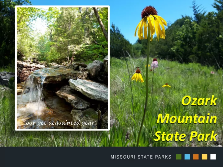
Ozark Mountain State Park
“our get acquainted year”
Mountain our get acquainted year State Park Natural Resource - - PowerPoint PPT Presentation
Ozark Mountain our get acquainted year State Park Natural Resource Inventories Plant Survey Natural Community Map Breeding Bird Monitoring Plots Native Bee Survey Native Plant monitoring Plots Natural
“our get acquainted year”
Plots
Plots
Plots
Plots
(7 rare species)
(eg roadrunner, prairie warbler, wood pewee, fish crow and kestrel) (18% are exotic weeds)
“protect and improve quality and aquatic resources in Roark Creek, by preserving a signature natural glade-woodland environment in its watershed”
“protect and improve quality and aquatic resources in Roark Creek, by preserving a signature natural glade-woodland environment in its watershed”
Protect water quality and aquatic life in Roark Creek Preserve the birds, wildlife and plants Rehabilitate the woodlands and glades
and glade restoration
they start in November
Prescribed burn
Ken McCarty Natural Resource Management Program Director 573-751-8660 Ken.McCarty@dnr.mo.gov
Cultural Resources Research at Ozark Mountain State Park
Amanda Pesce, Archaeologist
Methodology
1. Archival Research Including:
Quarterly and other online accounts of Garber Residents or their descendants
boundaries within which certain activities may have occurred.
Homestead adjacent to Roark Creek built approximately 1924
Maps
1873-1910
transferred her land to the Keithley family
Garber was 1903, during which 4 land claims were established.
Garber History Highlights
Joel Garber:
Boundaries Town moved three times.
State Park Boundaries Life in Garber:
tomatoes, strawberries, alfalfa, potatoes, corn, wheat, and lumber.
pigs and chickens
Previous Archaeological Survey of the “Bass House” - 1993
with some data missing
construction/modification
Bush built the home
well house
Archaeology at Ozark Mountain State Park
Limited Survey 9 Recorded Prehistoric Sites
B.C.)
1450-1650).
purchasing the land from C.O. Bass (Charlie) and lived there for less than a year
Frank and remodeled the home in 1914.
drilled the well near the home
cellar
and decides he needs to build more barn room
Thanks to JK Ross and his weekly submissions to The Taney County Republican, we now know that:
Fronabarger/Garber School House
WF Fronabargerdonated the land for the school house January 1903 – School commences in Garber (the most popular year for homestead patents) Called the “FronabergerSchool District” as late as 1907 1909 – Land sold to Calvin Jones 1915 - Leonard Jones married Pearl Fronabergerand were said to live near the school
Fronabarger/Garber School House
Condition of the School and Interpretation Historical Events: Spelling Bees Literacy Society Meetings Sunday School (since 1914) Pie Suppers Kandy Kangaroo Kourt
Feel free to contact me regarding any information you would like to share about the history of Ozark Mountain State Park: Amanda Pesce Amanda.pesce@dnr.mo.gov 573-522-2733
CARRIE W OLKEN P LANNING SECTION CHIEF CARRIE.WOLKEN@DNR.MO.GOV
Preamble & Mission Natural Resources Plan Cultural Resources Plan Recreation Plan Interpretation Plan Conceptual Development Plan Operations Plan
Conceptual Development Plan is
GENERAL MANAGEMENT PLAN
SIGNIFICANCE
stakeholder interests and public input PURPOSE
CONCEPTUAL DEVELOPMENT PLAN
CONCEPTUAL DEVELOPMENT PLAN
PROCESS
CONCEPTUAL DEVELOPMENT PLAN
CDP’s TYPICALLY INCLUDE
(“Bubbles”)
OZARK MOUNTAIN STATE PARK
PROCESS
Carrie Wolken DNR-MO State Parks Planning & Development Program (573) 751-5382 Carrie.Wolken@dnr.mo.gov