
SLIDE 1
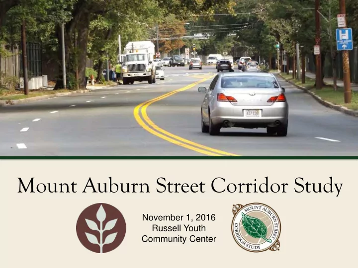
November 1, 2016 Russell Youth Community Center
Mount Auburn Street Corridor Study November 1, 2016 Russell Youth - - PowerPoint PPT Presentation
Mount Auburn Street Corridor Study November 1, 2016 Russell Youth Community Center Commonwealth of Massachusetts Governor Charles D. Baker Lieutenant Governor Karyn E. Polito Energy and Environmental Secretary Matthew A. Beaton Department
November 1, 2016 Russell Youth Community Center
Mount Auburn Street Corridor Study
Governor
Lieutenant Governor
Energy and Environmental Secretary
Department of Conservation and Recreation Commissioner
Mount Auburn Street Corridor Study
Mount Auburn Street Corridor Study
Mount Auburn Street Corridor Study
Mount Auburn Street Corridor Study
Mount Auburn Street Corridor Study
Mount Auburn Street Corridor Study
Mount Auburn Street Corridor Study
Mount Auburn Street Corridor Study
Mount Auburn Street Corridor Study
indications
– Poor visibility for existing signals approaching from Fresh Pond Parkway – Rear-end crashes on Fresh Pond Parkway NB and SB – Red light running
peak hours – No “protected” (green arrow) phasing; vehicles must turn left against oncoming traffic – Crashes involving SB left- turning vehicles and NB through vehicles
Mount Auburn Street Corridor Study
Signals
“all red” signal phases
Fresh Pond Parkway Left Turns 24/7
Mount Auburn Street Corridor Study
– Unclear vehicle paths – High-speed turns due to large corner radii
signal phasing – Motorists may make illegal turn rather than attempt to find legal route – e.g. Fresh Pond Parkway southbound vehicles looking for Mt. Auburn Hospital
southbound) – Wide enough for 3-4 lanes, marked for 2 lanes
Mount Auburn Street Corridor Study
– No overhead indications at most approaches – Large intersection area
Gerrys Landing Road in three stages – Two pedestrian crashes – Pedestrians more likely to disobey signals with longer delay
Mount Auburn Street Corridor Study
Improve Markings
Lane
Crossings
Mount Auburn Street Corridor Study
– Intersects Mt. Auburn St. just 100’ east of Aberdeen Avenue stop line
queue for intersection – Stop line set back from Aberdeen Avenue by 100’
– No overhead signals – poor visibility – Westbound left-turn lag phase – left-turn and rear-end crashes – Aberdeen southbound left-turns get little green time
Mount Auburn Street Corridor Study
Takeaways – Mount Auburn Street at Brattle Street/Aberdeen Avenue
Bike Crossing
Mount Auburn Street Corridor Study
Mount Auburn Street Corridor Study
Mount Auburn Street Corridor Study
Mount Auburn Street Corridor Study
Mount Auburn Street Corridor Study
and residents
Coolidge Hill Neighborhoods
Cemetery, Mt. Auburn Hospital, Shady Hill, and Tufts Health Plan
Mount Auburn Street Corridor Study
1. Calm traffic, provide clarity, reduce crashes and severity of crashes 2. Improve connectivity, air quality and expand mobility choices by: a. Measuring people, not cars b. Reducing transit delays c. Improving safety, access, parking and comfort for bicycles d. Maintaining mobility for motor vehicles e. Improving safety, attractiveness, noise, and comfort for pedestrians and residents 3. Address cut-through traffic in the Larchwood, Huron Village, and Coolidge Hill Neighborhoods 4. Offer short-term and long-term solutions 5. Acknowledge enforcement and special uses by BB&N, Mt. Auburn Cemetery, Mt. Auburn, Shady Hill, and Tufts Health Plan
Mount Auburn Street Corridor Study
Mount Auburn Street Corridor Study
Percent Bus Vehicles = 2% Percent Bus Person Throughput = 43% Bus Throughput = 925 persons/hour Vehicle Throughput = 1,200 persons/hour Percent Bus Vehicles = 3% Percent Bus Person Throughput = 56% Bus Throughput = 985 persons/hour Vehicle Throughput = 765 persons/hour
Mount Auburn Street Corridor Study
Bus Travel Time Option B*
Queue Jump * With two-stage crossing
travel time savings with bus lanes
reduction in 90th percentile travel time
Mount Auburn Street Corridor Study
Auto Travel Time Option B*
improve on Mt Auburn due to signal timing changes at Fresh Pond Parkway
Queue Jump * With two-stage crossing
Mount Auburn Street Corridor Study
Bus Travel Time Option A*
queue jump
between Homer and Aberdeen * With two-stage crossing
provides over 2.5 minutes travel time savings
Mount Auburn Street Corridor Study
Auto Travel Time and Pedestrian Delay
at FP
Mount Auburn Street Corridor Study
Mount Auburn Street Corridor Study
Mount Auburn Street Corridor Study
DRAFT CONCEPT
Mount Auburn Street Corridor Study
DRAFT CONCEPT
Mount Auburn Street Corridor Study
DRAFT CONCEPT
Mount Auburn Street Corridor Study
Mount Auburn Street Corridor Study
DRAFT CONCEPT
Mount Auburn Street Corridor Study
DRAFT CONCEPT
Mount Auburn Street Corridor Study
DRAFT CONCEPT
Mount Auburn Street Corridor Study
Mount Auburn Street Corridor Study
Mount Auburn Street Corridor Study
DRAFT CONCEPT
Mount Auburn Street Corridor Study
DRAFT CONCEPT
Mount Auburn Street Corridor Study
DRAFT CONCEPT
Mount Auburn Street Corridor Study
– Sight lines – RRFB visibility and recognition – Speeds – Noise – Lack of desire line
DRAFT
Mount Auburn Street Corridor Study
– Circulation
DRAFT
Mount Auburn Street Corridor Study
DRAFT DRAFT CONCEPT
Mount Auburn Street Corridor Study
DRAFT CONCEPT
Mount Auburn Street Corridor Study
DRAFT CONCEPT
Mount Auburn Street Corridor Study
Speed Table Feasibility Research:
speeds can be reduced anywhere from 1% to 21%, but they have rarely been used on high volume or high volume streets in the US.
context or a side street residential context.
they may have applications on approaches to high-speed intersections where low speeds are desired. (NCHRP 613)
Mount Auburn Street Corridor Study
Mount Auburn Street Corridor Study
Mount Auburn Street Corridor Study
Mount Auburn Street Corridor Study
Mount Auburn Street Corridor Study
Mount Auburn Street Corridor Study
DRAFT CONCEPT
Mount Auburn Street Corridor Study
DRAFT CONCEPT
Mount Auburn Street Corridor Study
Mount Auburn Street Corridor Study
FIRST PLANTINGS LIKELY SPRING 2018
Mount Auburn Street Corridor Study
DRAFT CONCEPT
Mount Auburn Street Corridor Study
DRAFT CONCEPT
Mount Auburn Street Corridor Study
DRAFT CONCEPT
Mount Auburn Street Corridor Study
DRAFT CONCEPT
Mount Auburn Street Corridor Study
Mount Auburn Street Corridor Study
Mount Auburn Street Corridor Study
DRAFT CONCEPT
Mount Auburn Street Corridor Study
DRAFT CONCEPT
Mount Auburn Street Corridor Study
Mount Auburn Street Corridor Study
– Long and short-term options, their benefits and traffic analysis – Please bring your friends and neighbors!
Mount Auburn Street Corridor Study
– Submit online at: http://www.mass.gov/eea/agencies/dcr/public-
– Write: Department of Conservation and Recreation, Office of Public Outreach, 251 Causeway Street, Suite 600, Boston, MA 02114 – Deadline (pertaining to this meeting): Thursday, 10/15/16
website in their entirety.
MaryCatherine.McLean@massmail.state.ma.us