LOOP 360 IMPROVEMENT STUDY November 2016 Loop 360 Improvement - - PowerPoint PPT Presentation

loop 360 improvement study
SMART_READER_LITE
LIVE PREVIEW

LOOP 360 IMPROVEMENT STUDY November 2016 Loop 360 Improvement - - PowerPoint PPT Presentation

analysis and comparison purposes only. Plan). were not intended as proposals, but are for the final report. These scenario evaluations different evaluation criteria and summarized in scenarios that were examined using 10 identification of 9


slide-1
SLIDE 1

LOOP 360 IMPROVEMENT STUDY

November 2016

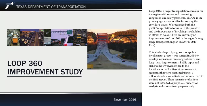
Loop 360 is a major transportation corridor for the region with severe and increasing congestion and safety problems. TxDOT is the primary agency responsible for solving the corridor’s issues. We recognize both the public’s expectation for us to fix the problem and the importance of involving stakeholders in efforts to do so. There are currently no improvements to Loop 360 in the region’s long range transportation plan (CAMPO 2040 Plan). This study, shaped by a grass roots public involvement process, was started in 2014 to develop a consensus on a range of short- and long- term improvements. Public input and stakeholder involvement led to the identification of 9 different improvement scenarios that were examined using 10 different evaluation criteria and summarized in the final report. These scenario evaluations were not intended as proposals, but are for analysis and comparison purposes only.

slide-2
SLIDE 2

This is not the first time TxDOT has looked to make major improvements to the corridor. Two previous studies with potential solutions for the corridor have been proposed. Both proposals stalled because of considerable

  • pposition.

The current study, initiated in 2014, embodied a 4-step process to identify and evaluate potential short- and long- term mobility and safety solutions, refine and present study solutions, and identify next steps to move forward in the project development process. The study is unique in that it was a technical process lead by public involvement and is

  • nly the first step in a process leading from

planning to completion of a six-lane divided highway with no traffic signals on the mainlanes and flyovers to US 183 and south MoPac.

Loop 360 Improvement Study

Loop 360 Improvement Study Process

Y T O D A Y Continuing through other phases

slide-3
SLIDE 3

Loop 360 is one of the most congested highways in the Capital Area. Three segments

  • f the roadway are on TTI’s top 100 “Most

Congested Roadways” list. It takes 70% longer to travel during peak travel periods than in normal free flowing conditions along Loop 360. It has not been substantially improved since its initial completion in 1982 as a four-lane rural arterial roadway and it has become a major quality of life issue for its users. As noted, previous efforts to improve Loop 360 were not well-received by the

  • community. While TxDOT’s overall goal was

to improve travel conditions along Loop 360, the community was not brought into the planning process; therefore, members of the public did not understand how the determination was made to use a particular improvement method, nor did the public embrace or support the results of the planned improvement.

Loop 360 Improvement Study

Quality of Life Issue

Texas

Transportation Institute (TTI) top 100

“Most Congested Roadways” #50 - RM 2244 to US 290/SH 71 #58 - US 183 to RM 2222 #93 - RM 2222 to RM 2244 Rush hour travel time is almost twice as long as normal

slide-4
SLIDE 4

We initiated the current improvement study as a fresh start to address the ongoing transportation issues on Loop 360. Lessons learned from previous efforts led to a different approach to actively engage the public throughout the planning process. The study is not a continuation

  • f previous efforts, but a new community-driven

effort to identify and address problems in both the short- and long-term. Approximately 80 stakeholders were invited to represent their respective organizations on one of six section working groups corresponding with the six distinct corridor sections. Additional stakeholders were identified and engaged as study information was distributed through a variety of means through newspaper advertisements, electronic notifications, online participation opportunities, and word-of-mouth. To date, TxDOT has held 11 section working group meetings and 43 stakeholder meetings, and has received more than 3,600 survey responses and 2,085 comments. The input gathered through these efforts has been incorporated into each phase of the study, including the identification of problems and potential solutions, as well as the evaluation, refinement and presentation of solutions.

Loop 360 Improvement Study

Focused on Public Involvement Grassroots approach

  • Intensive and continuous
  • Six stakeholder working groups
  • 43 neighborhood meetings
  • 3,600 survey responses
slide-5
SLIDE 5

Many people have their favorite solution for Loop 360. It was important to demonstrate performance of various alternatives, so that people can see how their preferred solution fairs in comparison to the others. The study helped to introduce facts and analysis into the discussion.

Loop 360 Improvement Study

Study Goals for Loop 360 Devise solutions Discuss options Develop acceptance Determine solutions – Short-term – Mid-term – Long-term

slide-6
SLIDE 6

Nine scenarios were ultimately developed using the input of technical experts, stakeholder working group members, and neighborhood meetings. It is important to note these scenarios are for comparison purposes

  • nly. All have a purpose with exception to the

No-Build or “Do Nothing” scenario.

Loop 360 Improvement Study

Loop 360 Scenarios

Scenario 1: Scenario 2: Scenario 3: Scenario 4: Scenario 4.C: Scenario 5: Scenario 5.M: Scenario 6: Scenario 6.M: Note: For comparison purposes only, not necessarily project recommendations No-build (no improvements) Intersection improvements Add two lanes, keep existing traffic signals Remove traffic signals from mainlanes using over/underpasses at major intersections Same as Scenario 4 with flyovers to US 183 and south MoPac Same as Scenario 4.C with addition of two general purpose lanes Same as Scenario 5 with additional managed lanes instead of general purpose lanes Convert existing four lanes to local access lanes, and add four general purpose mainlanes with flyovers to US 183 and south MoPac Same as Scenario 6 but with managed mainlanes

slide-7
SLIDE 7

Loop 360 Improvement Study

Scenario 1 – No-Build (Do Nothing) Only improvements already in the 2040 CAMPO plan are constructed 2040 CAMPO Plan contains no significant improvements

slide-8
SLIDE 8

Loop 360 Improvement Study

Scenario 2 – Intersection Improvements Major intersections would be optimized for throughput with reasonable access. Includes: – signal timing – turn lanes – intersection design changes – innovative intersections

slide-9
SLIDE 9

Loop 360 Improvement Study

Scenario 3 – Add Two Lanes, Keep Existing Traffic Signals Maintains existing at-grade signalized intersections, but adds one lane in each direction Includes all intersection improvements from Scenario 2

Some portions of Loop 360, such as the section between south MoPac and US 290/SH 71, already have three lanes in each direction. Scenario 3 would add one additional lane in each direction to the remaining portions of the corridor.

slide-10
SLIDE 10

Loop 360 Improvement Study

Scenario 4 – Grade-Separate Existing Four Lanes Remove the traffic signals from mainlanes between US 183 and south MoPac and between Major intersecting streets would be accessible via ramps to/from the mainlanes, grade-separated by building over/underpasses Access modifications would be made at minor intersections to improve safety and reduce wait times to access Loop 360 where overpasses/underpasses are not feasible or cost-effective Overpass Loop 360 and RM 2222 Underpass I-35 and 11th Street south MoPac and US 290

slide-11
SLIDE 11

Loop 360 Improvement Study

Scenario 4.C – Grade-Separate Existing Four Lanes, Add Flyovers and Improved Connections

Includes all improvements from Scenario 4 with improved connections and flyovers from Loop 360 to US 183 and south MoPac In Scenario 4, the congestion at US 183 and south MoPac controls the flow of traffic entering and exiting the Loop 360 corridor; Scenario 4.C is primarily intended to show the anticipated mobility impacts of alleviating some of the traffic bottlenecks at US 183 and south MoPac

slide-12
SLIDE 12

Loop 360 Improvement Study

Scenario 5 – Grade-Separate Existing Four Lanes, Add Two General Purpose Lanes, Add Flyovers and Improved Connections Includes all improvements outlined in Scenario 4.C Adds one grade-separated, general purpose lane in each direction

slide-13
SLIDE 13

Loop 360 Improvement Study

Scenario 5.M – Grade-Separate Existing Four Lanes, Add Two Managed (Tolled/HOV/Transit) Lanes, Add Flyovers and Improved Connections Same as Scenario 5, but with added lanes being managed Managed lanes would have restricted access from the existing general purpose lanes Managing the lanes would also provide the additional benefit of improving emergency vehicle access and transit viability

Managed lanes on MoPac

slide-14
SLIDE 14

Loop 360 Improvement Study

Scenario 6 – Maintain Existing Four Lanes, Add Four General Purpose Lanes, Add Flyovers, and Improved Connections Relocates the four existing at-grade general purpose signalized lanes to serve as local access lanes for neighborhoods, businesses, schools, etc. Adds two grade-separated, general purpose lanes in each direction to serve as through-lanes for longer trips, and includes improved connections and additional flyovers to connect Loop 360 to US 183 and south MoPac

Scenario 6 would look much like other major highways in the Capital Area region, with grade-separated mainlanes for longer “through” trips, and at-grade frontage roads to provide local access to neighborhood, businesses, schools, and other destinations along the corridor.

slide-15
SLIDE 15

Loop 360 Improvement Study

Scenario 6.M – Maintain Existing Four Lanes, Add Four Managed (Tolled/HOV/Transit Lanes), Add Flyovers and Improved Connections Same as Scenario 6, except additional four through lanes would be managed Managing the lanes would also provide the additional benefit of improving emergency vehicle access and transit viability

Scenario 6.M would look much like Scenario 6, though the four additional lanes would be managed to control their traffic flow. The existing general purpose lanes would serve as frontage roads. This is a similar configuration to tolled projects in the region, such as SH 130 (left) and the 290 toll road.

slide-16
SLIDE 16

Loop 360 Improvement Study

Scenario Evaluation Listed By Criteria

The study further looked into the future to predict potential outcomes of each scenario if implemented based on a certain set of assumptions (such as forecasted 2040 regional traffic volumes, population and employment growth, and specific proposed improvements to be made). The nine scenarios were analyzed by the 10 criteria. The results from these 10 evaluation criteria helped TxDOT compare and contrast the proposed corridor improvements.

Corridor Mobility: How could each scenario improve travel within the corridor? Regional Mobility: How could each scenario improve travel to/from locations outside the corridor or on congested connecting or “cut-through” roadways? Safety: How effectively could each scenario address safety issues for cars, bicycles and pedestrians? Cost: How much funding would be needed to implement each scenario? Constructability: How easily could each scenario be constructed? How much disruption of existing traffic/ neighborhoods? Potential Aesthetics/Visual Impacts: How could each scenario impact the visual characteristics of the surrounding area, including the Pennybacker bridge? Potential Environmental Impacts: How could each scenario impact environmental features along the corridor such as water resources, wildlife habitats, parks and greenbelts, rights-of-way, etc.? Longevity: How far into the future would each scenario effectively handle mobility needs along the corridor? Transit/Emergency Access: How well would each scenario accommodate public transit options and handle emergency vehicle access? Implementation Time: How long would it take to complete construction of each scenario, including environmental approvals and necessary funding?

Loop 360 Improvement Study — Scenario Evaluation Criteria

slide-17
SLIDE 17

Loop 360 Improvement Study

Criteria Conclusions

Safety – Eliminate at-grade crossings and intersections; control access from side streets and driveways Regional Mobility – Eliminate traffic signals to reduce congestion—six lanes increases capacity without reducing access, eight lanes handles the greatest demand but increases travel times Corridor Mobility – Balance throughput with access using over/underpasses Constructability – Cleared right-of-way; Pennybacker bridge; cliffs, valleys and creeks Aesthetics – When is less more? When is more too much? Environmental Impacts – Cleared right-of-way, habitat, Bull Creek, Barton Creek, parks Longevity of Improvements – Grade-separation is key Transit Viability/Emergency Access – Managed lanes are key Implementation – Approval time, construction complexity, funding availability

slide-18
SLIDE 18

The scenario analysis results summary is contained in the report (pages 19-36), but this table gives a simplified version for comparison purposes. The weighting of these criteria is a subjective matter, however, with a goal of safety and mobility over a lengthy time at a reasonable construction and environmental cost, then the best improvement solution lies between Scenarios 4, 4.C, 5, and 5.M.

Loop 360 Improvement Study

Criteria Comparison

slide-19
SLIDE 19

Loop 360 Improvement Study

Loop 360 Facts

Scenarios 1-4 carry the same traffic volumes because they lack improved connections to/from US 183 and south MoPac (flyovers/intersection improvements); the improved connections of Scenarios 4.C – 6.M facilitate additional traffic into the corridor Scenarios 4 – 6.M have no stops between US 183 and south MoPac Access to/from US 183 and south MoPac will always be limited by the capacity

  • n those highways

The Pennybacker bridge, as constructed, should handle six lanes plus improved bicycle/pedestrian accommodations There is plenty of right of way, but much of it is encumbered with cliffs, valleys, and environmental features There is adequate cleared right of way along most of the corridor for six continuous lanes, plus extended ramps and auxiliary lanes Traffic demand for Loop 360 is ultimately limited by future capacity of adjoining highways – US 183, north MoPac and south MoPac

(More details on the specifics of each scenario are contained in the report, pages 38-46.)

slide-20
SLIDE 20

Although the corridor was broken into six sections for the public involvement process, Loop 360 operates in three distinct segments requiring a unique strategy:

  • South segment – US 290/SH 71 to south

MoPac – the most traveled section and connects two major highways

  • Center segment – south MoPac to US

183 – the longest segment and varied in terrain

  • North Capital of Texas Highway segment –

US 183 to north MoPac – a city street whose traffic is dictated by the surrounding highways

Loop 360 Improvement Study

Unique Segments

slide-21
SLIDE 21

This study is the beginning of a process. Because of the serious and critical nature of safety and congestion problems, the process will seek to bring relief as quickly as possible.

Loop 360 Improvement Study

Next Steps

Continue to implement short-term improvements that may include: – Turn lane and signal improvements – Intersection reconstruction – Consider Diverging Diamond Intersections at RM 2244 and RM 2222 Develop a conceptual layout of the corridor from US 290/SH 71 to US 183: – Determine the locations for grade-separations – Prioritize projects with the greatest impact on reducing congestion Determine which intersections will proceed to environmental clearance; once cleared they will then proceed to design and, when funding is available, to construction Coordinate design of Loop 360 with other major highway projects, such as US 183 North, MoPac Improvement Project, and proposed MoPac South, so that projects in those corridors may be constructed to integrate future Loop 360 improvements Conduct a detailed study of all the access roads and ramps in the triangle of intersections created by US 183, north MoPac and Capital of Texas Highway to improve their ability to handle increasing traffic demand Identify funding for initial grade-separation projects

slide-22
SLIDE 22

TxDOT is committed to incorporating community values and implementing changes to Loop 360 to address the mobility and safety needs, while also maintaining the aesthetic and environmental appeal of this iconic central Texas roadway.

Loop 360 Improvement Study

TEXAS DEPARTMENT OF TRANSPORTATION

QUESTIONS?

www.Loop360Study.com

Bruce Byron Project Manager bruce.byron@txdot.gov 512-832-7107